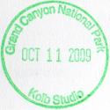
 |
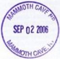
MAMMOTH CAVE NATIONAL PARK
Mammoth Cave, KY - September 2, 2006
GPS Coordinates: N37.18670 W86.09900 (actual)
National Park Service Web Site: At This Link
I rode my bike to Mammoth Cave simply to get out and ride. When I got there I noticed that
they had the Passport Books for sale and even though I knew the consequences I bought one. This
stamp was the first one I captured.
|
|
|
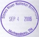
STONES RIVER NATIONAL BATTLEFIELD
Murfreesboro, TN - September 4, 2006
GPS Coordinates: N35.88081 W86.43489 (actual)
National Park Service Web Site: At This Link
|

|
Stones River National Battlefield was an easy one for me to get, and they had three
stamps available. Murfreesboro is only about 25 miles from my home so I headed
out one morning to visit the park. Photos of my trip there are at
This Link
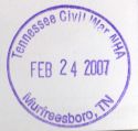
Update - 02-24-07 - When I was at Stones River in September they did not have the
stamp for the Tennessee Civil War NHA but they do now! I read somewhere that
the stamp was there so I rode back up to check and sure enough it was. The
lady at the Visitor Center that I talked to said it was a recent addition.
Update - 07-12-08 - I visited Stones River today to get the new Underground Railroad Freedom
Network stamp and they currently have six stamps available, four of which are official dated
National Park Passport stamps. The other two are the Stones River National Battlefield
stamp shown above and a Tennessee Historical Commission stamp for Stones River.
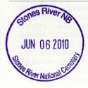
Update - 06-06-10 - I visited Stones River today to get the new National Cemetery stamp and
they currently have sseven stamps available, five of which are official dated
National Park Passport stamps. The other two are the Stones River National Battlefield
stamp shown above and a Tennessee Historical Commission stamp for Stones River.
The five official stamps at this site are:
- Stones River National Battlefield - Murfreesboro, TN
- Stones River National Cemetery - Murfreesboro, TN
- Tennessee Civil War National Historic Area - Murfreesboro, TN
- Trail of Tears National Historic Trail - Tennessee
- Underground Railroad Freedom Network - Stones River NB
|
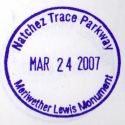
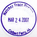
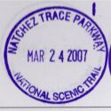
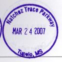
|
NATCHEZ TRACE PARKWAY
Tennessee, Alabama, Mississippi
GPS Coordinates: See Below
National Park Service Web Site: At This Link
The Natchez Trace Parkway spans 444 miles from the northern terminus at Nashville, TN to
the southern terminus at Natchez, MS. I've been down it to the Colbert Ferry Crossing
just over the Alabama state line, and it is one of my favorite places to ride my bike.
Photos of some of my trips down "The Trace" are on this web site at these links:
Natchez Trace Parkway photos
Fall Foliage Ride
IMPORTANT NOTE!
I talked to a staff member at the Tupelo Visitor Center on September 7, 2008 regarding stamps at some of the sites on the
south end of the Natchez Trace Parkway. I was told that the ONLY stamp now available on the NTP is the
one at the Tupelo Visitor Center. I was told that they felt it was getting difficult to manage and just threw all of
the stamps away except for the main VC at Tupelo. As of now there is ONLY ONE STAMP FOR THE ENTIRE NTP
and it is at the Tupelo Visitor's Center. If you have any of the stamps for sites other than the Tupelo VC
they are collector's items because they are no longer available!
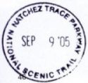
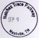
There are a number of Passport Stamp sites on the Natchez Trace Parkway. Below is some
information about a few of them:
Natchez Trace Parkway Northern Terminus - Mile 444 - GPS Coordinates: N36.02990 W86.97535 (Actual)
No passport stamp at this location. Since it is the northern end of the Natchez Trace
Parkway it is provided for reference only.
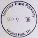
Leipers Fork Ranger Station - Mile 430 - GPS Coordinates: N35.89408 W87.02418 (Actual)
There is a passport stamp at the Leipers Fork ranger station, however finding someone there at
a specific time is difficult. It is a station used by the rangers that patrol the northern
section of the parkway, and they do their job very well. It is much easier to see them patroling
up and down the road than sitting at the ranger station. If you see one on the road (and you
probably will you might be able to ask them to radio and see if anyone is there.
Note that the "Official" listing of passport stamps at EParks.Com
as of 03/22/2008 only shows two stamps for the NTP in Tennessee. Those are both at the Meriwether
Lewis Monument (see below). This is incorrect since all three of the stamps obtained on September
9, 2006 (yes, I know one of them shows "2005" and the other doesn't show a year, that was my bad!) are
all three in fact in Tennessee at this location.
Meriwether Lewis National Monument - Mile 385.9 - GPS Coordinates: N35.51017 W87.45993 (Actual)
The Meriwether Lewis National Monument is the location where Meriwether Lewis (of Lewis and Clark
fame) died. At one time there was a passport stamp at this site, and it is listed on most of
the passport stamp location lists, however it is no longer there. It is very difficult to
catch someone at this location, even more so than at Leipers Fork, but I was lucky enough to see
a ranger there one time and he searched thoroughly for the stamp. He said that the last time
he had seen it was about 2 years previously (sometime in 2004) and at that time it was in the cabin
that is at the monument. Apparently someone stole it and is has never been replaced.
Update - 03/24/2007 - The Meriwether Lewis stamp is available at the Tupelo Visitor Center however
you must specifically ask for it.
Colbert Ferry Crossing - Mile 327.3 - GPS Coordinates: N34.83394 W87.94828 (Actual)
I rode to the Colbert Ferry Crossing to get the stamp on September 9, 2006. Apparently I picked
a day right after they closed for the season because there was nobody there. I could see the
Passport Station through the glass door, but I resisted the temptation to bash it in. I'm not
sure exactly what their operational months are but they are closed during the winter. I'll get
another shot at this one when I head for Tupelo, MS as soon as it warms up a bit!
Update - 03/24/2007 - The Colberts Ferry stamp is available at the Tupelo Visitor Center however
you must specifically ask for it.
Tupelo Visitor Center - Mile 266.0 - GPS Coordinates: N34.33032 W88.71020 (Actual)
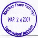
I rode to the Tupelo Visitor Center (among other places) on March 24, 2007. They have most
of the stamps for the entire Trace there, however they are somewhat stingy with them. Actually
they aren't really stingy they just want to insure that you actually visit a specific site before they
give you a stamp for it. Since I had been to Colbert's Ferry Crossing twice and the Meriwether Lewis
monument 3 times I did get the stamps for those sites.
Tupelo National Battlefield - Mile 259.7 - GPS Coordinates: N34.25548 W88.73752 (Actual)
Tulepo National Battlefield is about 8 miles from the Tupelo Visitor Center in the city
of Tulpelo. The site is unattended and the stamp is at the NTP Visitor Center in Tupelo.
|
|
SHILOH NATIONAL MILITARY PARK
Hardin County, TN - October 8, 2006
GPS Coordinates: N35.15128 W88.32170 (actual)
National Park Service Web Site: At This Link
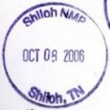
I rode to Shiloh on October 8, 2006 with my friend and riding buddy AGirl. It was a
gorgeous early fall day and we could not have asked for better weather. To make it
an epic day, AGirl got the last National Park Passport stamp that she needed to have all
of them in Tennessee (not bad for a lady who lives in Arizona!) and also turned over 50,000
(that's fifty thousand!) miles on her DL1000 since last November.
A few photos of our trip are at
This Link
Note that the Trail Of Tears stamp for Tennessee is also available at this site.
|
|
FORT DONELSON NATIONAL BATTLEFIELD
Dover, TN - October 15, 2006 & February 16, 2008
GPS Coordinates: N36.48283 W87.86301 (actual)
National Park Service Web Site: At This Link
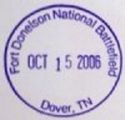
I rode to Fort Donelson three times in 2006. Twice by myself and once in company
with three other V-Strom owners (one of whom was my riding buddy AGirl). It is a
great ride from Nashville, and the park is very interesting to ride through. There
is a spot that overlooks the Cumberland River that I suspect looks very much the same as
it did during 1862. There is also a family of American Bald Eagles that live there
and apparently love to have their photos taken.
Photos of Fort Donelson and my trips there are at
This Link
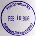
Update - February 16, 2008 - Ft. Donelson has a new stamp! I just happened to notice that there were two stamp
on the stand, and the ranger I talked with said it was very new. It is for the Underground Railroad Freedom
Network. This stamp is not listed on the official stamp listing at EParks.Com
under the listing for Tennessee but it is listed at the end of the document in the "National Trails" section.
|

|
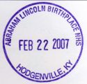
ABRAHAM LINCOLN BIRTHPLACE
Hodgenville, KY - February 22, 2007
GPS Coordinates: N37.53066 W85.73632 (actual)
National Park Service Web Site: At This Link
The weather was nice for late February. Too nice to do anything but get out and ride! To that
end I decided to ride up to Hodgenville, KY and visit the birthplace of Abraham Lincoln. I managed
to get two stamps at this site because during the winter months they keep the stamp for Lincoln's Boyhood
Home there as well.
Photos of my trip are at This Link
|
|
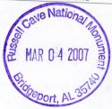
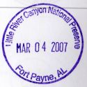
RUSSELL CAVE NATIONAL MONUMENT
Bridgeport, AL - March 4, 2007
GPS Coordinates: N34.97914 W85.81000 (actual)
National Park Service Web Site: At This Link
It was COLD when I left Nashville, but grabbing two stamps made a 250 mile round trip worthwhile. They
had the stamp for Little River Canyon National Preserve there as well as the stamp for Russell Cave
National Monument.
Photos of my trip are at This Link
|
|
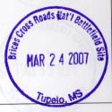
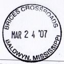
BRICE'S CROSSROADS NATIONAL BATTLEFIELD
Baldwyn, MS - March 24, 2007
GPS Coordinates: N34.50452 W88.65763 (actual)
National Park Service Web Site: At This Link
This site commemorates a Civil War battle that occurred on June 10, 1864. According to the
NPS web site, "The Confederate victory at Brices Cross Roads was a significant victory for Major
General Nathan Bedford Forrest, but its long term effect on the war proved costly for the
Confederates. Brices Cross Roads is an excellent example of winning the battle, but losing
the war."
I rode to the Tupelo Visitor Center of the Natchez Trace Parkway on March 24, 2007 and came
back up through Baldwyn, MS to visit this site. The Visitor Center and the battlefield
site are separate so be sure to visit both of them if you are in the neighborhood.
The stamp on top was obtained at the Tupelo Visitor Center. Notice that it reads
"Tupelo, MS." The black stamp on the bottom was obtained at the Brice's Crossroads
Visitor Center and it reads "Baldwyn, MS." The site is actually located in Baldwyn, not Tupelo.
Photos of my trip are on This Page
|

|
CORINTH CIVIL WAR INTERPRETIVE CENTER
Corinth, MS - March 24, 2007
GPS Coordinates: N34.93725 W88.53011 (actual)
National Park Service Web Site: N/A
This is a relatively new site that commemorates the battle of Shiloh and its extent down into
Mississippi. The site was apparently completed and opened in 2005. It was difficult
to find much information about this site, but it does exist at the GPS coordinates shown above
and it does have a passport stamp.
Photos of my trip are on This Page
|
|
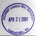
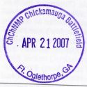
CHICKAMAUGA AND CHATTANOOGA NATIONAL BATTLEFIELD
Lookout Mountain, TN & Ft. Oglethorpe, GA - April 21, 2007
GPS Coordinates:
o N35.00954 W85.34374 (Lookout Mtn. - actual)
o N34.94039 W85.25934 (Ft. Oglethorpe - actual)
National Park Service Web Site: http://www.nps.gov/chch/
Both the Lookout Mountain (Chattanooga) and Ft. Oglethorpe stamps are in the Visitor Centers
at the GPS coordinates shown above. The Point Park Visitor Center at Lookout Mountain
(which is in Tennessee) also has the Georgia Trail Of Tears stamp but the Visitor Center at
Ft. Oglethorpe (which is in Georgia) does not. Go figure!
The road going to the Lookout Mountain VC is a winding, twisty, narrow mountain road, with a
lot of traffic on it. It is a relatively short distance from the bottom to the top, but
if you are in a large camper or towing a trailer you might want to rethink this one.
A few photos of my trip are at This Link.
|

|
OBED WILD AND SCENIC RIVER
Wartburg, TN - May 12, 2007
GPS Coordinates:N36.10584 W84.59812 (actual)
National Park Service Web Site: http://www.nps.gov/obed/
The Visitor Center for Obed Wild and Scenic River is actually in downtown Wartburg at
208 North Maiden Street. Wartburg is a small town so it is not difficult to find
the Visitor Center. Unlike most stamp sites you won't have to worry about this one
being open. When I visited they had a copy of the stamp in a box outside the front
door!
Photos of my trip are on This Page
|
|
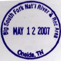
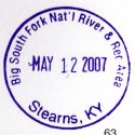
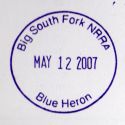
BIG SOUTH FORK NATIONAL RIVER AND RECREATION AREA
Oneida, TN and Stearns, KY - May 12, 2007
GPS Coordinates:
o N36.48774 W84.69824 (Oneida, TN - actual)
o N36.69904 W84.47648 (Stearns, KY - actual)
National Park Service Web Site: http://www.nps.gov/biso/
The Visitor Center for the Tennessee side of the Big South Fork NRRA is not difficult to
find. Follow Highway 297 west from Oneida and then just follow the signs. The
stamp is inside the Visitor Center.
The Stearns, KY side is a bit different. The Visitor Center is in a Historic District near
the Stearns Museum. The street address is 83 Henderson Street (I think). Follow the
signs for the Stearns Museum. The museum is in an old house on top of a hill. At the bottom
of the hill is the Stearns Coal and Lumber Company, an old train depot, and some other historical
areas. The Visitor Center is inside the Train Depot, and there is only a small sign on the
door. The GPS coordinates are in the parking lot approximately 100' from the entrance.
Here Is A Link to a photograph
that shows the area.
The Stearns VC has two stamps. The one for the Big South Fork NRRA (Stearns, KY) as well as
the "Blue Heron" stamp.
Photos of my trip are on This Page
|
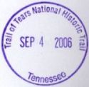
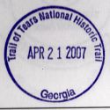

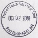
|
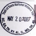
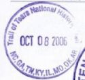
TRAIL OF TEARS NATIONAL HISTORIC TRAIL
| Alabama - |
Russell Cave - GPS Coordinates: N34.97914 W85.81000 (actual) |
| Arkansas - |
Fort Smith - GPS Coordinates: N35.38750 W94.43049 (actual) |
| Georgia - |
Chattanooga National Battlefield - GPS Coordinates: N35.00954 W85.34374 (actual) |
| Kentucky |
Hopkinsville, KY - GPS Coordinates: N36.85284 W87.46993 (actual) |
| Missouri - |
|
| North Carolina - |
|
| Oklahoma - |
|
| Tennessee - |
Shiloh National Military Park - GPS Coordinates: N35.15128 W88.32170 (actual)
Stones River National Battlefield - GPS Coordinates N35.88081 W86.43489 (actual)
|
National Park Service Web Site: http://www.nps.gov/trte/planyourvisit/trail-of-tears-commemorative-park.htm
HOPKINSVILLE, KY
This stamp is somewhat difficult to obtain, and you will notice that mine is not truly
"Official". The Heritage Center is only open on Friday and Saturday from 10:00 am
until 2:00 pm because they do not have enough volunteers to keep it staffed. In
addition, the "Real" stamp is presently located at the Chamber of Commerce office (I'm
not certain where that is) although it is supposed to be delivered to the Heritage
Center "Any time now". The stamp that I got does not specifically state "Kentucky"
on it, but the "New" one does. Additionally the stamp that was there only went to
the year 2000 so the volunteer added the "2" and "7" to make "2007". I can't complain
though since I visited on a Sunday. I just happened to catch someone there and she
was kind enough to provide me with the stamp and provide some history on the
site. Hopkinsville is close to Nashville so I'll pay another visit to the site and
update the information when I can.
Photos of my visit are at
This Link
Park Web Site: http://www.TrailOfTears.org
CHICKAMAUGA NATIONAL BATTLEFIELD
The Georgia stamp is available in the Visitor Center of the Chattanooga National Battlefield
at Lookout Mountain, TN but **NOT** at the Chickamauga National Battlefield at Fort Oglethorpe,
GA. Go figure!
STONES RIVER NATIONAL BATTLEFIELD
The Tennessee stamp is available at the Stones River National Battlefield at
Murfreesboro, TN. in the Visitor Center.
SHILOH NATIONAL BATTLEFIELD
The Tennessee stamp is available at the Shiloh River National Battlefield
in the Visitor Center.
RUSSELL CAVE NATIONAL MONUMENT
The Alabama stamp is available at the Russell Cave National Monument at
Bridgeport, AL. in the Visitor Center.
FORT SMITH NATIONAL HISTORIC SITE
The Arkansas stamp is available at the Fort Smith National Historic Site in
Fort Smith, AR. in the Visitor Center.
|
|
GREAT SMOKY MOUNTAINS NATIONAL PARK
Tennessee & North Carolina - June 30-July 1, 2007
GPS Coordinates:
o N35.58640 W83.84327 (Cades Cove VC - actual)
o N35.73383 W83.52185 (Gatlinburg VC - actual)
o N35.51296 W83.30692 (Oconaluftee VC - actual)
o N35.68432 W83.53609 (Sugarland VC - actual)
o N35.67778 W83.74552 (Townsend VC - actual)
National Park Service Web Site: http://www.nps.gov/grsm/
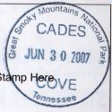
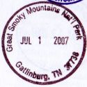
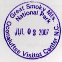
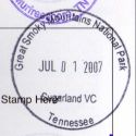
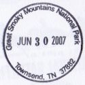
There are five Visitor Centers in the Great Smoky Mountains National Park and each one has a
separate Passport Stamp. The actual GPS locations of the Visitor Centers are shown
above. All of the VC's are in Tennessee except for Oconaluftee which is in North Carolina
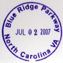
and is also the south end of the Blue Ridge Parkway. The Oconaluftee VC has a separate
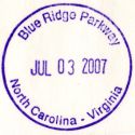
stamp for the Blue Ridge Parkway to. The Blue Ridge Parkway stamp is shown to the left and
all of the stamps for the individual Visitor Centers are shown below.
Photos of my trip are on This Page
|
|
BLUE RIDGE PARKWAY
North Carolina and Virginia - July 2-July 3, 2007
GPS Coordinates:
o N35.46031 W83.14101 (Waterrock Knob VC - actual)
o N35.59237 W82.48098 (Folk Art Center - actual)
o N35.70035 W82.37939 (Craggy Gardens VC - actual)
o N35.85393 W82.05076 (Museum of NC Minerals - actual)
o N35.95536 W81.92840 (Linville Falls VC - actual)
o N36.09056 W81.81407 (Linn Cove Viaduct VC - actual)
o N36.14938 W81.69250 (Moses Cone Memorial Park VC - actual)
o N36.57393 W80.84949 (Blue Ridge Music Center - actual)
o N36.81162 W80.34993 (Rocky Knob VC - actual)
National Park Service Web Site: http://www.nps.gov/blri/
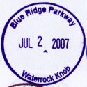
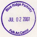
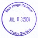
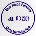
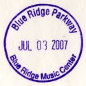
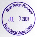
There are twelve Visitor Centers along the Blue Ridge Parkway and I was told that each one has a
separate Passport Stamp. I know for certain that at least nine of them have their own stamp
but I have not visited the northern three VC's. The actual GPS locations of the Visitors
Centers that I have visited are shown above. The Oconaluftee Visitirs Center in the Great
Smoky Mountains National Park is at the south end of the Blue Ridge Parkway and it has a stamp
for the Parkway as well as a stamp for the Great Smoky Mountains (see the section above).
The stamp for the parkway itself is shown to the left and is available at some of the Visitors
Centers (specifically Oconaluftee in the Great Smoky Mountains National Park, Linnville Falls,
and the Blue Ridge Music Center at least). Note that the Parkway stamp from Oconaluftee VC
(see the section above) is slightly different from the one available at the Parkway VC's in that
state name for Virginia is abbreviated at the Oconaluftee VC and spelled out at the VC's along
the Blue Ridge Parkway.
Photos of my trip are on This Page
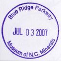
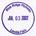
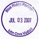
|

|
OVERMOUNTAIN VICTORY
VA, TN, NC, SC
National Park Service Web Site: http://www.nps.gov/ovvi/
North Carolina
GPS Coordinates:N35.85393 W82.05076 (actual)
Date of Visit: July 4, 2007
Visitor Center for the Museum of North Carolina Minerals on the Blue Ridge Parkway.
South Carolina
GPS Coordinates:N35.13701 W81.81850 (actual)
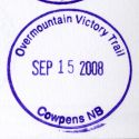
Date of Visit: September 15, 2008
Visitor Center for Cowpens National Battlefield.
|

|
CARL SANDBURG HOME
Flat Rock, NC - July 2, 2007
GPS Coordinates:N35.27356 W82.44445 (actual)
National Park Service Web Site: http://www.nps.gov/carl/
The Visitor Center for Carl Sandburg's home is located in a residential area of Flat Rock, NC
(near Hendersonville, NC) at 81 Carl Sandburg Lane. The home is approximately 0.3 mile
away from the parking area and there is about 110' of elevation change. A shuttle is
available for those who need assistance.
Photos of my trip are on This Page
|
|
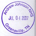
ANDREW JOHNSON TAILOR SHOP
Greeneville, TN - July 4, 2007
GPS Coordinates:N36.16266 W82.82945 (actual)
National Park Service Web Site: http://www.nps.gov/anjo/
The Visitor Center for the Andrew Johnson Tailor Shop site is in downtown Greenville, TN at
121 Monument Ave. There are several buildings associated with the site however the VC
itself is plainly marked and there are signs throughout downtown Greenville directing visitors
to the site.
Photos of my trip are on This Page
|
|
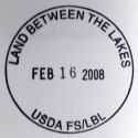
LAND BETWEEN THE LAKES
Golden Pond, KY - February 16, 2008
GPS Coordinates:N36.77965 W88.06372 (actual)
Web Site: http://www.lbl.org/
This is not a true National Park Passport Stamp, but for the collectors it is dated and labeled so
it is probably worth having. The stamp is in the Golden Pond Visitor Center just off of
Highway 68.
Photos of my trip are on This Page
|
|
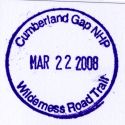
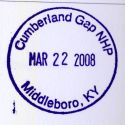
CUMBERLAND GAP NATIONAL HISTORICAL PARK
Middlesboro, KY - February 22, 2008
GPS Coordinates:N36.60250 W83.69582 (actual)
Web Site: http://www.nps.gov/cuga/
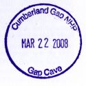
Cumberland Gap has 5 passport stamps and all are located at the main Visitor Center. Directions to the park
are on the park's web site at This Page.
Photos of my trip are on This Page


|


|
GEORGE ROGERS CLARK NATIONAL HISTORIC PARK
Vincennes, IN - May 17, 2008
GPS Coordinates:N38.67783 W87.53534 (actual)
Web Site: http://www.nps.gov/gero//
There are two stamps at this site however only one is an "Official" stamp. The bonus stamp shows a likeness
of the memorial but it is not dated. Both stamps are in the Visitor Center but they are not out on display.
The site is in the middle of Vincennes, IN however it is not difficult to find. There are numerous signs
directing visitors to the site, and the GPS coordinates above are in the parking lot.
Photos of my trip are on This Page
|

|
ABRAHAM LINCOLN BOYHOOD HOME
Lincoln City, IN - May 17, 2008
GPS Coordinates:N38.11347 W86.99580 (actual)
Web Site: http://www.nps.gov/libo/
The site is actually between Gentryville and Lincoln City however their web site indicates the mailing address as
Lincoln City. It is not a difficult site to find since both towns are very small. There are plenty of
signs directing visitors to the site and the GPS coordinates above are in the parking lot of the Visitor Center.
Photos of my trip are on This Page
|
|
OZARK NATIONAL SCENIC RIVER
Date of Visit: May 17, 2008
Web Site: http://www.nps.gov/lecl/
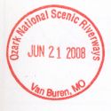
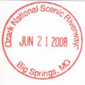
There are five sites for Ozark National Scenic River passport stamps in Missouri. They are at:
o Van Buren
o Big Spring
o Round Spring
o Eminence
o Alley Spring
I have only visited the site at Van Buren and it has stamps for both Van Buren and Big Spring. GPS coordiantes
of the Van Buren Visitor Center are N36.99990 W91.01460 (actual).
Photos of my trip are on This Page
|
|
LEWIS AND CLARK NATIONAL HISTORIC TRAIL
Date of Visit: May 17, 2008
Web Site: http://www.nps.gov/lecl/
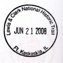
There are two Passport Stamp sites in Illinois for the Lewis and Clark National Historic Trail, one
at Ft. Kaskaskia State Park in Ellis Grove, IL. and one at Hartford, IL.
Ft. Kaskaskia State Park - Ellis Grove, IL (GPS Coordinates: N37.97111 W89.91138 +/-)
The coordinates shown above are the approximate coordinates at the state park visitor center. This VC was
closed the day I was there, however I knew it before I left home and had found that there is a copy of the stamp
at the Pierre Menard Home approximately 1.5 miles from the state park VC. The GPS coordinates at the Pierre
Menard Home are N37.96072 W89.90469 and these are actual coordinates.
Photos of my trip are on This Page
|
|
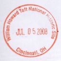
WILLIAM H. TAFT NHS
City & State: Cincinnati, OH
Date of Visit: July 5, 2008
GPS Coordinates: N39.12000 W84.50860 (actual)
Web Site: http://www.nps.gov/wiho/
The site is in downtown Cincinnati, OH at 2038 Auburn Ave. The GPS coordinates above are in
the parking lot of the Visitor Center (Note that there is not much parking available!) The
actual home is next door.
Photos of my trip are on This Page
|

|
THE WRIGHT BROTHERS - WRIGHT FLYER III NHS
City & State: Dayton, OH
Date of Visit: July 5, 2008
GPS Coordinates: N39.72847 W84.19911 (actual)
Web Site: http://www.nps.gov/daav/
This stamp is a little bit ornery to get. The National Historic Site is located on the grounds of
Carillon Historical Park which is an Ohio State Park. To get to the NHS you will have to pay an
entry fee of $7 to get onto the State Park. Even if you have a National Park Passport you will still
have to pay because the State Park system does not recognize the National Park season passes. Other
than that the Visitor Center for the Flyer III is easy to find. The GPS coordinates shown above are
in the Carillon State Park parking lot and the VC for the Flyer III is several hundred feet away.
Photos of my trip are on This Page
|

|
THE WRIGHT BROTHERS - BICYCLE SHOP
City & State: Dayton, OH
Date of Visit: July 5, 2008
GPS Coordinates: N39.75585 W84.21207 (actual)
Web Site: http://www.nps.gov/daav/
This stamp is in the Aviation Trail Visitor Center which is across the parking lot from the Bicycle Shop. The
GPS coordinates shown above are in a small parking lot across the street from the complex.
Photos of my trip are on This Page
|
|
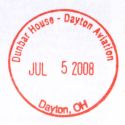
THE WRIGHT BROTHERS - PAUL LAURENCE DUNBAR NHS
City & State: Dayton, OH
Date of Visit: July 5, 2008
GPS Coordinates: N39.75800 W84.21883 (actual)
Web Site: http://www.nps.gov/daav/
I have no idea why this stamp is considered to be part of the Wright Brothers Aviation Heritage. It
is at the home of Paul Laurence Dunbar who was the first
African-American to gain national eminence as a poet. As far as I know he had nothing to do with the
Wright Brothers.
Regardless, the stamp is at the site, and the site is in downtown Dayton at the GPS coordianates shown above.
Photos of my trip are on This Page
|
|
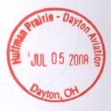
THE WRIGHT BROTHERS - HUFFMAN PRAIRIE IC
City & State: Dayton, OH
Date of Visit: July 5, 2008
GPS Coordinates: N39.79398 W84.08918 (actual)
Web Site: http://www.nps.gov/daav/
This is an easy one to find. It is near Wright-Patterson Air Force Base at the GPS coordinates
shown above. The stamp is in the Visitor Center.
Photos of my trip are on This Page
|

|
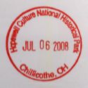
HOPEWELL CULTURE NHS
City & State: Chillicothe, OH
Date of Visit: July 5, 2008
GPS Coordinates: N39.37567 W83.00645 (actual)
Web Site: http://www.nps.gov/hocu/
This stamp is in the Visitor Center located at Mound City. The street address is 16062 State Route 104
in Chillicothe, OH. There are five sites and the one with the Visitor Center is called "Mound City". The
GPS coordinates shown above are in the parking lot.
As can be seen there are two stamps available however only one of them is an "Official" dated stamp.
Photos of my trip are on This Page
|

|
UNDERGROUND RAILROAD FREEDOM NETWORK
According to the site listing at EParks.Com there
are 22 stamps available for the Underground Railroad Freedom Network. As I collect them I will add
information below.
FORT DONELSON NMP - DOVER, TN
Date of Visit: February 16, 2008
GPS Coordinates: N36.48283 W87.86301 (actual)
Stamp Location: Park Visitor Center
Web Site: http://www.nps.gov/fodo/
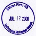
STONES RIVER NMP - MURFREESBORO, TN
Date of Visit: July 12, 2008
GPS Coordinates: N35.88081 W86.43489 (actual)
Stamp Location: Park Visitor Center
Web Site: http://www.nps.gov/stri
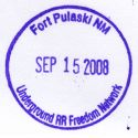
FT. PULASKI NM - TYBEE ISLAND, GA
Date of Visit: September 15, 2008
GPS Coordinates: N32.01882 W80.89975 (actual)
Stamp Location: Park Visitor Center
Web Site: http://www.nps.gov/fopu
|
|
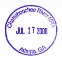
CHATTAHOOCHEE RIVER NRA
City & State: Atlanta, GA
Date of Visit: July 19, 2008 (yes, I know the date on the stamp is wrong)
GPS Coordinates: N33.98719 W84.32533 (actual)
Web Site: http://www.nps.gov/chat/
The stamp is in the Island Ford Visitor Center. Be prepared to pay $3 for this stamp! There is
no fee for using the park however there is a $3 fee for parking. I guess you could park on the street
and not drive into the facility, but it would be a long walk! You could also take a chance and not
pay the $3 however there is a $75 fine if you get caught!
Photos of my trip are on This Page
|
|
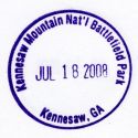
KENNESAW MOUNTAIN NATIONAL BATTLEFIELD
City & State: Kennesaw, GA
Date of Visit: July 19, 2008 (yes, I know the date on the stamp is wrong)
GPS Coordinates: N33.98316 W84.57846 (actual)
Web Site: http://www.nps.gov/kemo/
The stamp is in the Visitor Center and is not difficult to find. The roads to the park are well marked
so this is an easy one to get.
Photos of my trip are on This Page
|

|
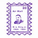
MARTIN LUTHER KING NHS
City & State: Atlanta, GA
Date of Visit: July 19, 2008
GPS Coordinates: N33.75821 W84.37347 (actual)
Web Site: http://www.nps.gov/malu/
The hardest thing about getting this stamp is just getting there! The facility is located in
downtown Atlanta, GA and I DO NOT recommend that you even think about going if there is the slightest
chance of encountering traffic. I'm not sure what that leaves in the way of options but getting
to this site is very difficult through traffic. When I was there I-75 and I-85 were being repaved
so I couldn't even use the interstates. My GPS kept telling me to "Turn Right" and the damn street
would be closed. I'd keep going, my GPS would say "Recalculating" and then "Turn Right on ..." and
the street would be closed. I finally got there though. The GPS coordinates above are in the
parking lot to the north of the Visitor Center. Follow the walkways and you will see the VC.
As can be seen there are two stamps available but only one of them is a dated stamp. I always go
ahead and get the "Bonus" stamps even though they are not "Official".
Photos of my trip are on This Page
|
|
|
FALLEN TIMBERS BATTLEFIELD NHS AND FALLEN TIMBERS MEMORIAL NHS
City & State: Maumee, OH
Date of Visit: Not Visited
GPS Coordinates: N41.56699 W83.64544 (approximate)
Web Site: City of Maumee, OH or
Toledo Lucas County Public Library
I have not visited this site however I received an email from the librarian of the Maumee branch of the Toledo Lucas
County Public Library who informed me that the stamps for these two sites are at their library. I was told that
since the two historic sites are non-staffed, and are maintained by the local Metropark system, that the stamps are at the
library so that they would be available. I was also informed that they are just down the street from Fort Miamis
NHS so be sure and stop at Ft. Miamis for the stamp there when you visit!
Also be sure to tell Erin how grateful you are for voluntarily passing the information about these two stamps
along! These are two of the sites that would be difficult to get the stamps from unless we knew about
this. It would be great if more people took the initiative to let stamp collectors know about situations
like this one. I for one am very grateful!
The branch library is located at:
501 River Road
Maumee, OH 43537
(419) 259-5360
|
|
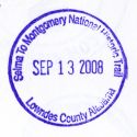
SELMA TO MONTGOMERY NATIONAL HISTORIC TRACE
City & State: Selma, AL
Date of Visit: September 13, 2008
GPS Coordinates: N32.27082 W86.72788 (actual)
Web Site: http://www.nps.gov/semo/
The stamp is in the Visitor Center of the Lowndes County Interpretive Center. The center is on Highway 80
23.7 miles west of I-65 Exit 167.
Photos of my trip are on This Page
|

|
TUSKEGEE AIRMEN NHS
City & State: Tuskegee, AL
Date of Visit: September 13, 2008
GPS Coordinates: N32.45664 W85.68296 (actual)
Web Site: http://www.nps.gov/tuai/
The stamp is in the Visitor Center.
Photos of my trip are on This Page
|

|
JIMMY CARTER NATIONAL HISTORIC SITE
City & State: Plains, GA
Date of Visit: September 13, 2008
GPS Coordinates: N32.03706 W84.39285 (actual)
Web Site: http://www.nps.gov/jica/
The stamp is in the Visitor Center.
Photos of my trip are on This Page
|
|
|
ANDERSONVILLE NHS
City & State: Andersonville, AL
Date of Visit: September 13, 2008
GPS Coordinates: N32.20719 W84.12875 (actual)
Web Site: http://www.nps.gov/ande/
The stamp is presumably in the Visitor Center however the site was closed when I got there.
|

|
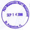
FORT MATANZAS NATIONAL MONUMENT
City & State: St. Augustine, FL
Date of Visit: September 14, 2008
GPS Coordinates: N29.71510 W81.23437 (actual)
Web Site: http://www.nps.gov/foma/
The stamp is in the Visitor Center.
Photos of my trip are on This Page
|


|
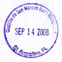
CASTILLO DE SAN MARCOS NATIONAL MONUMENT
City & State: St. Augustine, FL
Date of Visit: September 14, 2008
GPS Coordinates: N29.89661 W81.31246 (actual)
Web Site: http://www.nps.gov/casa/
The stamp is in the book store inside the facility. There is a $3 charge to enter however if
you let the person at the ticket counter know that you only want the Passport Stamp they will usually
waive the entry fee if you will come right back out.
|
|
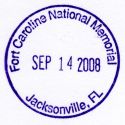
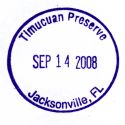
FORT CAROLINE NATIONAL MONUMENT
TIMUCUAN NATIONAL PRESERVE
City & State: Jacksonville, FL
Date of Visit: September 14, 2008
GPS Coordinates: N30.38578 W81.49744 (actual)
Web Site: http://www.nps.gov/foca/
The stamps for both Ft. Caroline and the Timucuan Ecological Preserve are in the Visitor Center.
Photos of my trip are on This Page
|
|
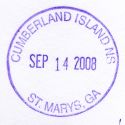
CUMBERLAND ISLANDS NATIONAL SEASHORE
City & State: St. Marys, GA
Date of Visit: September 14, 2008
GPS Coordinates: N30.72157 W81.54834 (actual)
Web Site: http://www.nps.gov/cuis/
The stamp is in Visitors Center.
|
|
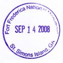
FORT FREDERICA NATIONAL MONUMENT
City & State: St. Simons Island, GA
Date of Visit: September 14, 2008
GPS Coordinates: N31.22297 W81.38897 (actual)
Web Site: http://www.nps.gov/fofr/
The stamp is in the Visitor Center.
Photos of my trip are on This Page
|


|
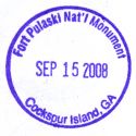
FORT PULASKI NATIONAL MONUMENT
City & State: Tybee Island, GA
Date of Visit: September 15, 2008
GPS Coordinates: N32.01882 W80.89975 (actual)
Web Site: http://www.nps.gov/fopu/
The stamp is in Visitors Center. There is also a stamp for the Underground Railroad Freedom Network.
|
|
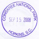
CONGAREE NATIONAL PARK
City & State: Hopkins, SC
Date of Visit: September 15, 2008
GPS Coordinates: N33.83024 W80.82309 (actual)
Web Site: http://www.nps.gov/cong/
The stamp is in the Visitor Center.
This park was formerly the Congaree Swamp National Monument. In 2003 it became a National Park and the stamp
for Congaree Swamp NM was no longer used. The ranger I spoke with told me that they had kept the old stamp
around for a long time but he had not seen it lately. It may still be there somewhere but was not available
when I was there.
Photos of my trip are on This Page
|
|
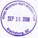
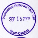
KINGS MOUNTAIN NATIONAL MILITARY PARK
City & State: Blacksburg, SC
Date of Visit: September 15, 2008
GPS Coordinates: N35.14090 W81.37665 (actual)
Web Site: http://www.nps.gov/kimo/
The stamp is in the Visitor Center. There is also a stamp for the Overmountain Victory NHT.
Photos of my trip are on This Page
|

|
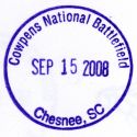
COWPENS NATIONAL BATTLEFIELD
City & State: Chesnee, SC
Date of Visit: September 15, 2008
GPS Coordinates: N35.13701 W81.81850 (actual)
Web Site: http://www.nps.gov/fopu/
The stamp is in the Visitor Center. There is also a stamp for the Overmountain Victory NHT.
|
|
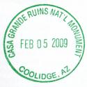
CASA GRANDE RUINS NATIONAL MONUMENT
City & State: Coolidge, AZ
Date of Visit: February 5, 2009
GPS Coordinates: N32.99512 W111.53664 (actual)
Web Site: http://www.nps.gov/cagr/
The stamp is in the Visitor Center.
|
|
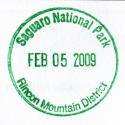
SAGUARO NATIONAL PARK
City & State: Tucson, AZ
Date of Visit: February 5, 2009
GPS Coordinates: N32.17990 W110.73644 (actual)
Web Site: http://www.nps.gov/sagu/
The stamp is in the Visitor Center.
|
|
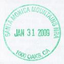
SANTA MONICA MOUNTAINS NATIONAL RECREATION AREA
City & State: Thousand Oaks, CA
Date of Visit: January 31, 2009
GPS Coordinates: N34.18597 W118.88398 (actual)
Web Site: http://www.nps.gov/samo/
The stamp is in the Visitor Center.
|

|
JUAN BAUTISTA DE ANZA NATIONAL HISTORIC TRAIL
City & State: Thousand Oaks, CA
Date of Visit: January 31, 2009
GPS Coordinates: N34.18597 W118.88398 (actual)
Web Site: http://www.nps.gov/juba/
The stamp is in the Santa Monica Mountains NRA Visitor Center.
|
|
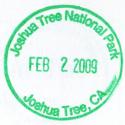
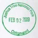
JOSHUA TREE NATIONAL PARK
City & State: Joshua Tree, CA
Date of Visit: February 2, 2009
GPS Coordinates:
- Joshua Tree: N34.13504 W116.31466 (actual)
- Cottonwood: N33.74873 W115.82437 (actual)
Web Site: http://www.nps.gov/jotr/
Both of the stamps I got are in the visitor centers at the GPS coordinates above.
|
|
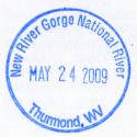
National Coal Heritage - Fayette Station Road
City & State: Fayetteville, WV
Date of Visit: May 24, 2009
GPS Coordinates: Unknown
Web Site: Unknown
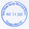
I got the stamp at the Canyon Rim VC.
|
|
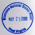
Bluestone National Scenic River
City & State: Beckley, WV
Date of Visit: May 24, 2009
GPS Coordinates: Unknown
Web Site: Unknown
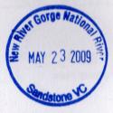
I got the stamp at the Sandstone VC.
|
|
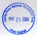
Gauley River NRA
City & State: Beckley, WV
Date of Visit: May 24, 2009
GPS Coordinates: Unknown
Web Site: Unknown
This stamp is available at either the Sandstone or Canyon Rim visitor center.
|



|
Little Rock Central High School
City & State: Little Rock, AR
Date of Visit: October 1, 2009
GPS Coordinates: N34.73821 W92.29713
Web Site: http://www.nps.gov/chsc/
The stamp is in the bookstore in the Visitor Center. Arkansas has their own stamp program in place and
there is a second dated stamp (the one shown in red) that should also be acceptable since it is different from
the NPS stamp. There is also an undated "Bonus" stamp as shown to the left.
|
|
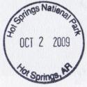
Hot Springs National Park
City & State: Hot Springs, AR
Date of Visit: October 2, 2009
GPS Coordinates: N34.51500 W93.05368
Web Site: http://www.nps.gov/hosp/
The stamp is in the bookstore in the Visitor Center.
|

|
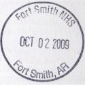
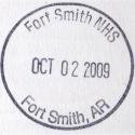
Fort Smith National Historic Site
City & State: Fort Smith, AR
Date of Visit: October 2, 2009
GPS Coordinates: N35.38750 W94.43049
Web Site: http://www.nps.gov/fosm/
The stamp is in the bookstore in the Visitor Center. Arkansas has their own stamp program in place and
there is a second dated stamp (the one shown at the bottom) that should also be acceptable since it is different from
the NPS stamp. There is also a third dated stamp for the Trail of Tears in Arkansas.
|
|
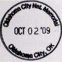
Oklahoma City National Memorial
City & State: Oklahoma City, OK
Date of Visit: October 2, 2009
GPS Coordinates: N35.47380 W97.51775
Web Site: http://www.nps.gov/okci/
The stamp is in the bookstore in the Visitor Center.
|
|
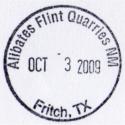
Alibates Flint Quarries National Monument
City & State: Fritch, TX
Date of Visit: October 3, 2009
GPS Coordinates: N35.57977 W101.70328
Web Site: http://www.nps.gov/alfi/
I was there but the ranger was not. There are two tours of the facility each day that are guided by
the ranger. When a tour is in progress the visitor center is closed. I was there during a tour
and chose not to wait an hour for the ranger to return so I did not get a stamp. I could see the
stamp station through the window so it is there however.
Update 11/02/09 - I sent a letter to the park office requesting that they stamp a piece of paper with the
Alibates Flint Quarries stamp and return it to me in the SASE I provided. Lo and behold about a week
later I got response from them. Not one, but TWO stamps! One for Alibates Flint Quarries and
another for Lake Meredith NRA! It is certainly nice to find a national park that will do this since
some of them seem to go out of their way to hide the stamps
(see Zion National Park!). Thank
you! Your help is greatly appreciated.
|
|
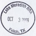
Lake Meredith National Recreation Area
City & State: Fritch, TX
Date of Visit: October 3, 2009
GPS Coordinates: N35.64377 W101.58637
Web Site: http://www.nps.gov/lamr/
I got this stamp indirectly from the Alibates Flint Quarries National Monument. I say "Indirectly" because
when I was there the ranger was gone on a tour. I sent a letter to the facility when I got home asking them
to send me a copy of the Alibates Flint Quarries stamp, and when they responded they included the Lake Meredith
stamp as well. I assume that the stamp is at the Park Headquarters in Fritch, TX (which is where the GPS
coordinates above point to) but I do not know that for certain.
|
|
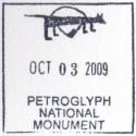
Petroglyph National Monument
City & State: Albuquerque, NM
Date of Visit: October 3, 2009
GPS Coordinates: N35.13848 W106.71092
Web Site: http://www.nps.gov/petr/
The stamp is in the Visitor Center.
|
|
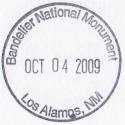
Bandelier National Monument
City & State: Los Alamos, NM
Date of Visit: October 4, 2009
GPS Coordinates: N35.77850 W106.26988
Web Site: http://www.nps.gov/band/
The stamp is in the Visitor Center.
|
|
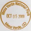
Mesa Verde National Park
City & State: Mesa Verde, CO
Date of Visit: October 5, 2009
GPS Coordinates: N37.25825 W108.49835
Web Site: http://www.nps.gov/meve/
The stamp is in the Visitor Center.
|
|
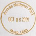
Arches National Park
City & State: Moab, UT
Date of Visit: October 5, 2009
GPS Coordinates: N38.61591 W109.61991
Web Site: http://www.nps.gov/arch/
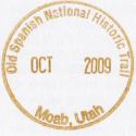
There are two stamps at this site, the stamp for Arches National Park and one for the Old Spanish Trail NHT. As
can be seen the Old Spanish Trail stamp was missing the date when I visited.
|
|
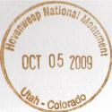
Hovenweep National Monument
City & State: Moab, UT
Date of Visit: October 5, 2009
GPS Coordinates: N37.38615 W109.07486
Web Site: http://www.nps.gov/hove/
The stamp is in the Visitor Center.
Be aware that this is without question the most remote site I have visited. I would not recommend visiting it
low on fuel. At the turn-off into the visitor center and campground there is a sign showing distances to the
three nearest towns. They all three read 41 miles. Click
This Link, switch it to "Satellite View" and take a look around. There is NOTHING close by. The GPS
coordinates shown above were taken in the visitor center parking lot.
The stamp reads "Utah / Colorado" however the visitor center is 1.6 miles west of the state line so it is
technically in Utah. The mailing address is in Cortez, CO however the visitor center is most assuredly
in Utah.
|
|
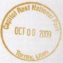
Capitol Reef National Monument
City & State: Torrey, UT
Date of Visit: October 6, 2009
GPS Coordinates: N38.29165 W111.26140
Web Site: http://www.nps.gov/care/
The stamp is in the Visitor Center.
|
|
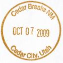
Cedar Breaks National Monument
City & State: Cedar City, UT
Date of Visit: October 7, 2009
GPS Coordinates: N37.61174 W112.83722
Web Site: http://www.nps.gov/cebr/
The stamp is in the Visitor Center.
This site normally closes for the year in mid-October because much later than that and it is in accessible. We
were there on October 7 and there was already a little bit of snow on the ground. The visitor center is at
10,300' MSL and the road in actually peaks at about 10,600' MSL.
|
|
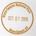
Bryce Canyon National Park
City & State: Bryce Canyon, UT
Date of Visit: October 7, 2009
GPS Coordinates: N37.64029 W112.17045
Web Site: http://www.nps.gov/brca/
The stamp is in the Visitor Center.
|
|
Zion National Park
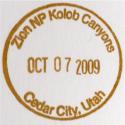
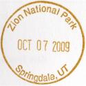
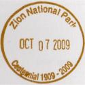
City & State: Cedar City, UT (Kolob Canyon VC) and Springdale, UT
Date of Visit: October 7, 2009
GPS Coordinates: N37.45344 W113.22572 (Kolob Canyon) & N37.19923 W112.98767 (Springdale)
Web Site: http://www.nps.gov/zion/
The stamps are in the Visitor Centers. The Centennial stamp is available in both of the visitor centers. Strangely
enough I damn near had to beg for the Springdale stamp. The only stamp on display was the centennial stamp that I had
already gotten at the Kolob Canyon VC. I asked a ranger whether they had one specifically for the Springdale VC and he
said that they did not. He said that the only one they had was the centennial stamp. I went back outside, dejected
and stampless, and my riding partner was talking to another motorcyclist. I said that there was no Springdale stamp and
the other rider said that there certainly was, he had just gotten it. He said that he asked the girl behind the counter
of the book store (NOT the same person I talked to!) and she had gotten it out of the back room for him. I went back
inside, asked the girl behind the counter in the book store, and sure enough it was hidden in the back room. Not only
do we have to ask for the stamps now but we have to ask the right person! What's up with that???
|
|
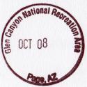
Glen Canyon National Recreation Area
City & State: Page, AZ
Date of Visit: October 8, 2009
GPS Coordinates: N36.93488 W111.48544
Web Site: http://www.nps.gov/brca/
The stamp is in the Visitor Center.
|
|
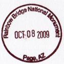
Rainbow Bridge National Monument
City & State: Page, AZ
Date of Visit: October 8, 2009
GPS Coordinates: N36.93488 W111.48544
Web Site: http://www.nps.gov/rabr/
I obtained this stamp at the Glen Canyon Visitor Center.
|
|
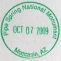
Pipe Springs National Monument
City & State: Moccasin, AZ
Date of Visit: October 7, 2009
GPS Coordinates: N36.86222 W112.73705
Web Site: http://www.nps.gov/pisp/
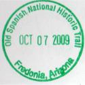
The stamp is in the Visitor Center. I also obtained the Old Spanish National Historic Trail stamp
for Arizona at this site.
|
|
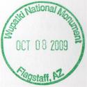
Wupatki National Monument
City & State: Flagstaff, AZ
Date of Visit: October 8, 2009
GPS Coordinates: N35.52024 W111.37110
Web Site: http://www.nps.gov/wupa/
The stamp is in the Visitor Center.
|
|
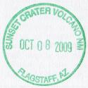
Sunset Crater Volcano National Monument
City & State: Flagstaff, AZ
Date of Visit: October 8, 2009
GPS Coordinates: N35.36932 W111.54353
Web Site: http://www.nps.gov/sucr/
The stamp is in the Visitor Center.
|
|
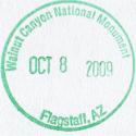
Walnut Canyon National Monument
City & State: Flagstaff, AZ
Date of Visit: October 8, 2009
GPS Coordinates: N35.17199 W111.50925
Web Site: http://www.nps.gov/waca/
The stamp is in the Visitor Center.
|

|
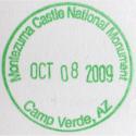
Montezuma Castle National Monument
City & State: Camp Verde, AZ
Date of Visit: October 8, 2009
GPS Coordinates: N34.61132 W111.83913
Web Site: http://www.nps.gov/moca/
The stamp is in the Visitor Center. There is also an undated "Bonus" stamp.
|
|
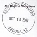
Red Rock Visitor Center (National Forest Service)
City & State: Sedona, AZ
Date of Visit: October 10, 2009
GPS Coordinates: N34.75757 W111.76402
Web Site: N/A
This is a National Forest Service site however they do have a dated stamp. The site is on Highway 179
about 6 miles south of Sedona, AZ.
|
|
|
Cape Lookout National Seashore
City & State: North Carolina
Date of Visit: N/A
GPS Coordinates: N/A
Web Site: http://www.nps.gov/calo/
I have not visited this site however I received an email from a volunteer at the site on September 30, 2009
who provides this information:
I have been volunteering at Cape Lookout and while I donít know the GPS position, I can tell you there are
passport stamps in both the Harkers Island and Light Station (not Keeperís Quarters) Visitor Centers. Portsmouth
has an unofficial stamp at the moment: the real one is supposed to be on order.
Thank you, Kerby! It would be wonderful if other people at the NPS sites would do the same thing and
provide some information pertaining to their sites. It is very much appreciated, thank you very much.
|
|
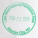
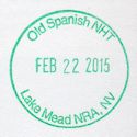
Lake Meade National Recreation Area
City & State: Boulder City, NV
Date of Visit: February 22, 2015
GPS Coordinates: N36.01007 W114.79678
Web Site: http://www.nps.gov/lake/
I got two stamps at this site, one for the Lake Meade NRA and another for the Old Spanish Trail. Both stamps were in the visitor's center, just inside the door as usual.
|
|
TENNESSEE HISTORICAL COMMISSION STAMPS
The Tennessee Historical Commission has stamps scattered around the state at numerous historic
sites. I don't know where they all are, but have run across a number of them myself. They
are undated and would not be considered "Official" NPS Passport Stamps, but I still try and get a
copy of them when I run across them.
According to a friend who provided me with a list of the sites, the Tennessee Historical Commission
had a stamp book available for purchase. The US Department of the Interior, the people who
are in charge of the National Park Service and the National Park Passport Stamp program threatened
to file suit against the State of Tennessee unless they stopped publishing their stamp book. As
I understand it the Department of the Interior felt it would cause competition against their program. This
is about the most absurd thing I have ever heard of, but it is typical of a government entity with nothing
better to do. Rather than think about the good it would bring, getting people out and to the parks,
they whine about competition.
From what information I have been able to gather there were about 95 stamps available when the program was
in full swing. I'm not sure how long ago that was but now many of the stamps have been misplaced and
are no longer available. Many of those that are still available are pretty beat up, dried out, and
do not stamp very well. Regardless, I'll update the information below as I visit more of the sites.
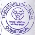 |
Shiloh National Military Park - Hardin County, TN
Visited: October 8, 2006 (photos Here)
GPS Coordinates: N35.15128 W88.32170 (actual)
Stamp Location: Visitor Center
|
|
 |
The Hermitage - Nashville, TN
Visited: August 26, 2007
GPS Coordinates: N36.21443 W86.61586 (actual)
Stamp Location: Ticket Window
|
|
 |
Belle Meade Plantation - Nashville, TN
Visited: April 5, 2008 (Photos Here)
GPS Coordinates: N36.10459 W86.86572 (actual)
Stamp Location: Visitor Center
|
|
 |
The Parthenon at Centennial Park - Nashville, TN
Visited: April 5, 2008 (Photos Here)
GPS Coordinates: N36.15056 W86.81566 (actual)
Stamp Location: Information Desk at Lower Entrance
|
|
 |
Manskers Station - Goodlettsville, TN
Visited: April 5, 2008 (Photos Here)
GPS Coordinates: N36.32385 W86.68974 (actual)
Stamp Location: Visitor Center
Two stamps; 1 for Manskers Station and 1 for Bowen House
|
|
 |
Bowen House - Goodlettsville, TN
Visited: April 5, 2008 (Photos Here)
GPS Coordinates: N36.32385 W86.68974 (actual)
Stamp Location: Mansker's Station Visitor Center
|
|
 |
Sam Davis Home - Smyrna, TN
Visited: April 5, 2008 (Photos Here)
GPS Coordinates: N35.99081 W86.50186 (actual)
Stamp Location: Visitor Center
|
|
 |
Cragfont - Gallatin, TN
Visited: June 7, 2008 (Photos Here)
GPS Coordinates: N36.40540 W86.34188 (actual)
Stamp Location: Visitor Center (upper floor in rear of structure).
|
|
 |
Rock Castle - Hendersonville, TN
Visited: June 7, 2008 (Photos Here)
GPS Coordinates: N36.27988 W86.59574 (actual)
Stamp Location: Visitor Center.
|
|
 |
Wynnewood - Gallatin, TN
Visited: April 5, 2008
GPS Coordinates: N36.39474 W86.31516 (actual)
Stamp Location: Unknown - No stamp obtained since site was under reconstruction.
|
|
 |
Oaklands Historic Mansion - Murfreesboro, TN
Visited: May 4, 2008 (Photos Here)
GPS Coordinates: N35.85558 W86.38569 (actual)
Stamp Location: Visitor Center
|
|
 |
Cannonsburgh Frontier Village - Murfreesboro, TN
Visited: May 4, 2008 (Photos Here)
GPS Coordinates: N35.84448 W86.39604 (actual)
Stamp Location: Visitor Center.
|
|
 |
Fort Donelson NMP - Dover, TN
Visited: May 4, 2008 (Photos Here)
GPS Coordinates: N36.48285 W87.86299 (actual)
Stamp Location: Visitor Center
|
|
 |
Buford Pusser Home - Adamsville, TN
Visited: May 24, 2008 (Photos Here)
GPS Coordinates: N35.23176 W88.38346 (actual)
Stamp Location: No stamp obtained. It has been lost and is no longer available.
|
|
 |
Stones River National Battlefield - Murfreesboro, TN
Visited: July 12, 2008
GPS Coordinates: N35.88081 W86.43489 (actual)
Stamp Location: Visitor Center
|
|
 |
Travelers Rest - Nashville, TN
Visited: July 12, 2008
GPS Coordinates: N36.07615 W86.76465 (actual)
Stamp Location: No stamp obtained. It has been lost and is no longer available.
|
|
 |
The Carter House - Franklin, TN
Visited: July 26, 2008
GPS Coordinates: N35.91741 W86.87319 (actual)
Stamp Location: Visitor Center - Parking is behind the house. Enter on Fowlkes St.
|
|
 |
Carnton Plantation - Franklin, TN
Visited: July 26, 2008
GPS Coordinates: N35.90656 W86.86375 (actual)
Stamp Location: No stamp obtained. It has been lost and is no longer available.
|
|
 |
James K. Polk Home - Columbia, TN
Visited: July 26, 2008
GPS Coordinates: N35.61500 W87.03720 (actual)
Stamp Location: Visitor Center to the right of the actual home
|
|
 |
The Athenaeum Rectory - Columbia, TN
Visited: July 26, 2008
GPS Coordinates: N35.61431 W87.04082 (actual)
Stamp Location: Visitor Center in front of structure.
|
|
 |
Rattle and Snap Plantation - Mt Pleasant, TN
Visited: July 26, 2008
GPS Coordinates: N35.56371 W87.15699 (actual)
Stamp Location: Unknown - The facility was closed when I visited it.
|
|
 |
Cookeville Depot Museum - Cookeville, TN
Visited: August 23, 2008
GPS Coordinates: N36.16459 W85.50908 (actual)
Stamp Location: No stamp obtained. It has been lost and is no longer available. They do, however, have an
"I Was There" bonus stamp but it is not an official THC stamp. To see an image of it
Click Here
|
|
 |
Sgt. Alvin York Home - Pall Mall, TN
Visited: August 23, 2008
GPS Coordinates: N36.54186 W84.96002 (actual)
Stamp Location: No stamp obtained. It has been lost and is no longer available. They do, however, have an
"I Was There" bonus stamp but it is not an official THC stamp. To see an image of it
Click Here
|
|
 |
Cordell Hull Museum - Byrdstown, TN
Visited: August 23, 2008
GPS Coordinates: N36.58220 W85.18481 (actual)
Stamp Location: No stamp obtained. It has been lost and is no longer available.
|
|
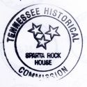 |
Sparta Rock House - Sparta, TN
Visited: October 4, 2008
GPS Coordinates: N35.91995 W85.40370 (actual)
Stamp Location: Inside the Rock House. It is in the back somewhere though so you must ask for it.
|
|
 |
Hohenwald Depot - Hohenwald, TN
Visited: October 18, 2008
GPS Coordinates: N35.54755 W87.55013 (actual)
Stamp Location: No stamp obtained. It has been lost and is no longer available.
|
|
 |
Homeplace 1850 - Tharpe, TN
Visited: May 30, 2009
GPS Coordinates: N36.65552 W87.97362 (actual)
Stamp Location: Inside the Interpretive Center. It is under the counter.
|
|
 |
Rhea County Courthouse - Dayton, TN
Visited: June 19, 2009
GPS Coordinates: N35.49468 W85.01251 (actual)
Stamp Location: No stamp obtained. It has been lost and is no longer available.
|
|
 |
Etowah L&N Depot - Etowah, TN
Visited: June 19, 2009
GPS Coordinates: N35.32323 W84.52439 (actual)
Stamp Location: No stamp obtained. It has been lost and is no longer available. They do have an "I Was
There" stamp but it is not a THC stamp.
|
|
 |
Historic Rugby - Rugby, TN
Visited: November 14, 2009
GPS Coordinates: N36.36024 W84.70034 (actual)
Stamp Location: The stamp is in the town Visitor Center at the GPS coordinates shown. Ask at the admission window,
it is in a drawer there.
|
|
 |
Chickamauga Visitor's Center - Ft. Oglethorpe, GA
Visited: N/A
GPS Coordinates: N34.94039 W85.25934 (actual)
I have the NPS Passport Stamp from this site which is where the GPS coordinates came from. I received word (Thanks Randy!) that there was a
Chickamauga THC stamp there as well, however the information was dated from 2004. Whether it is still there now is anyone's guess.
|
|
|
|
|

| Copyright © 1997-2008, Scott A. Craig, All Rights Reserved |
|
|


