|
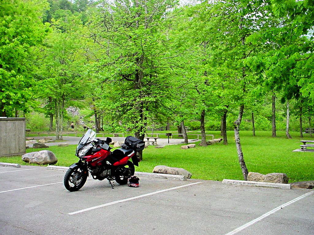
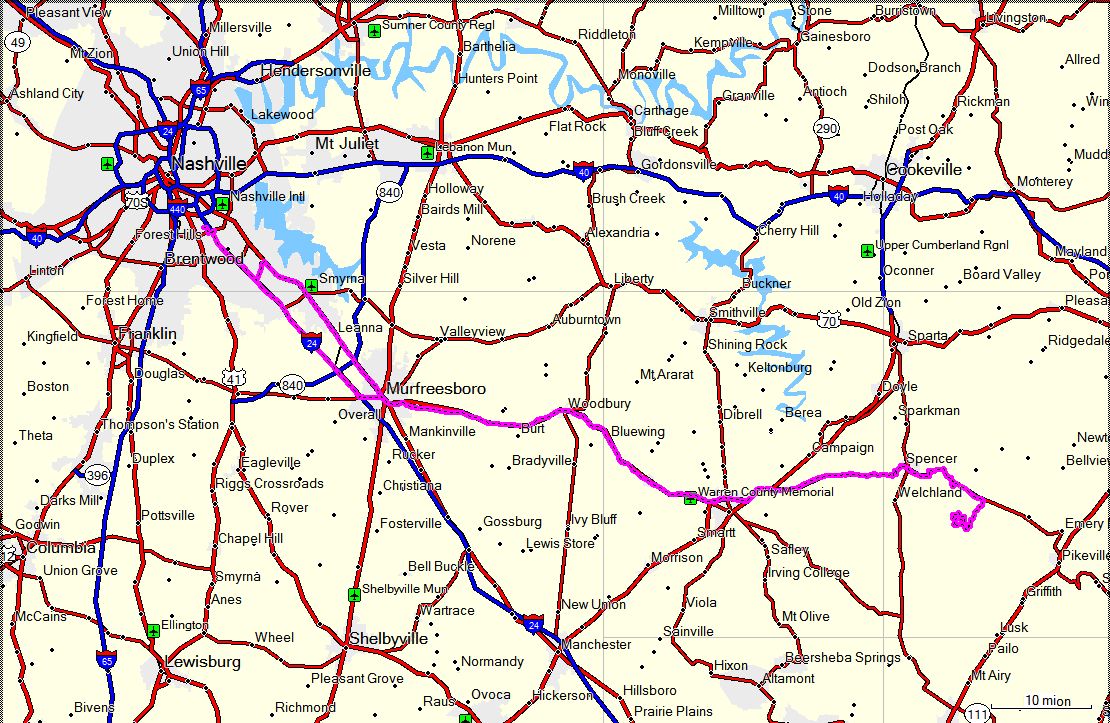
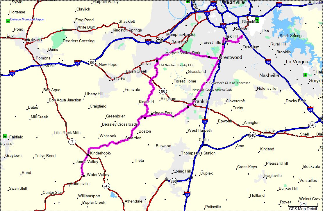
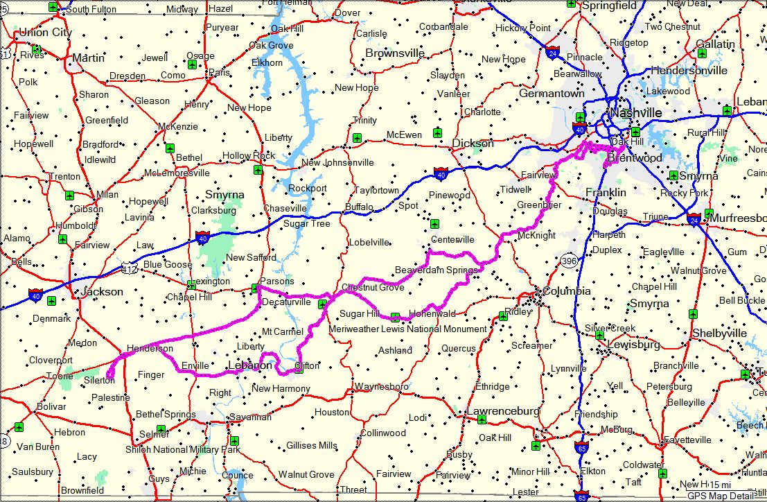
Here are some photos from recent day trips or just riding around. All
of the images are links to larger photos. Click the image to view the large photo. The large
image will open in a new window on most browsers. Web sites for destinations that have one may be
visited by clicking the link below the photo or in the text of the section.
Many of the sections will show GPS coordinates in the title. I try and remember to save the
coordinates when I arrive at a site, but sometimes I forget to do so. In those cases I get
the coordinates from the GPS software on my computer and show them as "+/-" to denote that they
are not exact.
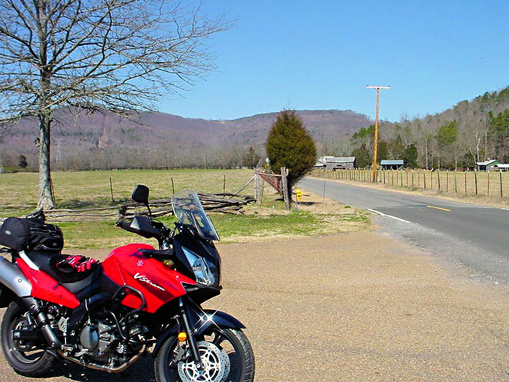
All rides prior to August 8, 2007 were on my Suzuki DL650 V-Strom. On that date I purchased
a Honda VFR800 Interceptor but I kept my V-Strom. Starting then I began showing which bike I rode
in the title line of a ride section. This is probably not of much interest to anyone else, but it helps me
remember which motorcycle I rode on a given day.
Most of the photos were taken by me, but some were taken by friends and other riders. ALL PHOTOS ARE COPYRIGHTED
AND MAY NOT BE USED FOR ANY PURPOSE WITHOUT THE EXPRESS WRITTEN PERMISSION OF THE OWNER
|
|
|
NEW YEARS DAY RIDE -- January 1, 2007 |
|
Yeah, it was a little cool and a whole lot cloudy but it just had to be done. It had rained for
the previous two days and I had to get out and ride my bike for a while. It was 41 degrees when I
left Nashville headed south and cooled a little more as I got away from Nashville. I rode a little
south of Chapel Hill, TN via Highway 31S and then cut over to Columbia via Highway 99 and 412. By
the time I got to Columbia I was pretty chilled so I stopped for some breakfast and then headed back to
Nashville. No photos taken, but a track from my GPS is shown below. Not a scenic ride or
a long trip or anything else, but anyone who rides bikes will understand what it's like to just get
out and ride for a while.
100 miles on the clock, many more to come this year! Just wait until the July 4 weekend trip!
|
|
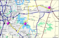
New Years Day Ride Track - 01/01/2007 |
|
|
|
|
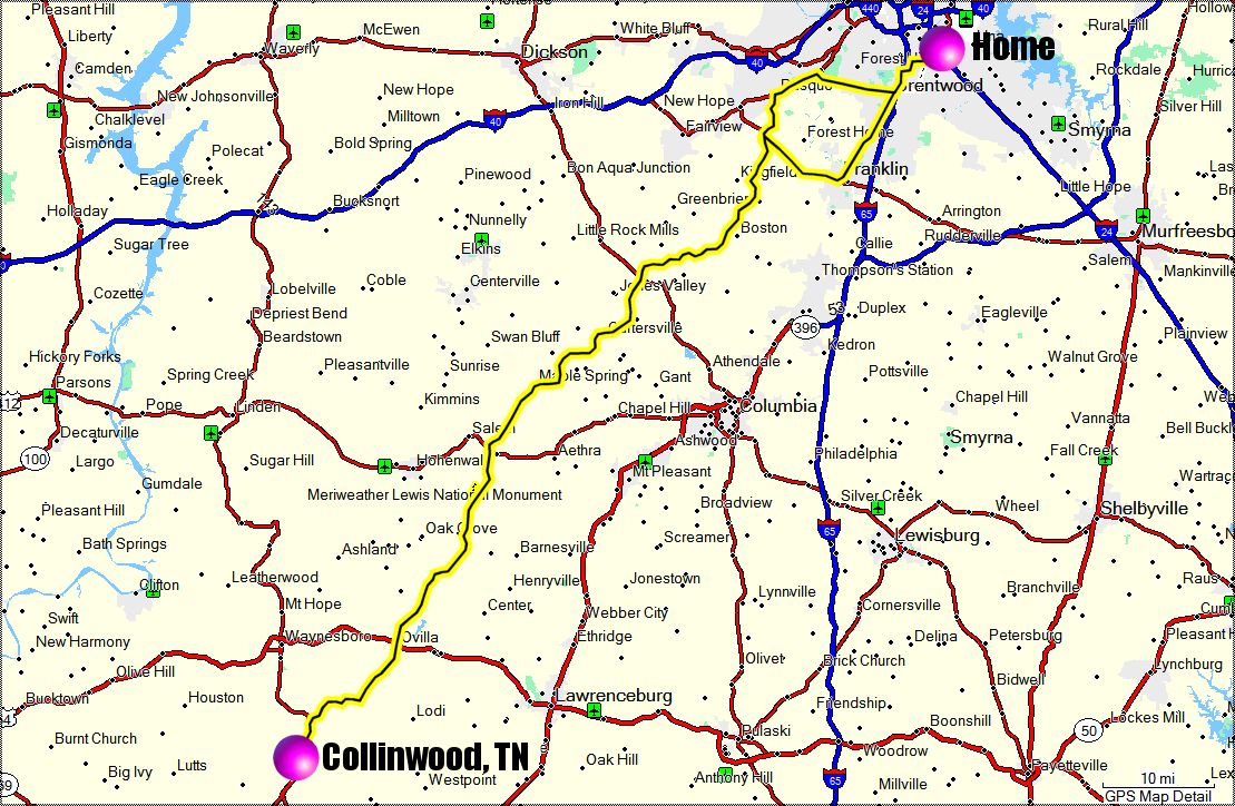
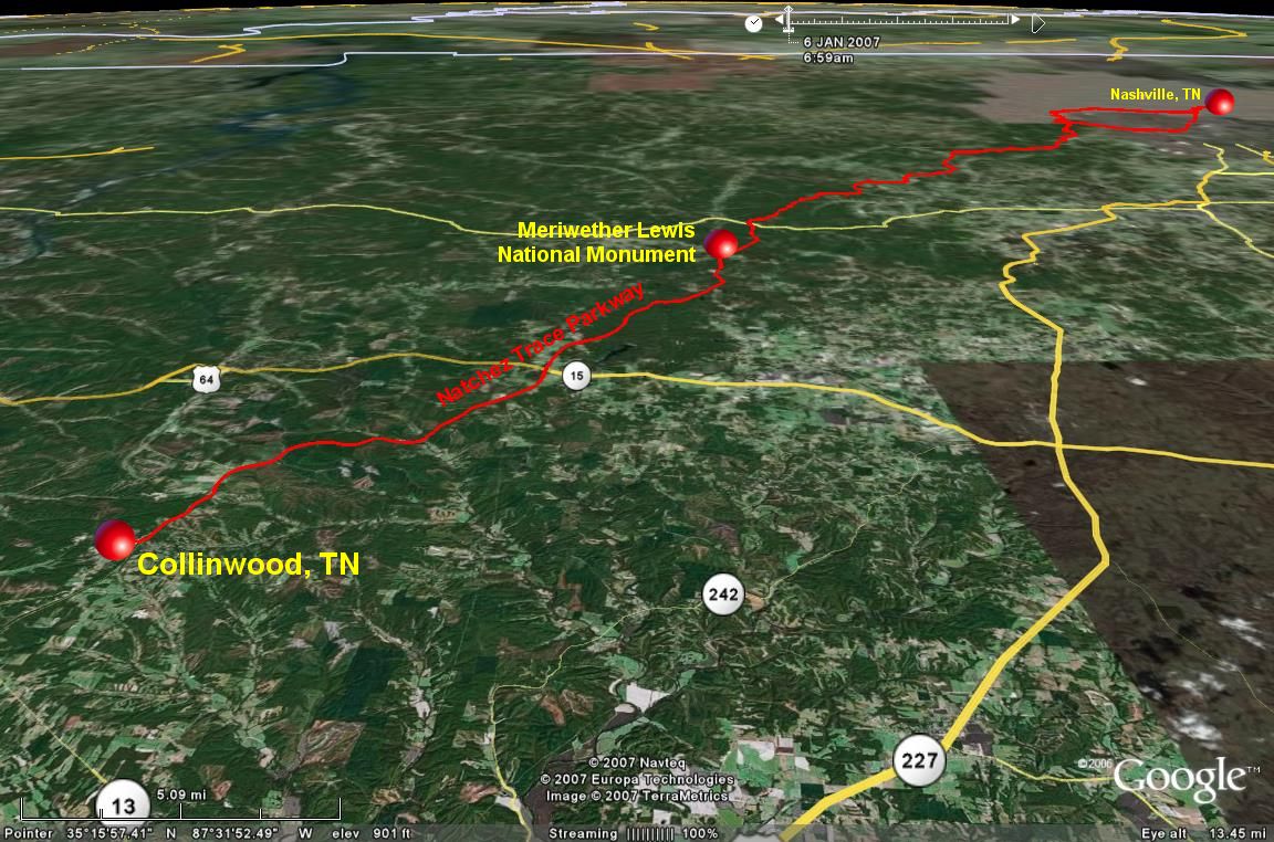
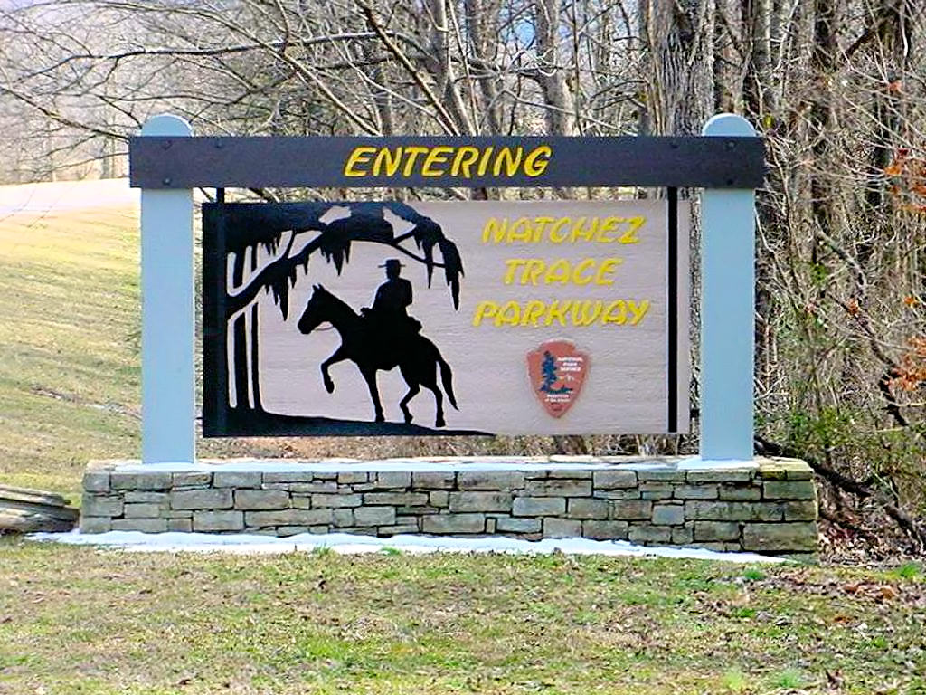
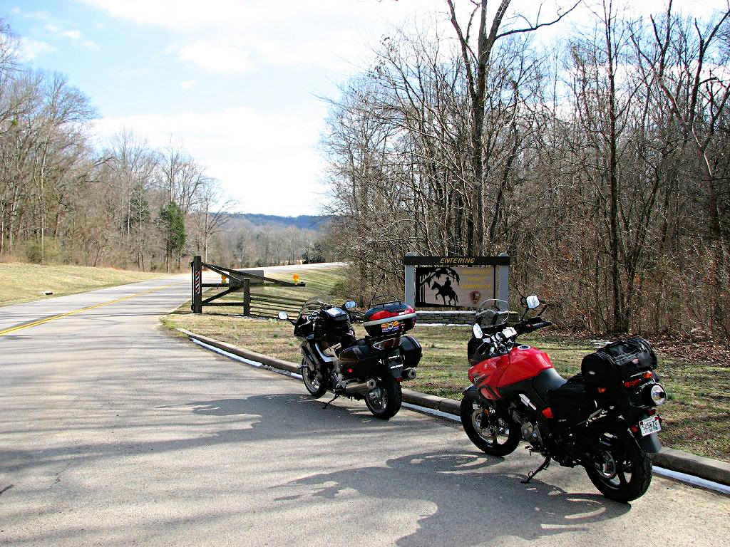
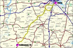
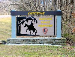
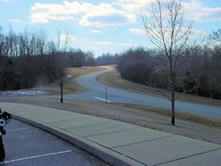
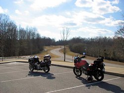
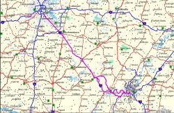
NATCHEZ TRACE PARKWAY - Nashville to Collinwood - January 6, 2007 |
|
No photographs this trip but I've been up and down the Natchez Trace Parkway many times
and have plenty of photos
Here and
Here. Today I was just riding. We don't often get 60+ degree days in January
and it was far too nice not to get out and ride.
I left Nashville about 6:15am, stopped at a Shoneys for breakfast, and headed over to the
Natchez Trace Parkway on Highway 100. I had originally intended to ride down to near the
Meriwether Lewis Monument and then cut over to Columbia and back home. When I hit the
monument it just felt good so I kept going. I wound up in Collinwood, TN just
north of the Tennessee / Alabama border. I stopped at the Wayne County Welcome Center
and had a cup of coffee, then headed back north up the Trace again. I got back home
about 1:00 in the afternoon after logging about 225 miles according to my GPS. Gorgeous
weather for January here so far. I keep waiting for it to come to a screeching halt but
until it does I'll keep on riding my bike! |
|
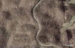
Natchez Trace Parkway - 01/06/2007 |

Google Earth Plus 3D View |
|
|
|
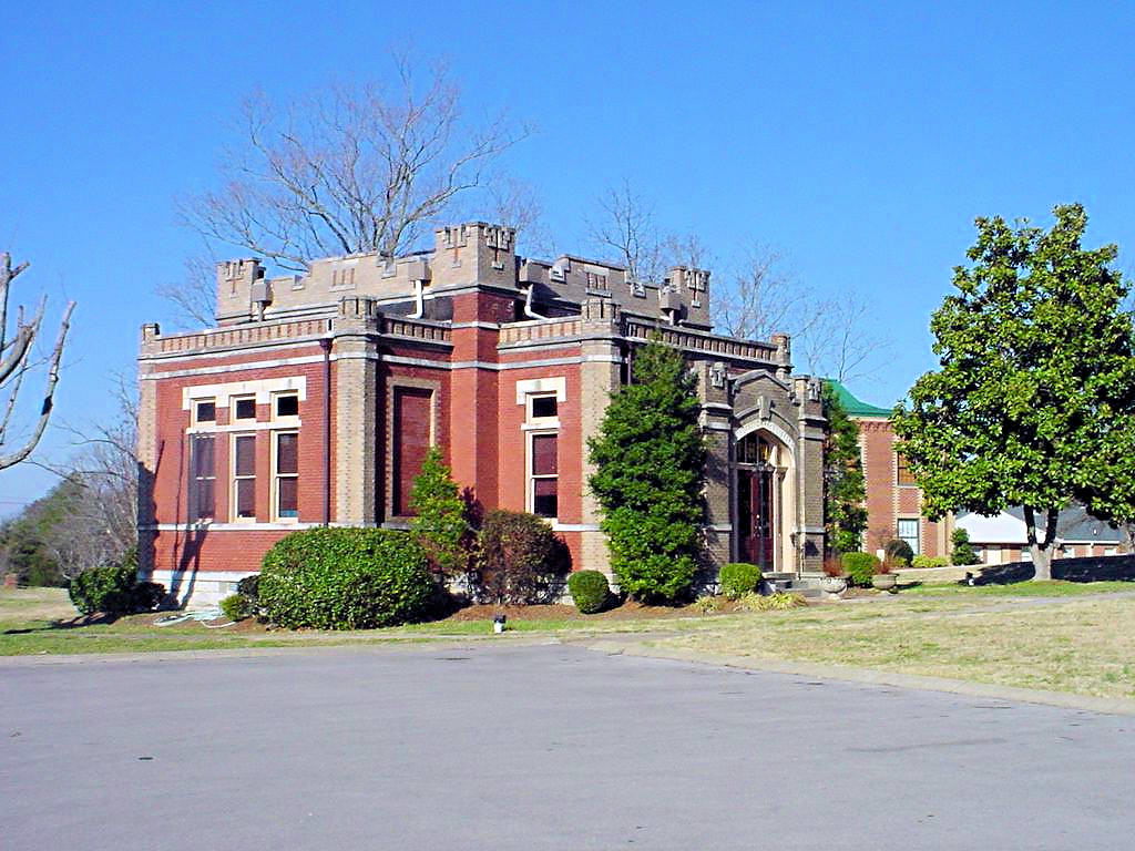
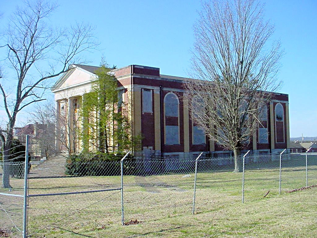
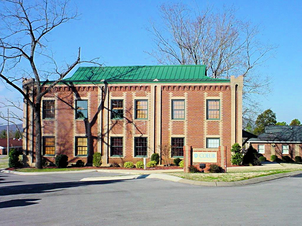
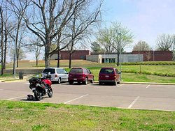
CASTLE HEIGHTS MILITARY ACADEMY - January 27, 2007 |
|
It was too nice today not to get out and ride, but it isn't going to last. The forecast high today
was 54 and the forecast high for tomorrow is 34. Somewhere in between there has to be some ugly
weather coming through so I decided not to take the trip I had originally planned (Tupelo, MS) and just
do some riding in this area. I logged about 100 miles, which is about 1/4 of what I had planned,
but it was great just ot be out riding. (Update - I did finally take the
Tupelo Trip on March 24)
CASTLE HEIGHTS MILITARY ACADEMY - I attended CHMA during the 1967
and 1968 school years, and I don't think I've been back to see it since that time. A lot has changed
in the intervening 40 years, but in many respects the old place is still looking good. Many of the
old buildings are still there (although some that I remember are long gone).
Below are a few photos of how the place looks today. I wish I could remember the names of all the
buildings but I can't. It doesn't feel the same without a bunch of cadets dressed in blue and gray
though. I did feel like I felt some old friends welcoming me back though; Col. Alvin Rochelle, Col.
Ralph Lucas, even Col. Leonard Bradley.
The Castle Heights Alumni Association has put up a web site for CHMA at
This Link. It provides an interesting view of the CHMA lifestyle, and there is even a photo of
me back in 1966.
|
|
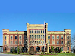
CHMA Main Building - 01/26/2007 |

CHMA - 01/26/2007 |
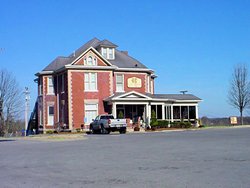
CHMA - 01/26/2007 |
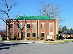
CHMA - 01/26/2007 |
|
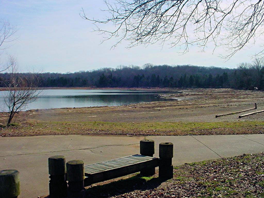
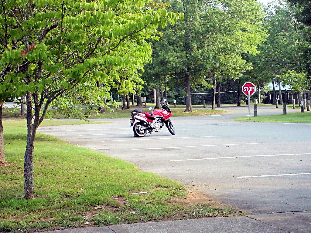
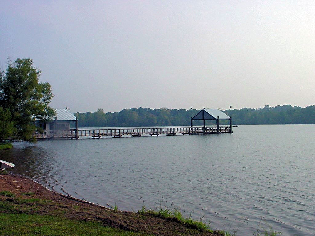
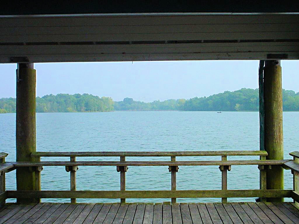
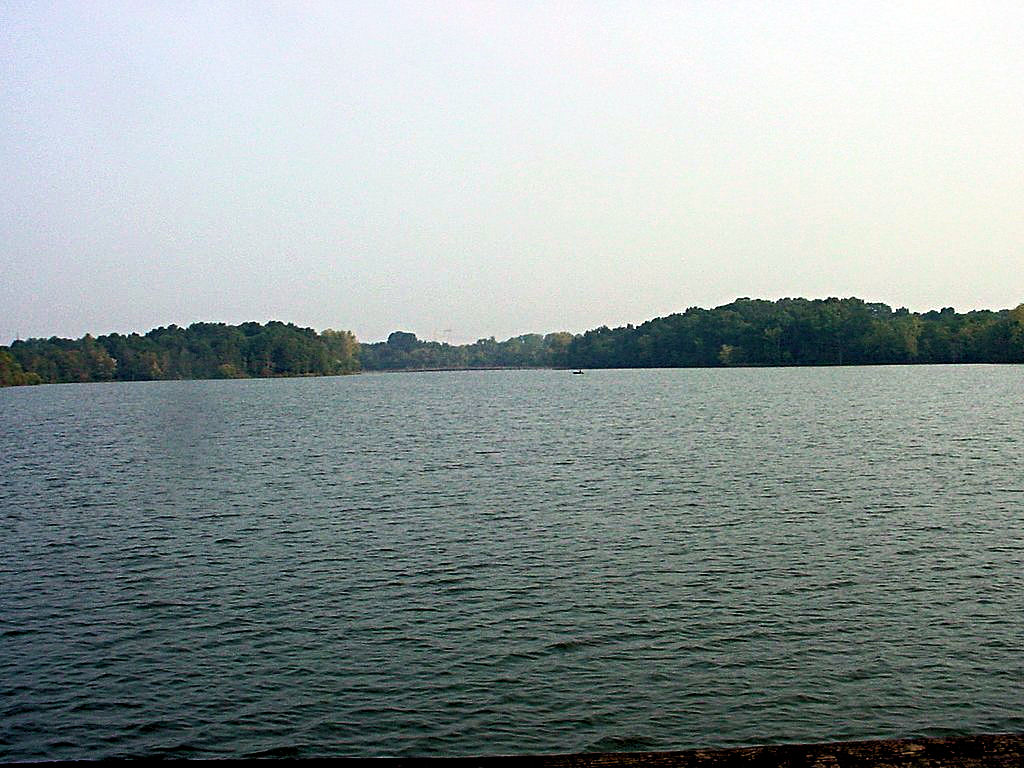
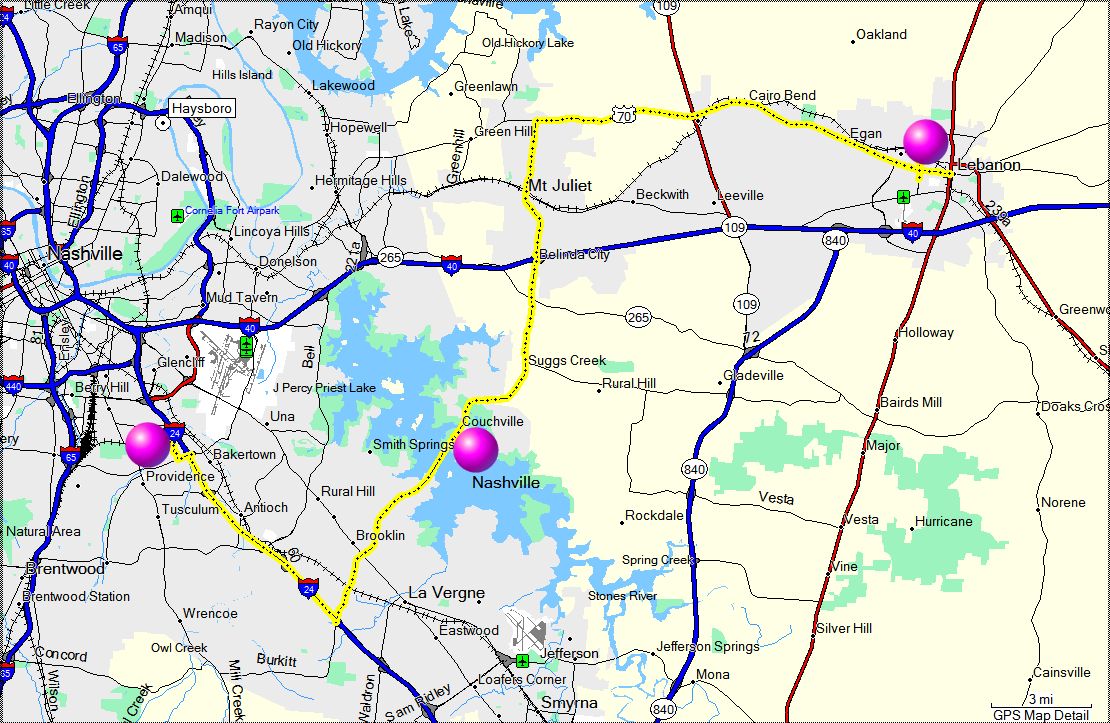
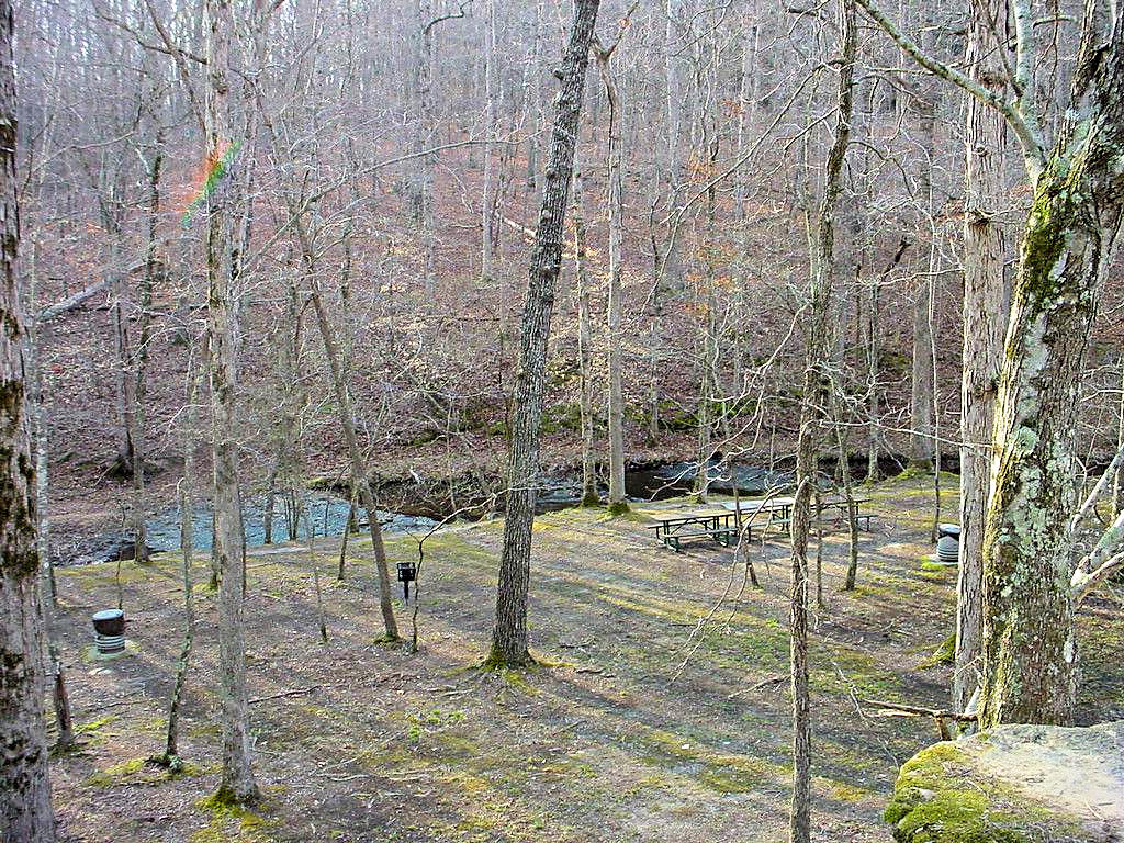
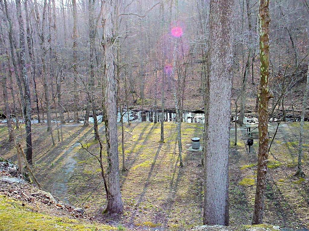
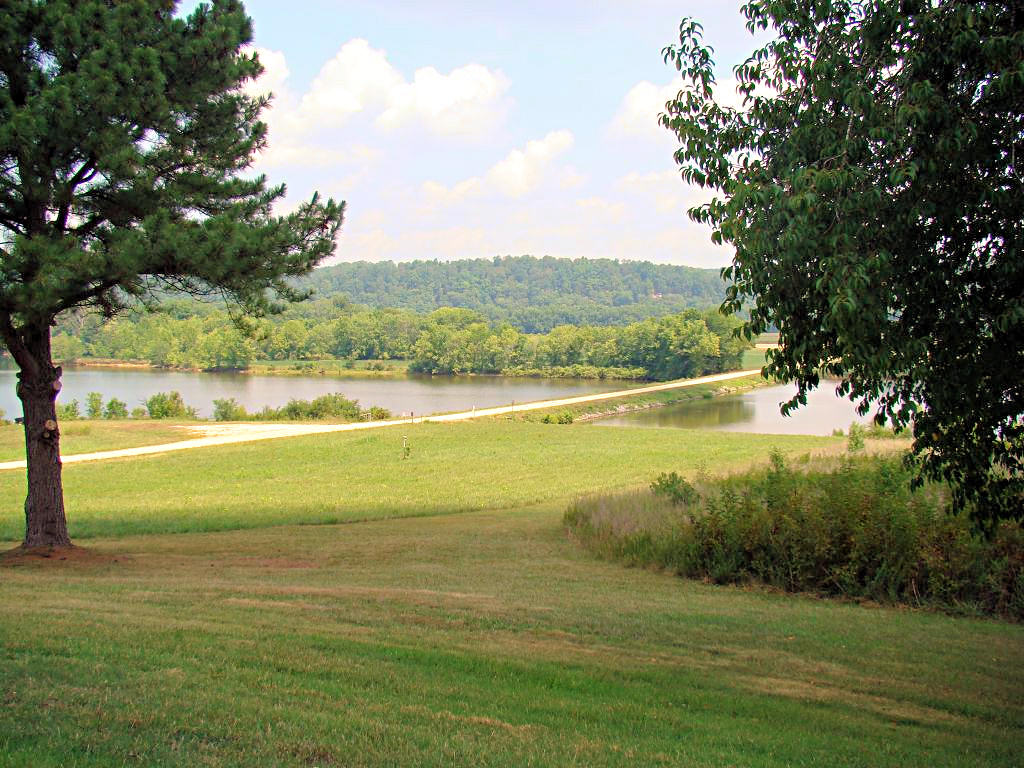
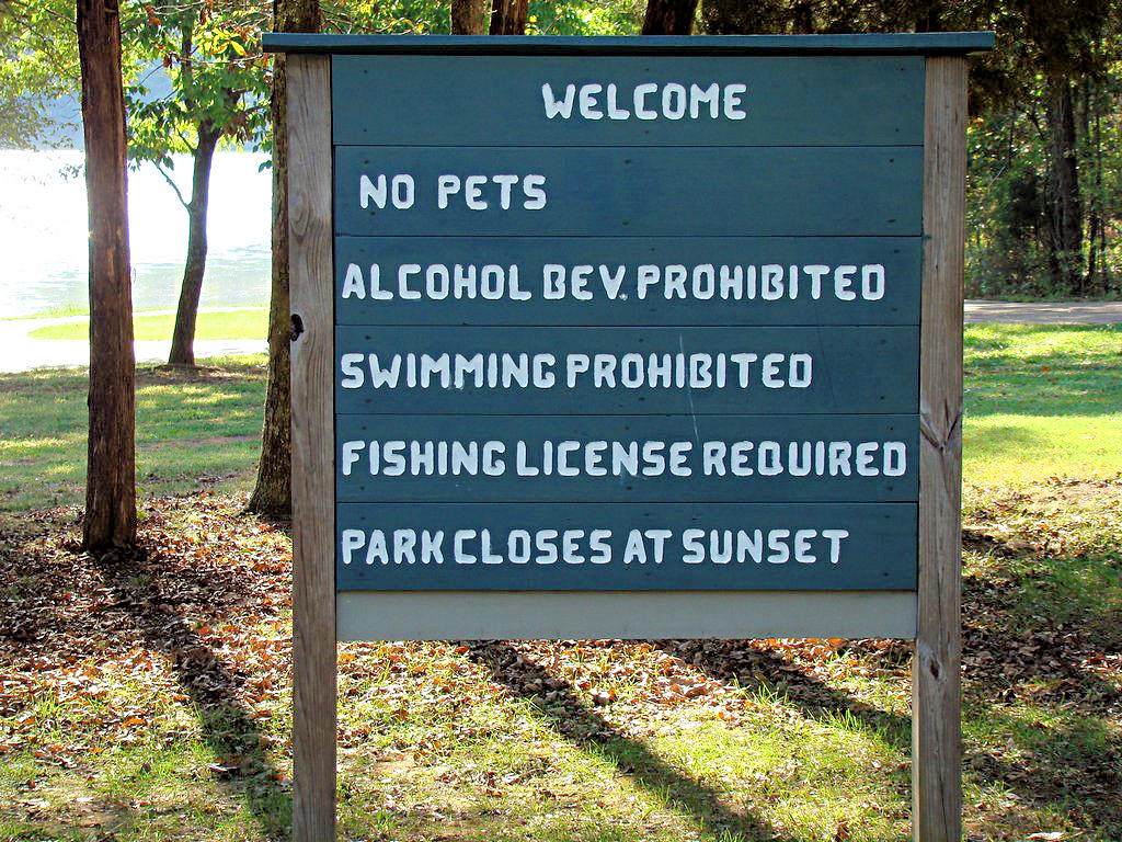
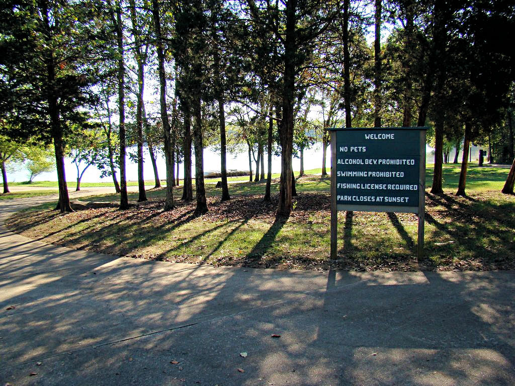
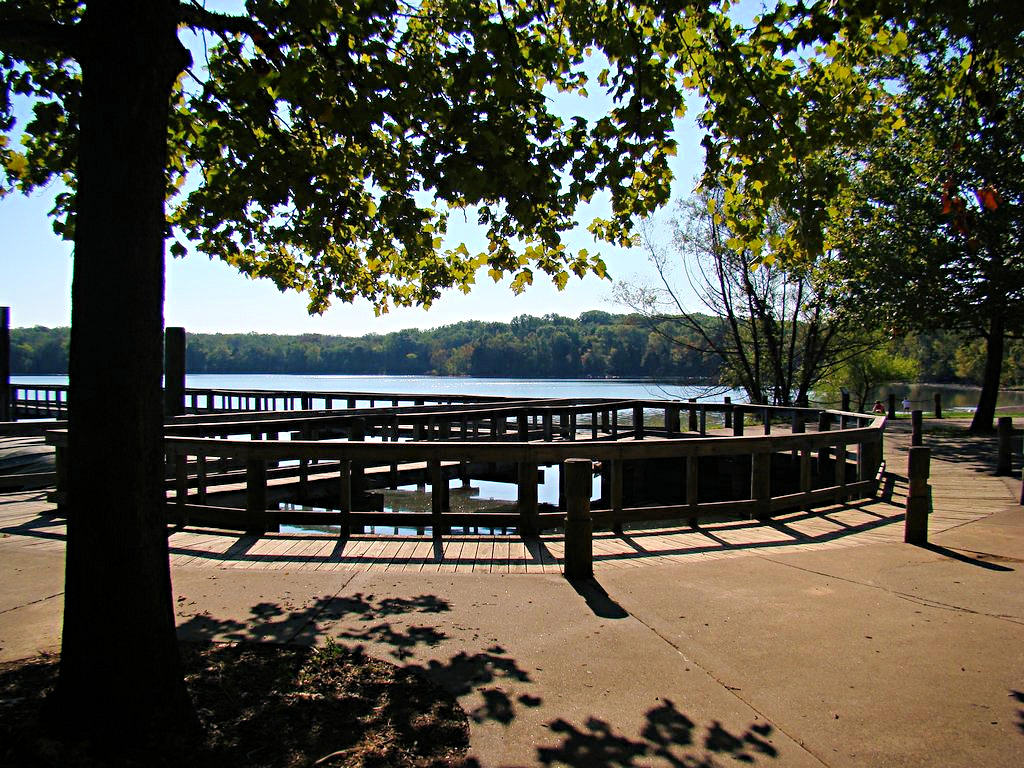
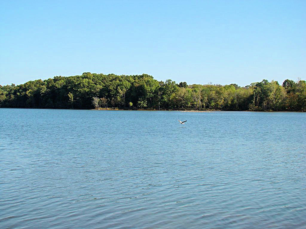
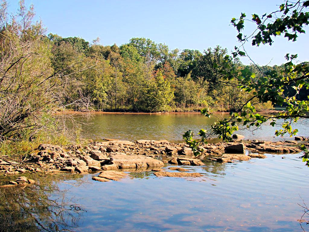
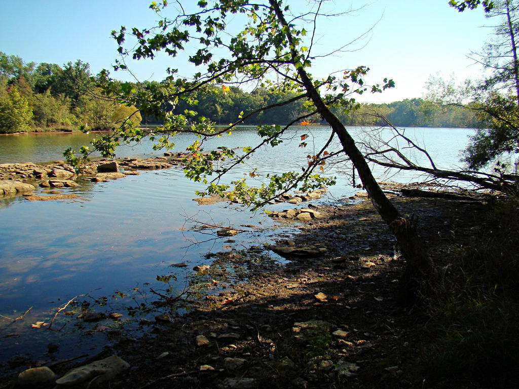
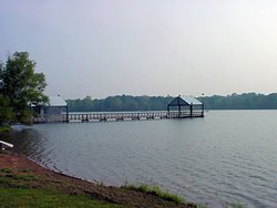
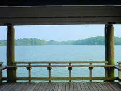
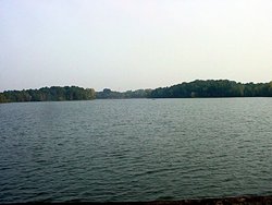
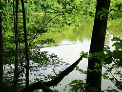
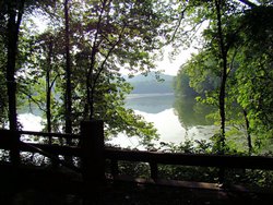
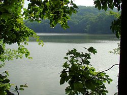
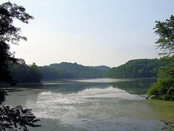
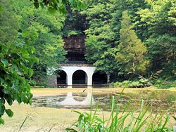
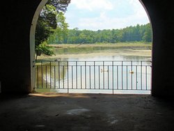
COUCHVILLE LAKE - I also stopped by Couchville Lake at Long
Hunter State Park on the way home. Couchville Lake used to be one of my favorite "Thinking Spots"
since it is so quet there. It is a relatively small lake, approximately 100 acres, but no power
boats are allowed on the lake. It is near Percy Priest Lake so there is the everpresent drone
from the people fishing and skiing but even so it is a peaceful spot to relax. There are paved
walking trails around the lake and a pedestrian bridge that crosses it midway.
Today it was just ugly. For some reason the water level was WAY down and it looked more like a
dried-up mud hole than a lake. Contrast the photos below with some I took last year. The
top row is today and the second row is from last August.
|
|
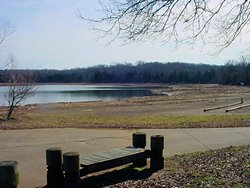
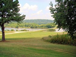
Couchville Lake at Long Hunter State Park
Nashville, TN - January 27, 2007 |
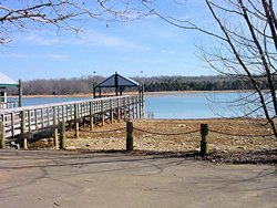
Couchville Lake at Long Hunter State Park
Nashville, TN - January 27, 2007 |
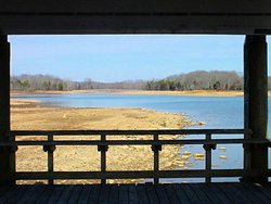
Couchville Lake at Long Hunter State Park
Nashville, TN - January 27, 2007 |
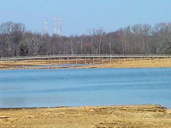
Couchville Lake at Long Hunter State Park
Nashville, TN - January 27, 2007 |
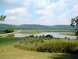
Couchville Lake at Long Hunter State Park
Nashville, TN - August 26, 2006 |
Couchville Lake at Long Hunter State Park
Nashville, TN - August 26, 2006 |
Couchville Lake at Long Hunter State Park
Nashville, TN - August 26, 2006 |
Couchville Lake at Long Hunter State Park
Nashville, TN - August 26, 2006 |
|
And, of course, I have to throw in a track of today's ride. Not very long, about 85 miles round
trip (and then a bit more around town), but for the end of January in Tennessee it is more than I had
expected to be able to do.
|
|
January 27, 2007 GPS Ride Track |
|
|
|
|
NATCHEZ TRACE PARKWAY - February 18, 2007 |
|
Lord it felt good to get out and ride some today! Not a long ride or a ride with a destination,
just a relief to get out and RIDE!
My riding buddy AGirl has been in Nashville for the past week
or so picking up her new 2007 Yamaha FJR1300A (see the story behind that at
This Link) and I think both of us were suffering from a bad case of Cabin Fever because of rain, snow,
and just bitter cold weather.
We left my house with no real destination in mind, and as usual wound up on the Natchez
Trace Parkway (guess you could say we got "Booted" in that direction). There is a
particular curve on The Trace that we have photographed with both of her LD bikes, and
in virtually every season of the year. Now we have a photograph with a little bit
of snow on the ground (it snowed here last night but was mostly gone by noon).
It was a bit cool, but it was GREAT to get out on a bike again!
We stopped at a Starbucks in Brentwood a bit later to warm up and talked about all of AGirl's
Upcoming Trips for 2007. She
is going to be a busy lady this year and that FJR won't stay new for long.
|
|
Natchez Trace Parkway - 02/18/2007 |

Natchez Trace Parkway - 02/18/2007 |
Natchez Trace Parkway - 02/18/2007 |
Natchez Trace Parkway - 02/18/2007 |
Natchez Trace Parkway - 02/18/2007 |
Natchez Trace Parkway - 02/18/2007 |

Me At Leipers Fork on The Trace - 02/18/2007 |
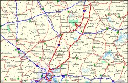
GPS Track Log - 02/18/2007 |
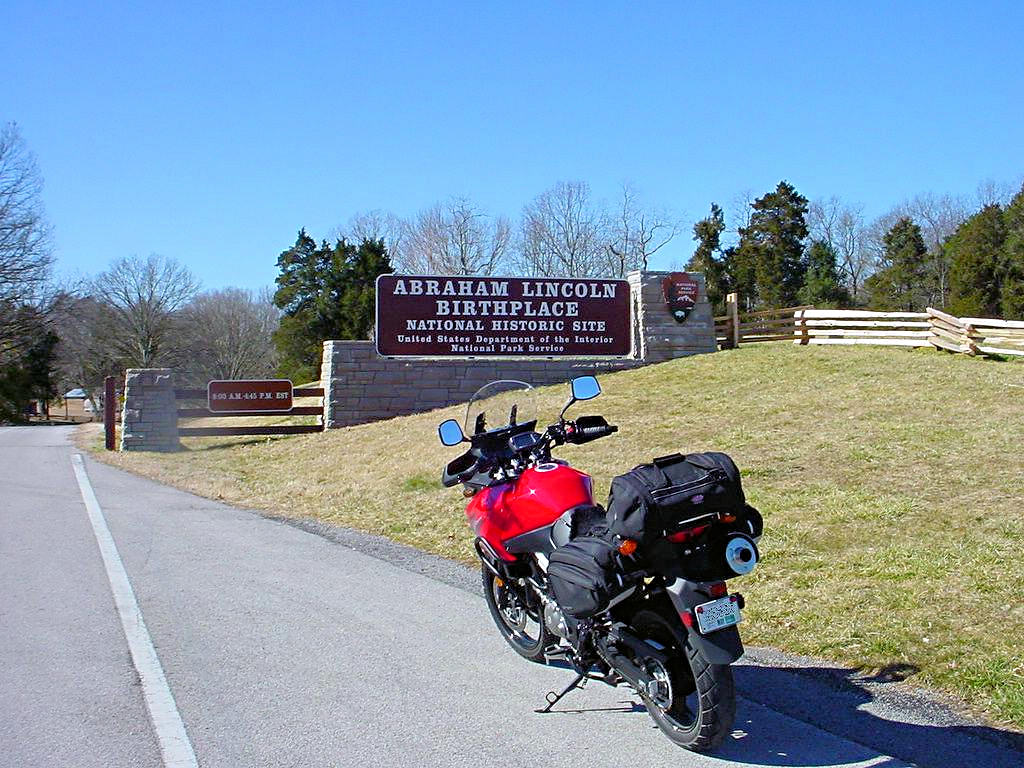
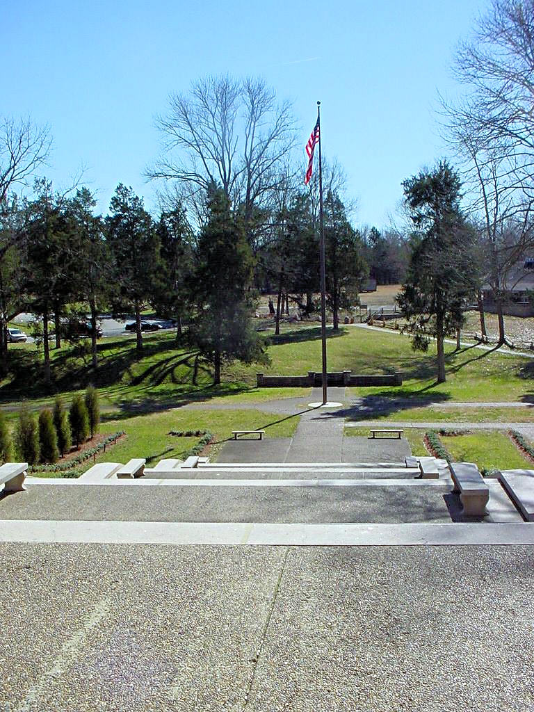
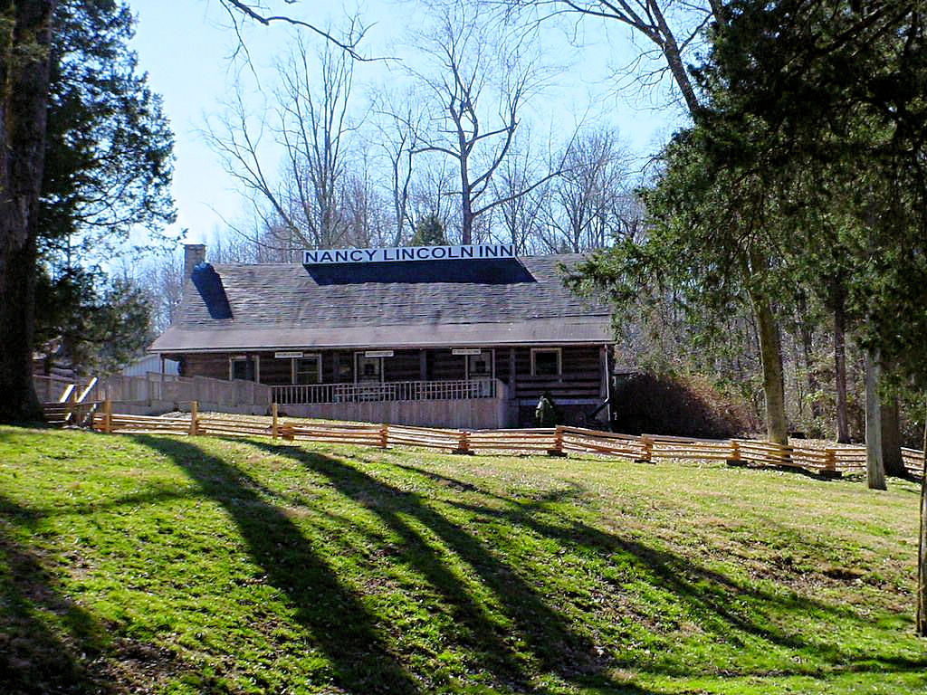
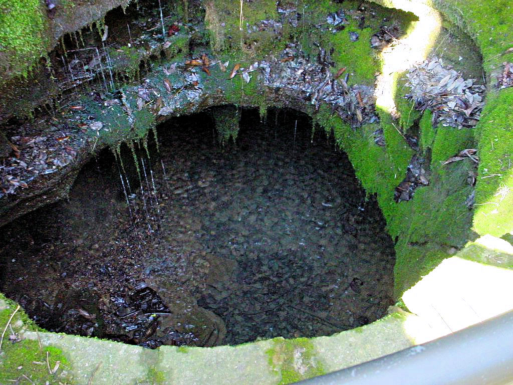
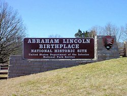
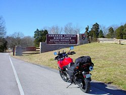
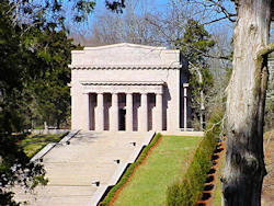
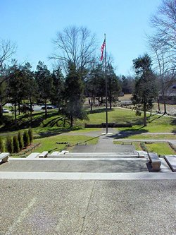
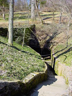
ABRAHAM LINCOLN'S BIRTHPLACE - Hodgenville, KY - February 22, 2007
GPS Coordinates: N37.53066 W85.73632
|
|
Yesterday was the first really nice day we have had in about 6 weeks or so (up to 70°) so I
decided to take off work today and ride somewhere. Since I've started collecting
National Park Passport Stamps it only
seemed logical that I ride somewhere that had a stamp available. I chose Abraham Lincoln's
Birthplace at Hodgenville, KY and headed out early. The ride up was perfect: Bright and clear,
not a breath of wind except from the trucks on I-65. The ride back was not. It was
windy as hell and blew me all over the road. Regardless it was a great ride.
The site is about 10 miles east of the Sonora exit of I-65 (exit 81) and well marked. The
National Park Service website is at This Link
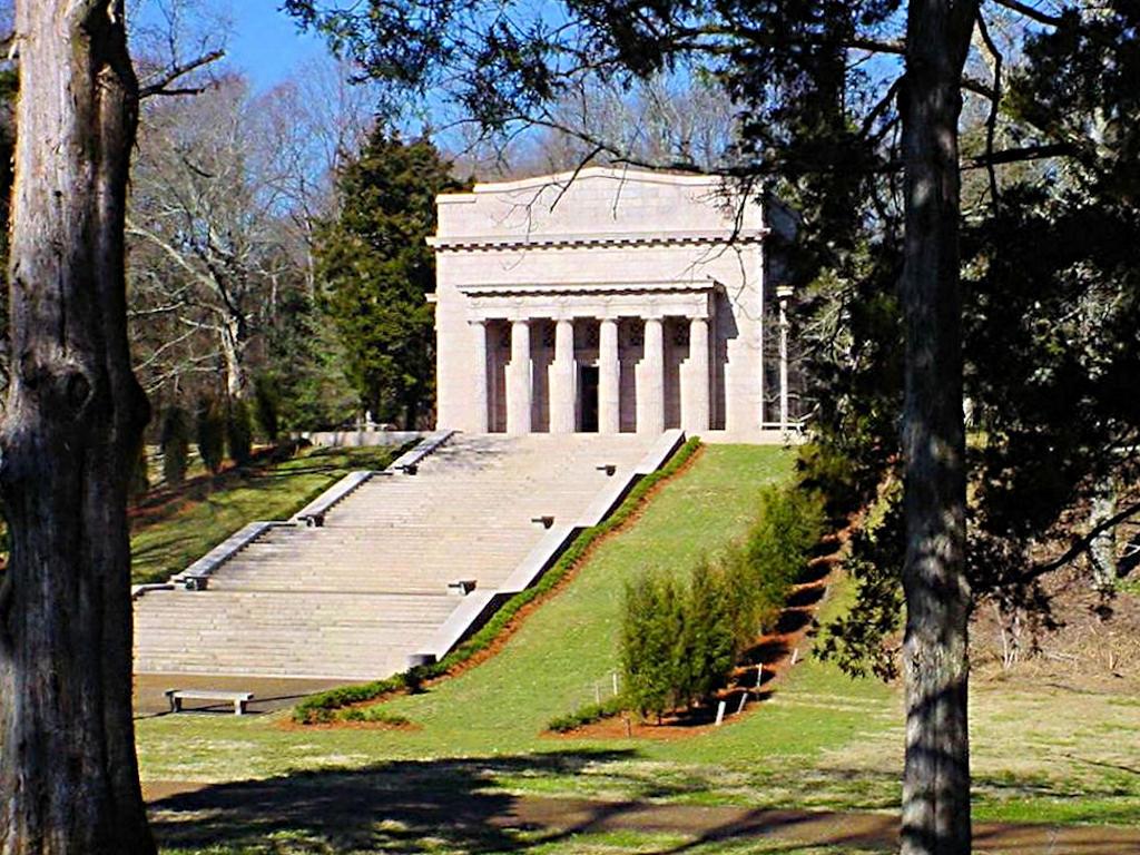
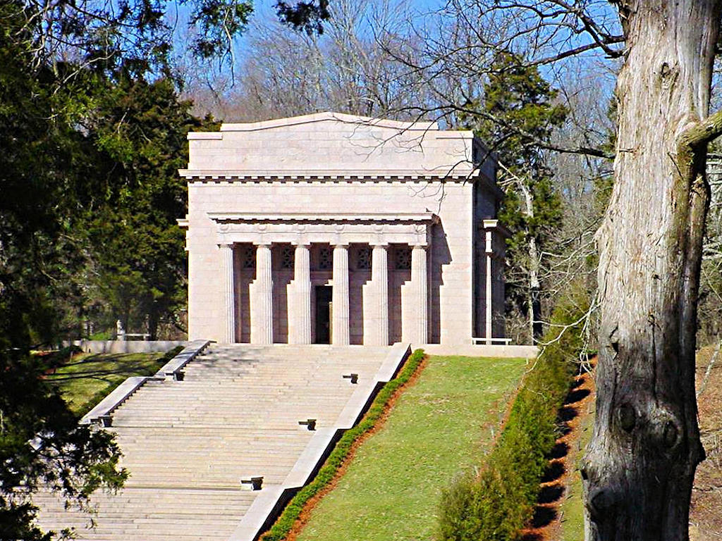
The large white structure in the second row of photographs is the "Cabin Memorial". Inside is,
"An early 19th century Kentucky cabin [which] symbolizes the one in which Abraham was born". It
was somewhat dim inside and I could not use the flash on my camera so I did not get any good photos
of the cabin itself. It is simply a one-room log cabin as would be expected.
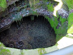
The second photo in the third row is of a set of stone steps that leads down to the "Sinking Spring" which
is a spring that the Lincoln family used for their water. The third photo shows the spring today. I
for one would not want to depend on that as my source of drinking water!
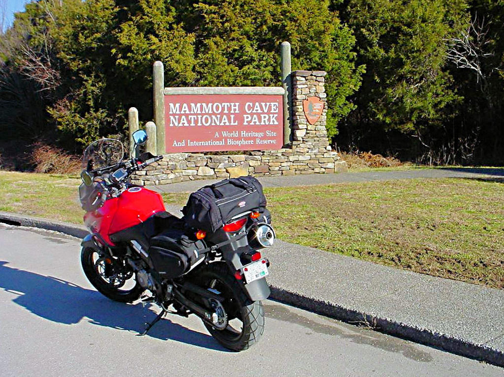
For some reason I also made a detour to Mammoth Cave National Park. I'm not real sure why since
I rode up there in September of last year and that was where I got my first stamp. I think I
stopped there just for spite since when I was there in September I had a fractured right foot and could
barely walk!
Three hundred miles on the clock today (I came home the longer way!), so that makes up for a few of those
weekends I was stuck in the house over the winter.
|
|
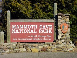
Mammoth Cave - 02/22/2007 |
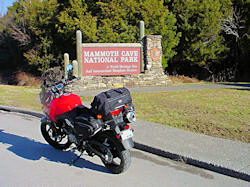
Mammoth Cave - 02/22/2007 |
Mammoth Cave - 02/22/2007 |
Lincoln's Birthplace - 02/22/2007 |
Lincoln's Birthplace - 02/22/2007 |

Lincoln's Birthplace - 02/22/2007 |
Lincoln's Birthplace - 02/22/2007 |
Lincoln's Birthplace - 02/22/2007 |
Lincoln's Birthplace - 02/22/2007 |
Lincoln's Birthplace - 02/22/2007 |
Lincoln's Birthplace - 02/22/2007 |
GPS Track Log - 02/22/2007 |
|
SHORT DAY RIDE - Stones River National Battlefield - February 24, 2007 |
|
The forecast for today was for lots of rain and wind with thunderstorms developing later in the day. It
was pretty warm for February though and I had to get out and ride a bit. I missed a
National Park Passport Stamp for the Tennessee Civil War NHA when I was at Stones
River National Battlefield last fall so I made a quick run to Murfreesboro and snagged it. The lady
I talked to said that the reason I didn't get it in September was that it was a relatively new stamp and
they didn't have it at that time. Good thing Murfreesboro is as close to home as it is! Sorry,
AGirl, I've got one you don't have!
I didn't take any photos, but there are several at
This Link from my trip there in September, 2006. I did keep a track log running on my GPS though, and
that image is shown below.
If you haven't guessed from my track log images I absolutely detest running the interstates. If I'm
trying to make time that's the only way to go, but if I'm in no hurry I'll avoid the interstates like the
plague. The reason I love riding a bike is to enjoy the scenery and the ride itself. Blasting
down the interstate, fighting wind from the trucks, watching for idiots that don't pay any attention to
people around them, dodging "Tennessee Road 'Gators" (the pieces of tire that trucks throw up and then
leave in the middle of the road), bouncing over concrete expansion joints, avoiding potholes that our
highway department never gets around to properly fixing, that is not my idea of enjoying a ride. I
prefer the solitude and quiet of the secondary roads and highways and given a choice that's the way I will always go.
|
|
|
|
|
|
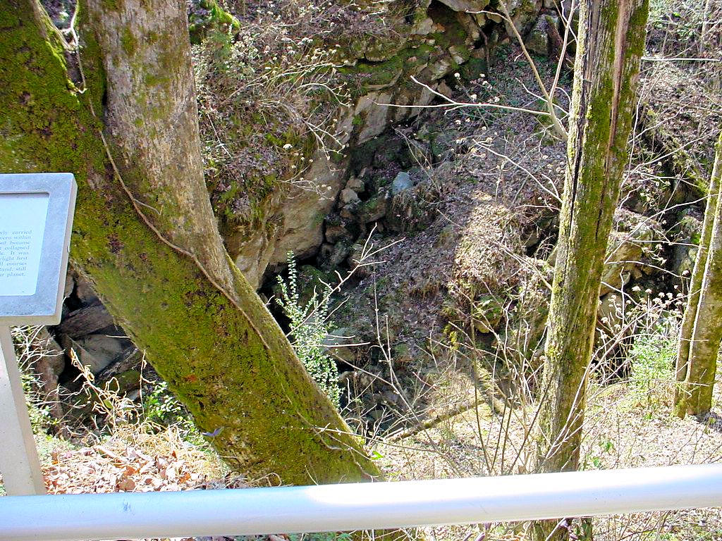
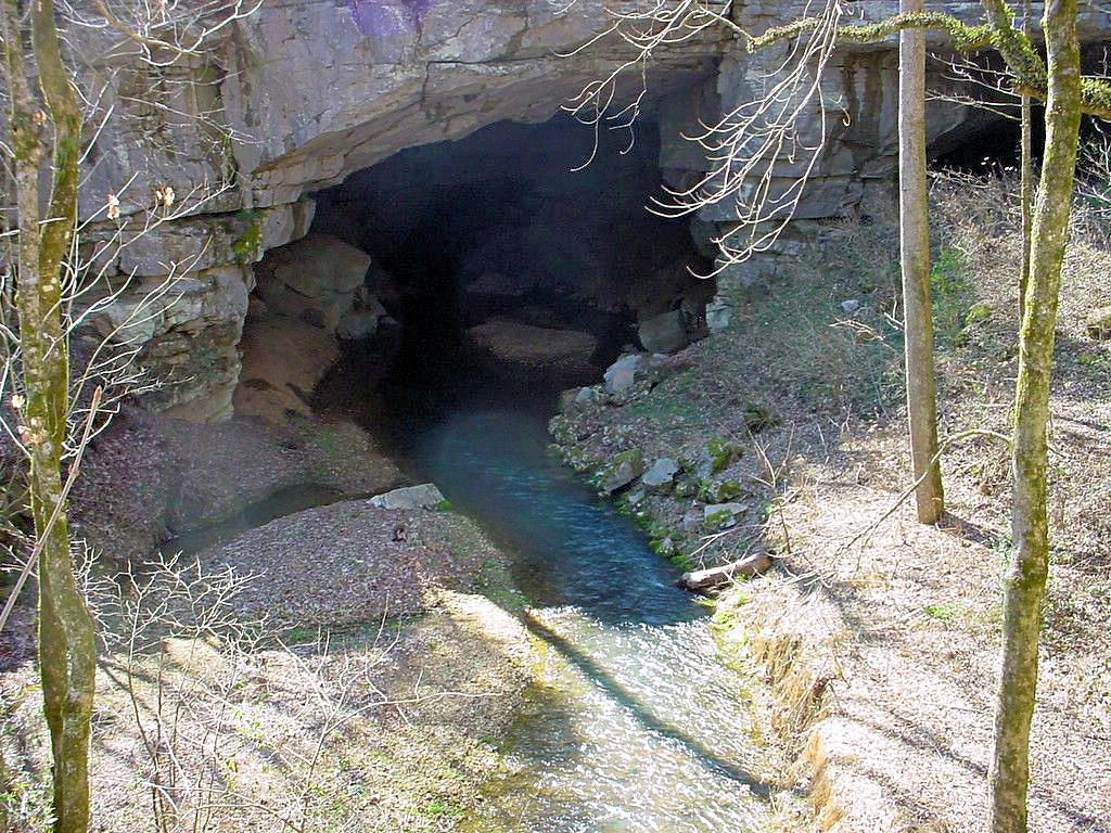
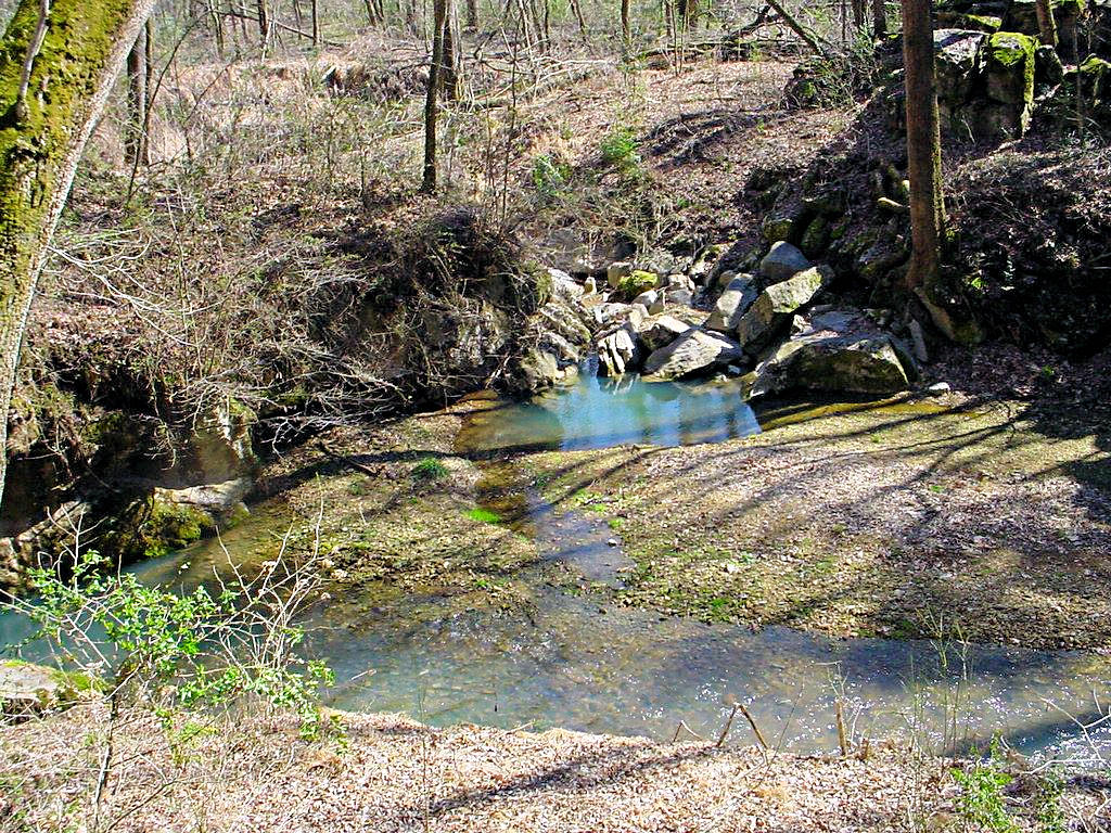
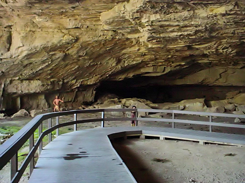
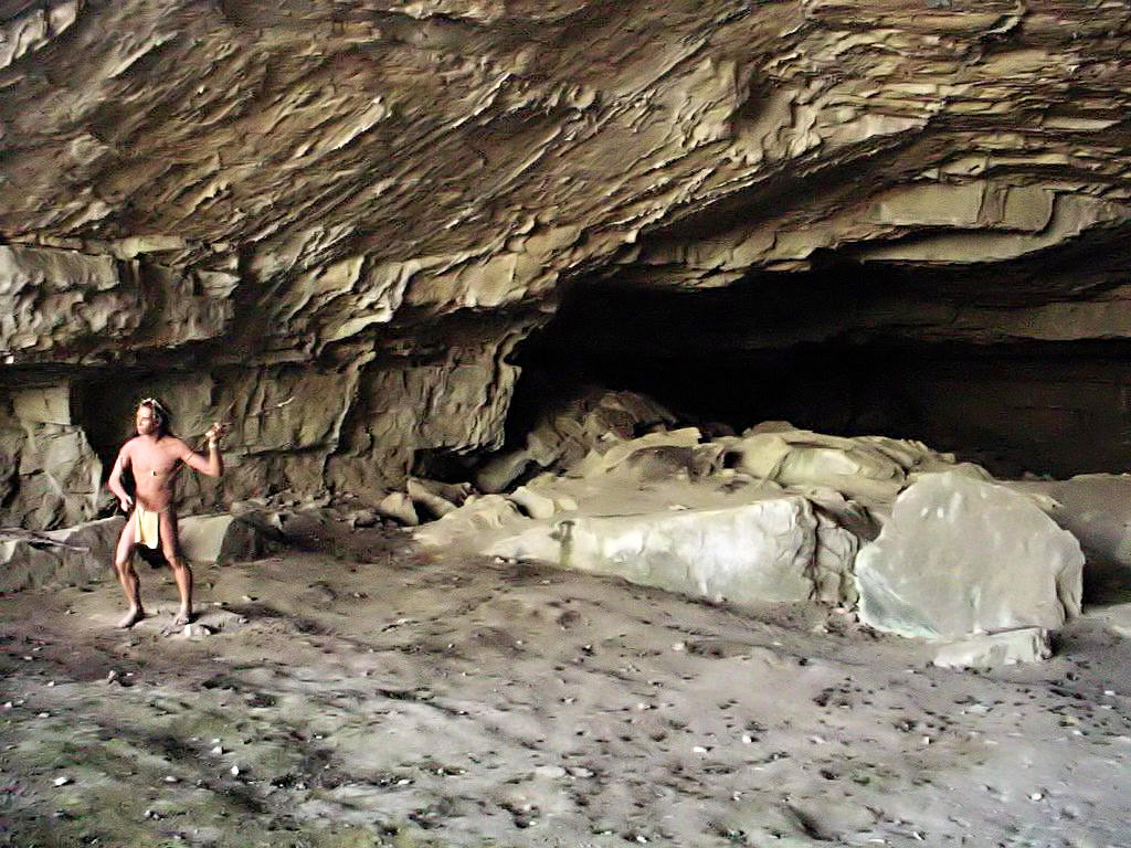
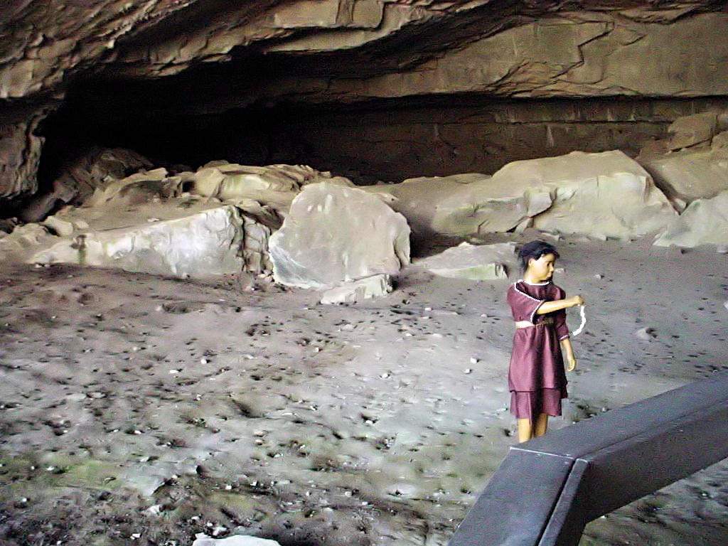
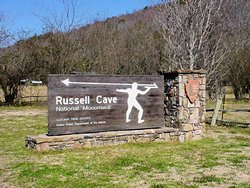
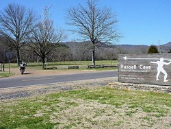
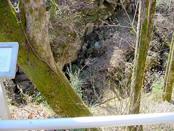
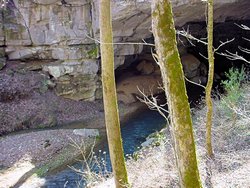
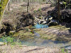
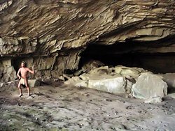
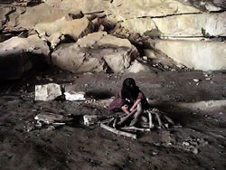
RUSSELL CAVE NATIONAL MONUMENT - Bridgeport, Alabama - March 4, 2007
GPS Coordinates: N34.97914 W85.81000
|
|
Russell Cave National Monument provides an interesting insight into the lives of prehistoric man
circa. 6500 B.C. to 1650 A.D. I'm not much of an historian but it was interesting to view
the relics from the cave and see a place where people lived nearly 8,000 years ago. To tell
the truth it was hard for me to believe that people COULD live there. I stood there
in my First Gear Killimanjaro jacket and Joe Rocket pants, with insulated gloves and a neck wrap
and tried to imagine what it was like to inhabit that cave. It gets COLD here during the
winter, and because of the humidity the cold will penetrate the best of clothing. I tried
to imagine what it would have been like just surviving in these kinds of conditions but I could
not. On top of that, you only get to eat what you kill. No neighborhood Kroger store
for these people.
To me the word "Cave" has connotations of a deep labyrinth of passages. Not so for this
one. It was more like a gash scooped out of the face of the mountain. Perhaps 75
feet deep and 3 times as wide. No secondary passages that I saw, and it was completely
open in the front. The only shelter from the elements that it provided was from rain
and snow. Wind and cold would blow right in. I just could not believe people could
exist there in the winter.
The site is about 20 miles southwest of Exit 152 in Tennessee on I-24. If you are using
a GPS to get there I would **STRONGLY** recommend that you follow the signs and **NOT**
your GPS! I walked into the Visitor's Center and was greeted by the people working
there. They asked where I had come from and I said something like, "Down some 2-lane
gravel driveway for the past 10 miles or so!" They laughed and one said, "You must have been
following a GPS." When I said I was he commented, "Someone really needs to tell the makers of
them that the highway through Orme is nothing but a 1½ lane gravel road!" I agree
heartily! Follow Highway 72 south of South Pittsburg, and then turn onto CR-75 and you will
be on 4-lane asphalt for most of the way and 2-lane asphalt for the rest of the way. Follow
your GPS through Orme and you will not like the roads! Imagine a washboard covered with
gravel and then sprinkled with pieces of tree limbs and you'll be pretty close.
Here Is A Link to a GoogleEarth image of part of the road. No, not
the paved road to the southwest, it's the scar coming through the woods from northeast to
southwest. Nope, not the big scar either, the little one. Still don't see it?
Try This Photo
The National Park Service web site for Russell Cave is at
This Link
All in all it was a good trip today. It was cloudy, cold and windy when I left Nashville
(30 degrees when I left and 44 when I got back) but as you can see from the photos the clouds
blew out and left a clear blue sky behind. I got tired of fighting trucks and wind on
I-24 on the way back home and bailed off of I-24 at Manchester. I stopped for a cup of
coffee to warm up and then came home on US Highway 41 the rest of the way. 240 more
miles on the clock this year! That's about 1,300 since January 1.
|
|
Russell Cave - 03/04/2007 |
Russell Cave - 03/04/2007 |
Russell Cave - 03/04/2007 |
Russell Cave - 03/04/2007 |
Russell Cave - 03/04/2007 |
Russell Cave - 03/04/2007 |

Russell Cave - 03/04/2007 |
Russell Cave - 03/04/2007 |
Russell Cave - 03/04/2007 |

Russell Cave - 03/04/2007 |
Russell Cave - 03/04/2007 |

Russell Cave - 03/04/2007 |
Russell Cave - 03/04/2007 |

Russell Cave - 03/04/2007 |
Russell Cave - 03/04/2007 |
GPS Track Log |
|
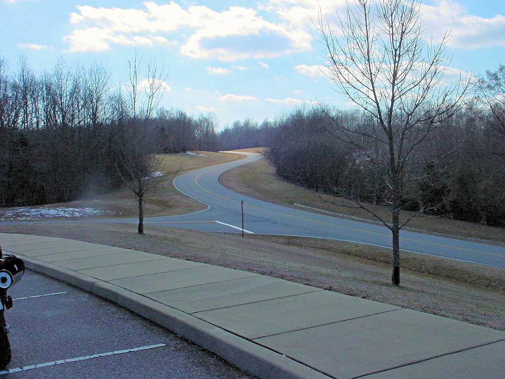
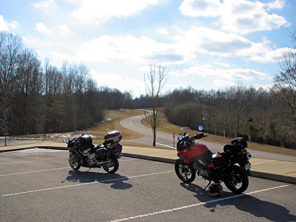
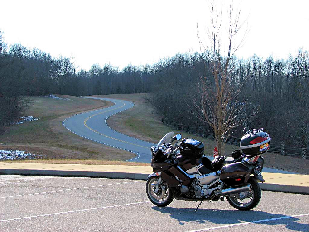
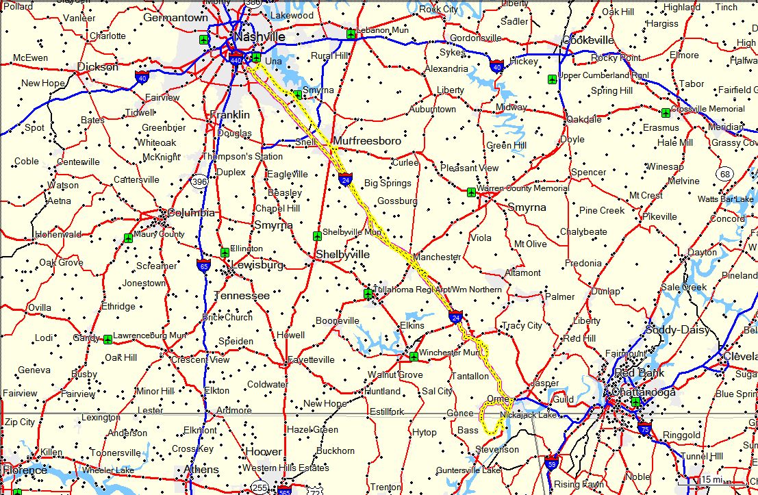
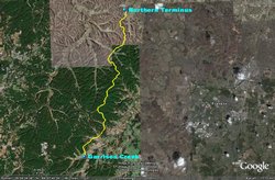
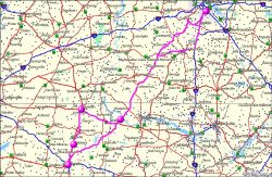
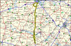
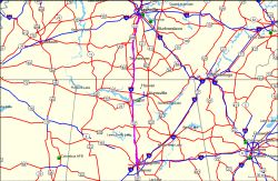
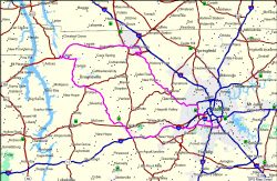
NATCHEZ TRACE PARKWAY - March 10, 2007
|
|
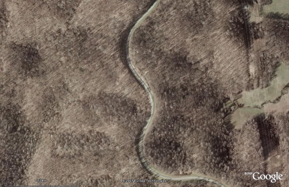
Anyone who has looked at my ride photos will not have a hard time realizing that I really enjoy
riding up and down the Natchez Trace Parkway. It's
not a Tail Of The Dragon or a Devil's Highway, but it is a ton of fun on a bike. Eighty two
sweeping curves in the north 15 miles. Yes, I did count them. It tends to flatten out
and straighten out after that, but the north 15 miles are just plain fun.
|
|
 |
 |
|
|
|
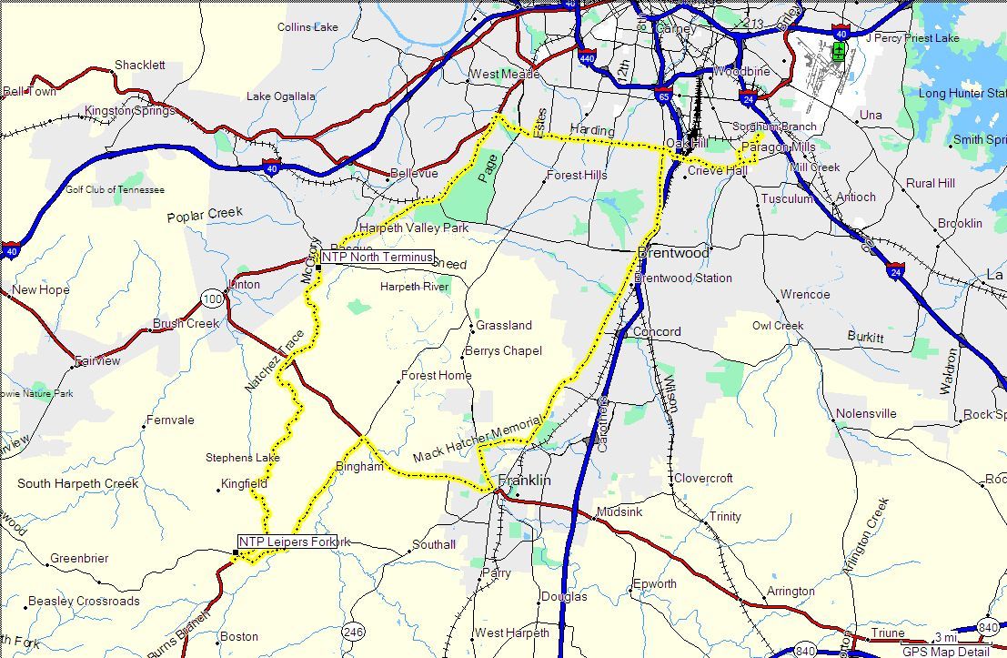
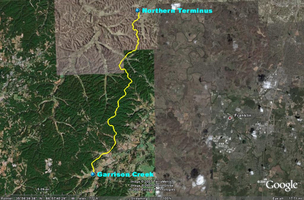
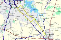
The two Google Earth Plus images above will give an idea of the road from the Northern Terminus
(mile 444.0, GPS coordinates N36.02990 W86.97535) at Highway 100 in Nashville, TN to Garrison
Creek (mile 427.6, GPS coordinates N 35.87371 W 87.03245). As can be seen there is very
little in the way of straight roadway, however the curves are not peg-draggers or anything like
that, they are easy sweeping curves. The speed limit on The Trace is 40 mph from the
Northern Terminus to just past Highway 46 at Leipers Fork where it changes to 50 mph. Garrison
Creek is about 1 mile past Highway 46. The road changes dramatically from that point to
(at least) the Alabama state line. It becomes more of a plain old "Highway" and is not
nearly as much fun to ride. The "Land Of 82 Sweepers" is easy, relaxing, and fun.
I had planned to ride to Tupelo, MS today and make a loop through 5 Passport Stamp sites however
the weather forecast was iffy. The weather guessers have been forecasting a 40% chance of
rain all week, and when I went to bed last night they had changed that to a 60% chance. I
am not a big fan of riding in the rain (oh, be quiet AGirl!) so I decided to postpone that
trip. It is about 450 miles round-trip and I'd prefer more optimum weather conditions for
that one. Of course, when I woke up this morning the sun was shining and it was
60° It kept warming up from there and topped out at about 70° In other words,
it would have been a perfect day for that trip. Oh well, there will be other days. I
decided to stay around here but the weather was just to great to sit at home so I rode down (and
up and down again!) The Trace. 100 more miles on the clock and I've got another short one
planned for tomorrow!
|
|
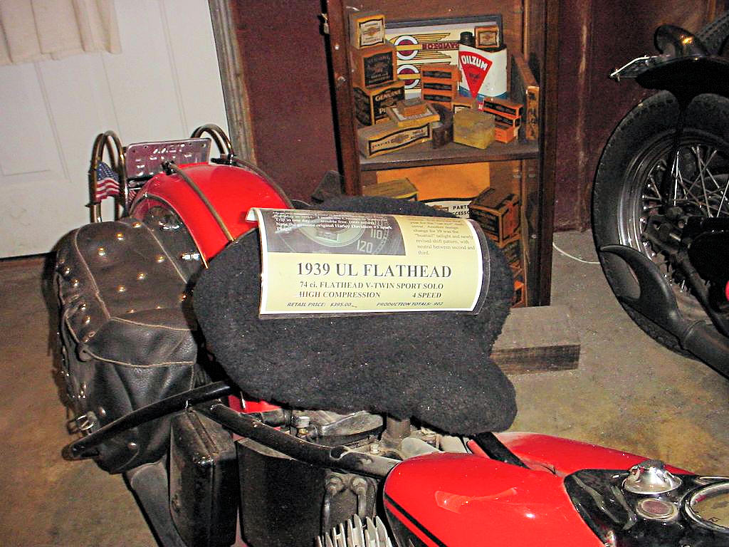
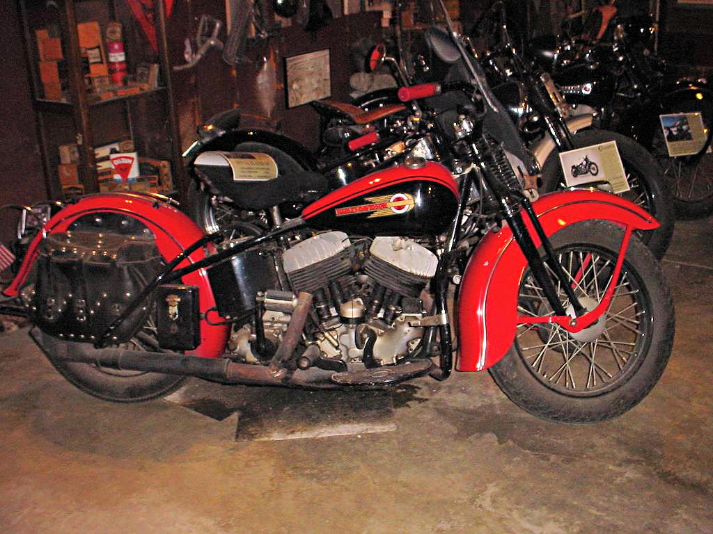
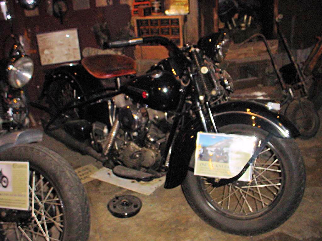
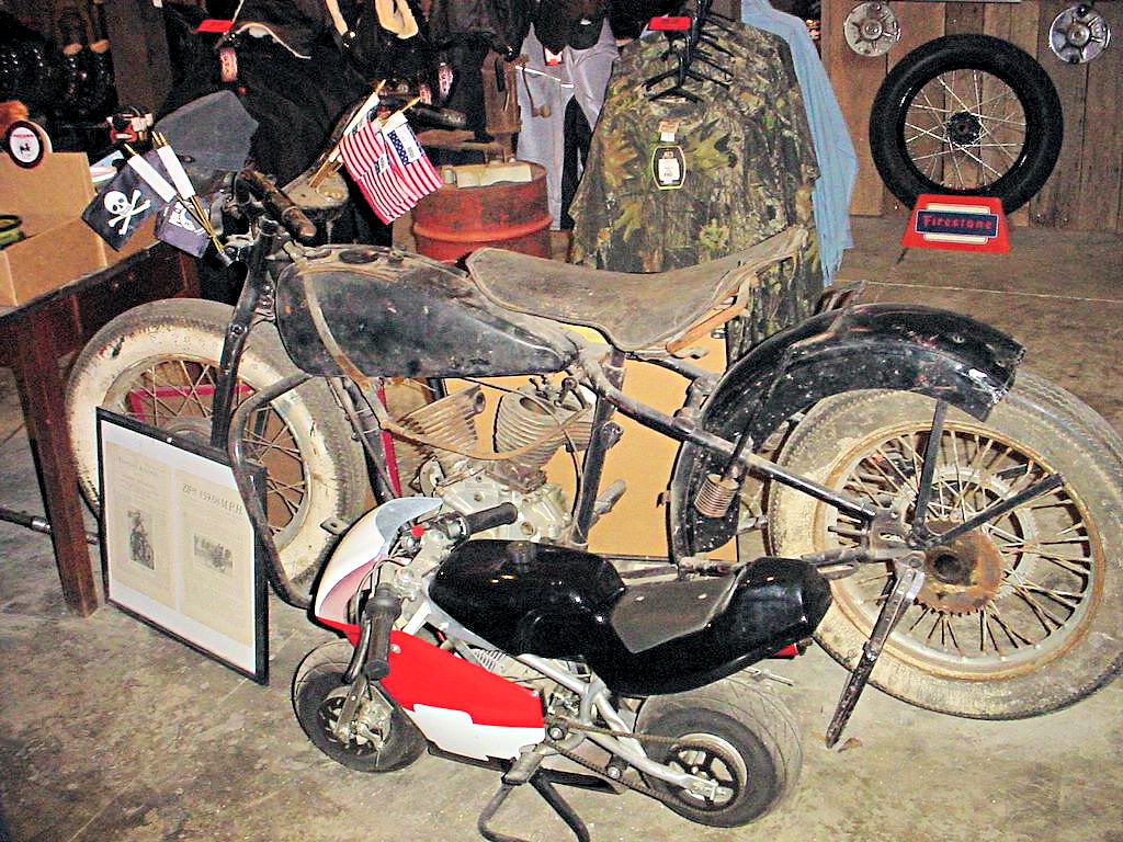
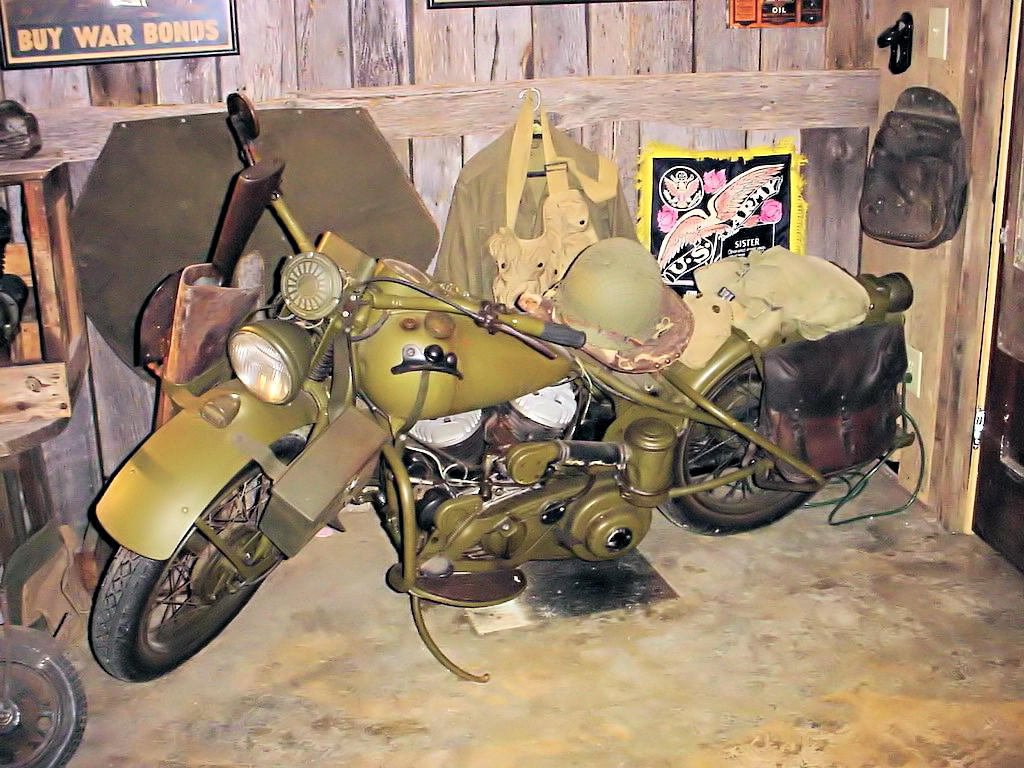
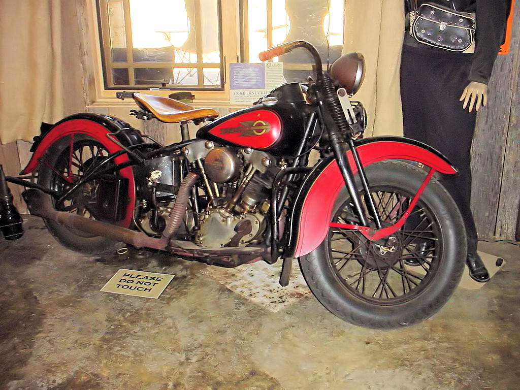
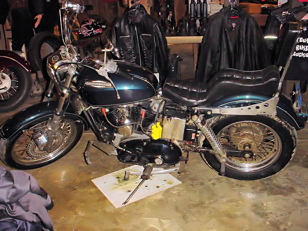
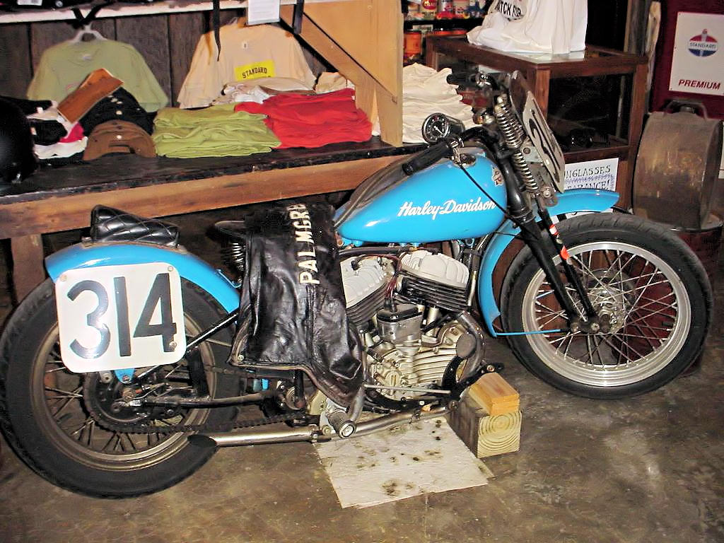
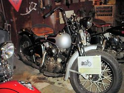
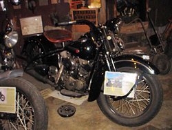
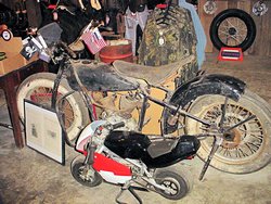
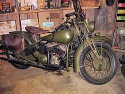
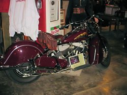
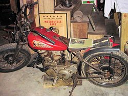
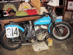
CYCLEMO'S VINTAGE MOTORCYCLE MUSEUM - March 11, 2007
Red Boiling Springs, TN - GPS Coordinates: N36.53044 W85.84845
|
|
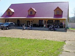
Cyclemo's Vintage Motorcycle Museum in Red Boiling Springs, TN.
is a very interesting place. It is a combination store and museum catering primarily to the
large V-Twin bikes (i.e. Harley-Davidson) but is a trip back in time for many of us old-timers. I
have to admit that my Suzuki looked quite out of place parked outside admidst the group of Harleys
but nobody seemed to care so I didn't either.
I've wanted to make a trip up there since last winter when I ran across their site on the internet, and
today seemed to be the perfect day for it. Hardly a cloud in the sky, 60° when I left home,
and just a little bit of breeze to keep things interesting. It was about 175 miles round-trip
from home, but an easy ride. Seeing those old bikes made it all worthwhile to. If you are
up that way stop in and take a look. It's worth the trip.
They have about a dozen bikes on display from back in the 30's and 40's. I took photos of them
however the photos on Their Web Site are much better
than mine.
|
|
 |
 |
 |
 |
 |
 |
 |
 |
 |
 |
 |
 |
 |
 |
 |
|
|
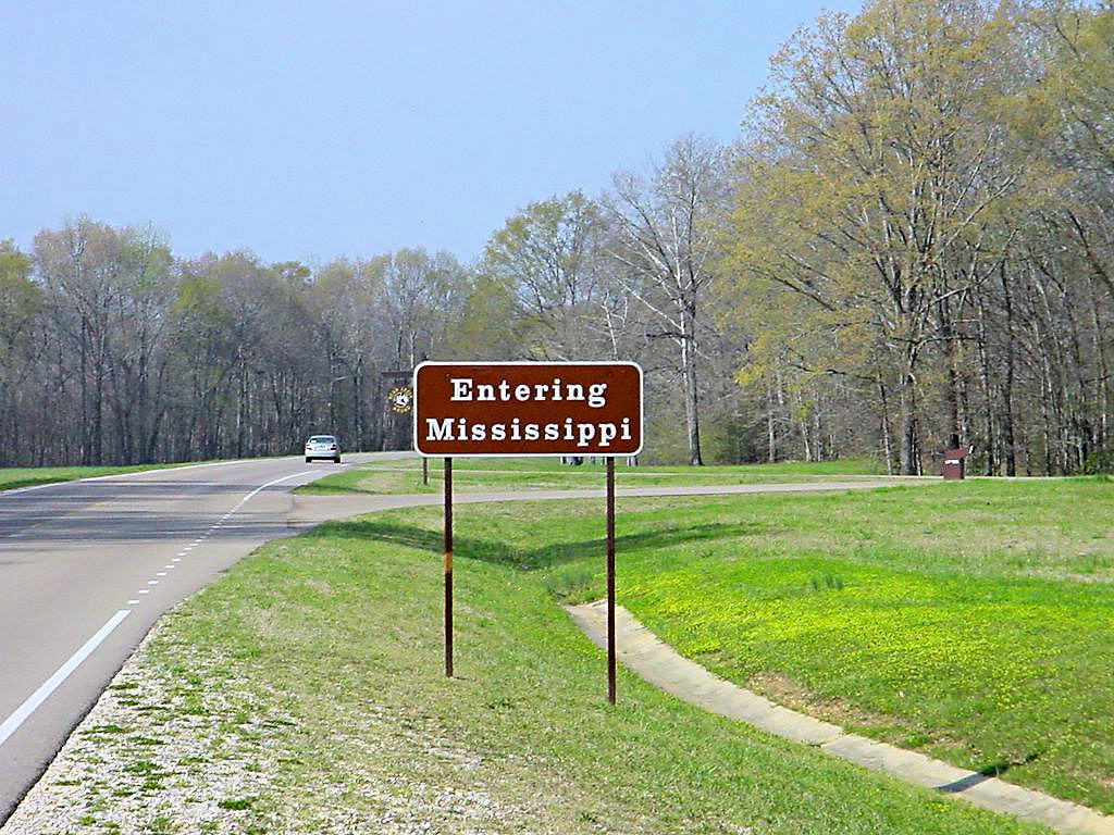
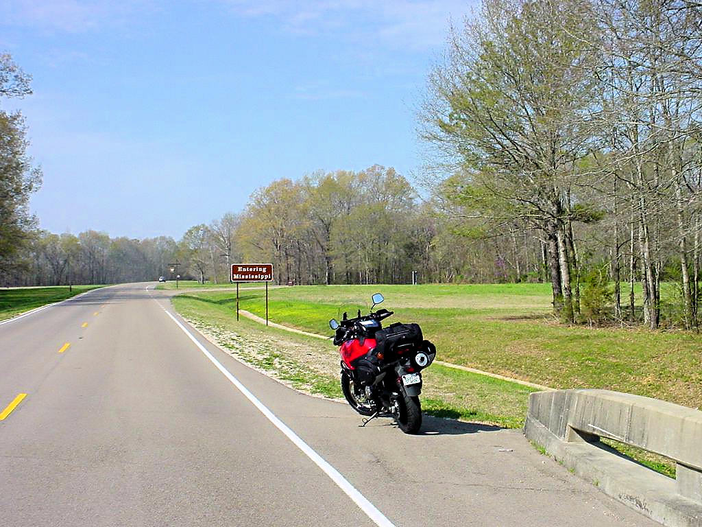
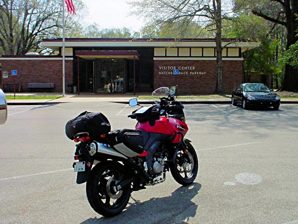
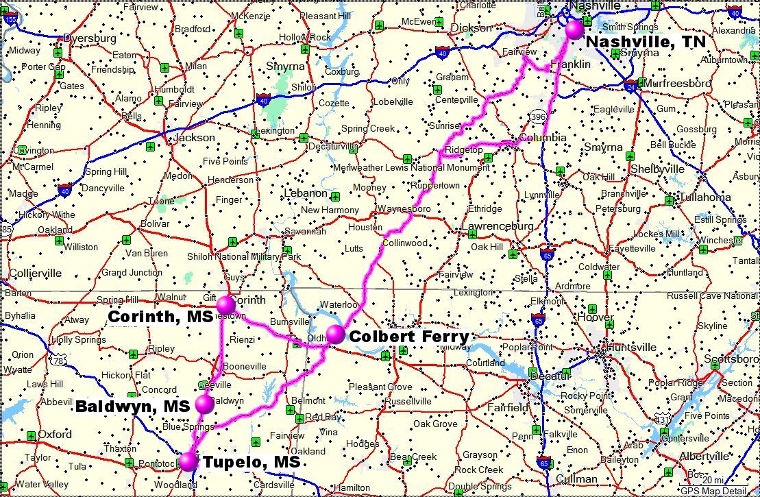
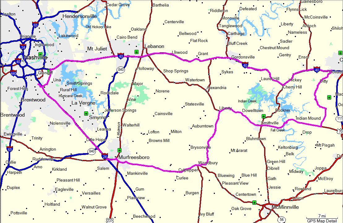
STAMP QUEST TO TUPELO, MS - March 24, 2007
|
|
The weather cooperated and I did make the Tupelo, MS loop I've been putting off
for several weeks. It was WARM here and even warmer in
Mississippi. It was worth it though.
I got interested in collecting National
Park Passport Stamps last fall, and I've actually been planning this trip since then. I
rode to the Colbert Ferry Crossing on the Natchez Trace Parkway in September to get a Passport
Stamp but they had already closed for the season. I later found out that the stamp is at
the Tupelo Visitor's Center and have been trying to find a decent day since then. I later
found that there are several other stamps in that area so the run to Tupelo has evolved into a
5-stop Stamping Quest. In reality I picked up 8 stamps because the Tupelo Visitors Center
had two that I had been unable to get, as well as s different stamp for one of the other sites.
The trip was 453 miles round trip (441 miles according to my GPS). I left at 6:00am, grabbed some
breakfast at a Waffle House, and headed south. I picked up the Natchez Trace Parkway at
Highway 412 west of Columbia and took it to Tupelo. I came back through Baldwyn, MS and
Corinth, MS and then back over to the trace just below the Tennessee River south of the Tennessee
state line. 453 miles (or 441!) make it my longest trip in a single day so far, and I also
turned over 10,000 miles on my V-Strom.
The eight stamps I picked up are:
o Natchez Trace Parkway - Colbert Ferry Crossing - Alabama
o Natchez Trace Parkway - Meriwether Lewis Monument - Alabama
o Natchez Trace Parkway - Parkway Visitor's Center - Tupelo, MS
o Natchez Trace Parkway - National Historic Trace
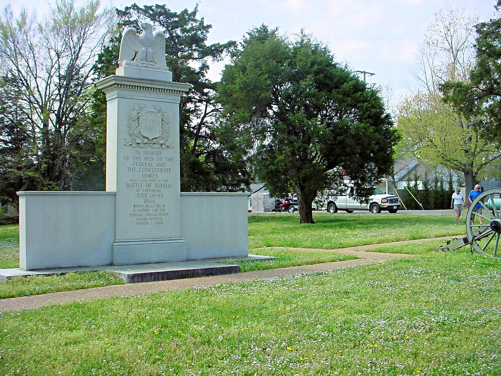
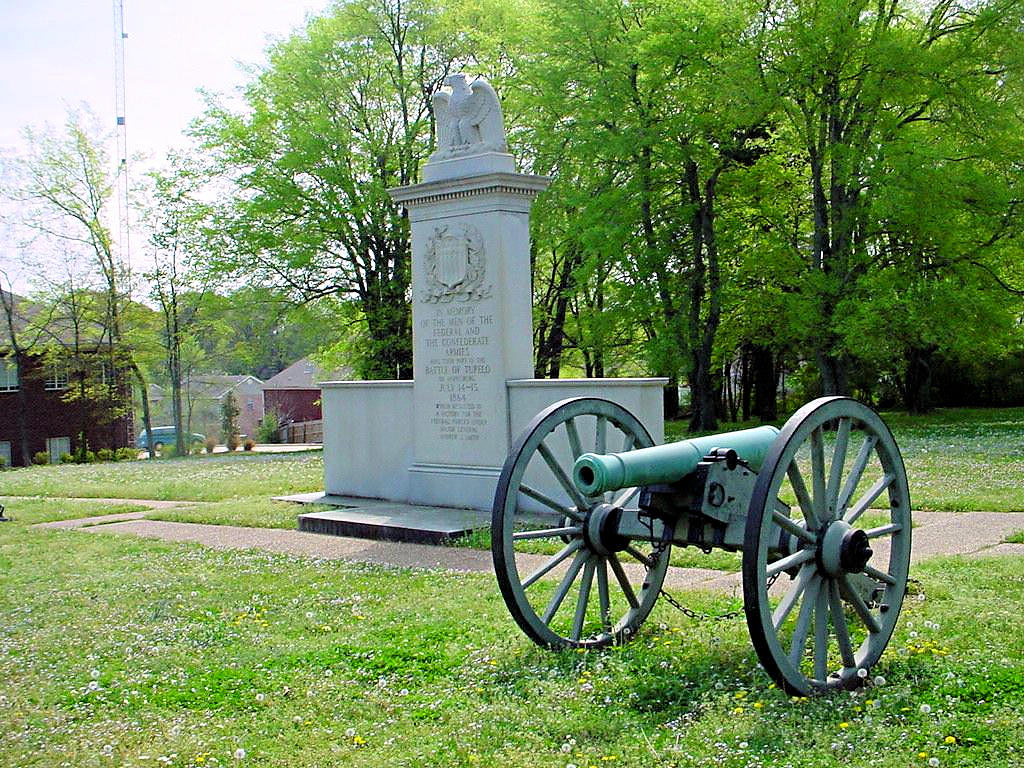
o Tupelo National Battlefield - Tupelo, MS
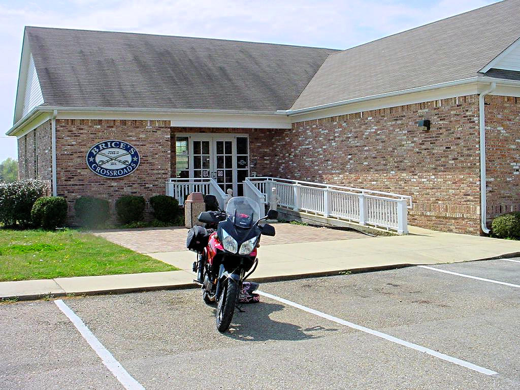
o Brices Cross Roads - Tupelo, MS (from the Tupelo Visitors Center)
o Brices Cross Roads - Baldwyn, MS
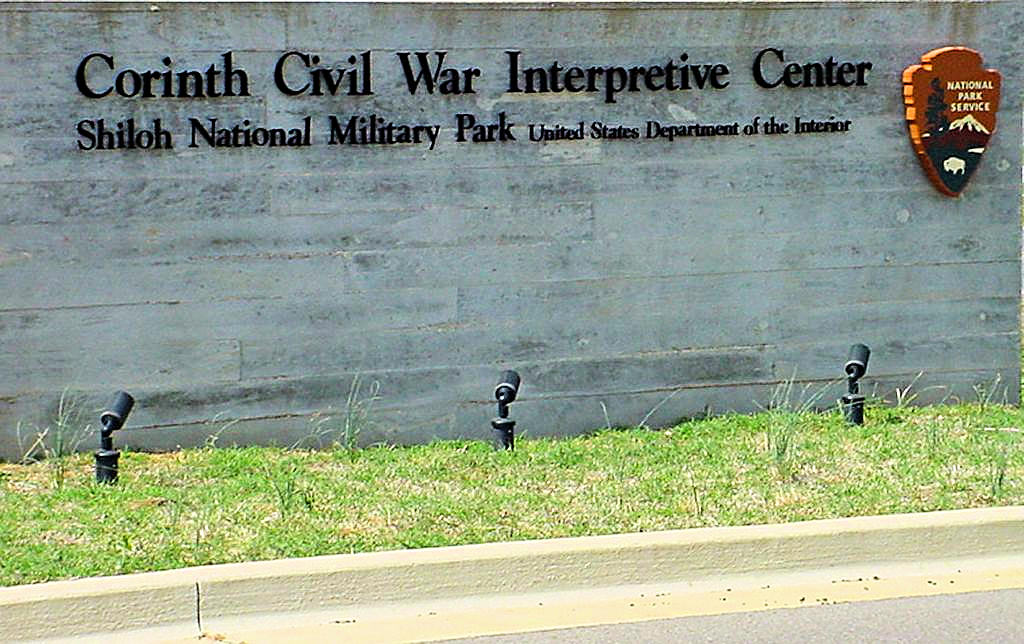
o Corinth Civil War Interpretive Center - Corinth, MS
A good ride. A long day and I was beat when I got home, but it was a lot of fun.
|
|
Jack's Branch - Mile 377.8
Natchez Trace Parkway - 03/24/2007 |
Jack's Branch - Mile 377.8
Natchez Trace Parkway - 03/24/2007 |
Mississippi - Alabama state line - Mile 308.9
Natchez Trace Parkway - 03/24/2007 |
Mississippi - Alabama state line - Mile 308.9
Natchez Trace Parkway - 03/24/2007 |
Mississippi - Alabama state line - Mile 308.9
Natchez Trace Parkway - 03/24/2007 |

Tupelo Visitors Center - Mile 266.0
Natchez Trace Parkway - 03/24/2007 |

Tupelo National Battlefield - Mile 259.7
Natchez Trace Parkway - 03/24/2007 |

Tupelo National Battlefield - Mile 259.7
Natchez Trace Parkway - 03/24/2007 |

Brices Crossroads National Battlefield - 03/24/2007 |

Corinth Civil War Interpretive Center - 03/24/2007 |
Corinth Civil War Interpretive Center - 03/24/2007 |

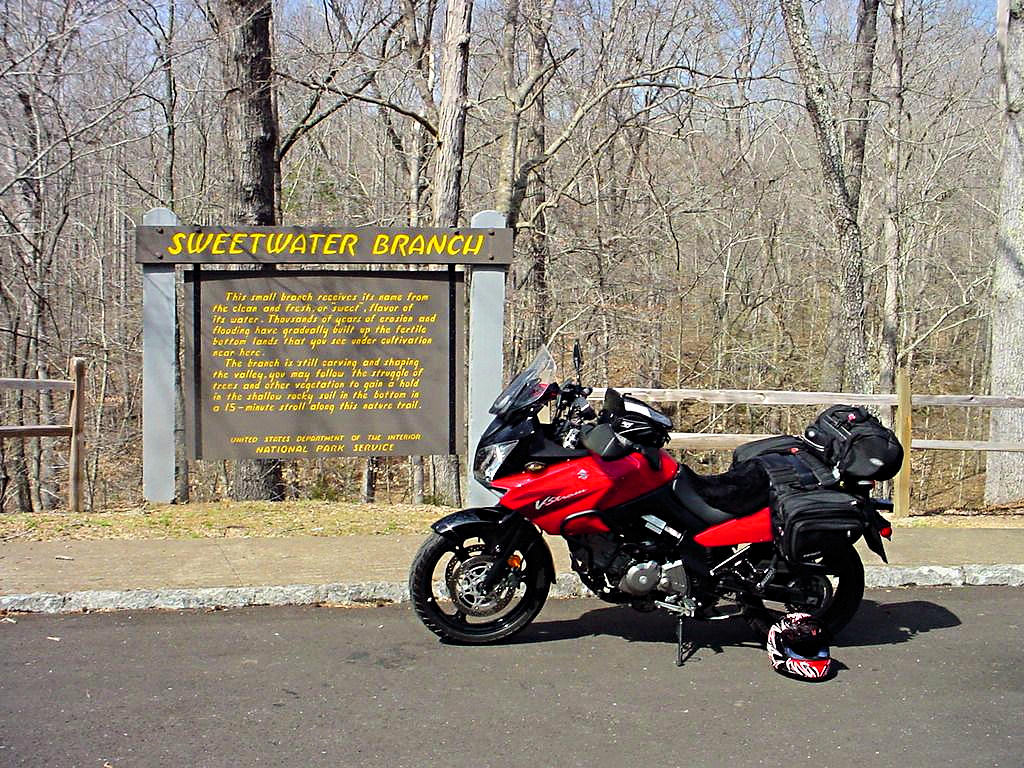
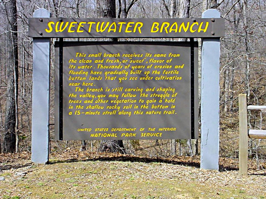
Sweetwater Branch - Mile 363.0
Natchez Trace Parkway - 03/24/2007 |
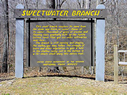
Sweetwater Branch - Mile 363.0
Natchez Trace Parkway - 03/24/2007 |

Sweetwater Branch - Mile 363.0
Natchez Trace Parkway - 03/24/2007 |
GPS Track Log - 03/24/2007 |
|
|
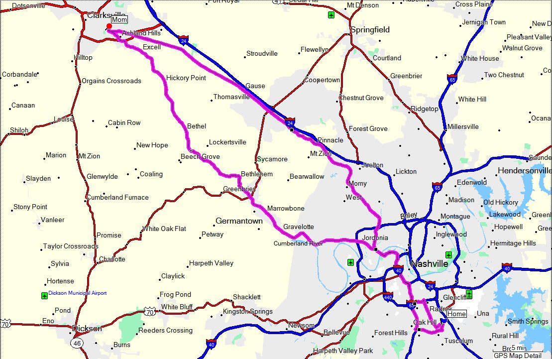
CLARKSVILLE, TN - Easter Sunday - April 8, 2007 |
|
I don't know what happened to our nice weather. When I rode to Tupelo, MS a couple of weeks
ago I actually got hot and had to start shedding layers on the way back. On Monday (4/2) the
high was 75°. On Tuesday (4/3) the high was 50°, and it's been downhill
since. Yesterday the temperature topped out at about 45° and then last night we set an
all-time record low of 24°. All told the temperature is ridiculous for Easter Sunday in
this part of the country. It is never, EVER this cold here this time of year! Our
average high is about 70° and the average low is about 47°.
I went to Clarksville, TN. today to see my mother and, regardless of the temperature, decided to ride
my bike instead of driving my Durango. According to the weather service it was 34° when
I left home and about 52° when I got back. On top of that the wind was blowing pretty
stiffly so to be honest the ride wasn't all that much fun. Of course just getting out and
riding, and also seeing my mom for a while, did make it worthwile. I also had an ulterior motive
for riding my bike; I have a new Metzeler Tourance tire on the rear that needed a good heat cycle on
it, and a new K&B fork brace on the front that needed to be tested.
I also stopped at the same Starbucks for a cup of coffee so I guess this is a repeat of my
130 Mile Cup Of Coffee ride.
I'm sure those who don't ride motorcycles wonder why someone with a perfectly good 4-wheel
vehicle that has a good heater would choose to ride a motorcycle when it's 34° outside. I
can't answer that except to say that to those of us who do ride bikes it makes perfect sense. It's
just one of those things that needs to be done.
No photos this trip but I have included the usual GPS track below.
|
|
 |
|
|
|
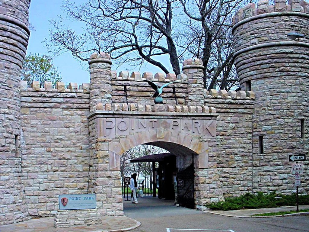
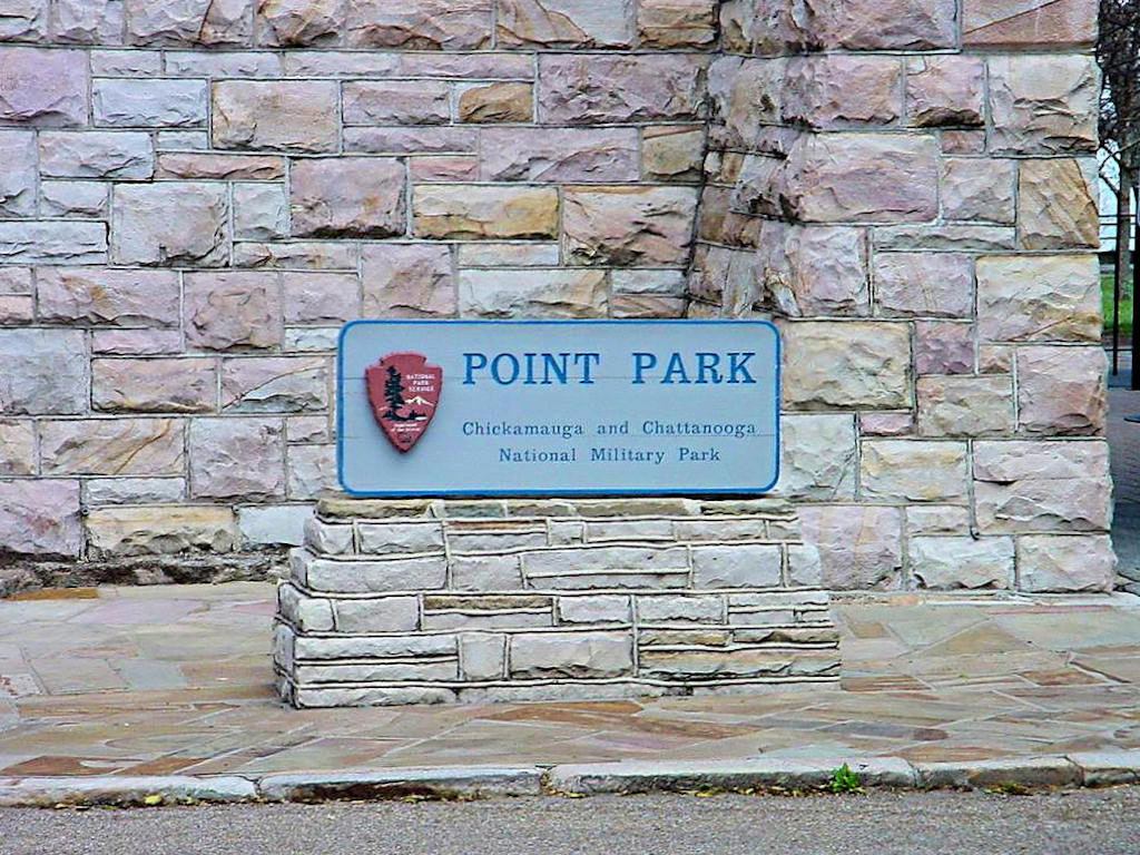
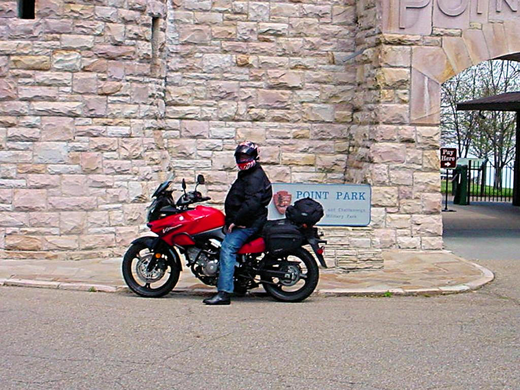
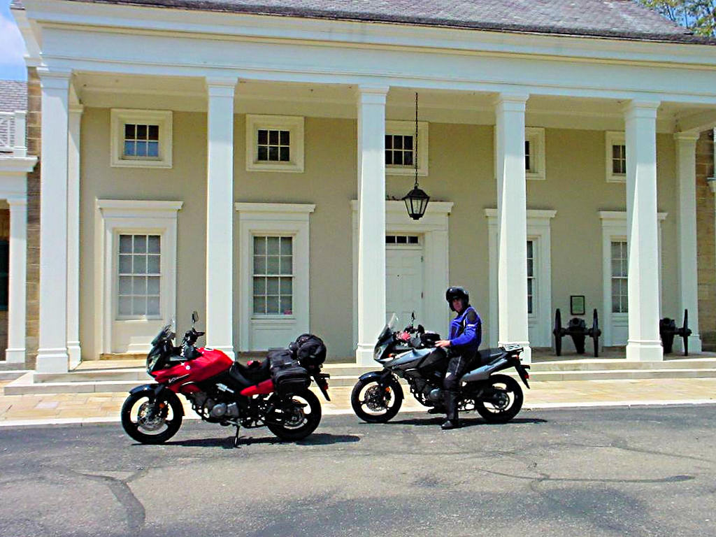
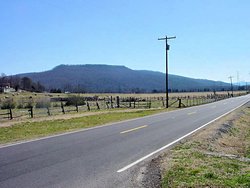
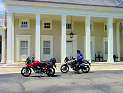
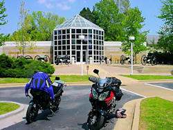
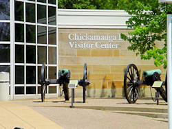
CHATTANOOGA, TN & FT. OGLETHORPE, GA - April 21, 2007
GPS Coordinates: N35.00954 W85.34374 (Lookout Mtn.), N34.94039 W85.25934 (Ft. Oglethorpe)
|
|
I left Nashville about 7:45 and met my friend and riding buddy Jim at the Waffle House in
Manchester, TN for breakfast. We were heading to Chattanooga, TN so I could pick up
the National Park Passport Stamps
at the Chickamauga and Chattanooga National Battlefield sites at Lookout Mountain, TN and
Ft. Oglethorpe, GA.
Today was an absolutely perfect day for a ride. A little chilly when I left Nashville (45°)
but it warmed up to 84° and I don't think there was a cloud in the sky. It just
doesn't get any better than that!
Jim lives near Manchester and knows the area between there and Chattanooga quite well. He
also seems to hate interstates about as much as I do so we decided to take the back roads instead
of beating down I-24. We went over Monteagle Mountain on the way down and Signal Mountain
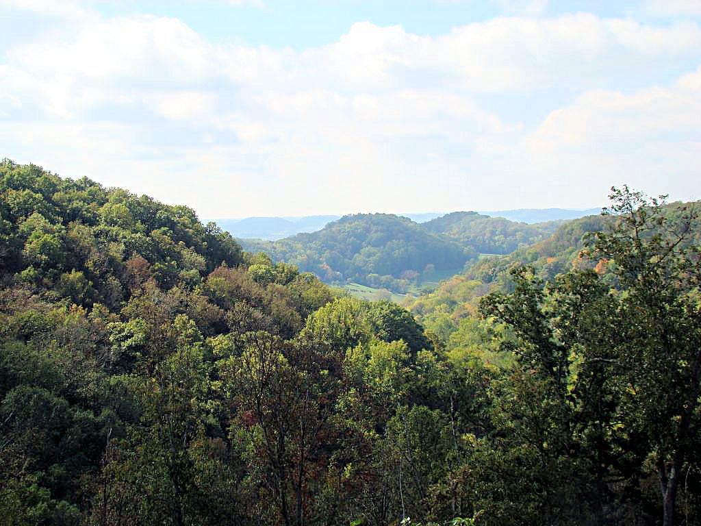
on the way back. The scenery in that area is absolutely gorgeous but I was having too
much fun riding to stop and take pictures. Winding mountain roads, Nickajack Lake to the side,
just fantastic. All I can tell you is that if you get over that
way ditch the interstate and take the backroads. It is a beautiful trip.
I do think that Jim and AGirl may have gone to school together. In fact I asked her whether
they did or not. She is unqestionably the master at finding the long way home, but Jim is
catching up quick! Straight-line distance down I-24 and back is 250 miles. My total
distance today was 312. Just kidding, Jim. I enjoyed every minute of it, and you picked
a great route both ways. We do have to go back down there some day so I can get some "Scenic
Photos" of the area though.
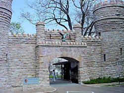
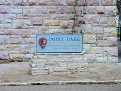
Take a close look at the second photo in the top row, the one that shows the entrance to Point
Park. Look closely at the gate and you will notice that there is a strip of grass and then
all you can see is sky! We didn't go in (there is an entry fee and we were in enough of a
hurry that we didn't have time to see the whole thing), but it is said that seven states can be
seen from Lookout Mountain. Wikipedia has a couple of good photographs taken on Lookout
Mountain at
This Link. According to my GPS the elevation at the bottom of the mountain is 672'
above sea level, and at the top of the mountain it is 2130' above sea level. Not a big
mountain as mountains go, but pretty good for our part of the country.
|
|
 |
 Chickamauga and Chattanooga NB
Lookout Mt, TN |
 Chickamauga and Chattanooga NB
Lookout Mt, TN |
 Chickamauga and Chattanooga NB
Lookout Mt, TN |
 Chickamauga and Chattanooga NB
Ft. Oglethorpe, GA |
 Chickamauga and Chattanooga NB
Ft. Oglethorpe, GA |
 Chickamauga and Chattanooga NB
Ft. Oglethorpe, GA |
 GPS Track Log
 |
D&H CYCLES - CULLMAN, AL. - April 28, 2007
GPS Coordinates: N34.22879 W86.86115
|
|
My friend AGirl made it into town last night after a 2,000 miles run from Phoenix. On
4/26 she got some bad gas and it made a mess of her fuel system. She was astute enough
to dump the gas out, refill the tank with some premium gas and some Techron to clean things
up but it still wasn't right. Since she bought the bike at D&H Cycles in Cullman, AL
it only seemed proper to take a day trip down there to get them to look at it.
We met at my office in Brentwood at 6:00 (yes, 6:00 in the morning!) and headed south on
I-65. After some breakfast at the Waffle House in Columbia, TN we headed further
south on I-65 (at a rather spirited pace!) to Cullman, AL. A georgeous morning, and
all the better because the rain that was forecast stayed away. We got to D&H about
9:00, just as they were opening, and spent a good part of the day watching them work on
her bike and talking with the techs and owners.
I have to say that this dealership is unlike any I've been around. They are small and
family-owned, but their attention to customer satisfaction is unbelievable. The tech
spent about 6 hours working on her bike, he did a TBS, checked and replaced the plugs,
cleaned out the fuel system, replaced the lean angle sensor (with one from the owner's
personal bike!) and did a few other odds and ends that she wanted taken care
of. What did they charge her? You wouldn't believe me if I told you so I
won't. Suffice it to say that no dealer I have EVER heard of would have done what
they did. On top of that they close at 2:00 on Saturday and it was after 3:00 when they
finished with it. No complaints, no dirty looks, just a "Do it right or not at all"
attitude. Her bike is fixed, it runs like a top, and the credit goes to the guys at
D&H. Their attitude toward their customers is virtually unheard of in this day and
time, and I hope they know how much their customers appreciate it.
No photos this trip but I have included the usual GPS track below. If you wonder
about the little bubble on the north end it's because we had to make the traditional pass up the
Natchez Trace Parkway on the way back into town!
That's 3,500 miles so far this year with more to come! I was hoping to make 12,000 miles on
my bike's one year birthday on May 1 but it looks like I'll be about 500 miles short.
|
|
 |
|
|
|
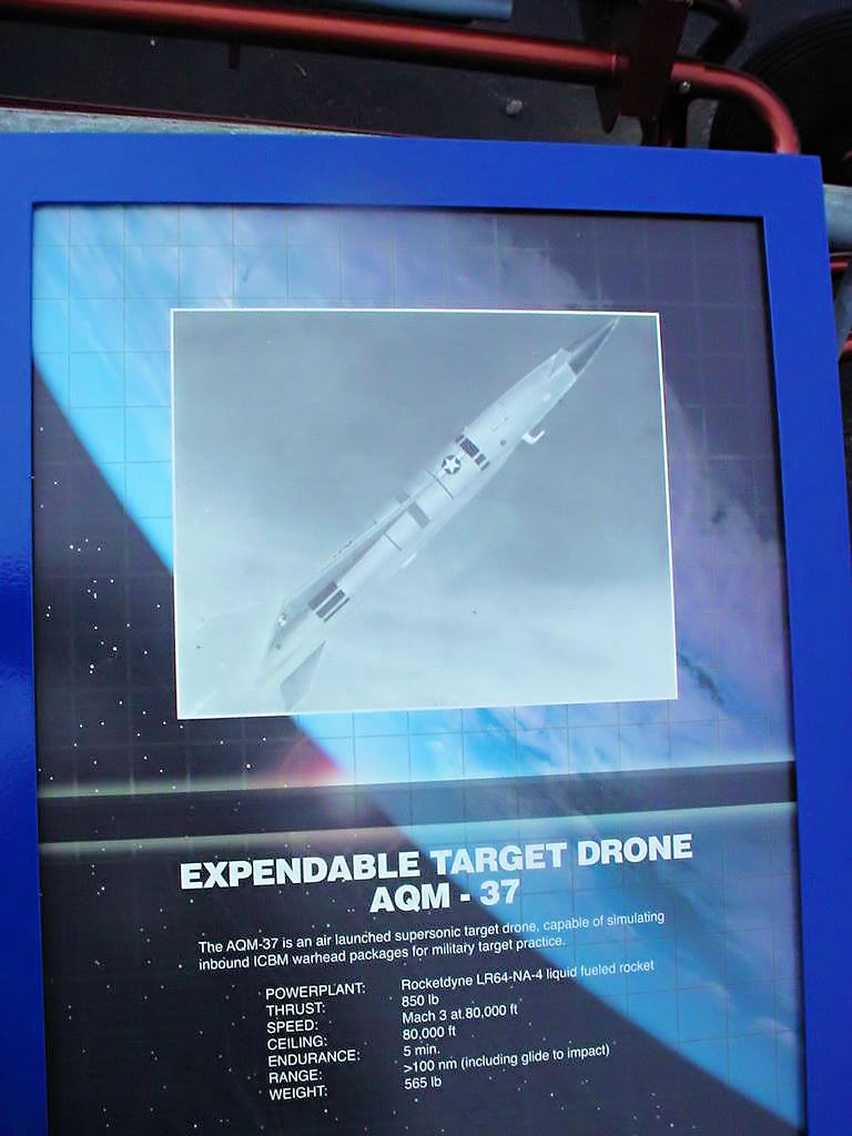
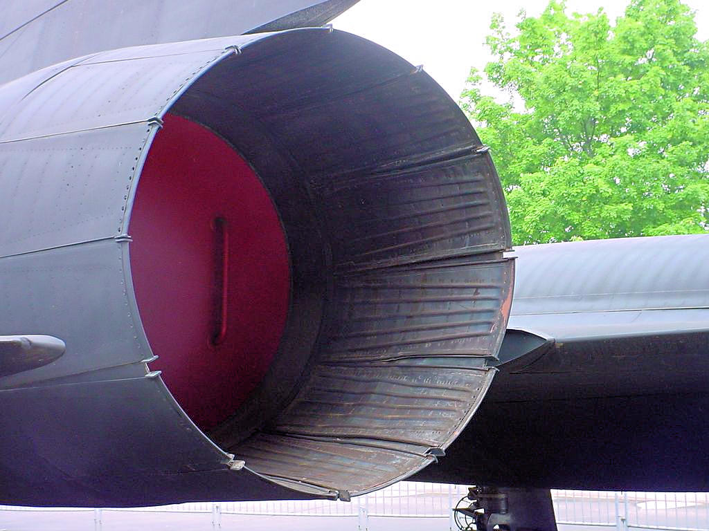
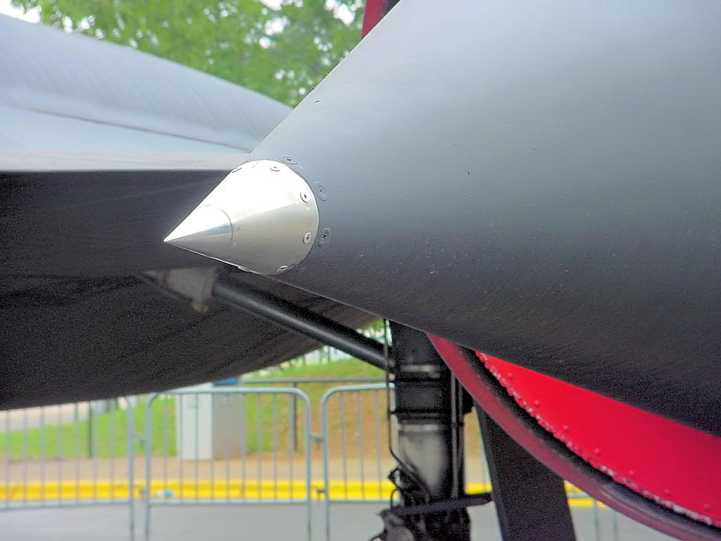
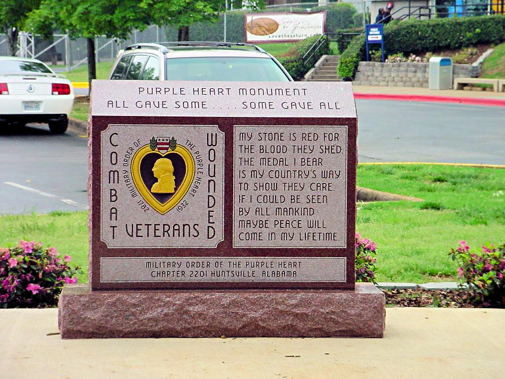
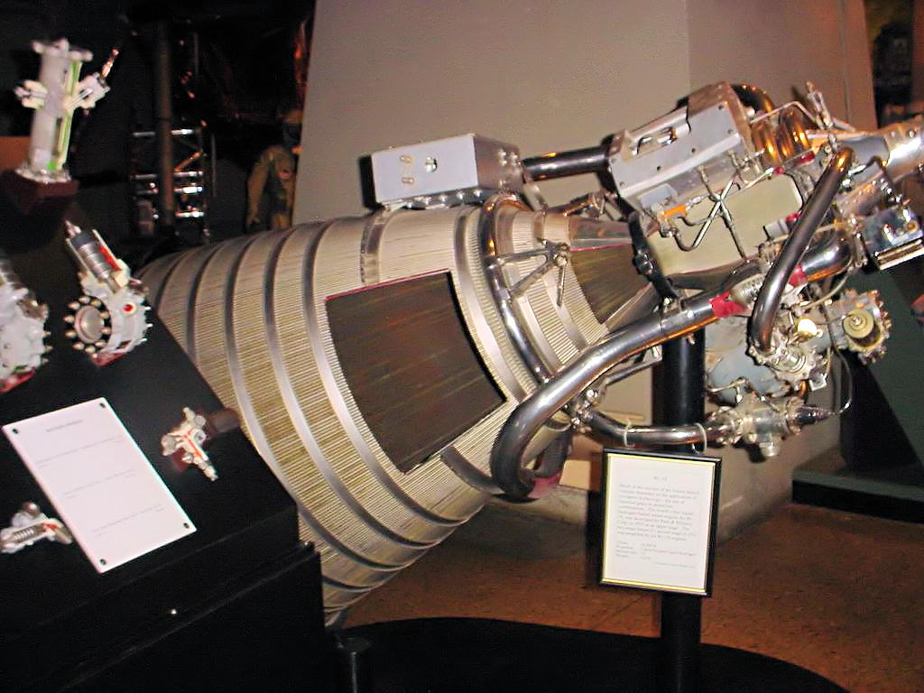
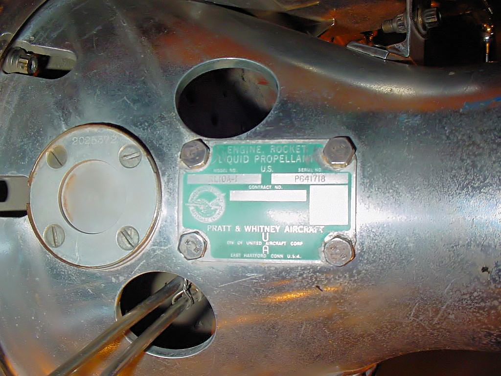
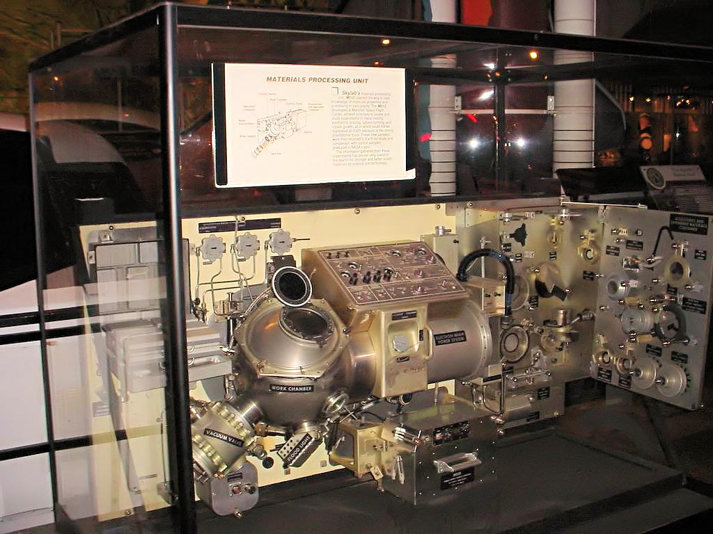
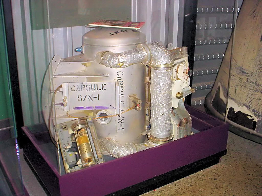
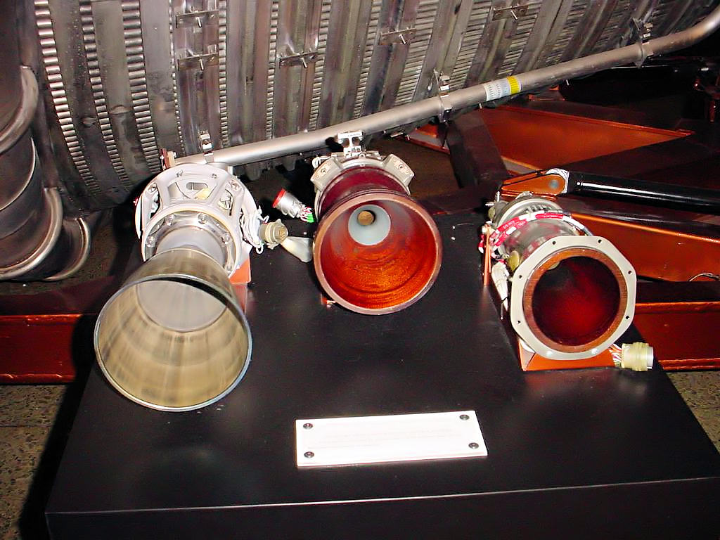
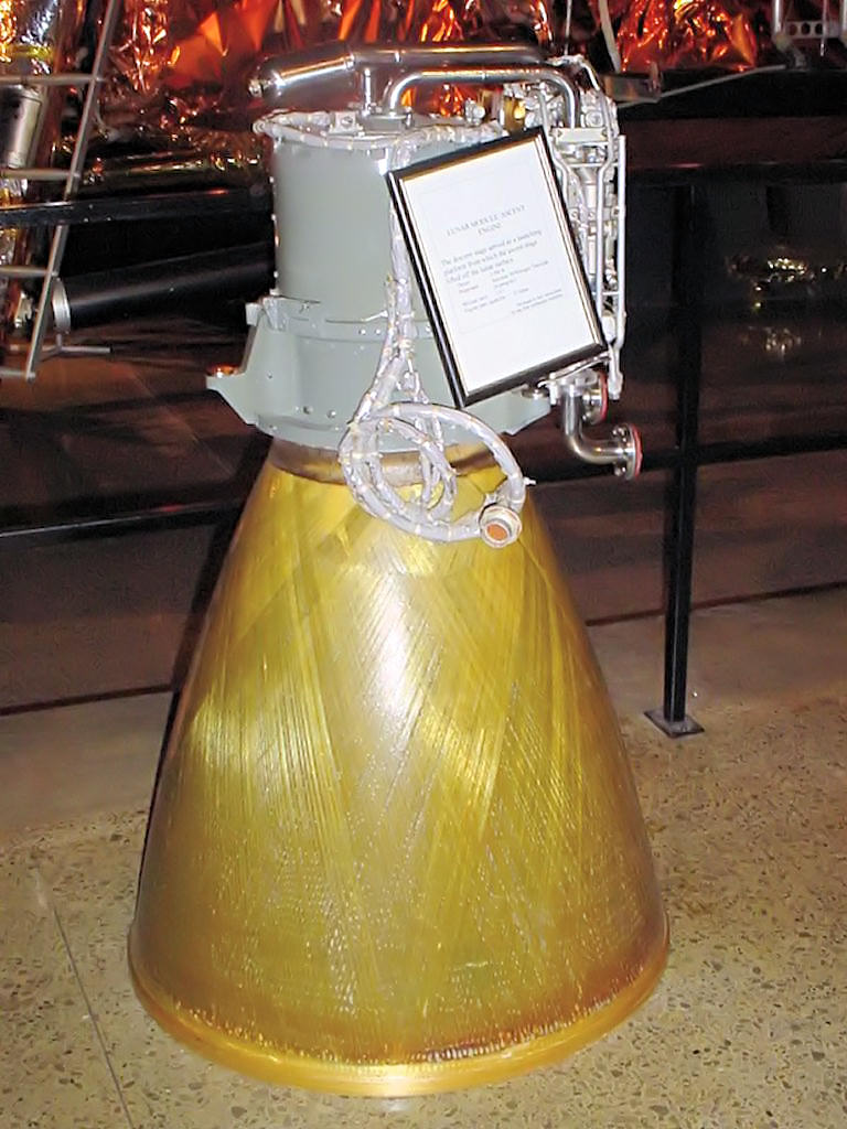
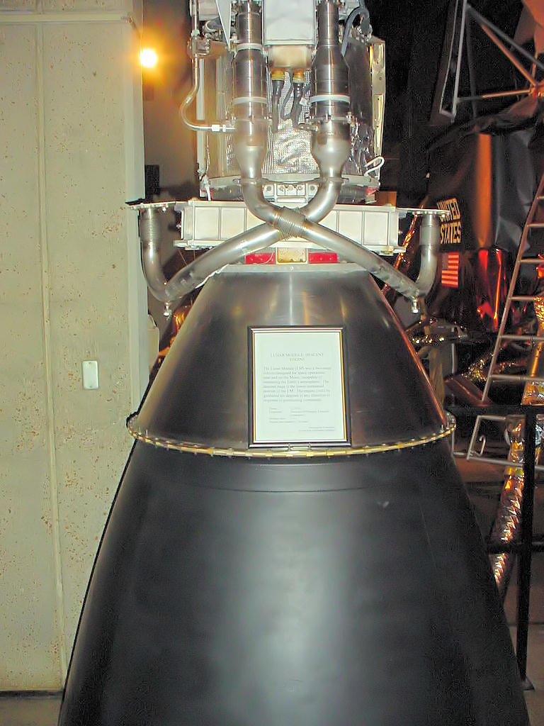
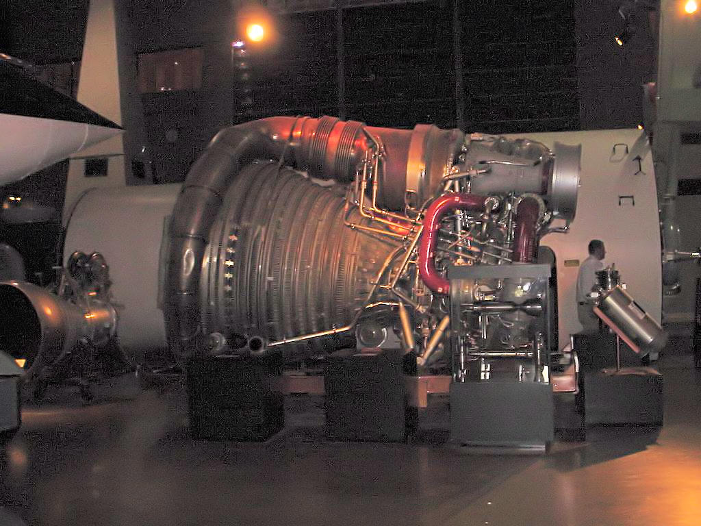
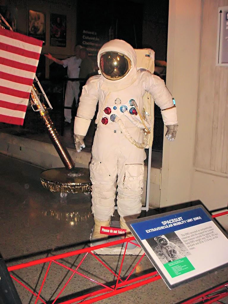
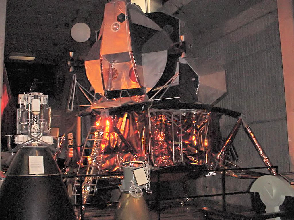
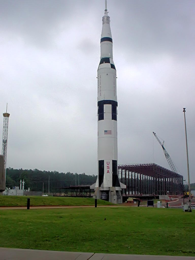
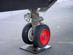
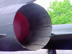
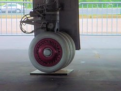
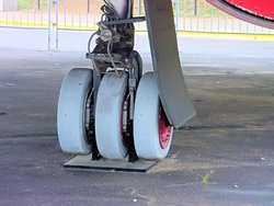
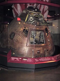
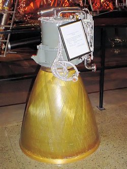
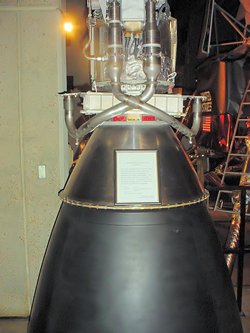
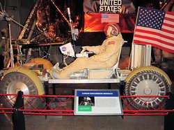
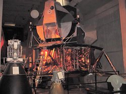
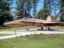
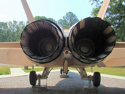
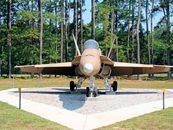
US SPACE AND ROCKET CENTER - Huntsville, AL - May 5, 2007
GPS Coordinates: N34.71174 W86.65267
|
|
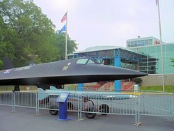
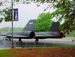
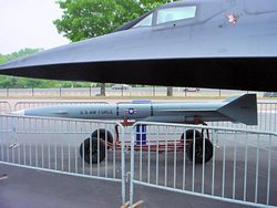
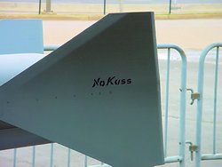
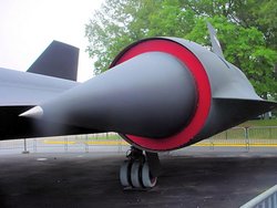
I've wanted to ride to the US Space and Rocket Center
at Huntsville, AL since I got my bike. Not
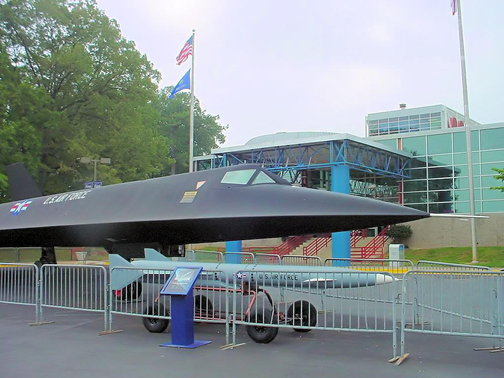
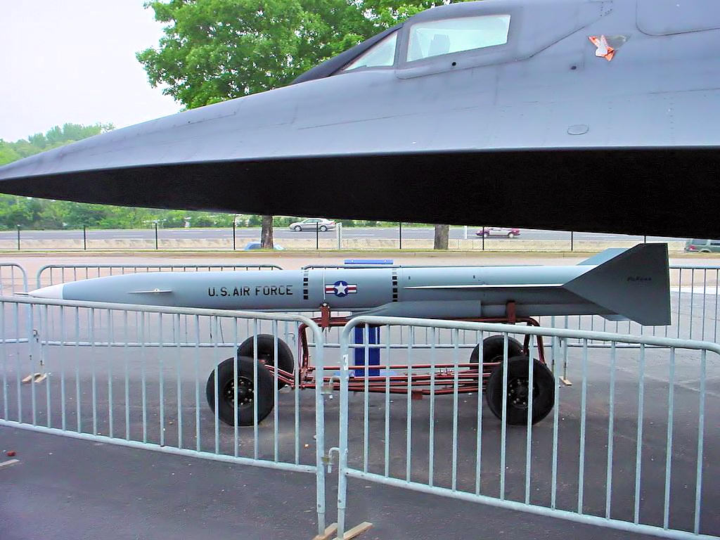
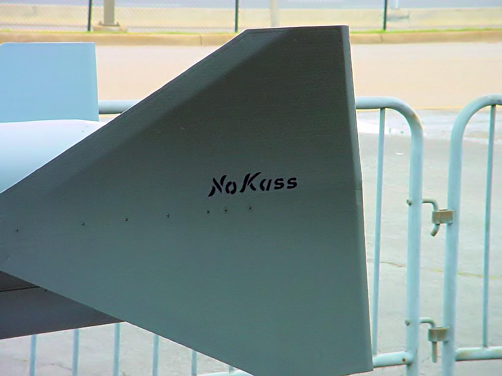
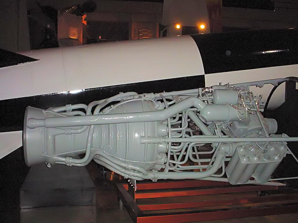
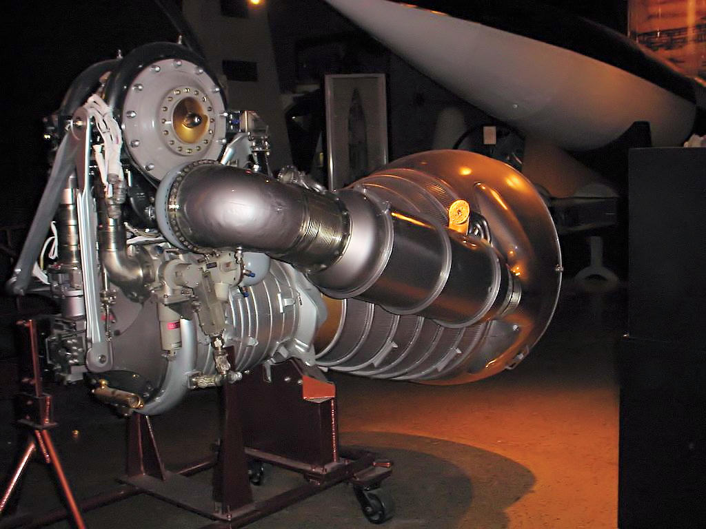
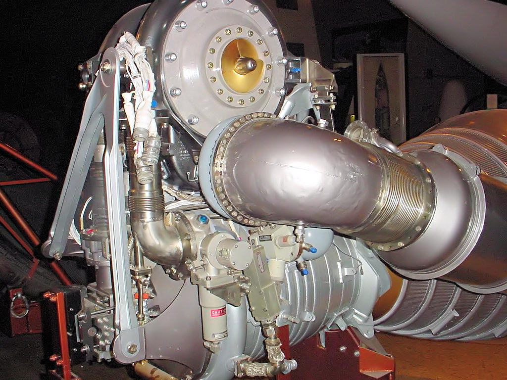
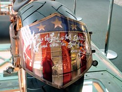
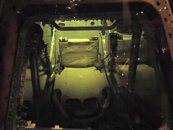
primarily because I'm a big space and rocket fan, but because they have a Lockheed A-12
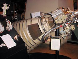
(NASA version of the SR-71 Blackbird) on static display. The aircraft is serial number 60-6930
and they are as beautiful up close as I expected them to be! Photos are included below.
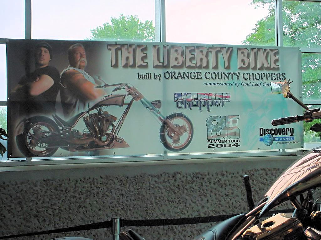
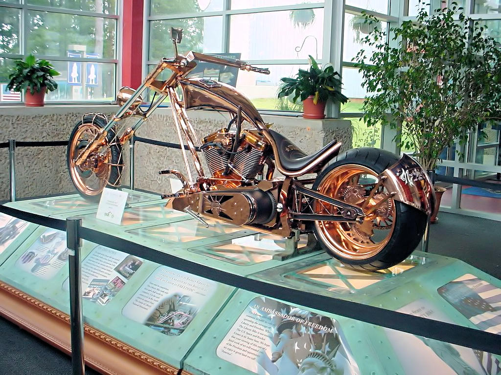
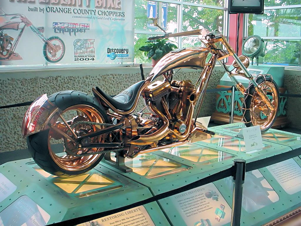
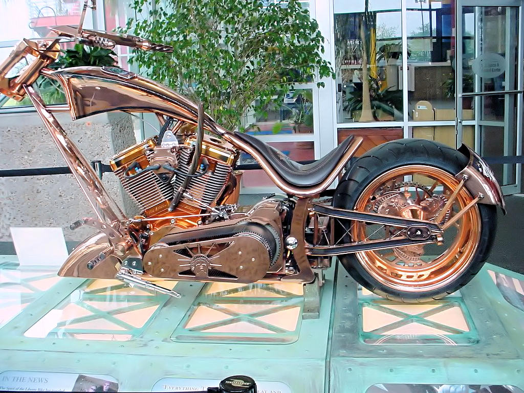
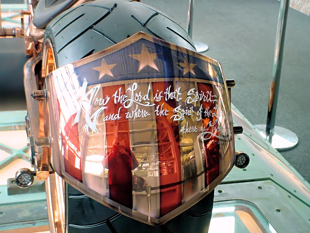
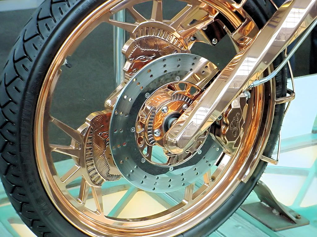
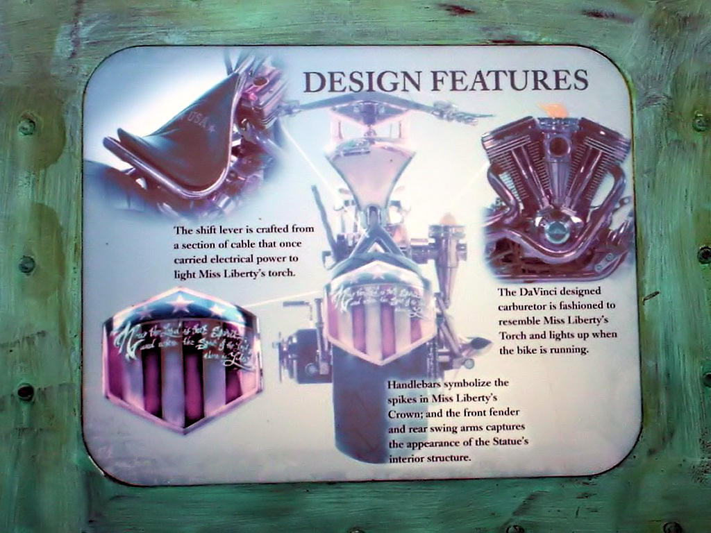
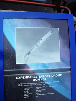
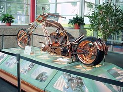
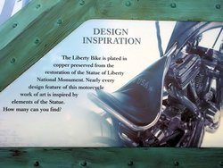
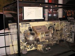
I was understandably surprised to see a motorcycle on display. No, not a "Space Bike" but a
real land-based motorcycle. The "Liberty Bike" is plated with copper removed during the
restoration of the Statue of Liberty. I'm not a huge fan of choppers, but it is a beautiful
machine and Orange County Choppers did a magnificent job on its construction.
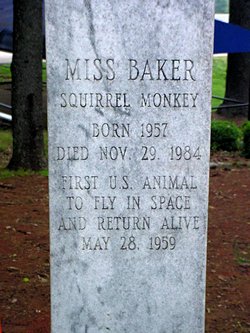
Surprisingly, the thing that made the greatest impression on me was unexpected and was something I happened
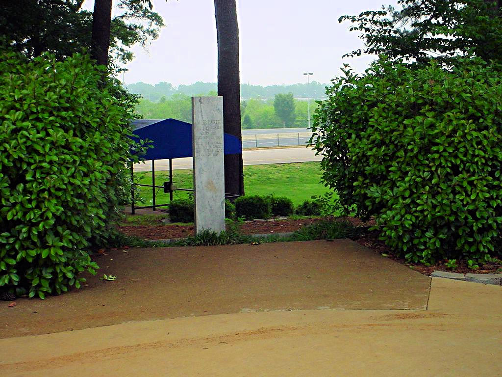
to notice on the way out. I saw a sign that read,
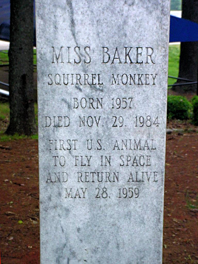
"Miss Baker's Memorial." I didn't know who
Miss Baker was, but nearby, enlosed in a group of shrubs, was a
simple stone marker. Miss Baker,
and her partner Mr. Able were the first two Americans to fly into space on May 28, 1959. Able was
a Rhesus monkey and he died two days after the flight. One of the medical electrodes that were
implanted in his body became infected and needed to be surgically removed. He apparently died from
a reaction to the anesthetic. Miss Baker, a Spider Monkey, survived the flight and is credited as being the first
American animal to fly in space and return alive. She lived until November 29, 1984 when she died
at the age of 27. I read on the internet that after her retirement from space flight she lived on
the grounds of the Space and Rocket Center and is buried there now. The actual nosecone of the
Jupiter rocket in which they flew is in the museum.
Here is a photograph of it. I
finally found a few photos of Able and Baker on the internet.
Here Is A Link to one of them.
It was an uneventful ride down and back although the weather was a bit on the "iffy" side. The
weather forecast for the past three days has been for rain and thunderstorms but they never really
showed up until yesterday evening. It stormed most of the night and was still wet when I left
this morning. Today's forecast was for a 40% chance of rain, and it materialized right as I got
back to Brentwood (Nashville suburb). The sky was black as midnight to the west and I could see
a solid wall of rain ahead. I bailed off the interstate and went around the rain so I barely got
damp.
Heading out I went through Chapel Hill, TN to the site I took my MSF BRC last year. I had been
wondering what was going on with the company I took it through (Mid-South Motorcycle Training Center)
since their web site has been down for several months. Apparently they are now defunct since the
storage container that they kept all their trainer bikes and gear in is gone and the range is vacant. If
anyone knows what is going on with them please Let Me Know.
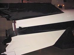
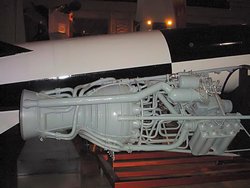
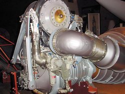
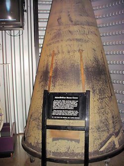
The US Space and Rocket Center in and of itself is awe inspiring. They have many, many displays of
replicas and mock-ups of space and rocket gear, as well as a lot of the real things to view. If you
are ever in the Huntsville area I Strongly recommend it as a stopping place.
|
|
US Space and Rocket Center - Huntsville, AL |
US Space and Rocket Center - Huntsville, AL |
US Space and Rocket Center - Huntsville, AL |
US Space and Rocket Center - Huntsville, AL |
US Space and Rocket Center - Huntsville, AL |
US Space and Rocket Center - Huntsville, AL |
US Space and Rocket Center - Huntsville, AL |
US Space and Rocket Center - Huntsville, AL |
US Space and Rocket Center - Huntsville, AL |
US Space and Rocket Center - Huntsville, AL |
US Space and Rocket Center - Huntsville, AL |

US Space and Rocket Center - Huntsville, AL |
US Space and Rocket Center - Huntsville, AL |
US Space and Rocket Center - Huntsville, AL |

US Space and Rocket Center - Huntsville, AL |
US Space and Rocket Center - Huntsville, AL |

US Space and Rocket Center - Huntsville, AL |
US Space and Rocket Center - Huntsville, AL |

US Space and Rocket Center - Huntsville, AL |

US Space and Rocket Center - Huntsville, AL |
US Space and Rocket Center - Huntsville, AL |

US Space and Rocket Center - Huntsville, AL |
US Space and Rocket Center - Huntsville, AL |

US Space and Rocket Center - Huntsville, AL |
US Space and Rocket Center - Huntsville, AL |
US Space and Rocket Center - Huntsville, AL |
US Space and Rocket Center - Huntsville, AL |
US Space and Rocket Center - Huntsville, AL |

US Space and Rocket Center - Huntsville, AL |
US Space and Rocket Center - Huntsville, AL |
US Space and Rocket Center - Huntsville, AL |

US Space and Rocket Center - Huntsville, AL |
US Space and Rocket Center - Huntsville, AL |
US Space and Rocket Center - Huntsville, AL |
US Space and Rocket Center - Huntsville, AL |

US Space and Rocket Center - Huntsville, AL |
US Space and Rocket Center - Huntsville, AL |
US Space and Rocket Center - Huntsville, AL |

US Space and Rocket Center - Huntsville, AL |

US Space and Rocket Center - Huntsville, AL |
US Space and Rocket Center - Huntsville, AL |
US Space and Rocket Center - Huntsville, AL |

US Space and Rocket Center - Huntsville, AL |
GPS Track Log |
|
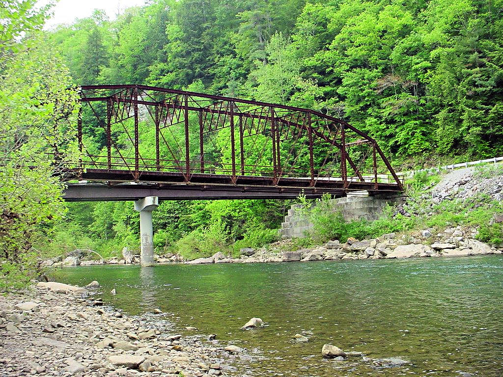
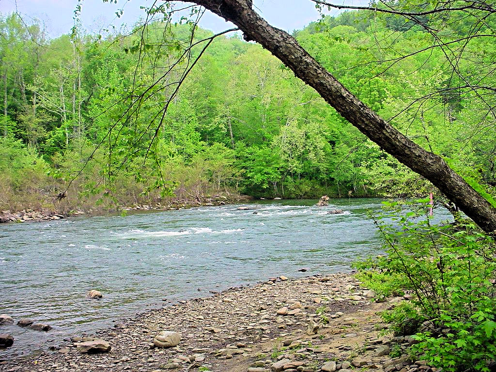
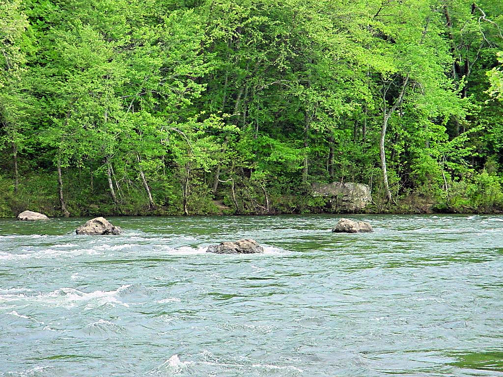
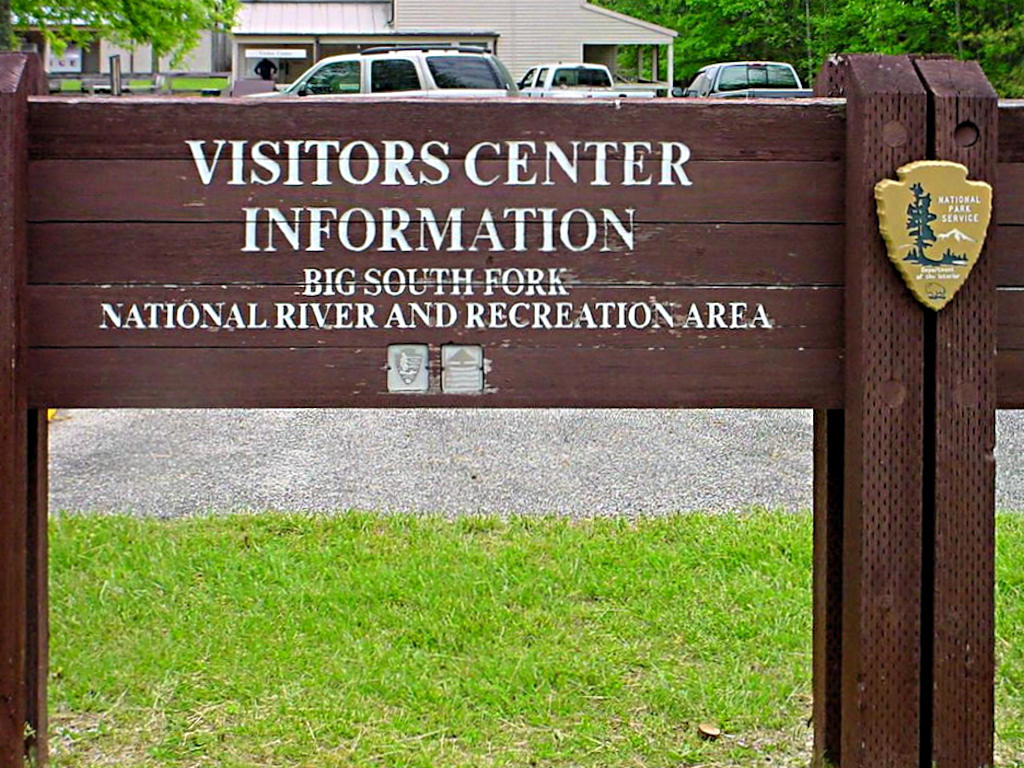
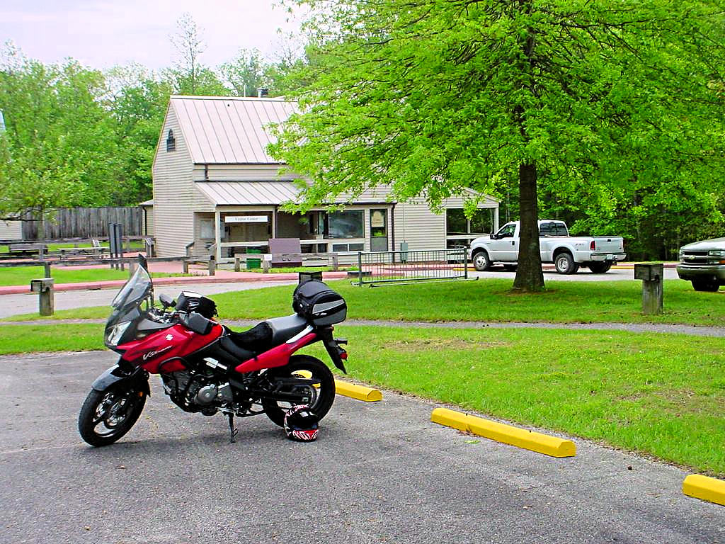
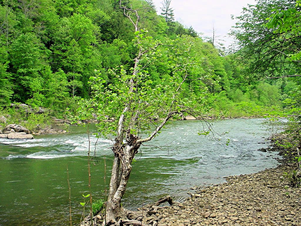
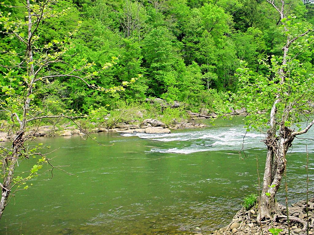
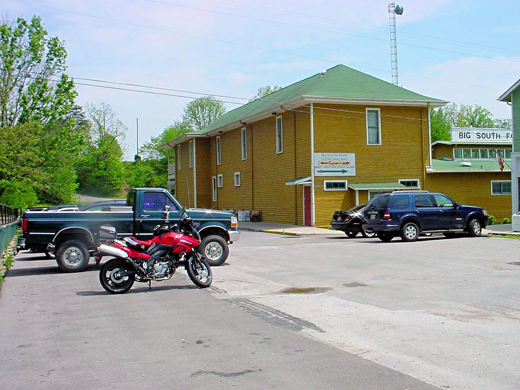
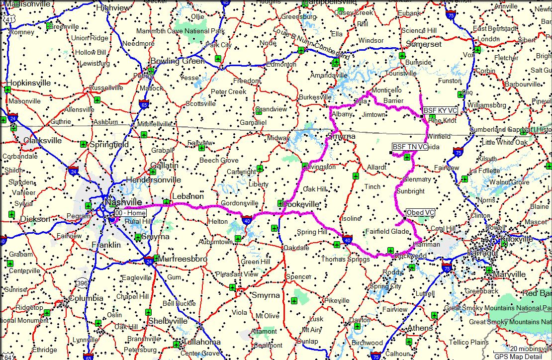
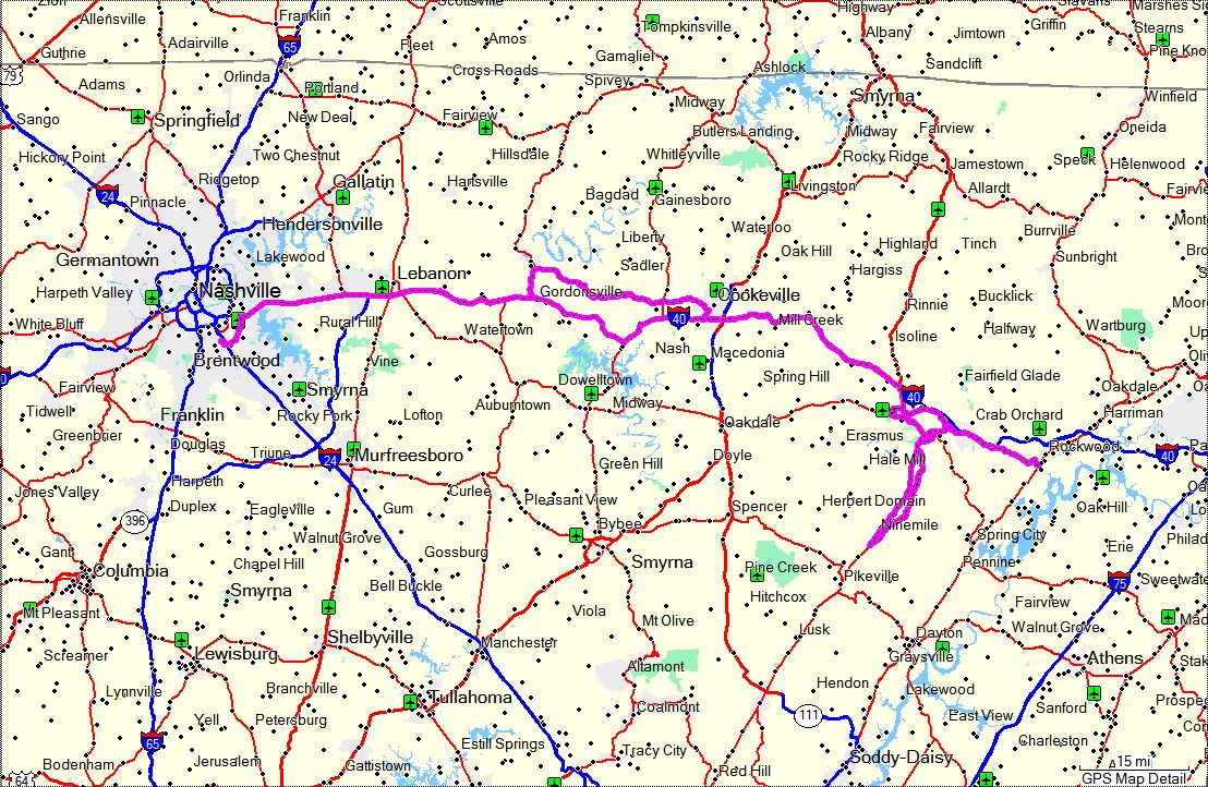
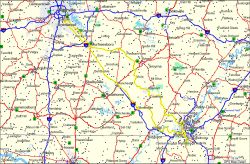
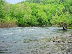
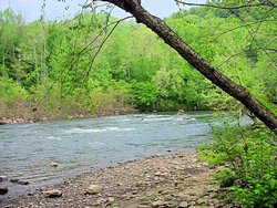
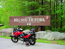
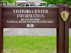
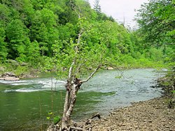
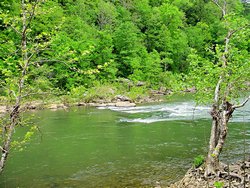
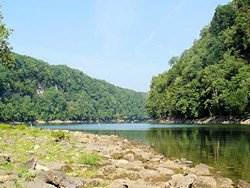
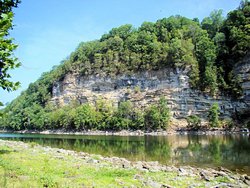
STAMP QUEST - Obed Wild and Scenic River / Big South Fork NRRA - May 12, 2007
|
|
Yet another National Park Passport Stamp
quest today. I left home about 6:00am headed for Wartburg, TN to visit the
Obed Wild and Scenic River and from there to the
Big South Fork National River and Recreational Area at
Oneida, TN and Stearns, KY. It was a pretty long ride from my point of view (451 miles round
trip) but the scenery in both areas was just magnificent. In addition to the scenery I
got 4 more Passport Stamps bringing my total up to 31.
The Visitors Center for Obed WSR is in Wartburg, TN. According the the Ranger on duty the building
used to be a bank and is now leased by the National Park Service for the Visitors Center. They
have a number of exhibits on display showing aquatic life from the river as well as a great deal of
information about the river itself. The river is quite long so I didn't even try to see much of it
but I did stop at the Nemo trailhead and take some photos.
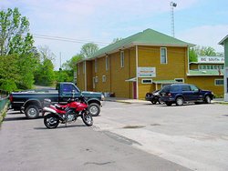
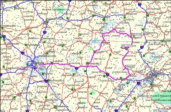
Big South Fork National River and Recreation Area spans the border between Tennessee and Kentucky. There
is a Visitors Center on the Tennessee side near Oneida, TN and another one in Stearns, KY. The
Tennessee VC is a traditional Visitors Center, but the one in Stearns is in a historic area of the
city, and is located inside a Train Depot (yes I think you can take a ride on the train!).
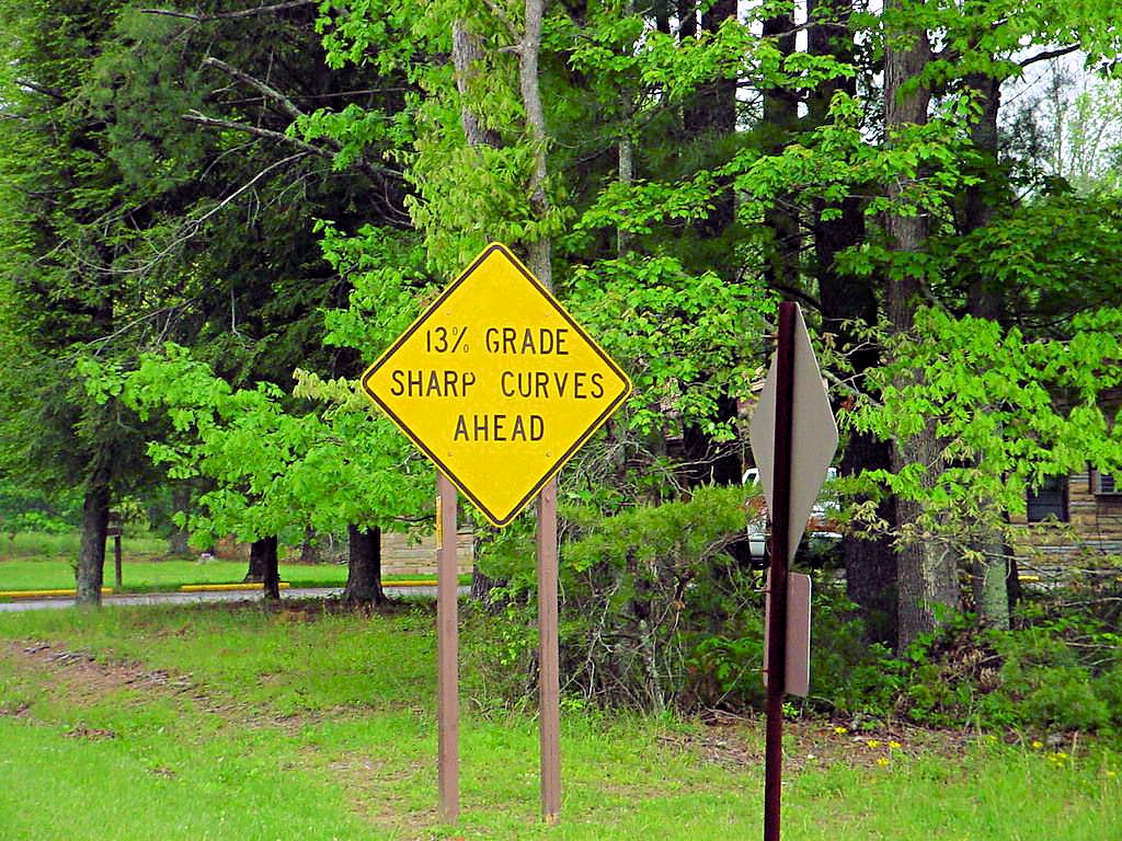
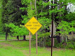
The ride itself was uneventful except for the roads going into Big South Fork. That is a magnificent
motorcycle road. One of the photos below shows a sign that reads "13% Grade / Sharp Curves Ahead"
and they are NOT kidding! It was a blast to ride on a bike! There were some hairpin turns
that were posted at 10 mph. I honestly think I saw my bike bend in the middle going around a
couple of them!
|
|
Obed Wild and Scenic River - Wartburg, TN |
Obed Wild and Scenic River - Wartburg, TN |
Obed Wild and Scenic River - Wartburg, TN |
Obed Wild and Scenic River - Wartburg, TN |
Obed Wild and Scenic River - Wartburg, TN |

Obed Wild and Scenic River - Wartburg, TN |
Big South Fork NRRA - Oneida, TN |
Big South Fork NRRA - Oneida, TN |
Big South Fork NRRA - Oneida, TN |

Big South Fork NRRA - Oneida, TN |
Big South Fork NRRA - Oneida, TN |
Big South Fork NRRA - Oneida, TN |
Big South Fork NRRA - Stearns, KY |
GPS Track Log |
|
|
|
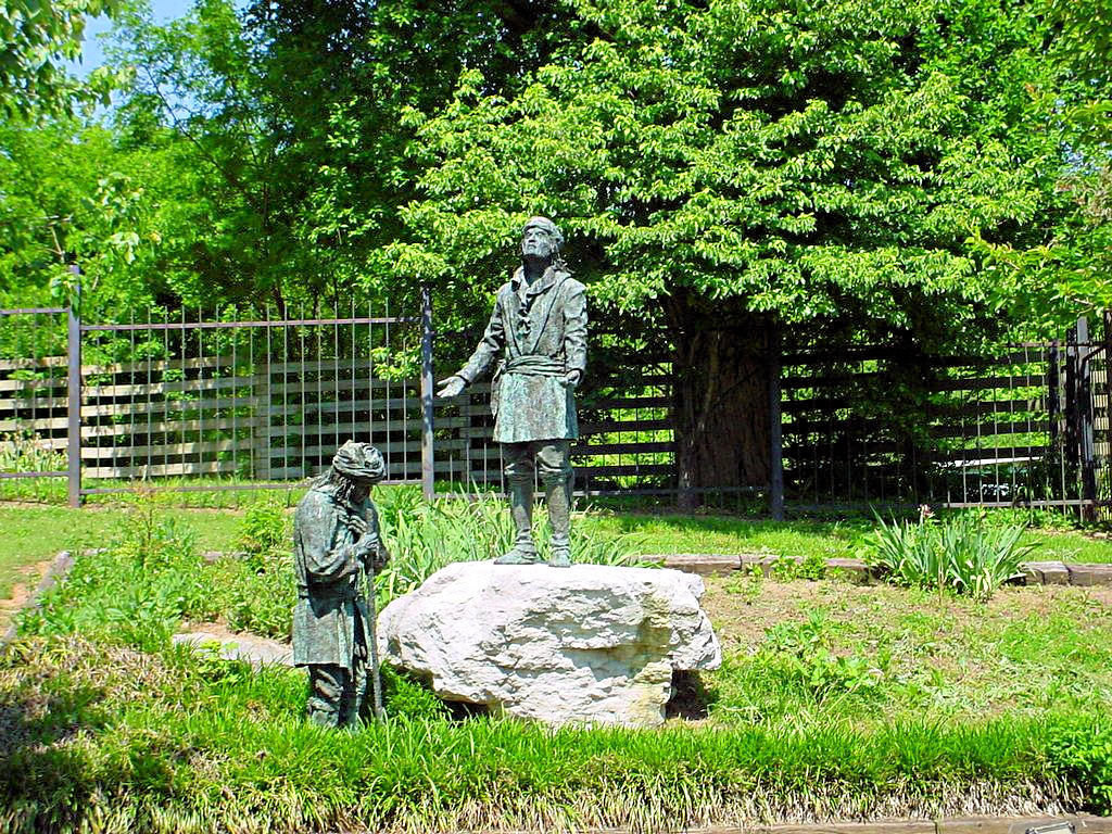
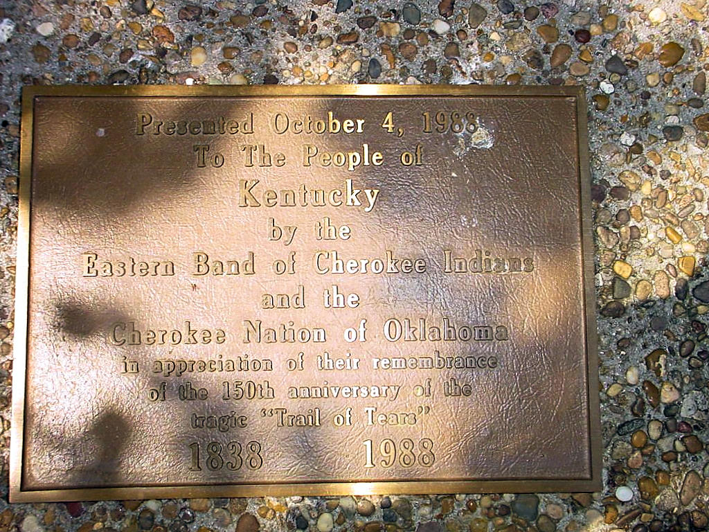
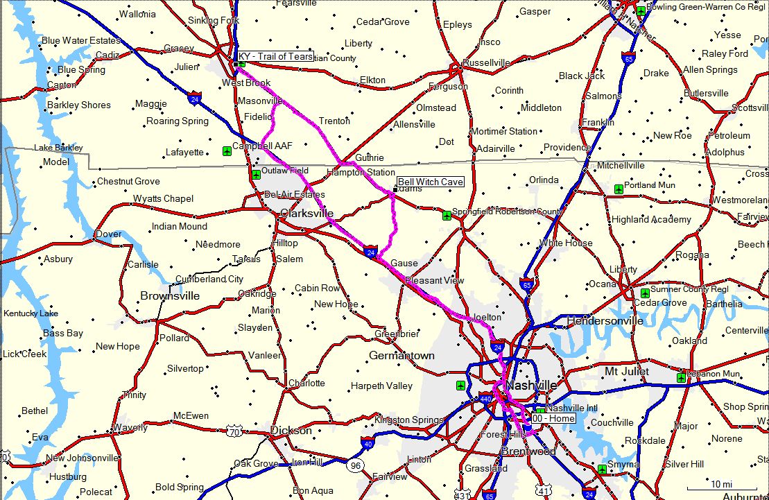
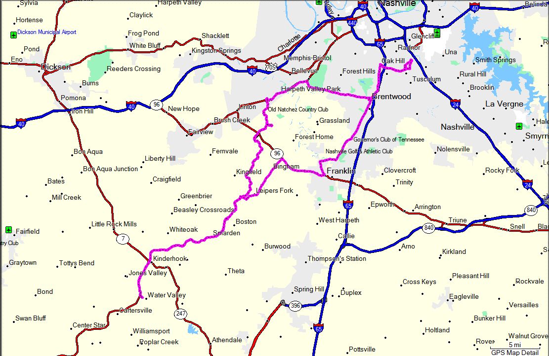
Hopkinsville, KY and Adams, TN - May 20, 2007
|
|
I had things I REALLY needed to get done today, but they didn't happen. I had breakfast
with some friends who invited me to ride with them. I told them I couldn't because I had
things I had to do, and I really had good intentions. But, the weather was too nice and
I had to get out and ride some. I headed for Hopkinsville, KY because I had heard that
there was a National Park Passport Stamp
there (which I got!) and then headed east for a stop at the Bell Witch Cave in Adams, TN.
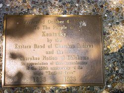
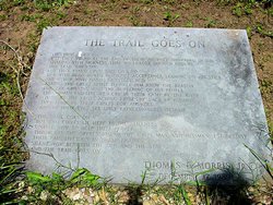
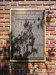
The stamp was at the
Trail of Tears Commemorative Park (or for their specific web site
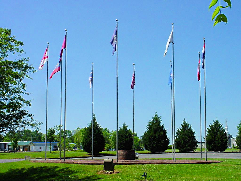
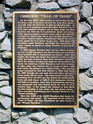
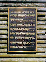
Click Here). The park is a very nice area dedicated to the Trail of Tears, or the forced relocation
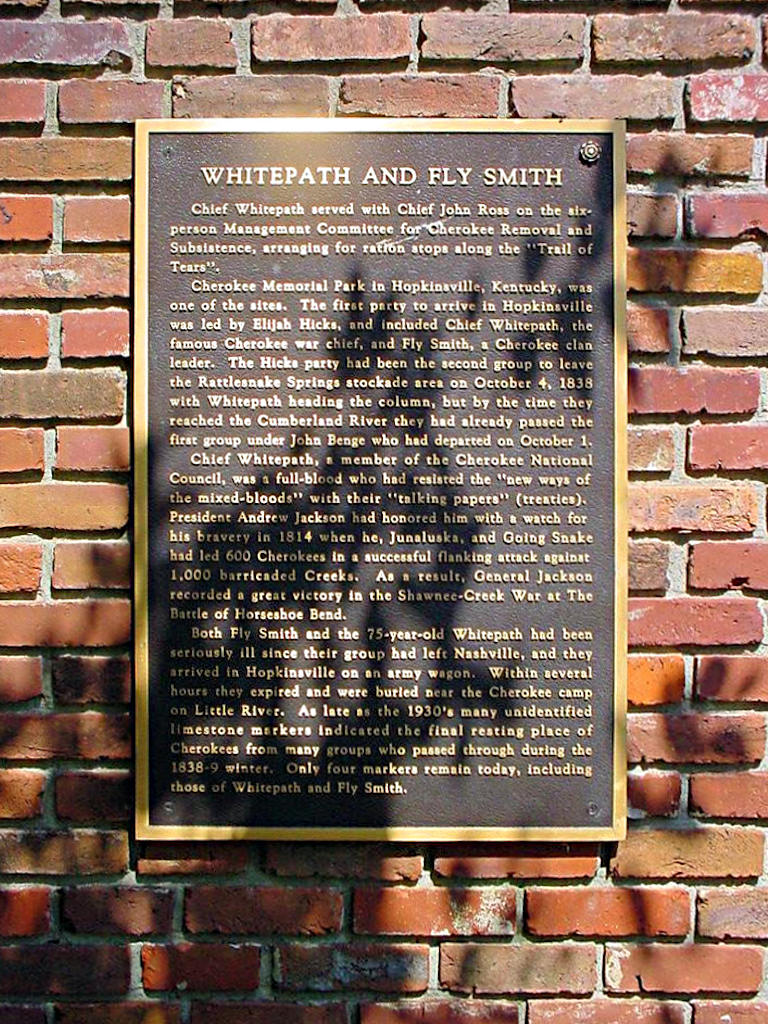
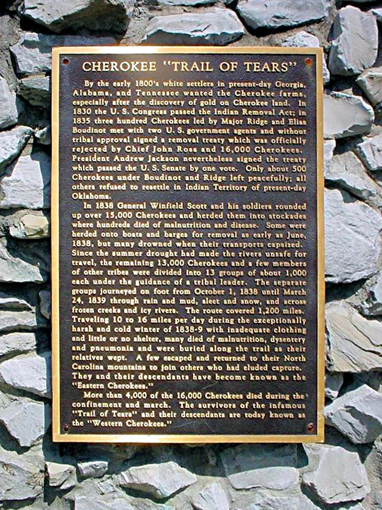
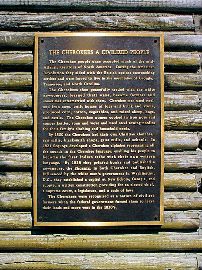
of the Cherokee Indians. Two Cherokee chiefs,Fly Smith and Whitepath, died there and their remains are
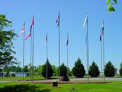
buried at the site. The flags shown in the photo below denote the 9 states that the Trail of Tears
crosses: Alabama, Arkansas, Georgia, Illinois, Kentucky, Missouri, North Carolina, Oklahoma, and Tennessee.
The Bell Witch Cave is the historic site of the Bell Witch
who, in 1820, haunted the Bell family. According to legend her purpose for the haunting was to
kill John Bell. Nobody knows why but she accompliahed her task.
Here Is A Link to the legend of Kate, the Bell Witch.
The cave tour was interesting, but I didn't see any evidence of the witch. Moreover, it was pretty
much just a big old cave. From a historic point of view it was quite interesting, but if you expect
more than just a cave you may be disappointed ;)
|
|

Trail of Tears Commemorative Park |
Trail of Tears Commemorative Park |
Trail of Tears Commemorative Park |
Trail of Tears Commemorative Park |
Trail of Tears Commemorative Park |
Trail of Tears Commemorative Park |
Trail of Tears Commemorative Park |
Trail of Tears Commemorative Park |
Trail of Tears Commemorative Park |
GPS Track Log |
|
|
|
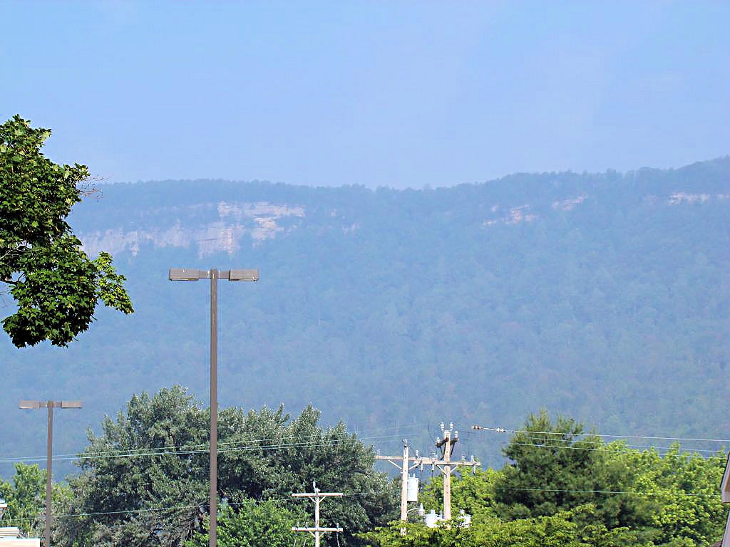
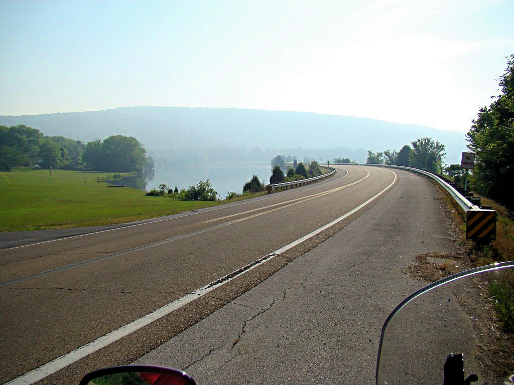
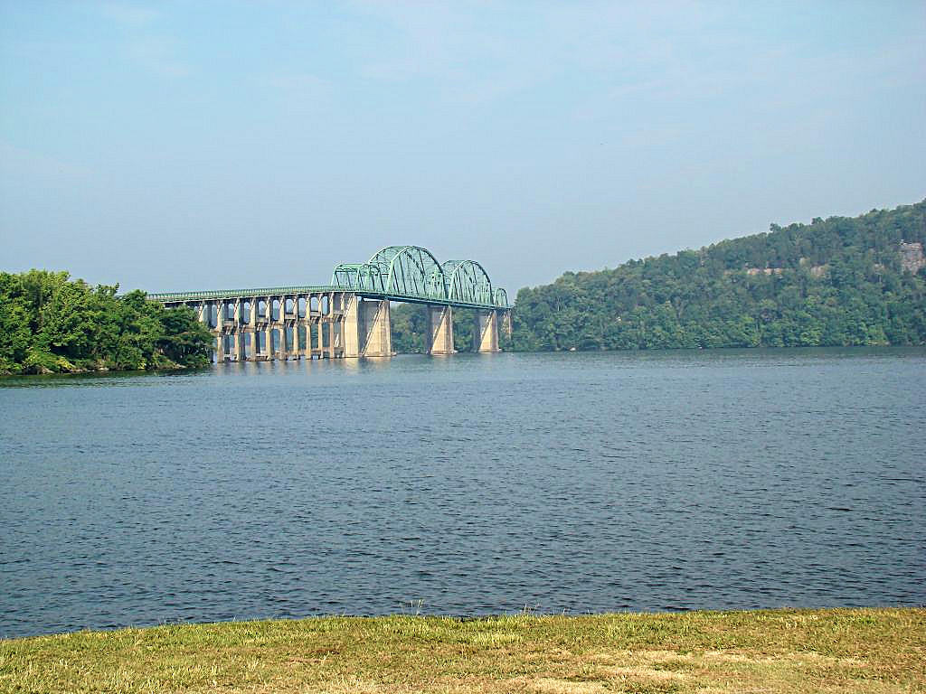
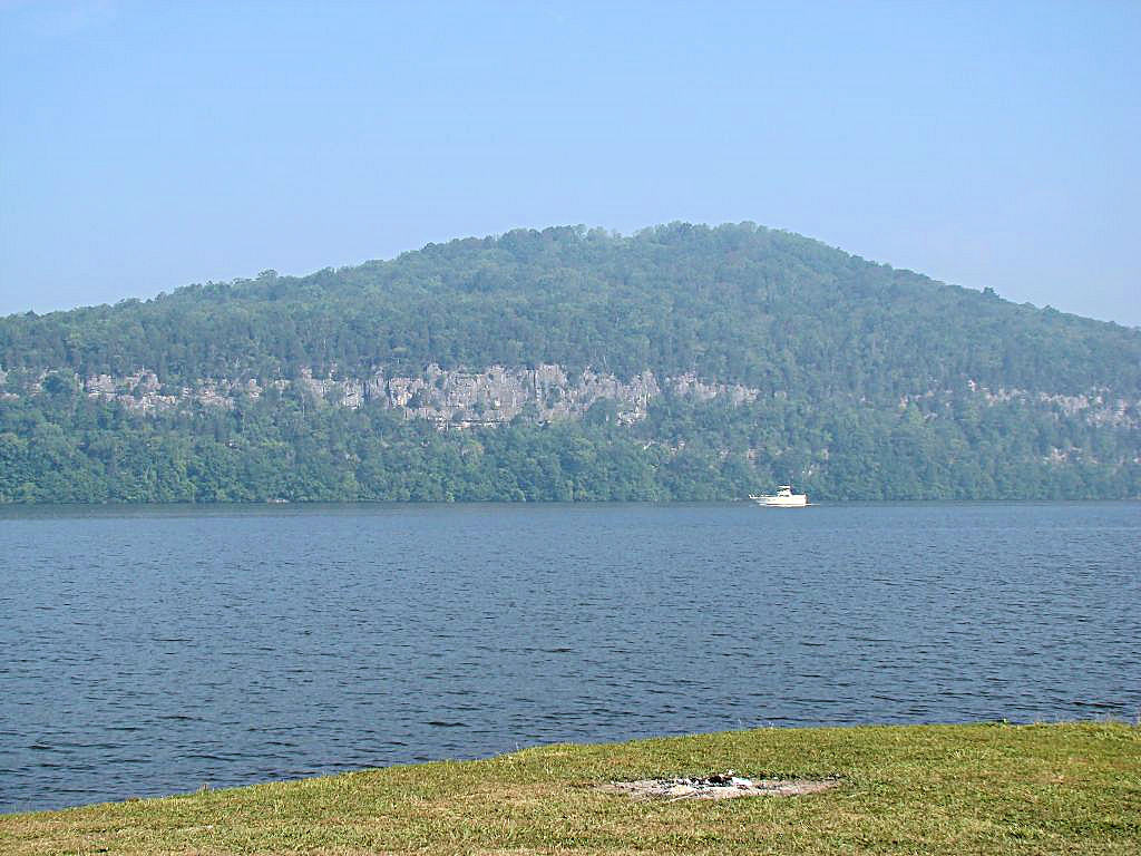
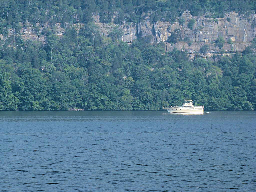
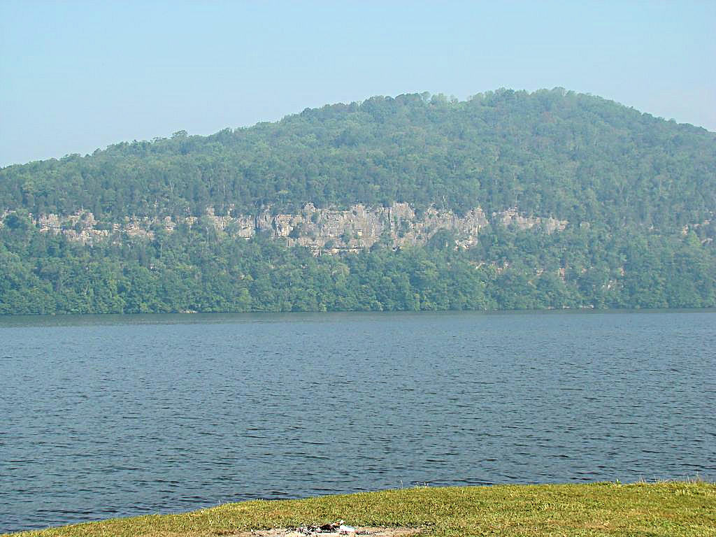
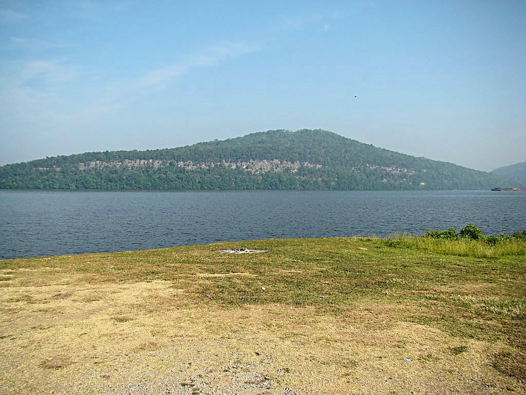
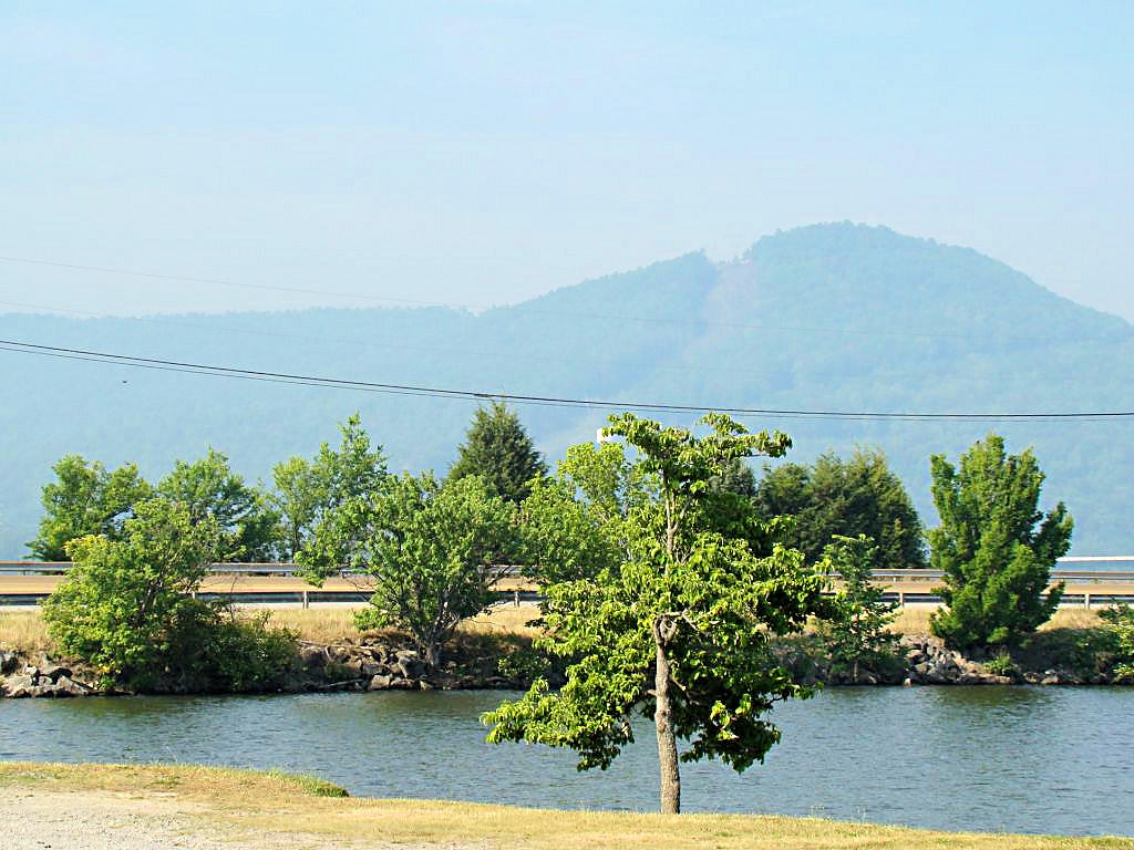
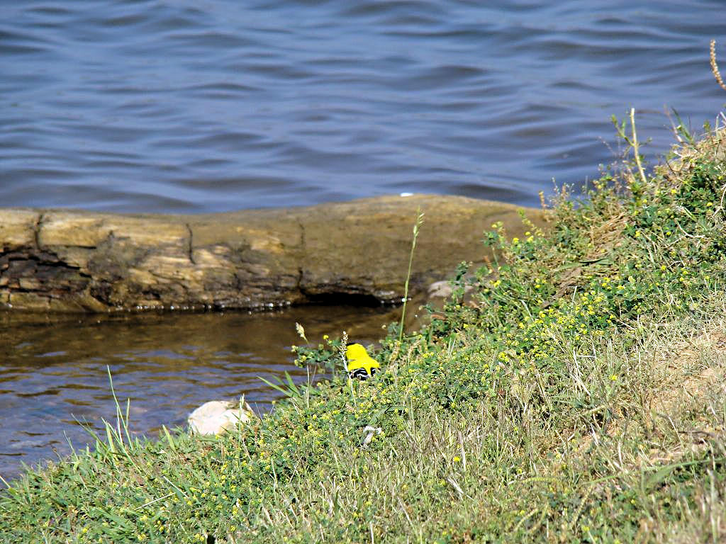
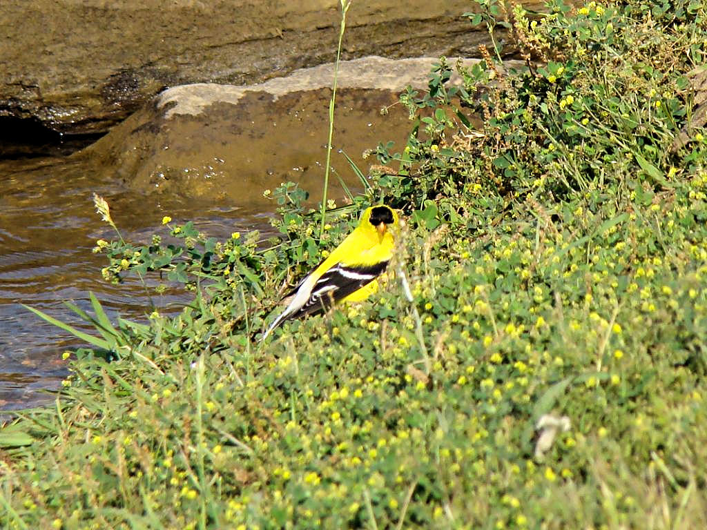
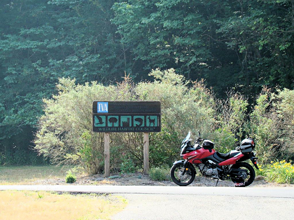
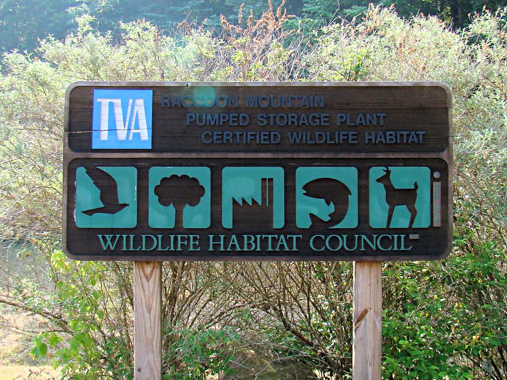
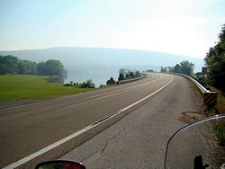
Chattanooga, TN - May 28, 2007
|
|
I rode to Chattanooga, TN today to visit my friend AGirl and meet her Matriarch. I've heard
a lot about Reecie, and it was certainly a pleasure to meet her and the rest of the family. I
can only hope that when I hit 84 I have 1/2 the enregy and abilities that she does. It was
also great to spend time with Scott and Jill and hear about their profession. All in all it
was a great trip and I had a blast.
I headed out early to try and beat the Memorial Day traffic. I made a stop at a Waffle House
(I know, the damn places are habit forming and now it's hard to eat breakfast anywhere else) in
Manchester, TN for breakfast and then ditched I-24 at Monteagle, TN to take US Highway 41 the rest
of the way into Chattanooga. That is a gorgeous area and I wanted to take some pictures of
areas I missed when I was down that way on
April 21, 2007. I didn't
get photos of some of the roads I wanted to get because there was just plain no place to get off the
road to take a photo. I was reluctant to just stop on the edge of the lane, for obvious reasons,
even though there was little traffic in the area. Coming home I started out on I-24 and it was
bumper-to-bumper holiday traffic. I told myself I was going to get off at Jasper, TN and head
up US 41 to Nashville, but I didn't. Then I said I was going to get off at Monteagle, TN and
head up US 41, but I didn't. Then I said I was going to get off at Manchester, TN and
head up US 41, but I didn't. When I got to Smyrna, TN (about 10 miles from home) I decided
I'd just go ahead and stay on I-24 ;)
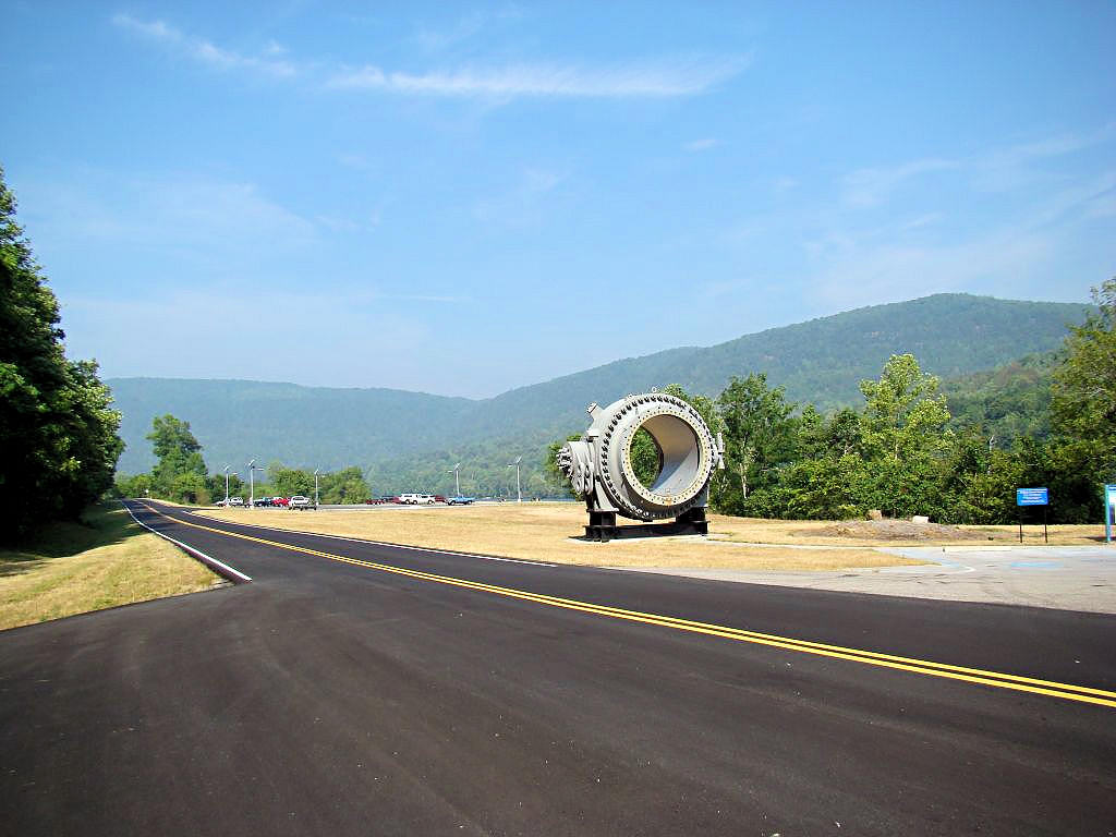
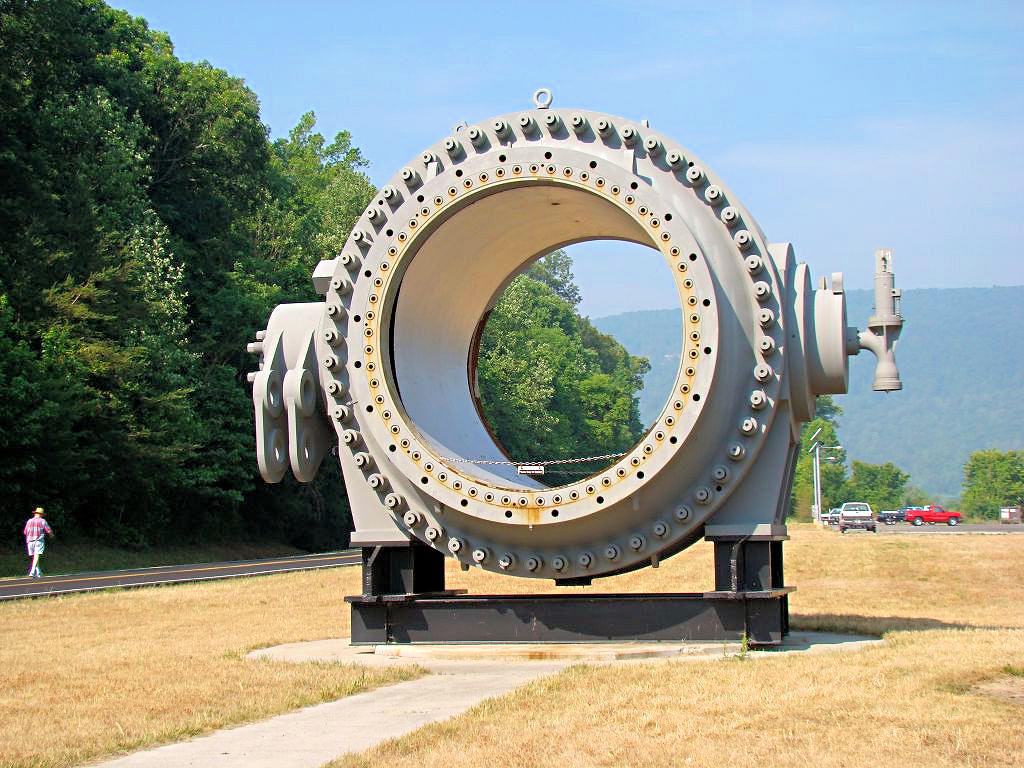
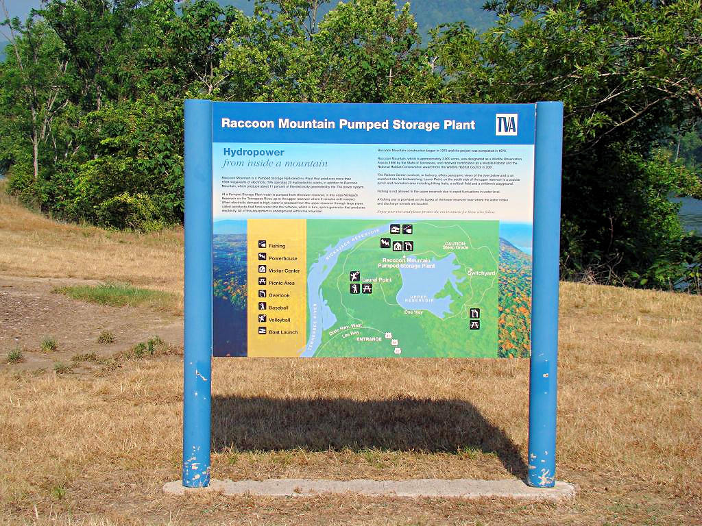
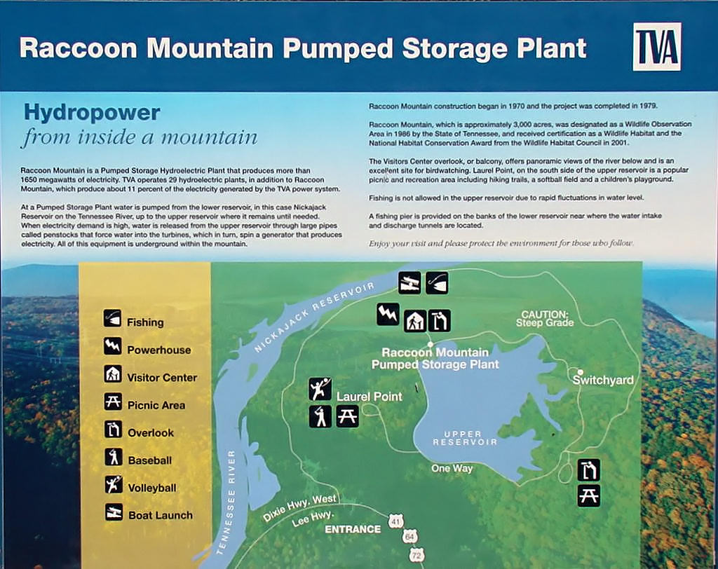
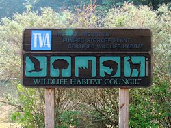
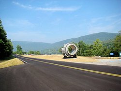
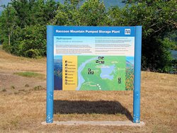
Most of the photos below were taken around Nickajack Lake, but there are some entitled "Racoon
Mountain" as well. As I got across the lake I happened to see a road with a sign that read
"TVA Racoon Mountain Visitor's Center" so I had to see where it went. This is a beautiful
ride along the edge of the Tennessee River and Nickajack Lake. I didn't stop at the Visitor's
Center but the sign indicating that it is a "Pumped Storage Plant" makes it seem like it would be
an interesting stop, especially for someone interested in engineering. For anyone who might
be interested in taking a look the GPS coordinates at the turn off from US Highway 41 onto McBrian
Lane are N36.03675° W85.41821°. In fact US Highway 41 from Jasper, TN into Chattanooga,
TN is a very scenic road that winds along beside the river.
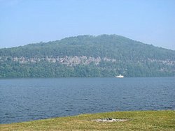
Another thing that can be seen in most of the photos is the reason that the mountains in this area
are named the "Smoky Mountains". The weather here is quite humid and hazy. Legend has it
that the haze during the summer is how the Smoky Mountains got their name. Even though it is
still only late May the humidity is making itself felt and the haze is easily visible in the photos
of the mountains. It isn't my camera nor is it the photos themselves. That's the way
the air looks in this part of the country for most of the summer.
This Photograph
or This One
are good examples. Notice how the foregrounds are relatively clear but the
mountains in the background look smoky because of the haze in the air.
|
|
Jasper, TN |
Jasper, TN |

Jasper, TN |
Nickajack Lake |
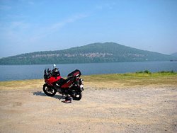
Nickajack Lake |
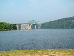
Nickajack Lake |
Nickajack Lake |
Nickajack Lake |
Nickajack Lake |
Nickajack Lake |

Nickajack Lake |
Nickajack Lake |
Nickajack Lake |

Racoon Mountain |
Racoon Mountain |
Racoon Mountain |

Racoon Mountain |
Racoon Mountain |

Racoon Mountain |
GPS Track Log |
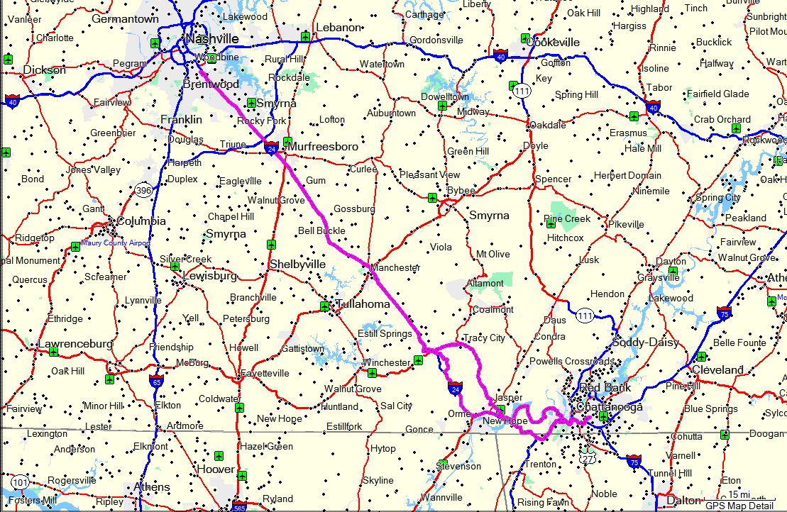
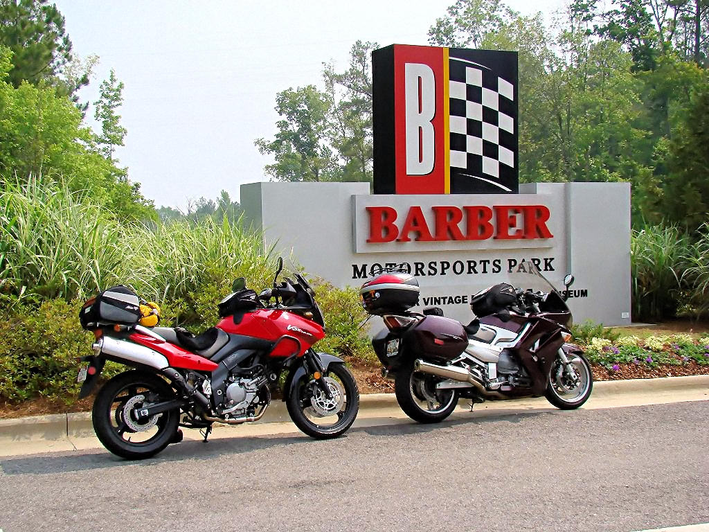
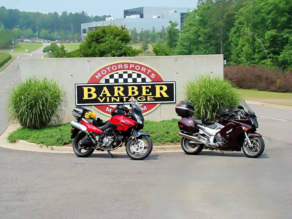
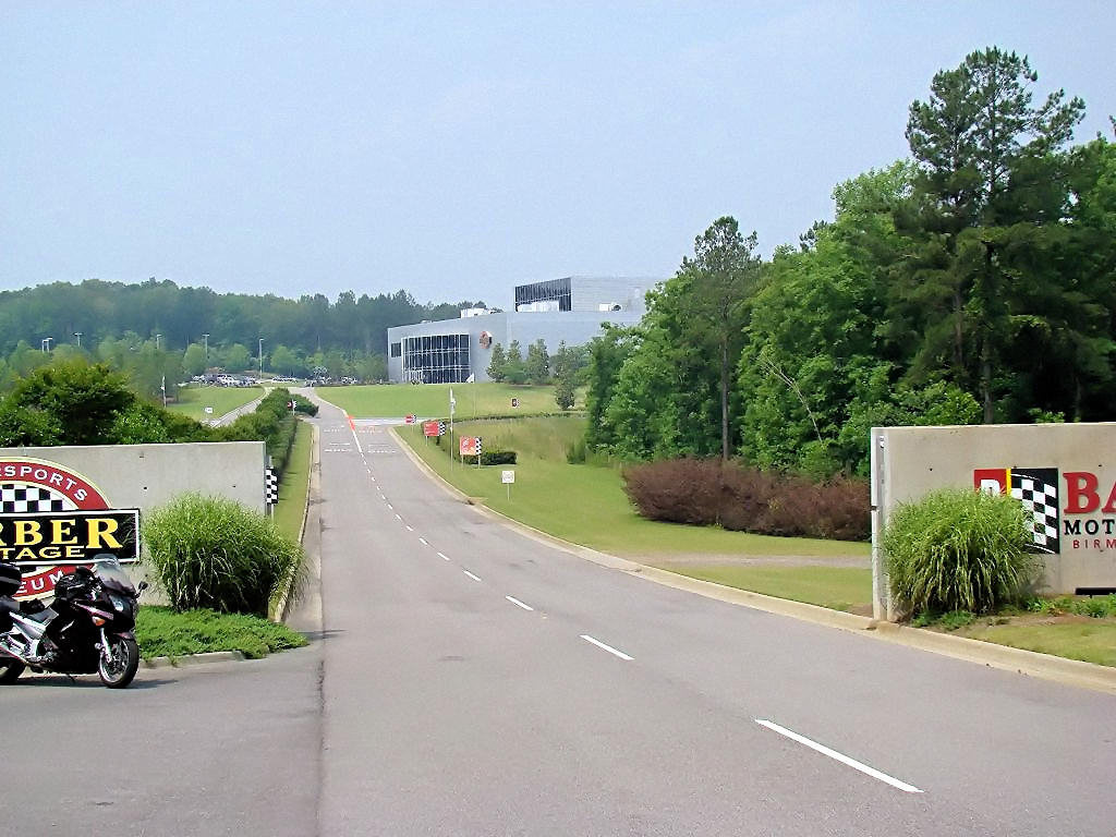
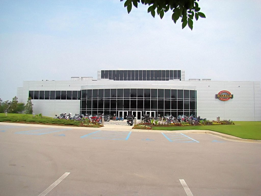
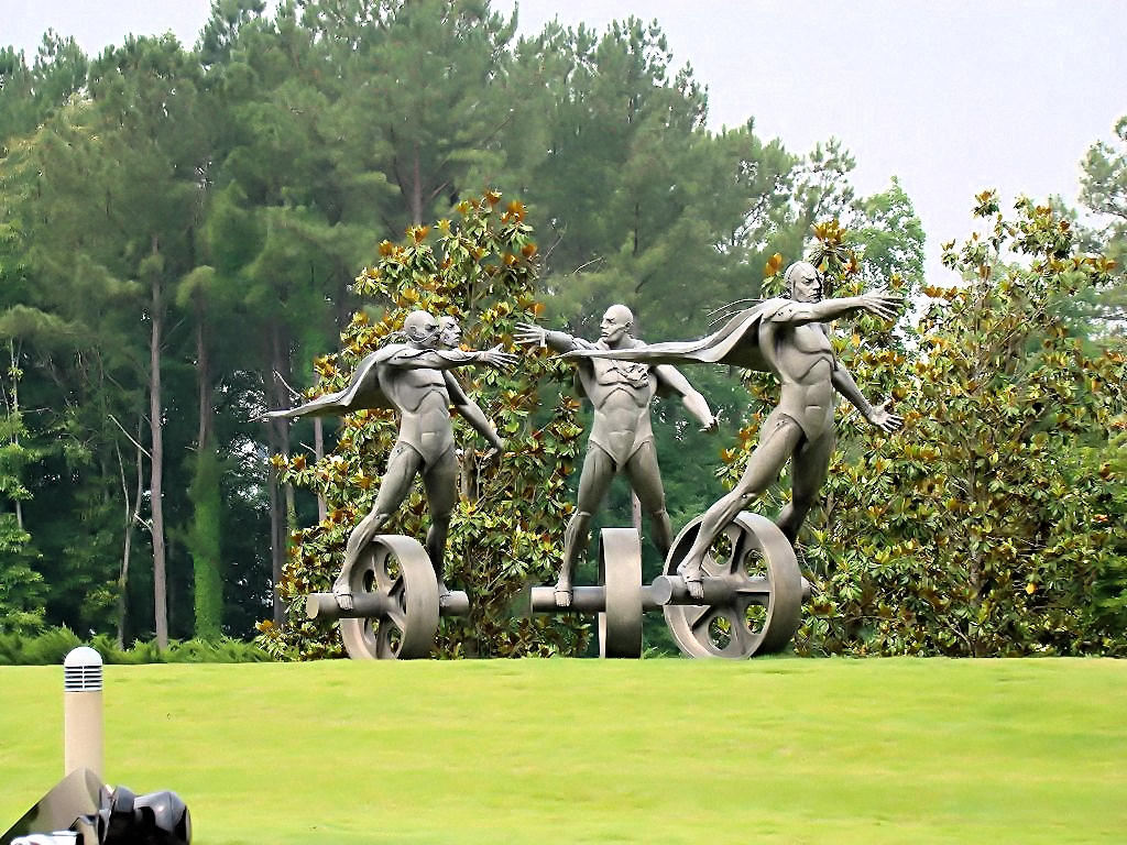
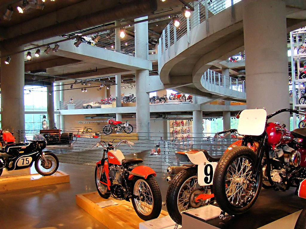
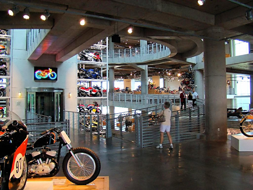
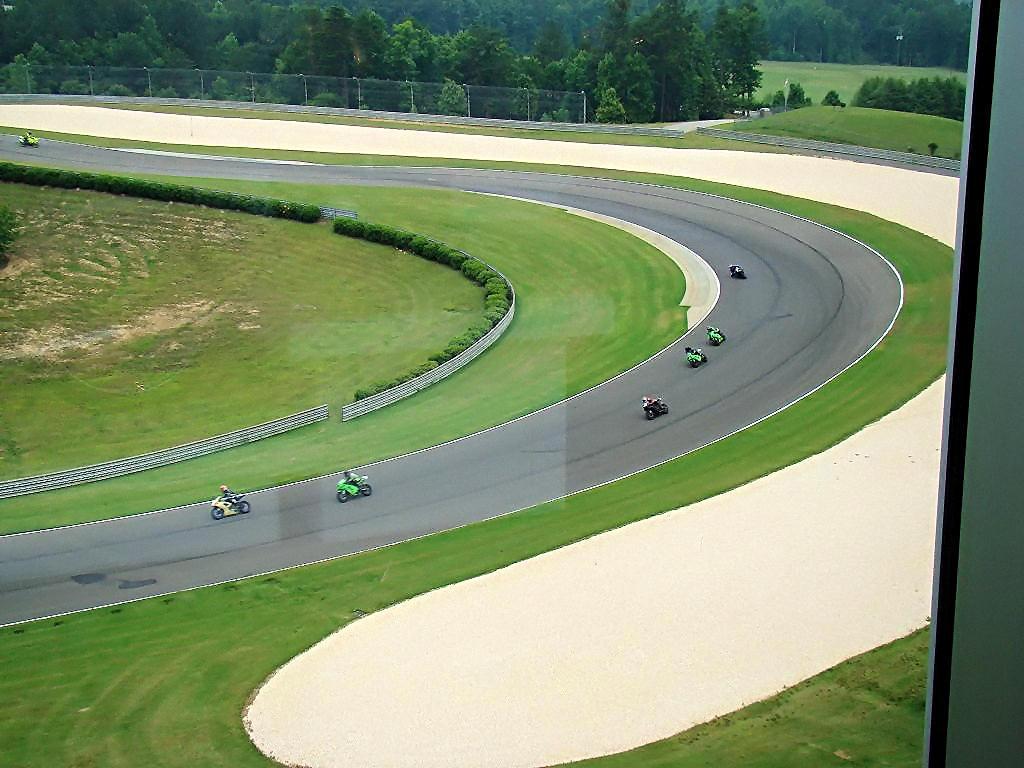
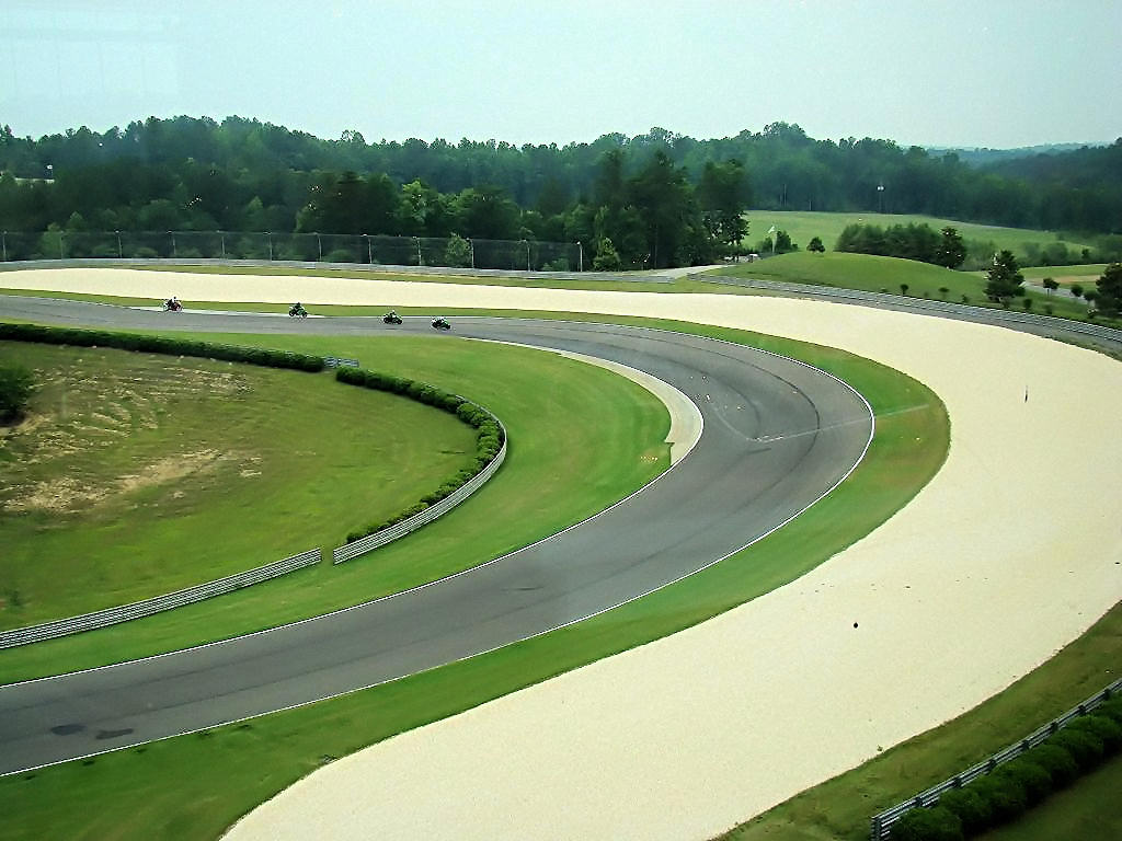
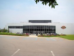
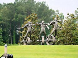
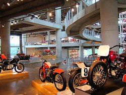
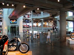
BARBER VINTAGE MOTORSPORTS MUSEUM - Birmingham, AL - June 2, 2007
GPS Coordinates: N33.53305 W86.61368
|
|
My friend AGirl and I headed south to the Barber Vintage Motorcycle Museum
in Birmingham, AL today. We met at my office in Brentwood at 6:00am and headed down
I-65. The ride down included a stop in Athens, AL at the Waffle House (of course!)
for some breakfast. We did hit a little bit of rain south of Athens and had to stop
for rain gear. It was really just a drizzle though, and the only thing it accomplished
was to get us hot in waterproof gear. Another stop about 20 miles from the museum had
to be made to get out of it!
The museum is absolutely magnificent. I don't know exactly how many motorcycles they
have on display, but their Web Site states that
at any given time there are at least 500 on display. They date from the early 1920's (at
least that's the earliest one I recall seeing) through the 2000's. There are also a lot
of racing cars (primarily Lotus's) dating back to the 60's and 70's on display. It may
date me but I do remember seeing a lot of them on the track back in those days.
We talked with a staff member who told us that every one of the bikes in the museum are capable
of being ridden within 2 hours. Every machine there is in running order, completely rebuilt
or refurbished, and virtually ready to go. He said that they put cosmoline in the fuel system
and mineral oil in the hydraulics. To get one ready to run they bleed the hydraulics and
add hydraulic fluid. They clean out the fuel system and add gas. Put a battery in
(where necessary since many of them were built before batteries!) and they are ready to rip.
One thing that amazed me was that there was not a speck of dust ANYWHERE! Every single
one of the displays is immaculately clean and dust free. This is quite amazing since
many of the displays cannot be reached without the use of a scissors lift because they are
stacked 5 stories high!
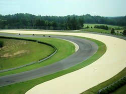
The back of the museum looks out over the racetrack, and there were a number of bikes on
the track today. They weren't race bikes, but appeared to be a class of some sort
or perhaps just a "Track Day". Regardless, the view from the museum is magnificent.
If you are a motorcycle fan, and are anywhere in the vicinity of Birmingham, I STRONGLY
recommend a stop at this place. It is absolutely amazing.
There are a few photographs below. If you want to see more, click
This Link!.
Update - September 30, 2007 - I made another trip to the Barber Museum yesterday and have a lot
more photographs on This Page.
|
|

Barber Vintage Motorsports Museum |

Barber Vintage Motorsports Museum |

Barber Vintage Motorsports Museum |
Barber Vintage Motorsports Museum |
Barber Vintage Motorsports Museum |
Barber Vintage Motorsports Museum |
Barber Vintage Motorsports Museum |

Barber Vintage Motorsports Museum |
Barber Vintage Motorsports Museum |
Barber Vintage Motorsports Museum |
Barber Vintage Motorsports Museum |
GPS Track Log |
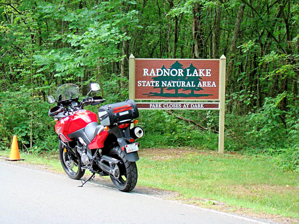
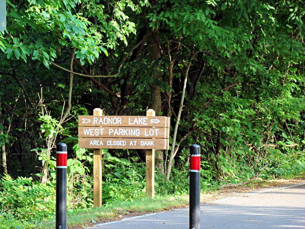
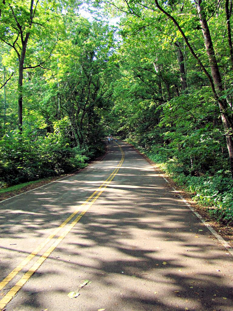
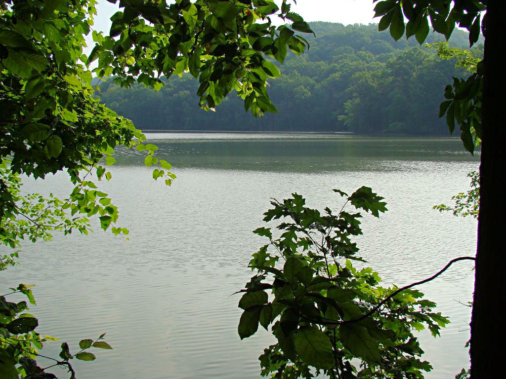
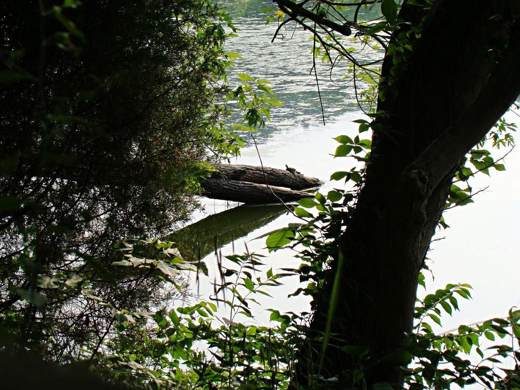
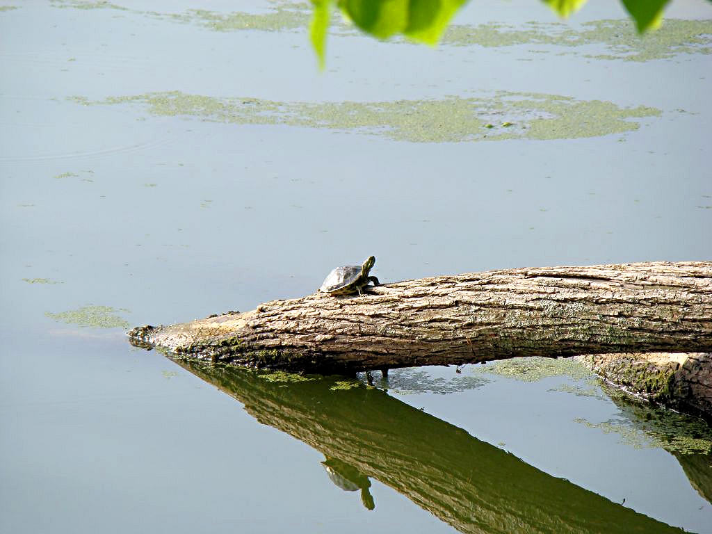
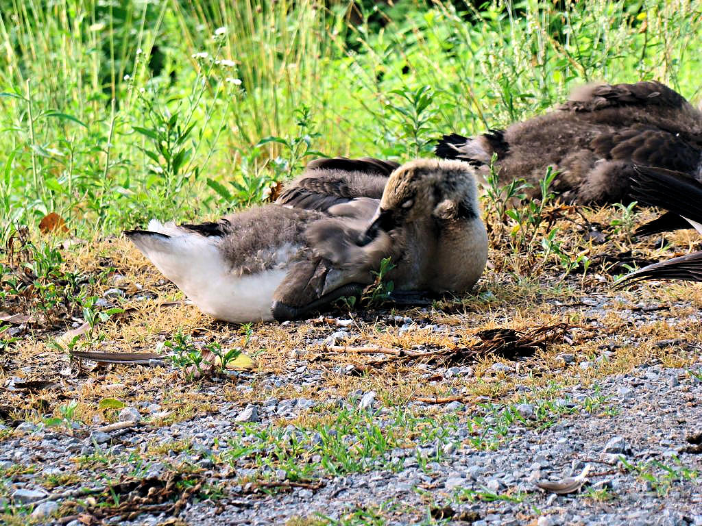
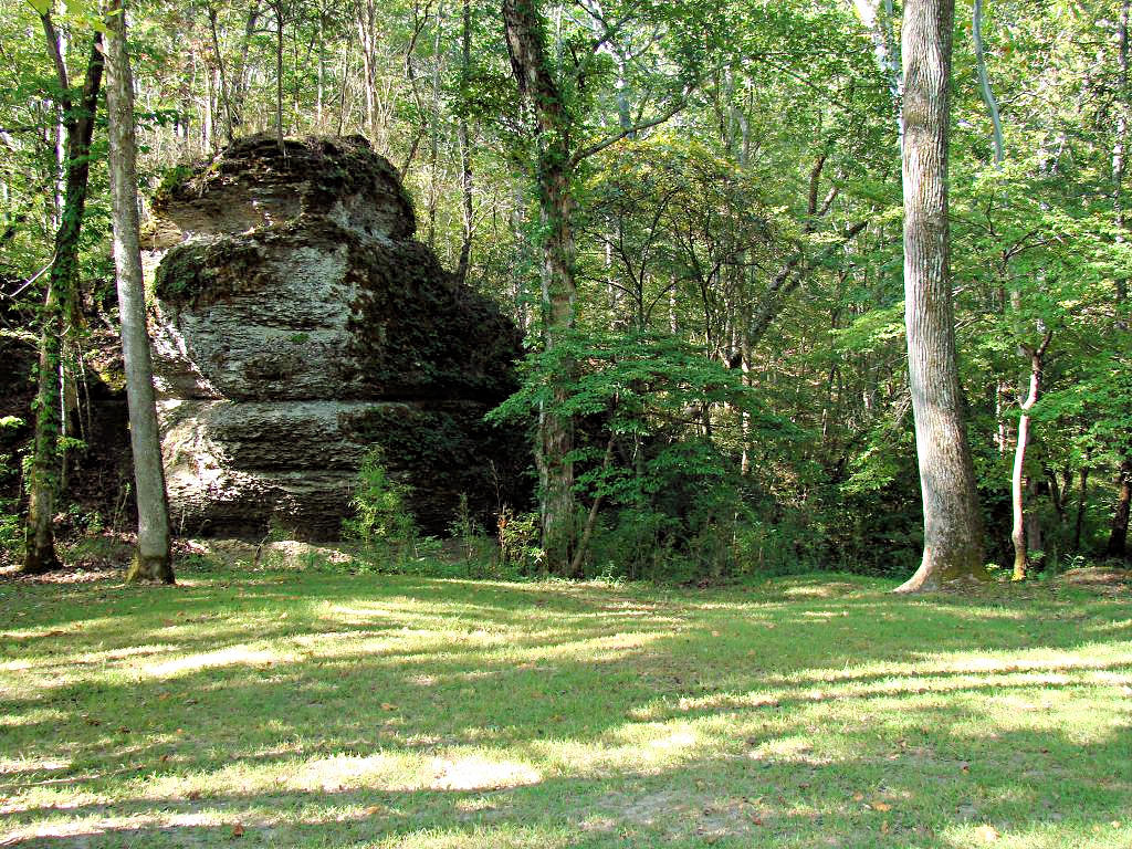
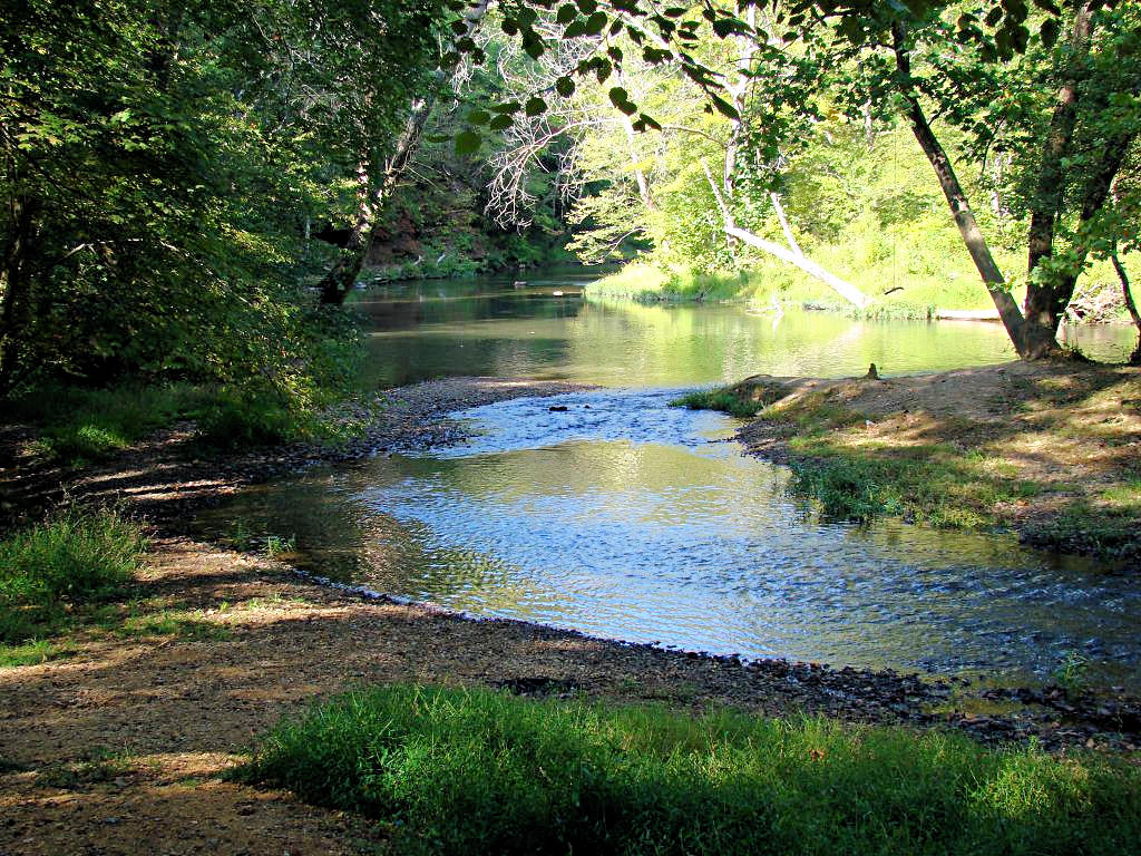
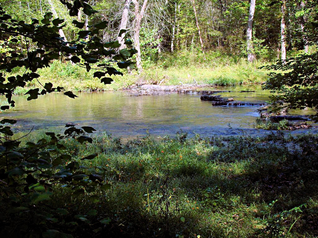
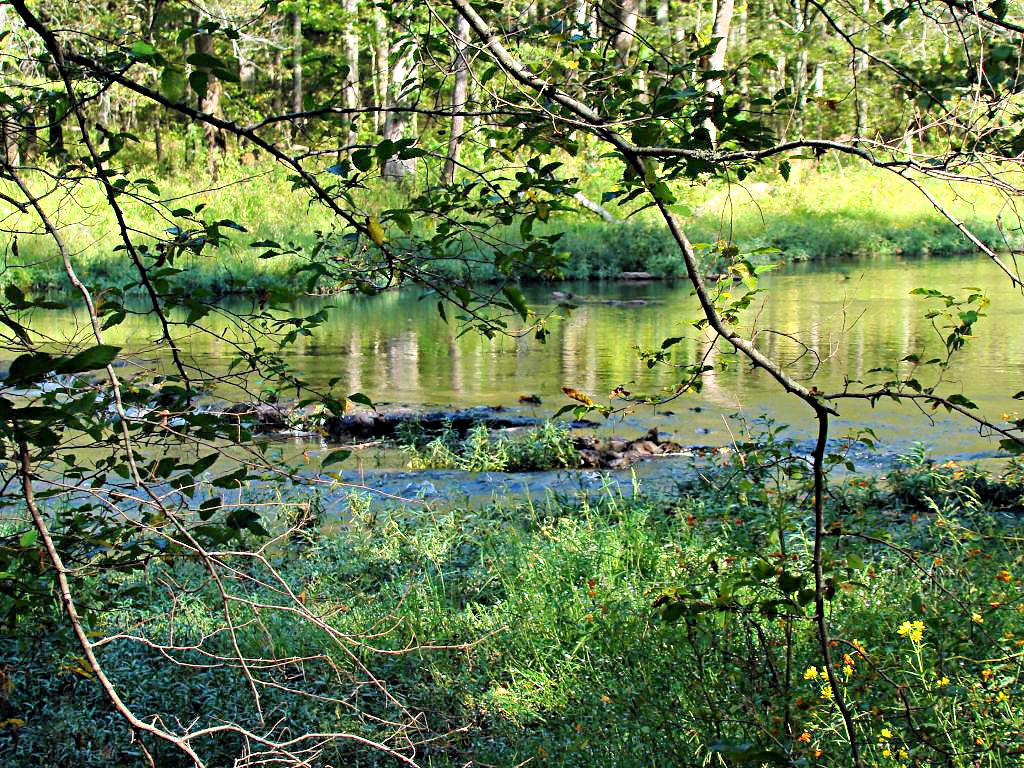
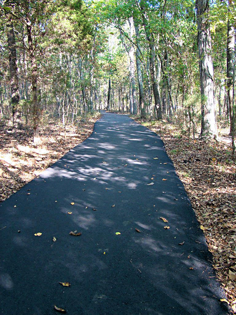
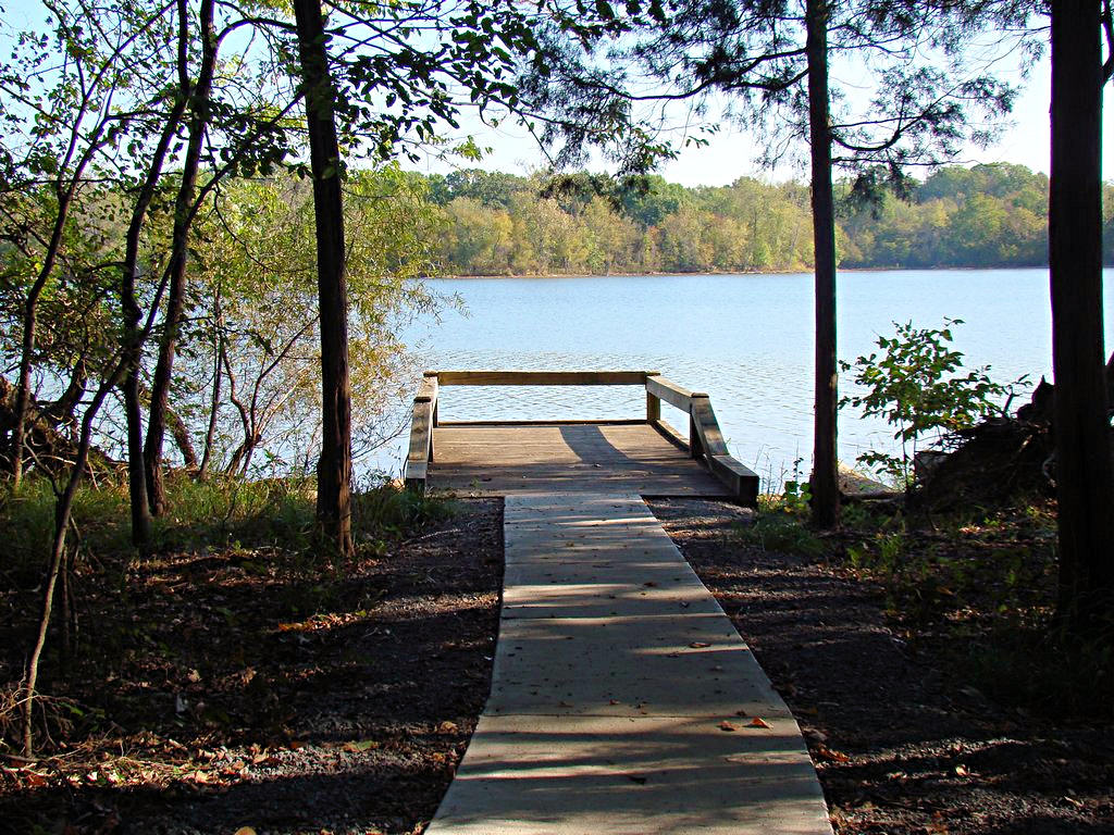
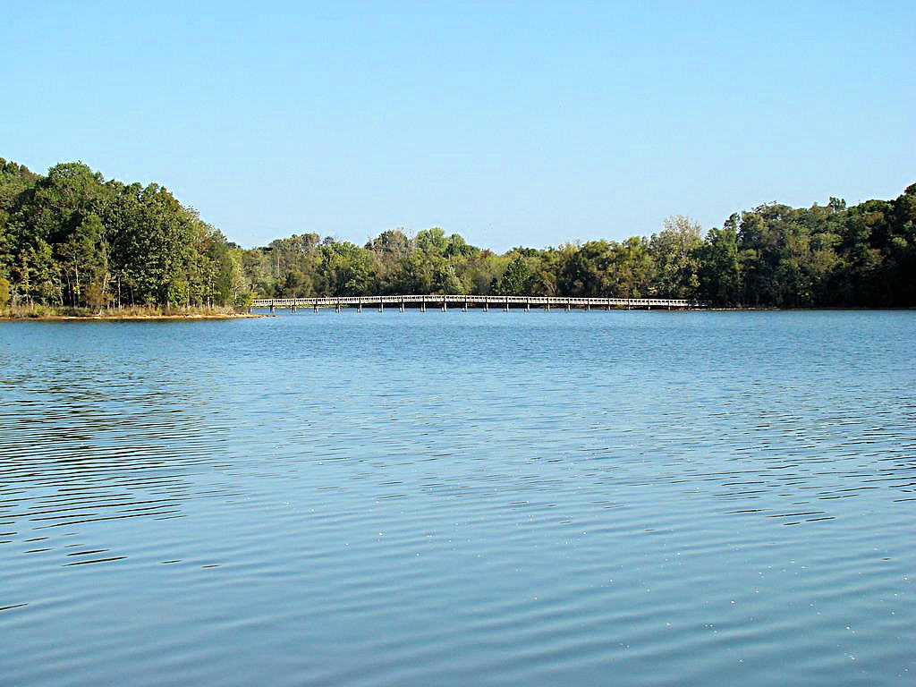
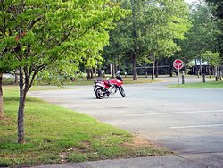
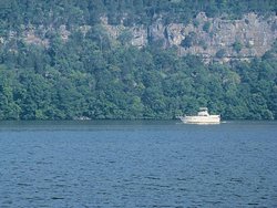
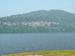
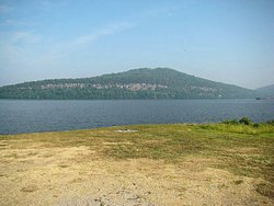
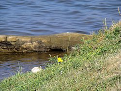
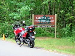
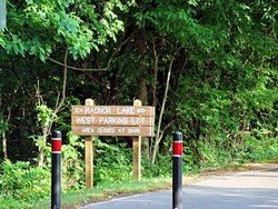
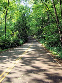
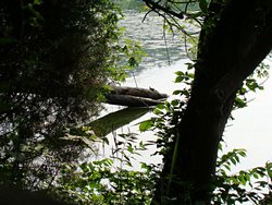
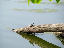
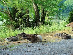
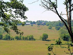
RADNOR LAKE STATE NATURAL AREA - NASHVILLE, TN - June 9, 2007
GPS Coordinates: N36.06245 W86.80992 +/-
|
|
OK, so it isn't a real "Trip" as far as that goes. There are two entrances to the lake,
one on the east side and one on the west side. The West Entrance, where I went in, is
a whopping 8 miles from my house so I didn't have to leave early, refuel on the way, or even
stop for breakfast. I've done a lot of traveling the past several weekends (not nearly
as much as my friend AGirl, but I can still
account for 4,400 miles since March 1), and have a trip to east Tennessee in 3 weeks so I
decided I'd probably stick close to home this weekend. Still, I had to get out and do
something so Radnor Lake seemed like a good choice.
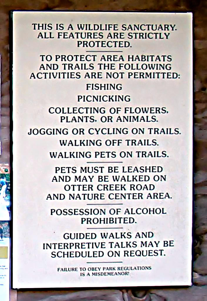
Radnor Lake State Natural Area
consists of 1,100 acres of land surrounded by the city of Nashville. It is
located on the southeast side of town and is primarily a protected "Natural Area". I
suppose that translates into a "Haven for Tree Huggers" since basically all you can do is
walk around and take pictures. There are signs everywhere warning about the penalties
for running or jogging on the trails, riding bicycles on the trails, picking the flowers,
fishing, traveling via motorized vehicles, taking pets on the trails, etc. Basically
everything most people would want to do in a "Park" is prohibited (and regardless of the sign
that says it is a "Wildlife Santuary" it is still a Tennessee State Park). Otter Creek
Road is a a paved road that runs from the east side of the lake to the west but it has been
closed to motorized vehicle traffic. Presumably bicycles and pets are allowed on that
road, but nowhere else. There are not even provisions anywhere for having a picnic
lunch (picnics are prohibited anyway!), so you'd better eat before you get there!
Don't get me wrong though, it is a lovely place. The lake is large and nestled among a
group of hills. There are many species of animals and birds that live there, and it is
quiet and restful. I've been there many times and always enjoy the peaceful
surroundings. If you are into hiking this would be a great place to visit. If you
are into more active passtimes Radnor Lake would probably not make your A-List.
|
|
 |
 |
 |
 |
 |
 |
 |
 |
 |
 |
 |
 |
|
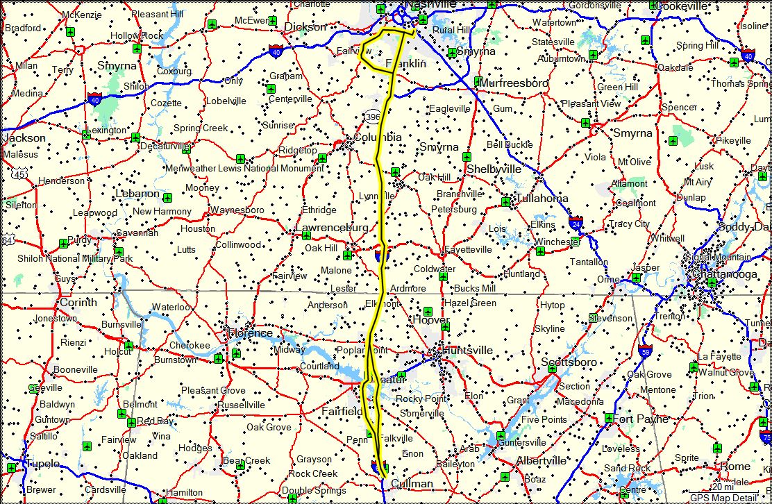
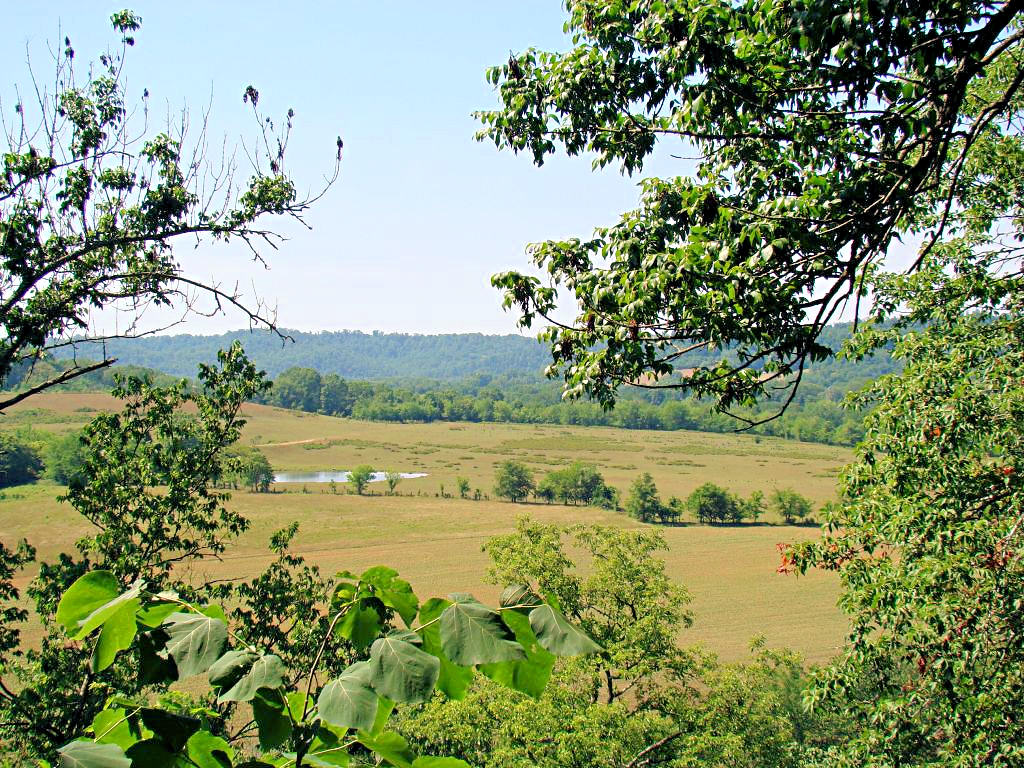
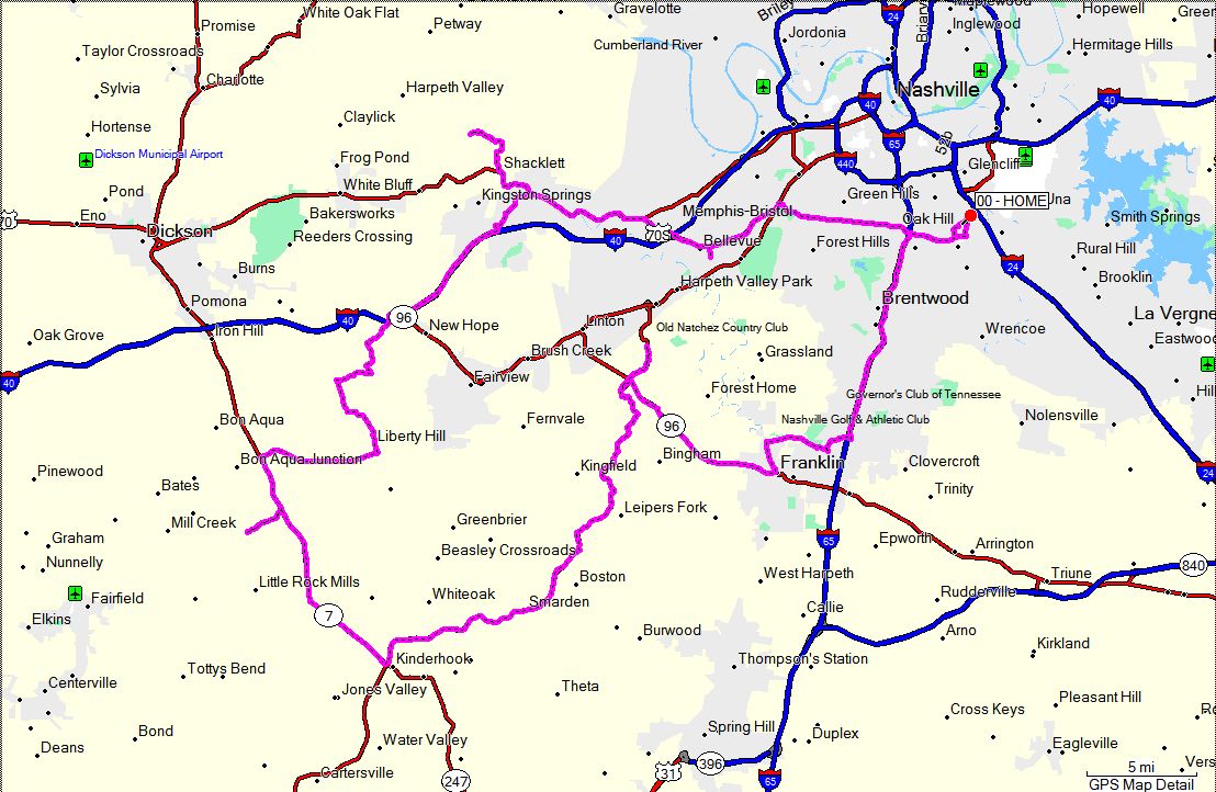
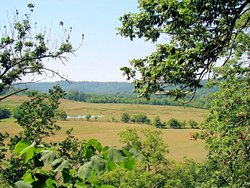
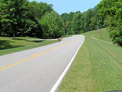
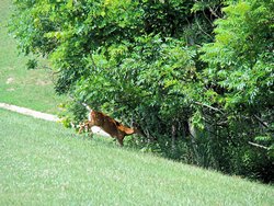
NATCHEZ TRACE PARKWAY - June 10, 2007
|
|
I had real intentions of staying around home today because I've really got a lot of stuff to
do before my trip in 3 weeks. OK, I really needed to stay home today because I've got
a lot of stuff to do before my trip in 3 weeks. Ah, hell, who am I kidding. I
knew I'd go out and ride some today. There was really never any question of it.
I didn't have any plans on where I wanted to go today so I went and got some breakfast and
somehow wound up on the Natchez Trace Parkway. To most people who know me that won't
come as much of a surprise either.
I rode down to the Jackson Falls site (about 40 miles south of Highway 100) and then headed
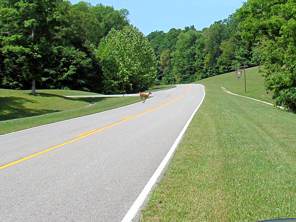
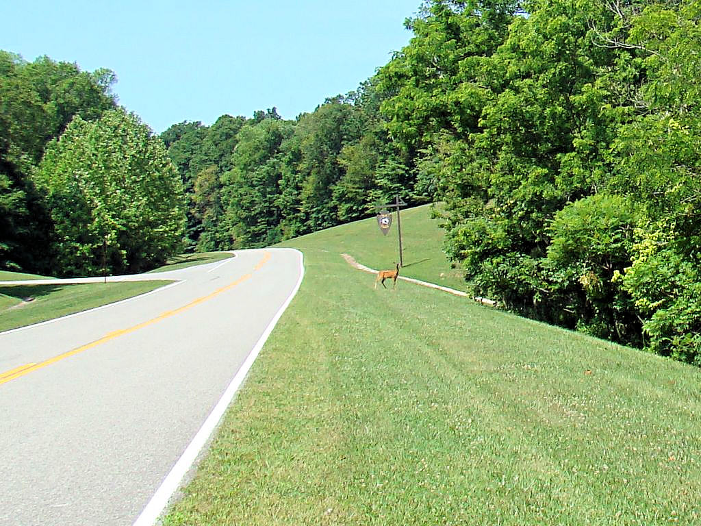
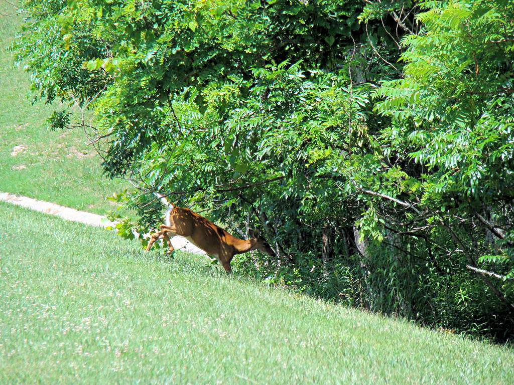
back north. While passing one of the historic stops on the way back I saw a large
Whitetail Deer standing there. I turned around and eased back up the road toward it,
and it stood there for a minute watching me. It was down in the ditch on the left side
of the photos below, and all I could see was it's head and ears poking up out of the ditch. I
got my camera out of my tank bag, and as soon as I raised it the deer started running across
the road in front of me. I managed to get three shots of it before it disappeared into
the woods. I really thing it's sticking its tongue out at me in the second one! I
love to watch those animals, they are so graceful and can almost defy gravity.
For those traveling the Natchez Trace Parkway please keep in mind that the woods on both sides
of the road are full of wildlife. I seldom see anything dead alongside the road, but there
is no telling how many deer, turkeys, squirrels, chipmunks, vultures, crows, skunks, opossums,
rabbits, and even armadillos (ATGATT possums) I've seen along The Trace. Hitting a small
animal will ruin their day. Hitting a large one will ruin yours, and it's a long way to call
a tow truck to come after you. Please keep your eyes open at all times and be careful.
|
|
 |
 |
 |
 |
 |
| |
|
|
ARNOLD AIR FORCE BASE - Tullahoma, TN - June 23, 2007
|
|
I had a new chain, sprockets, and front tire installed on my bike in preparation for my trip to
east Tennessee, North Carolina, South Carolina, Virgina, and Kentucky next weekend. Since
new chains tend to stretch for the first few hundred miles and I wanted to scuff the new tire in
I decided to go somewhere this weekend. Arnold Air Force Base in Tullahoma, TN has several
military aircraft on static display, and I noticed on their web site that they had some new ones
that I hadn't seen. Seeing airplanes up close and personal and putting some miles on my
bike at the same time seemed like the right thing to do so I headed southeast.
I took I-24 to Manchester for breakfast and then on to Tullahoma. I came back up Highway
41A through Shelbyville to get away from the interstate. It was an easy trip and only about 150
miles long. I haven't checked my chain yet but I bet that took care of a little bit of
the stretching.
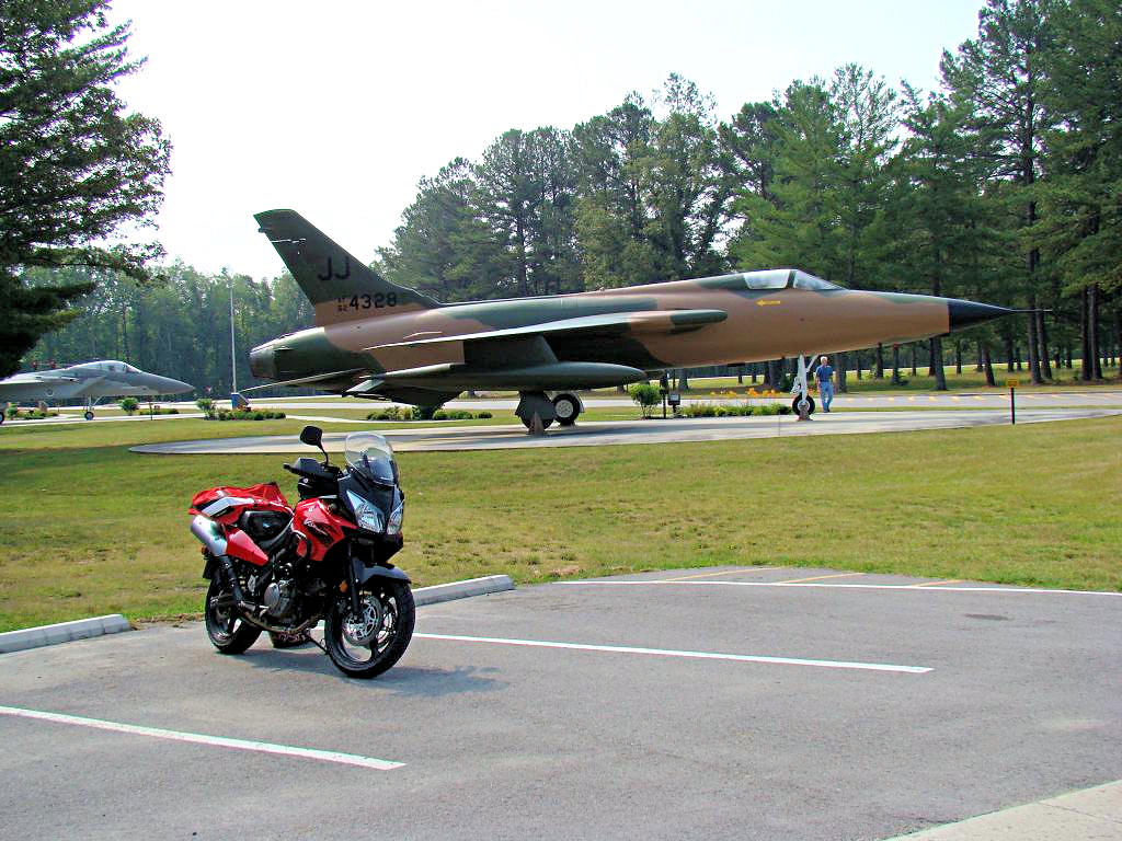
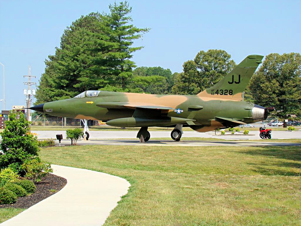
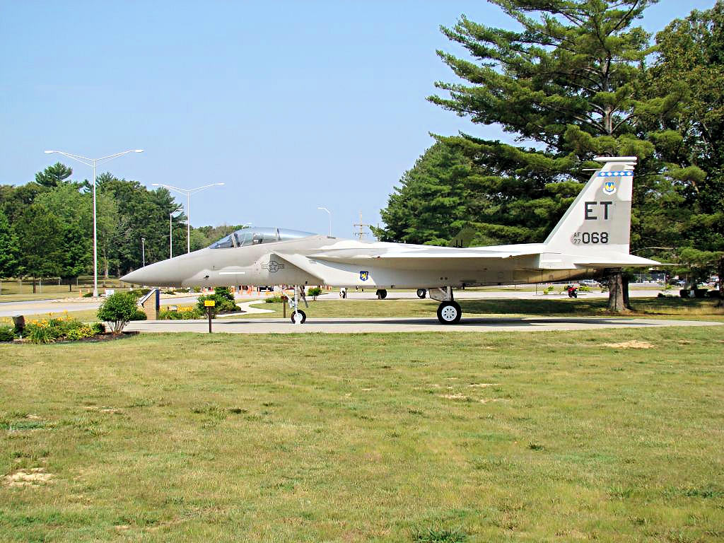
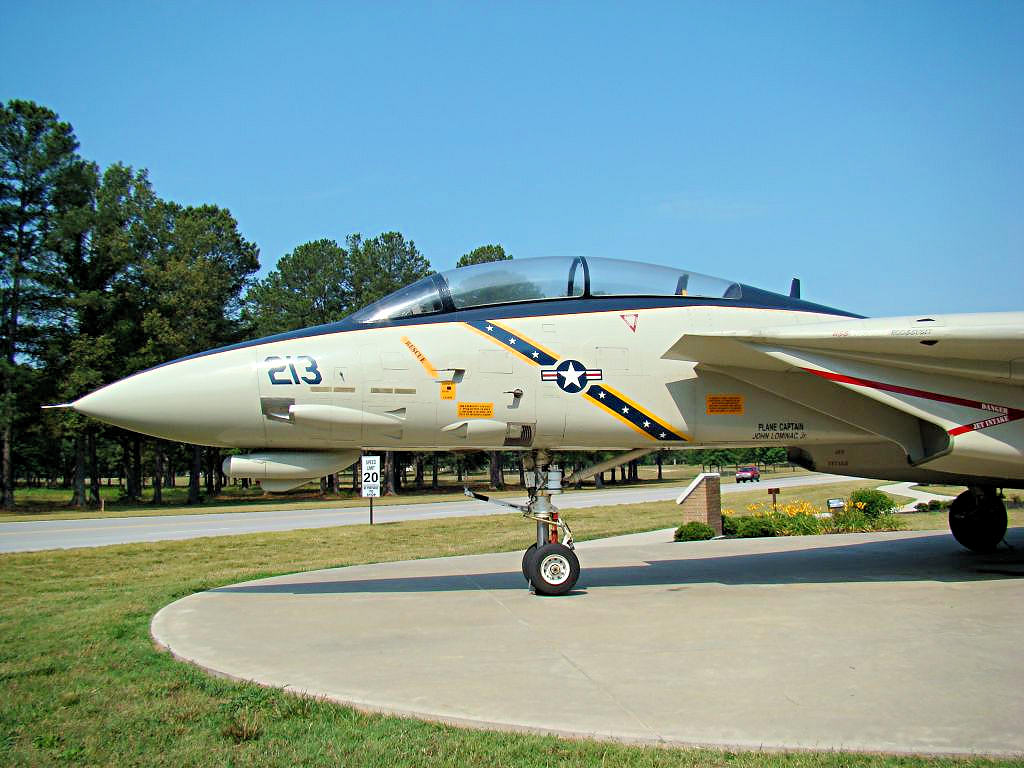
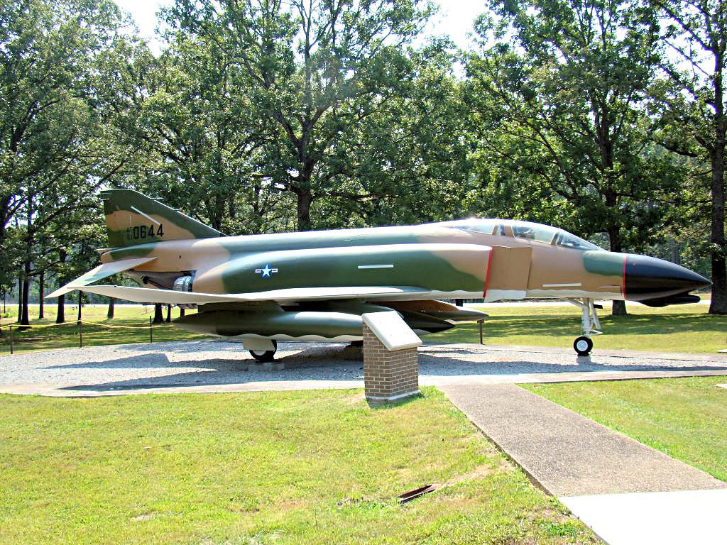
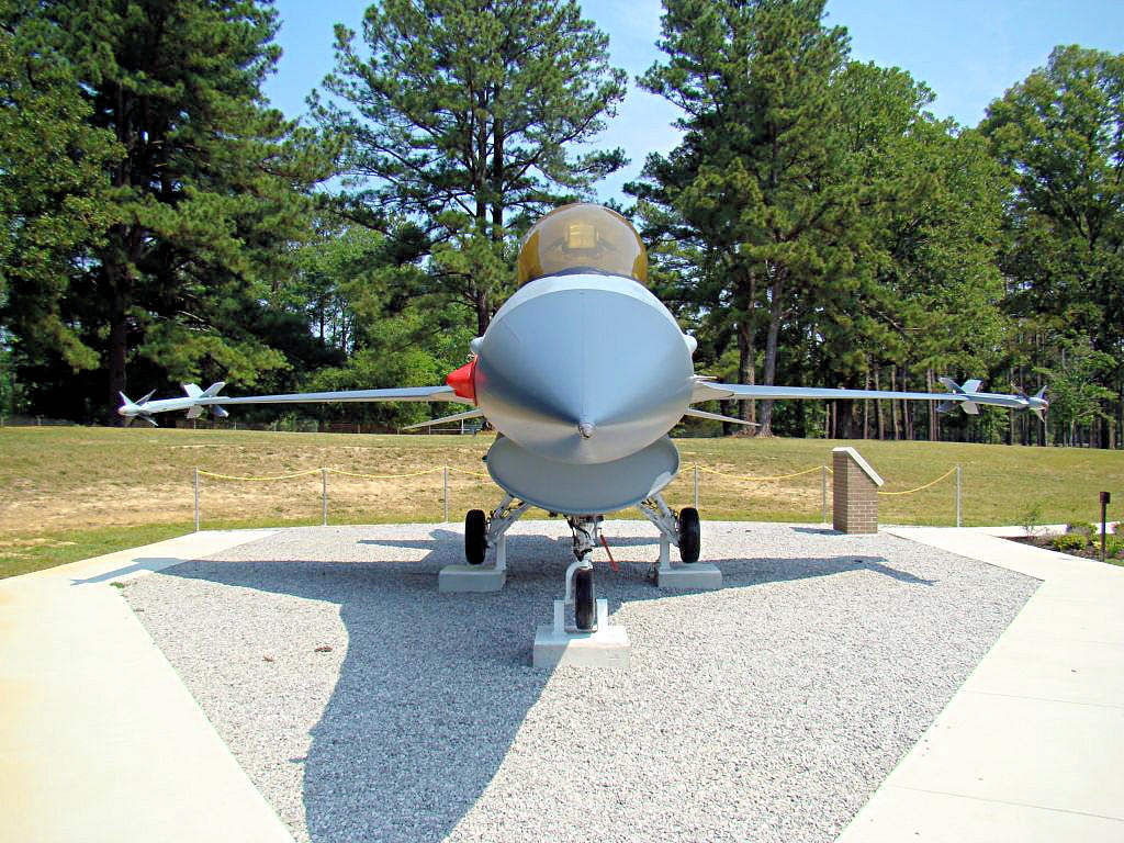
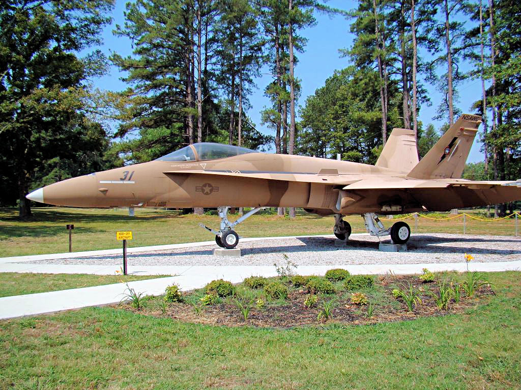
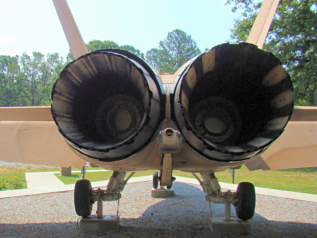
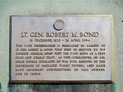
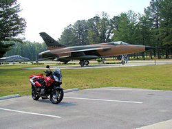
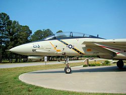
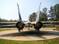
Presently there are six aircraft on public display at Arnold AFB: an F-15A, an F-105D, an F-14D, an F-4C,
an F-16A, and an F/A-18A. The F-15, F-105, and F-14
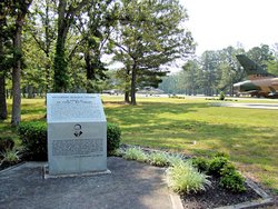
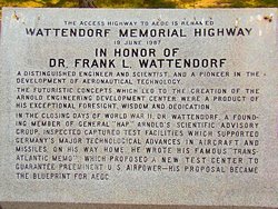
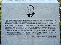
are at the main gate on Wattendorf Highway (GPS coordinates N35.38250 W86.02840) while the
F-4, F-16, and F/A-18 are on display at Gate 2 (GPS coordinates N35.36381 W86.05436). The
areas in which they are located are outside the gates and are accessible to the public.
The photos below are not all that I took. Most of the remaining photos are detail photos
of interest primarily only to airplane modelers so I didn't post them here. In addition, I
have more photos of the F-15A at
This Link and
of the F-4C at This Link. The
detail photos of the F-15 and F-4 were taken September 3, 2004 by me. At that time the F-14,
F-16, and F/A-18 were not present. The F-105 was there but I did not get many photos of
it. I was building a
Model of an F-4E at the time and the main reason for my trip was to get photos of the F-4C that
was on display.
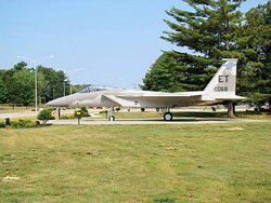
The F-15A was flown by Major Donn Corts and is aircraft 77-068. For some reason they have
painted out the pilot's name on the canopy rail, but it was there in 2004 when I took the original
photos of the aircraft. The paint on the aircraft looks relatively fresh, much better than
it did in 2004, so perhaps they had not finished with it when I took these photos. Compare
This Photo from today with
This Photo from 2004 and
you can easily see the difference in the paint.
In fact all of the three planes that were on display in 2004 are sporting new paint today. The
Eagle shows the most dramatic improvement, but that's primarily because the paint was so pitiful in
2004. I suspect that they were cleaned up for the F-14D presentation on March 30, 2007. Regardless
of the timing or the reason I'm grateful for whoever decided to make it happen. These aircraft
are historical "Gate Guards" and deserve to be maintained and treated with respect. They will
never fly again but they have earned our respect.
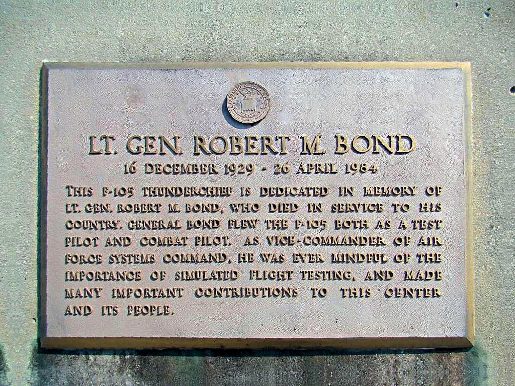
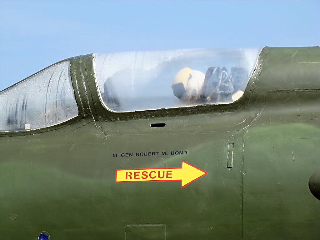
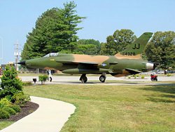
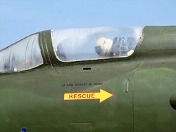
The F-105D was flown by Lt. General Robert M. Bond, and there is a plaque in front of the aircraft
that explains why it is there (see the last photo in the top row below). The "Thud" was an
amazing aircraft in its day. Nothing could touch one down low in the dirt and the trees, it
was the fastest airplane in the skies over Vietnam.
The F-14D is their newest display and is dedicated to the memory of Lt. Kara Hultgreen. Lt. Hultgreen was
the first female naval carrier-based fighter pilot and was killed on October 25, 1994 when her
starboard engine failed while on approach to the carrier USS Abraham Lincoln (CVN-72). There
is a good bit of information to be found about this woman on the internet, but the information about
her on Wikipedia covers her
life in a capsule.
I also stopped at the Beechcraft Staggerwing Museum in Tullahoma but they were apparently closed. As
can be seen by the photo below I only got as far as a closed gate across their entrance.
|
|
 |
 |
 |
 |
Republic Aviation F-105D "Thunderchief" |
Republic Aviation F-105D "Thunderchief" |
Republic Aviation F-105D "Thunderchief" |
McDonnell-Douglas F-15A "Eagle" |
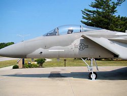
McDonnell-Douglas F-15A "Eagle" |
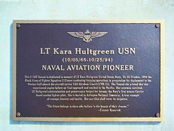
Lt. Kara Hultgreen |
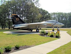
Grumman F-14D "Tomcat" |
Grumman F-14D "Tomcat" |
Grumman F-14D "Tomcat" |
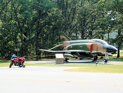
McDonnell-Douglas F-4C "Phantom" |
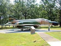
McDonnell-Douglas F-4C "Phantom" |
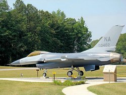
General Dynamic F-16A "Fighting Falcon" |

General Dynamics F-16A "Fighting Falcon" |
McDonnell-Douglas F/A-18A "Hornet" |
McDonnell-Douglas F/A-18A "Hornet" |
McDonnell-Douglas F/A-18A "Hornet" |
Staggerwing Museum Entrance |
GPS Track Log |
|
|
|
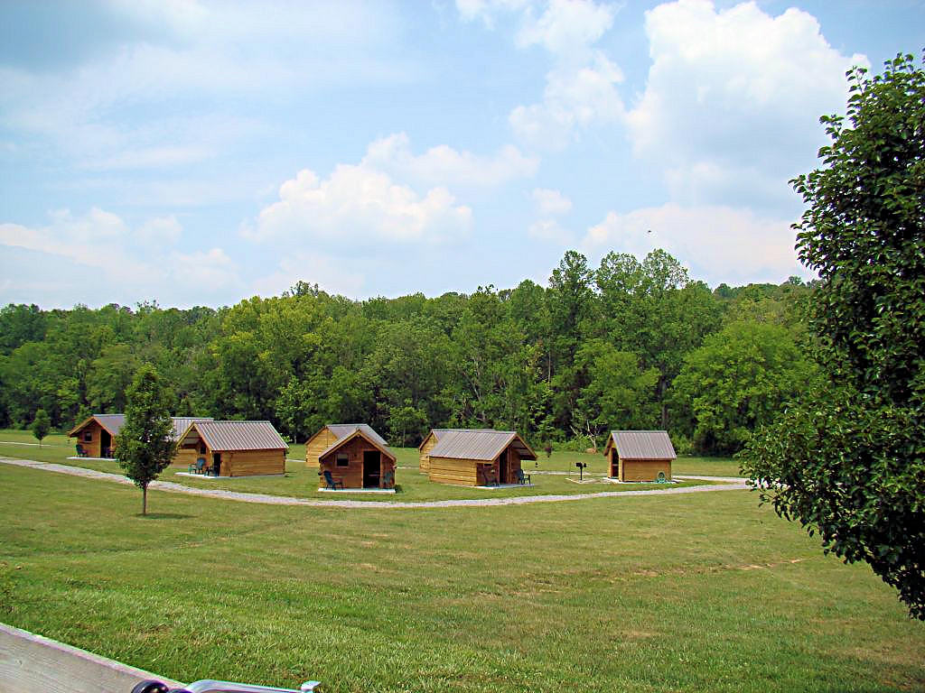
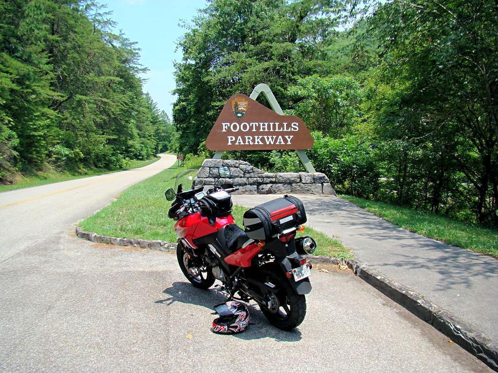
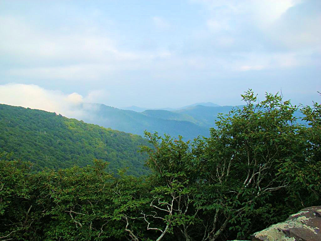
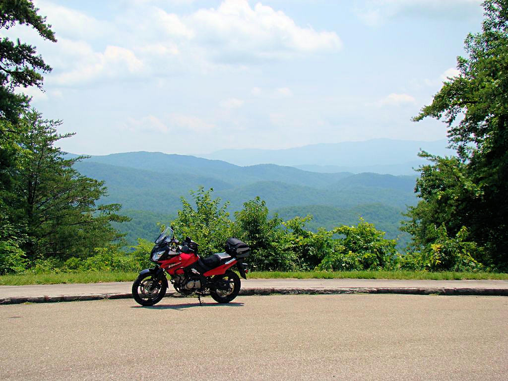
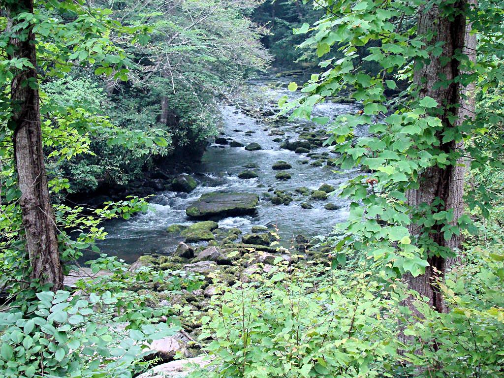
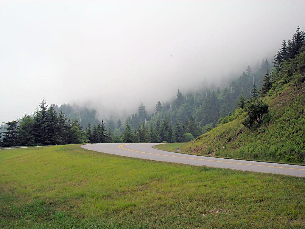
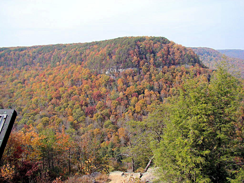
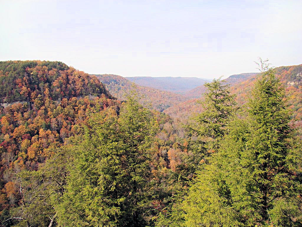
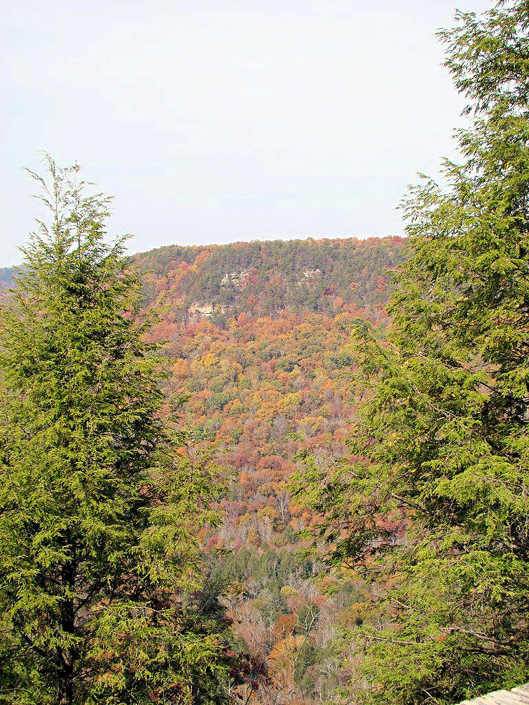
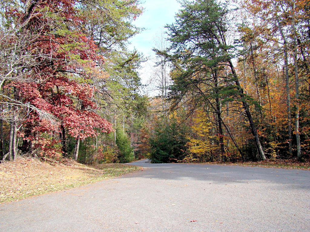
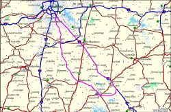
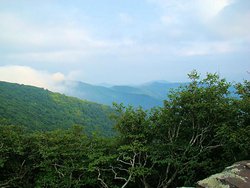
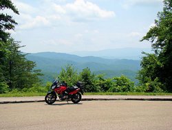
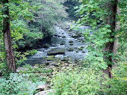
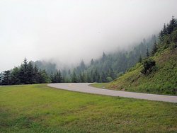
EAST TN, NC, AND SOUTH VA -- June 29 - July 4, 2007 |
|
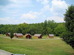
A group from the V-Strom forum at Stromtrooper.Com
met at the Cherohala Motorcycle Resort on the
weekend before Independance Day this year. I was there from June 29 to July 2 and met many
people who were just names on an internet forum previously. Afterwards I continued
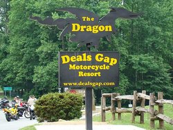
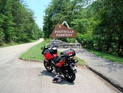
east and visited parts of Tennessee, North Carolina, and Virginia. I rode the Cherohala
Skyway, The Dragon, and 300 miles of the Blue Ridge Parkway. My trip was 1,500 miles round trip
and I took many photographs. Rather than show them all on this page (there are 185 of them!) I put them on a page to
themselves at This Link
Just so there will be a few photos on this page to keep this paragraph from getting lost, here are
a few of my favorites from the trip:
|
|
 |
 |
 |
 |
|
 |
 |
 |
 |
|
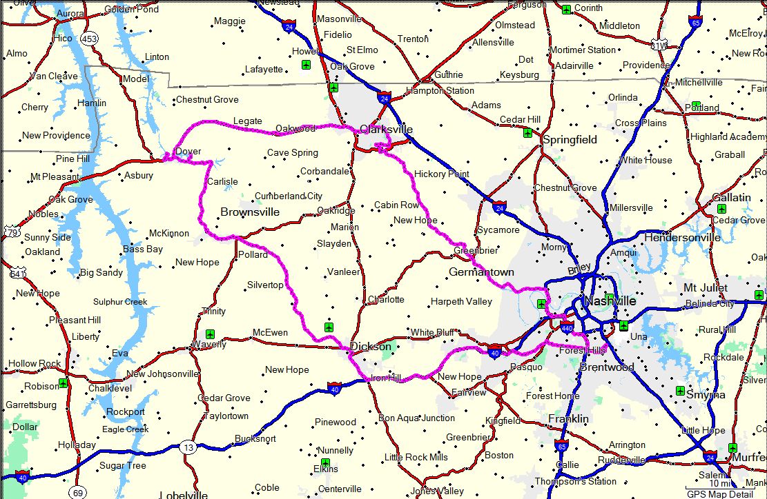
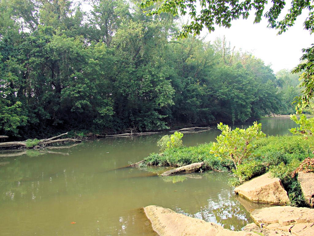
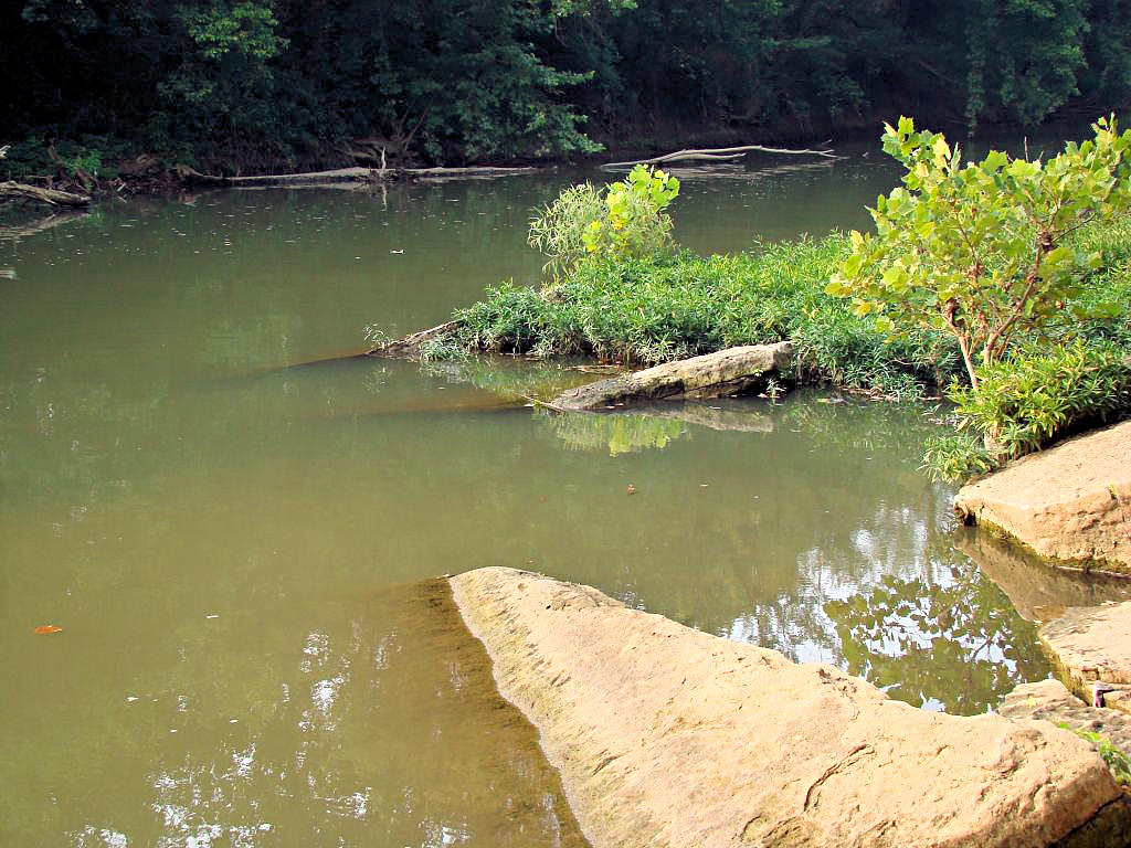
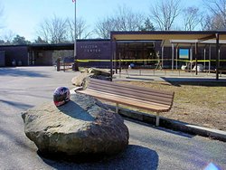
DAY RIDE - Ft. Donelson, Cross Creek NWR, Dunbar Cave - 07/14/2007 |
|
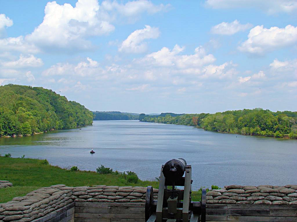
I wanted to get out and ride some today so I headed back to Fort
Donelson in Dover, TN. I hoped to see the Bald Eagles that live there but unfortunately
did not see any sign of them today. I was there last year at this time and photos are at
This Link.
Something that always amazes me about Fort Donelson is the view along the river. Take a look
at the first photograph below. Were it not for the boats on the river that view would be
exactly the same view that the Confederate soldiers saw in 1862. There is nothing in the
view that looks "Modern", the area is completely unchanged.
I also stopped at Cross Creek
National Wildlife Refuge but the visitor center was closed. Apparently budget cutbacks
are limiting their hours to times when most people cannot visit the facility, specifically 7:00 am
to 3:30 pm Monday through Friday. Cross Creek is an interesting place and I used to go there
frequently when I lived in Clarksville, TN to take pictures. In the fall there are thousands
of migratory geese that settle there for the winter and the water is completely covered with them.
I came back through Clarksville and stopped at
Dunbar Cave State Natural Area. This park has special meaning for me for a couple of
reasons. First, when we were children my mother used to take my sister and I there regularly
to swim in the pool and to visit the cave. It was a lively place on weekends with an atmosphere
more like an amusement park than anything else. A friend of my mother worked in the concession
stand and she would always give us something free when we visited. Secondly, the first job I had
with an engineering company was with King Engineers in Clarksville. The owner of the company, H. McKay
King owned Swan Lake Country Club as well as Dunbar Cave at the time.
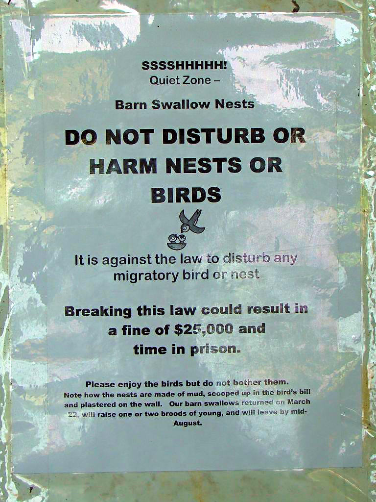
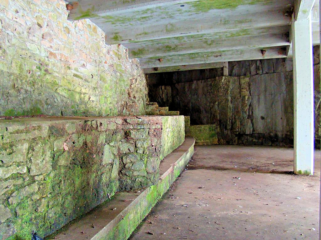
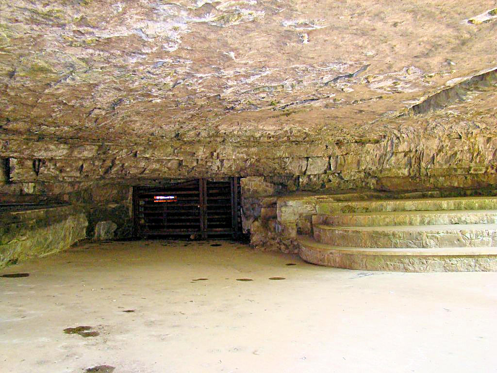
Dunbar Cave was also one of the "Coolest" places I recall as a kid to. This was before virtually every
home and building had central air conditioning, the best we could hope for was window air conditioners, and
I remember the "Cool" of Dunbar Cave. All caves are about 68° inside but Dunbar Cave blew air
out. The area around the concession stand (the area with my helmet in the photograph) and the pavillion
was always cool, even on the hottest days. The swimming pool was apparently spring-fed or fed with
water from the cave, and it was always freezing cold.
I also remember this stupid machine that was outside the concession area. It would produce coin-shaped
medallions with your name on them. They were about 1½" in diameter with spokes, kind of like an
old wagon wheel. We could "Type" out our name be selecting the letters with a big wheel and then pulling
a lever to stamp the letter into the aluminum of the medallion. Every single time I went out there I
had to make one of those, and I must have had a hundred of them scattered around the house.
Like Cross Creek I used to go there frequently back in the 70's to take photographs of ducks, geese, and
sunrises over the lake. Over the years the area has been taken over by the State of Tennessee and
designated a State Natural Area. Much like Radnor Lake in Nashville I think this primarily means it
is an area that they really don't know what else to do with. In the summer months the water in the
lake warms up and gets covered with algae that nobody cleans out. This really makes the entire place
look nasty. The geese are still there but now they swim in a mass of algae instead of water. The
cave area itself is no longer as well-maintained and could really use some cleaning up, but I guess they are
afraid they might offend a bug or something.
I'm personally not a big fan of environmentalists, naturalists, historical societies, etc. for one very
simple reason: They don't know when to quit. I'm all for preserving history and nature up to a point,
but damn, people, you can't keep everything! Sooner or later you have to face reailty. A short
example and then I'm off this soapbox: A number of years ago a building in downtown Nashville was gutted
by fire. Nothing remained of the building (and I mean NOTHING) except the front facade. There
was one single wall left and a construction crew used timbers to shore it up until a demolition crew could
tear it down before it fell into the street. Remember: ONE single wall, and a single wall does not
stand up well by itself. It took a year to finally get that wall torn down before it fell on
someone because the historical dimwits stepped in and said, "Oh no, you can't tear that wall down because
it has historical significance." It's a WALL, people, it is no longer a building and it no longer
has any significance except as a danger to people walking along the street. I'm done now, but some
of you people really need to take a reality pill or something.
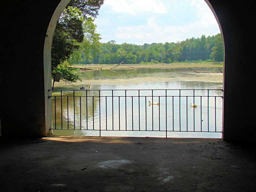
There is a photograph below that shows a view of the lake through an archway. At the bottom of the
archway is a steel railing with vertical bars spaced about 6" apart. My sister will strangle me
for putting this on my web site, but when we were kids she poked her head between two of those bars and
got it stuck. My mother was frantic, my sister was screaming, and I was laughing my head
off. Luckily there were several people around and two men pulled the bars apart enough for her to
get her head out. If they hadn't been there I guess we'd have been feeding her through the bars
for a while!
|
|

Fort Donelson |
Fort Donelson |
Cross Creek National Wildlife Refuge |
Cross Creek National Wildlife Refuge |
Cross Creek National Wildlife Refuge |
Cross Creek National Wildlife Refuge |
Dunbar Cave State Natural Area |
Dunbar Cave State Natural Area |

Dunbar Cave State Natural Area |
Dunbar Cave State Natural Area |
Dunbar Cave State Natural Area |
Dunbar Cave State Natural Area |
Dunbar Cave State Natural Area |

Dunbar Cave State Natural Area |
GPS Track Log |
|
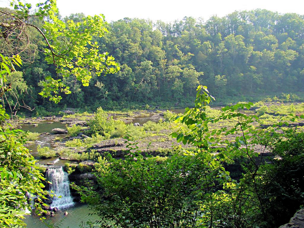
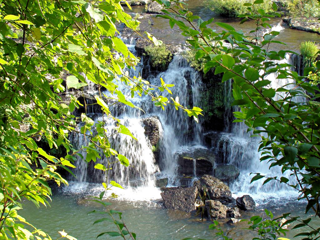
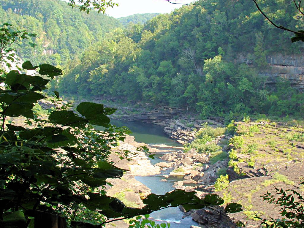
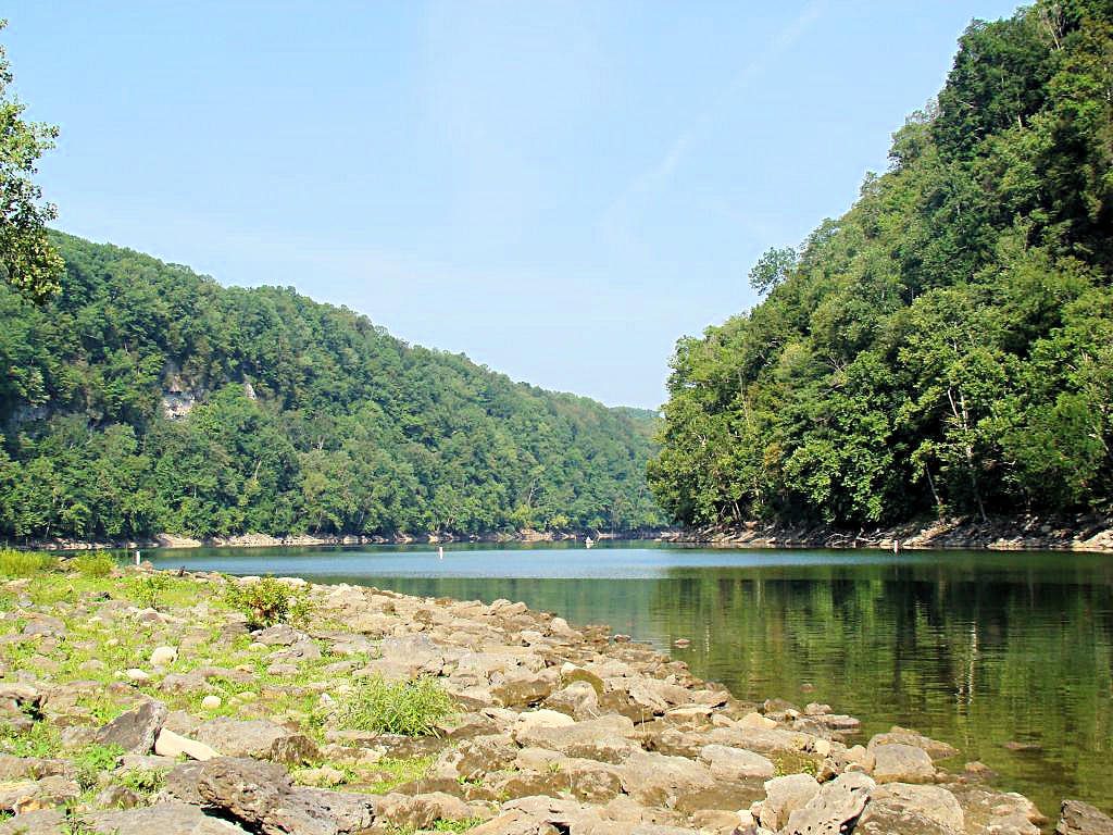
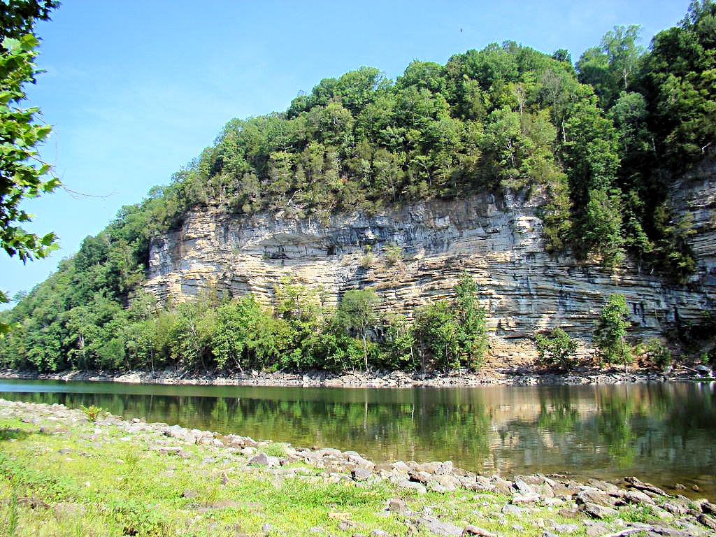
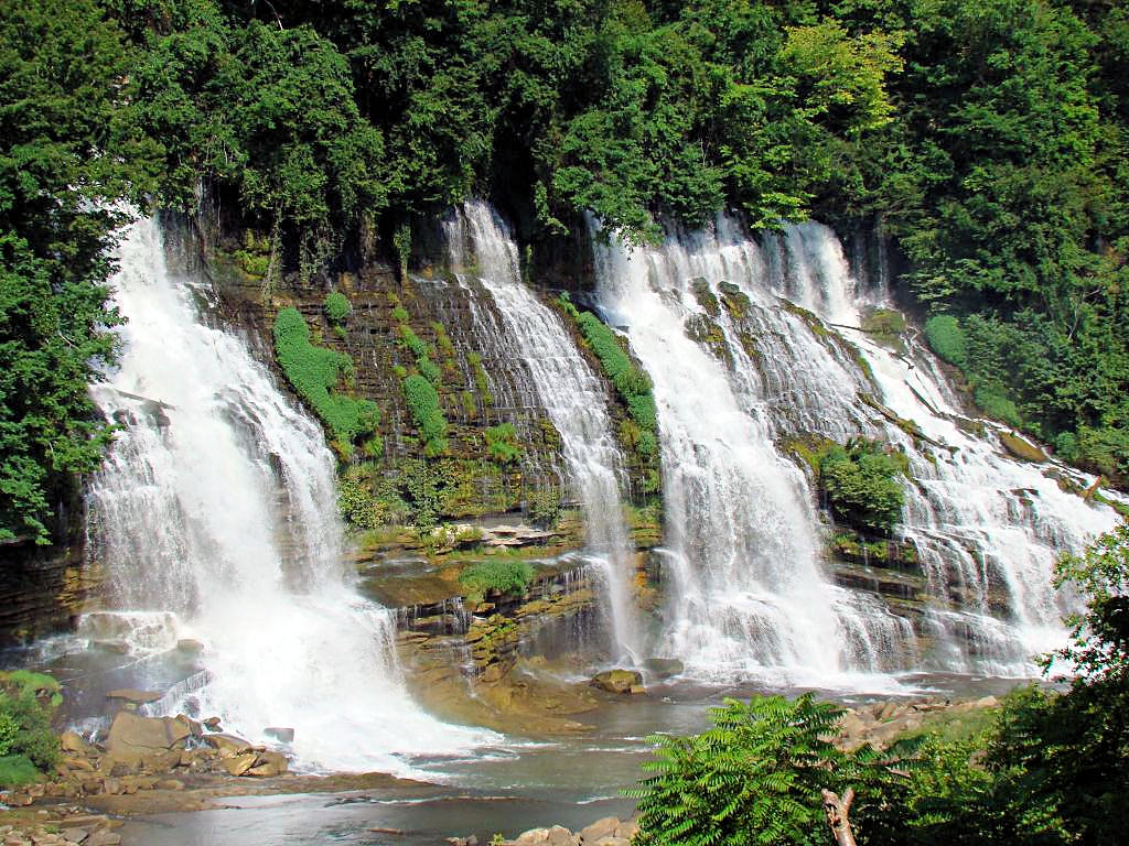
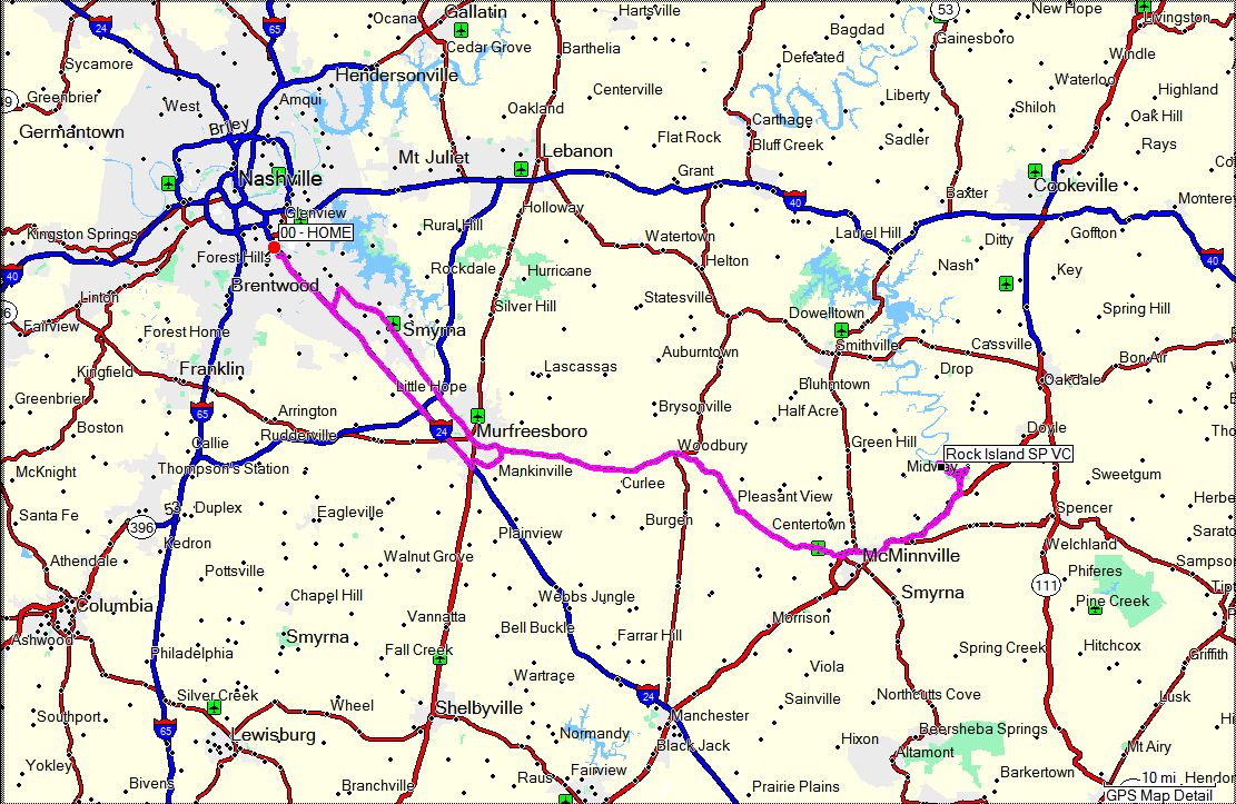
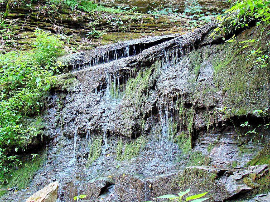
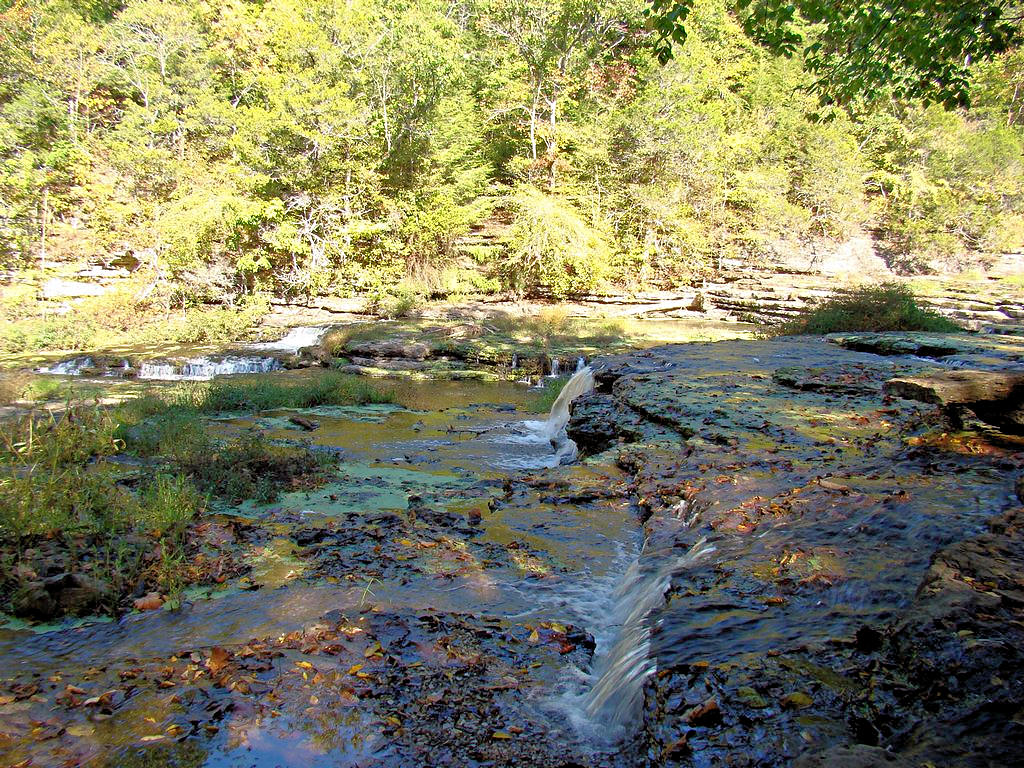
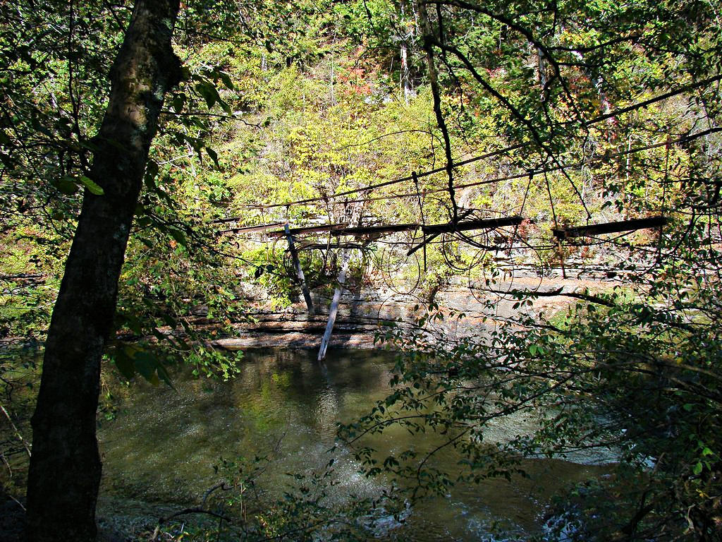
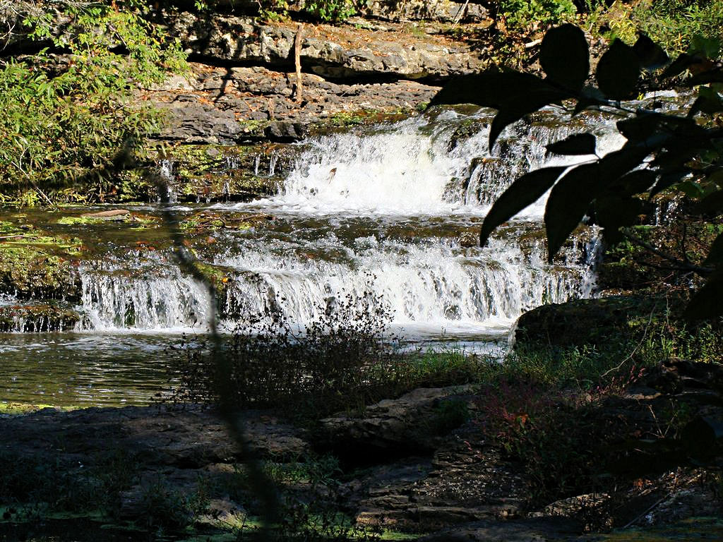
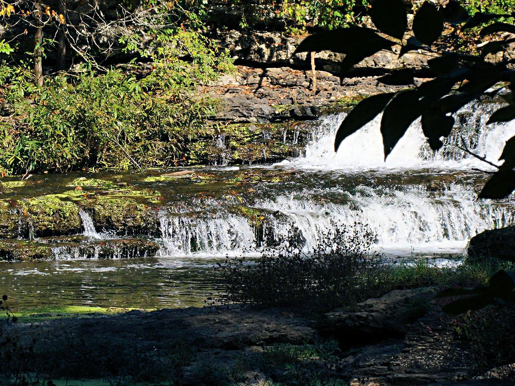
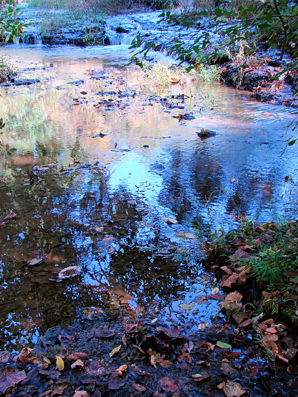
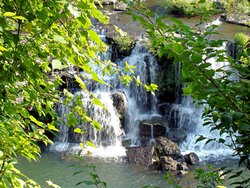
DAY RIDE - Rock Island State Park - 07/21/2007
GPS Coordinates: N35.80908 W85.64212 (at the Visitors Center)
|
|
I had to get out and ride today for a couple of reasons. First, after a couple of weeks of temperatures
in the 90's and humidity to match it has cooled off a little. The forecast for the next couple of days
calls for temperatures in the 80's and lower humidity. It won't last, it never does here this time of
year, so I'm going to enjoy it while I can. As a matter of fact, heading down the road this morning
in a mesh jacket I was actually a little bit cool!
The second reason I had to get out and ride is that I ran across a web site on the internet at
This Page that said there are 589 waterfalls
in the state of Tennessee. Admittedly many of them are wet-weather water falls and others are on private
property. Regardless, since I have seen about 3 of them in my life I decided to do something about
that. I headed out this morning for
Rock Island State Park northeast of McMinnville, TN at Rock Island, TN to take some
waterfall photographs. One of them was hard to photograph without hiking down (straight
down!) to the river because of trees, and I have way too many years and cigarettes under my belt
to do much hiking so I took what I could. The other waterfall, named Great
Falls, is accessible by road so I got some good pictures of it. The best of the bunch are
shown below.
|
|

Rock Island State Park |
Rock Island State Park |

Rock Island State Park |
Rock Island State Park |
Rock Island State Park |
Great Falls at Rock Island State Park |
Great Falls at Rock Island State Park |
GPS Track Log |
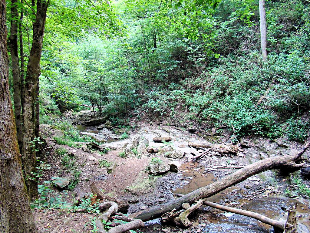
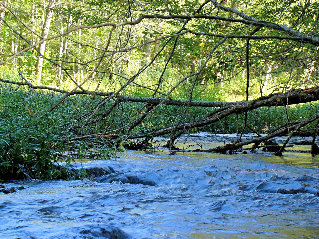
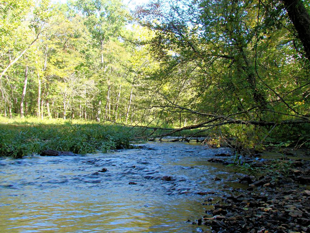
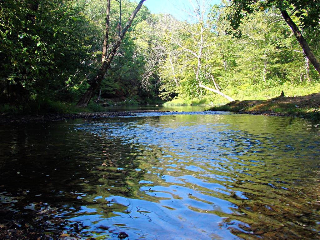
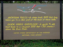
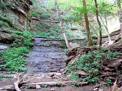
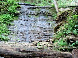
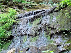
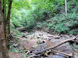
Jackson Falls on the Natchez Trace Parkway - 07/29/2007
GPS Coordinates: N35.69687 W87.29396
|
|
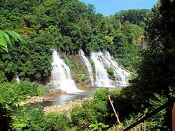
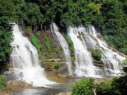
For the second installment of my Visit-All-Waterfalls-In-Tennessee quest I decided to ride to
Jackson Falls on the Natchez Trace Parkway. I've been down there several times but
never bothered to walk down to the falls themselves. The sign at the top that reads
"A Steep Trail ..." (first photo below) has always been enough to stop me. I almost
wish it had stopped me this time as well, but what the heck. I rode down there to see
the falls so see the falls I intended to do.
By the time I got to the bottom of the "Steep Trail" all I could think about was getting
back up that thing. The "Falls" themselves were quite disappointing but I could see
how, during wet weather, they could be quite interesting and attractive. At the end
of July in Tennessee things are usually anything but "Wet". This is our dry time of
year and about the only rain we typically get is from afternoon thunderstorms that are here
and gone in a few minutes. The "Clear Pool" mentioned on the sign at the top was nothing
but dried mud right now.
Here Is A Link to a page that shows what Jackson Falls can look like. A lot
prettier than what I saw today!
Photos are below. As you can tell I did manage to get back up that "Steep Trail" but it
was a close thing! If nothing else I can say truthfully that I have seen it now ;)
|
|
 |
 |
 |
 |
 |
 |
|
|
|
Waterfall Witch-Hunt - 08/04/2007
|
|
The weather here right now is horrible! The temperatures are hovering in
the upper 90's (it was 100 yesterday afternoon at 2:30) and the humidity is in
the 60% range and up. It hasn't rained a significant amount in several weeks
and the grass and trees are suffering from that. All of the waterways are way
down, and what water is in them is not flowing and dingy looking.
I still had to get out and ride some today though, so I left out early (as in about
6:30) to beat the heat. I decided to visit a couple of nearby waterfalls that
were shown on the list that I found on the internet. Perhaps my idea of a
"Waterfall" is more than what others consider to be a "Waterfall" but I saw
nothing. One of them was supposed to be in the Narrows of the Harpeth State
Park. I found the park but no waterfall. Where the second one was supposed
to be there is a house. Perhaps someone threw a bucket of water out a window and
that was enough for someone to put it on the list. Whatever the reason I struck
out completely.
The Narrows of the Harpeth State Park is an interesting place and I'll have to take
another short trip over there later in the year. Right now it's dull, dirty,
and dingy looking because the water is so low and still. I can see how it would
be a beautiful place when the water is up and flowing though, and I'm planning to go
back this fall when the trees are in color and get some photos there. There is
a trail there that I ws told has a magnificent view from the top and I'd bet it will
be gorgeous in a couple of months.
On the way back home I stopped at the bike shop and talked to my salesman about my
next bike. No, my V-Strom is not going anywhere, I love this bike and don't
intend to trade it in. I am going to get something with a bit more horsepower
and a bit more sporty styling though so stay tuned for more information about that.
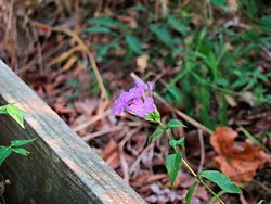
For now, a few ugly photos from the Narrows of the Harpeth State Park. The
little purple flower was right beside the stairs down to the river, and it was
about the only thing of color showing in an otherwise brown and dingy spot.
|
|
 |
 |
 |
 |
|
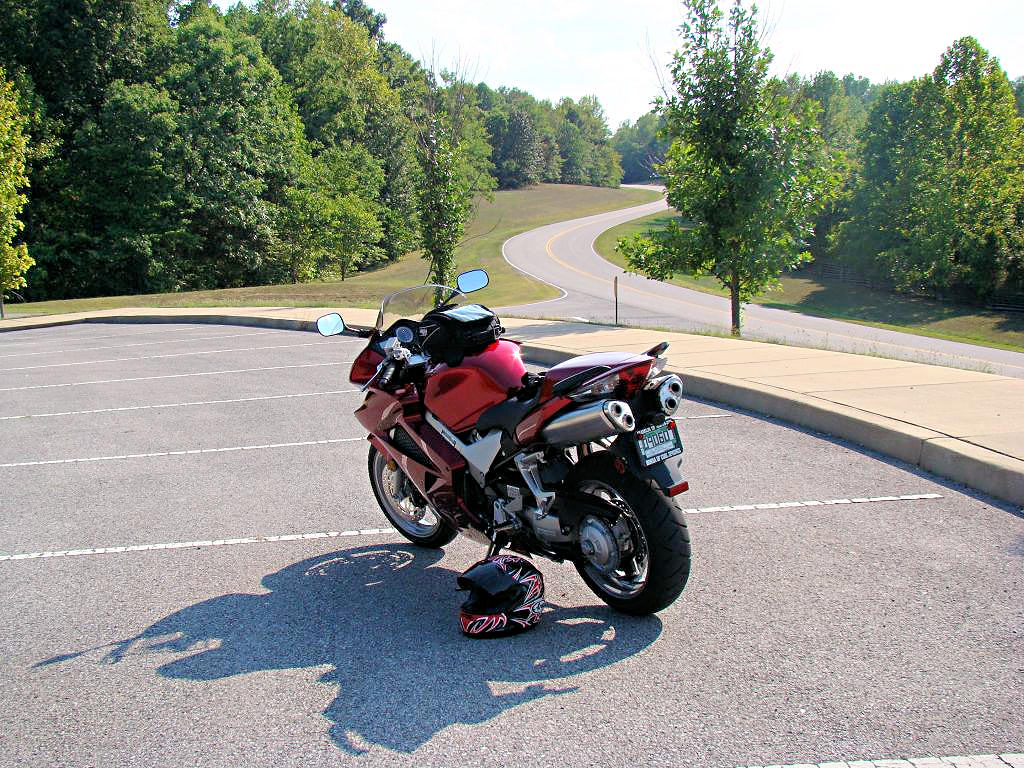
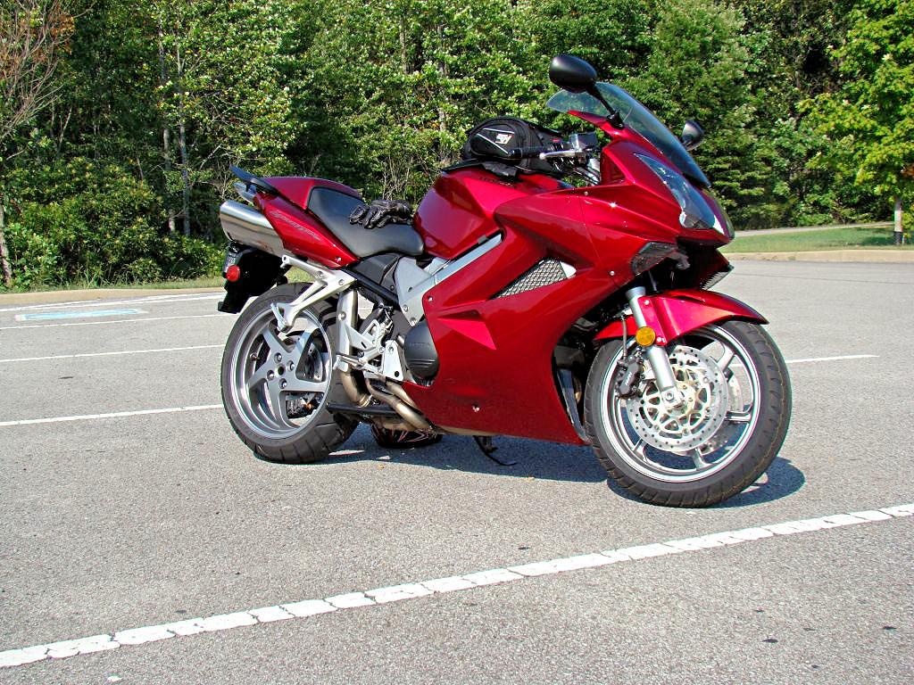
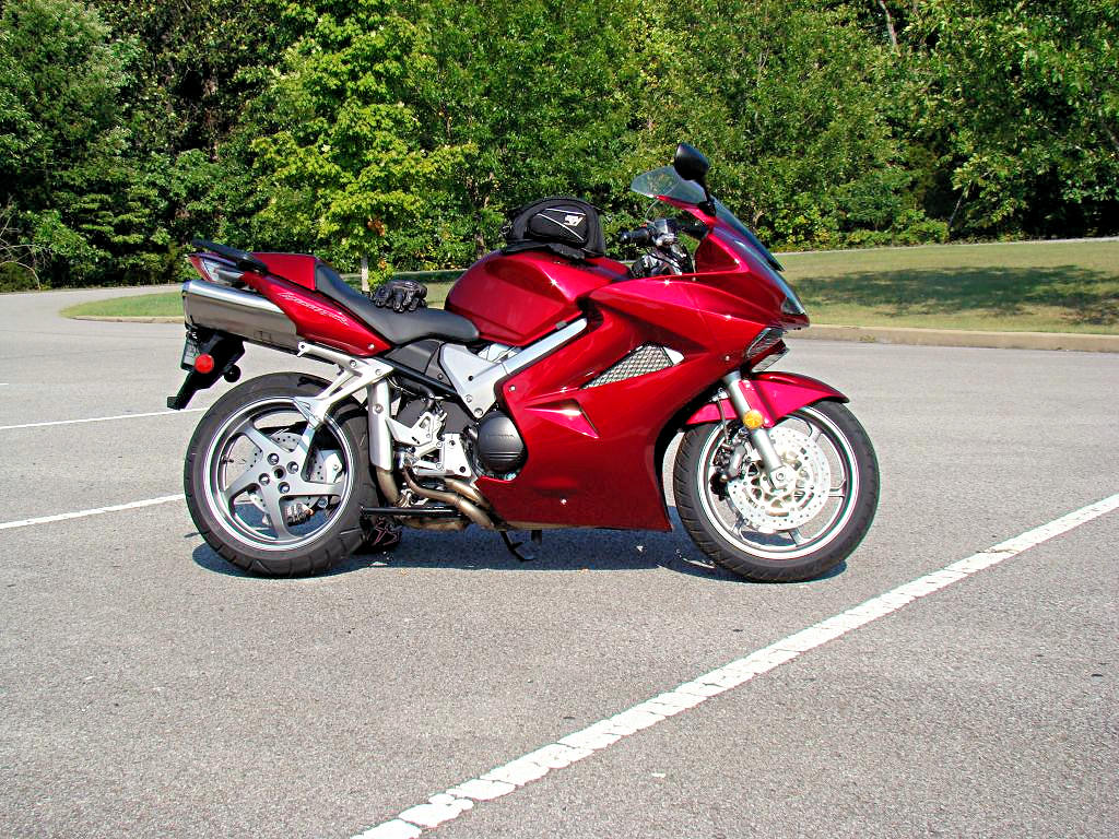
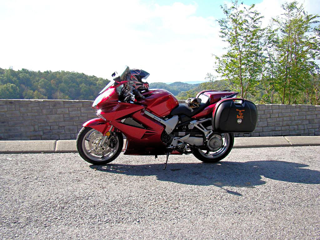
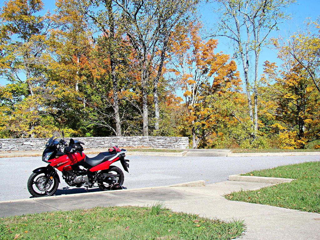
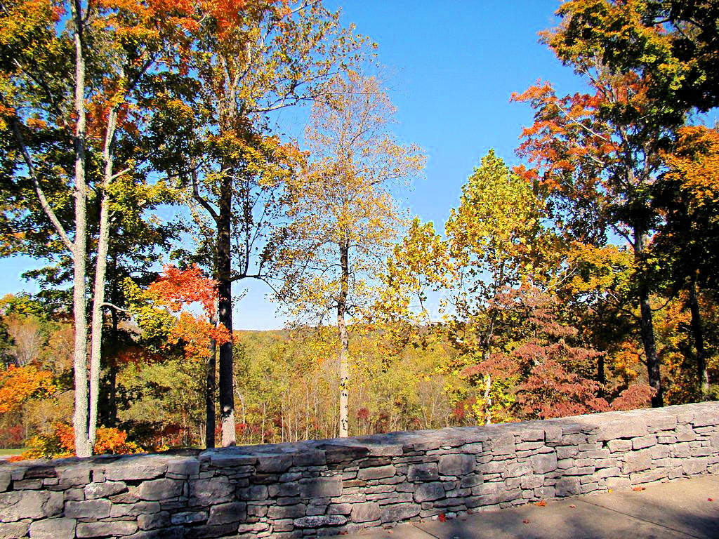
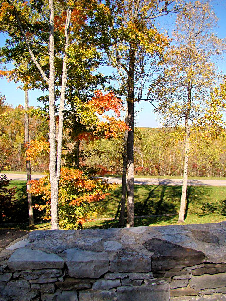
THE NEW VFR800 - 08/07/2007
|
|
It has been HORRIBLE hot and humid around here lately, but today it just didn't matter
at all. I bought a new Honda VFR800 Interceptor yesterday and after work today I just plain
had to get out and ride it a bit. I rode to the Natchez Trace Parkway and stopped at "The Curve"
at which many photos of my bike and AGirl's bikes have been taken. I took a few photos and headed
on south to Garrison Creek on The Trace and then back up to Highway 100 and home. The thermometer
on my bike showed 97° when I got home at 6:00pm but I hardly noticed. This bike is such a joy
to ride I just plain had a blast.
For those who don't understand how bad the humidity can be in this part of the country I included the
fourth photo below. I took it on August 4 and it shows how dense the haze is. Much of that
haze is caused by the humidity in the air, and it is like walking into a sauna. Doing nothing at
all makes one sweat. Shade does no good because the air is just as close and heavy in the shade
as it is in the sun. Tennessee in August is just not a good place to be!
|
|
 |
 |
 |
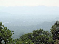 |
OUT AND ABOUT. FIGHTING THE HEAT! - 08/12/2007
'06 Suzuki DL650
|
|
As I mentioned above it has been HORRIBLE hot and humid around here lately. That
doesn't mean I haven't been riding, I just haven't been going anywhere significant. The new
VFR800 is 5 days old and only has 166 miles on it. It hasn't been parked but it hasn't gone
any where distant either. But the good side is that August is draining away (or perhaps "Melting
Away" is more appropriate) and the fall months are coming. I can hardly wait because I've got
some places I want to go and I want to get out and RIDE!!
I took my V-Strom out today, because I didn't want it to feel neglected, and hit the Natchez Trace Parkway
with a friend. David is a new rider and rides a Honda Rebel 250. To help him get comfortable
with his steed we headed for The Trace simply because it is such a pleasure to ride and because there
is so little traffic on it.
We met in Franklin at 8:00am to try and beat the heat. Actually the forecast was for slightly cooler
weather (98° instead of the 101° we had yesterday) but the humidity is still hovering in the 50%
to 60% range. The bottom line is that it was still HOT! We hit The Trace and headed south. We
rode to the Water Valley Overlook at mile 411.8, or about 25 miles from where we got on The Trace, and
then headed back north. Since David only had about 300 miles on his bike when we met this was a
significant distance for him and he did very well. Hope he enjoyed the ride, I know I did!
|
|
130 MILE BREAKFAST - 08/18/2007
'07 Honda VFR800
|
|
It is STILL terribly hot and humid around here. This past week saw highs over 100 every
day. Add high humidity to that and it is just really nasty. To make things worse
we haven't had any rain to speak of all month. It rained about 5 minutes yesterday
morning but all that did was make the humidity higher and get my bike dirty. That is
honestly the only rain I recall seeing all month.
I decided that hot or not I had to get out and give the new VFR a ride today. Much like
my 130 Mile Cup Of Coffee last
December I headed for Clarksville, TN. It's only about 50 miles from home, so I rode up
and grabbed some breakfast at a Waffle House (yes, I know there are a dozen Waffle Houses
within 10 miles of me. It's a bike thing.) I also rode around Clarksville a while
and then headed back home through Ashland City. Actually the total mileage was closer to
125 miles, but who cares when you're having fun?
It was a good ride. I took I-24 north and had to deal with the traffic but the VFR tends
to handle that with ease. The ride back through Ashland City is a bit more scenic than
I-24, but not a lot more. At least the road curves occasionally and is a lot more fun than
just pointing a bike down the interstate. I didn't want to try and get too creative with my
route since I don't have my GPS mounted yet. I know the roads in this area pretty well but
I can still get lost without much trouble ;)
|
|
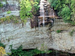
FALL CREEK FALLS STATE PARK - 08/25/2007
'06 Suzuki DL650 - GPS Coordinates: N35.66720 W85.35780 (at the waterfall)
|
|
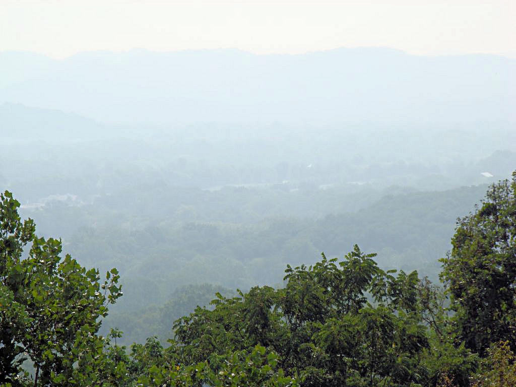
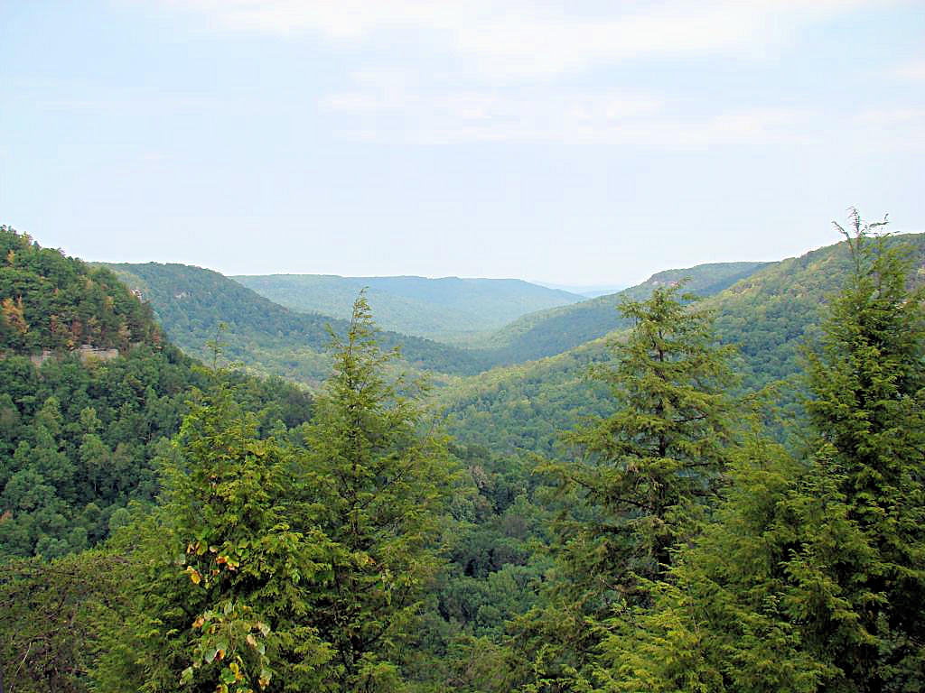
As I have pointed out for the past few weeks the weather around here has been miserably hot. We
got a slight respite from it today though, although it was very slight. Instead of the mid 100°
temperatures we've had virtually every day this past week it topped out in the mid 90's today, and there
was even a little breeze blowing to cool things down a bit more. You can also see in the photos below
that the humidity was down slightly. Seeing more than a half mile or so has been virtually impossible
all month because of the haze in the air. But today I got up and when I saw it wasn't already
blistering hot I decided to hop on the V-Strom and go somewhere. "Somewhere" in this case
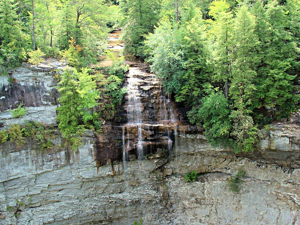
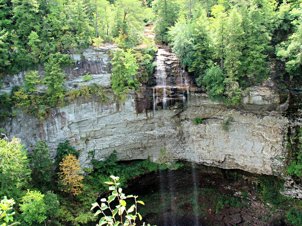
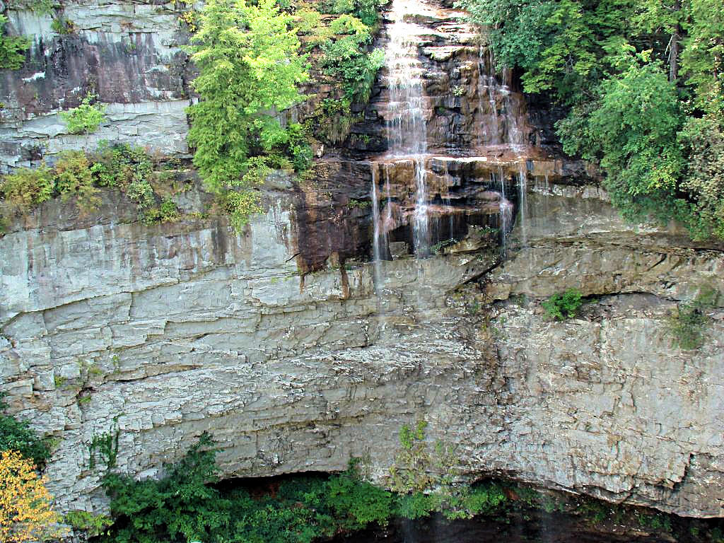
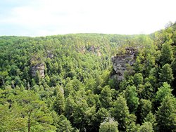
turned out to be Fall Creek Falls State Park.
I headed out about 8:30, stopped in McMinnville, TN for some breakfast, and headed to the park by way of
Highway 30 through Spencer, TN. I LOVE to ride that section of highway because of the twisties on
it. Here Is A GPS Plot of the
section going toward the park. As you can see there are several switchbacks and lots of plain old
fun curves. That alone made the trip worthwhile!
The falls themselves, as can be seen in the photos below, were a bit of a disappointment because of our
lack of rainfall for the past month. There was hardly any water going over the falls, and the creek
that feeds them was barely running. Compare
This Image taken today to This Photo
taken on August 5, 2006 when I was there. You can see a big difference in the volume of water even though
they were both taken in August but a year apart. August is our bad month around here as far as weather
goes, and this one has been worse than most. Personally I'll be glad when it's over and September gets
here. I could do with some cooler weather because I want to ride some without sweating!
Round trip was 217 miles by GPS, and it was really nice to get out again. It was a bit on the hot side when
I got home, but nothing like we've been having. I'll get a few more miles in somewhere tomorrow to. The
new VFR is scheduled for its 600 mile service on Tuesday and it only has 475 miles on it. What a shame, guess
I'll have to ride some!
|
|
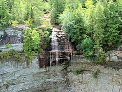
Fall Creek Falls State Park - Pikeville, TN
August 25, 2007 |

Fall Creek Falls State Park - Pikeville, TN
August 25, 2007 |
Fall Creek Falls State Park - Pikeville, TN
August 25, 2007 |
Fall Creek Falls State Park - Pikeville, TN
August 25, 2007 |
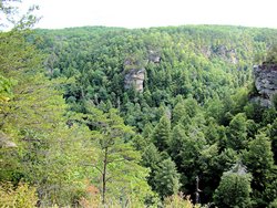
Fall Creek Falls State Park - Pikeville, TN
August 25, 2007 |
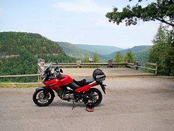
Fall Creek Falls State Park - Pikeville, TN
August 25, 2007 |
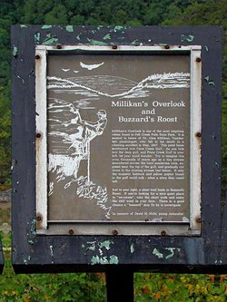
Fall Creek Falls State Park - Pikeville, TN
August 25, 2007 |
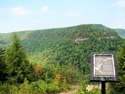
Fall Creek Falls State Park - Pikeville, TN
August 25, 2007 |
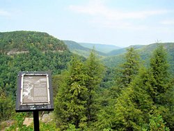
Fall Creek Falls State Park - Pikeville, TN
August 25, 2007 |
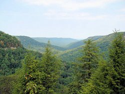
Fall Creek Falls State Park - Pikeville, TN
August 25, 2007 |
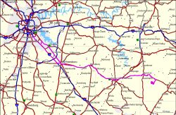
GPS Track Log |
|
OUT AND ABOUT (AGAIN) - 09/01/07 & 09/02/07
'07 Honda VFR800 and '06 Suzuki DL650
|
|
It finally cooled off here a little bit. Instead of the low-100° heat we have been
experiencing for the past month it was only in the low 90's this weekend. I got both of
my bikes out and rode some, but I didn't really go anywhere to speak of.
Saturday I decided to take the VFR and see if I could do some distance on it without my back,
shoulders, or neck bothering me afterwards. I made a big loop through Murfreesboro,
Woodbury, Auburntown, Liberty, Smithville, McMinnville, Hoodoo, Bell Buckle, Shelbyville,
Chapel Hill, Nolensville, and back home. I had read that there were some good roads down
in that area, and while I did find some "Nice" roads I didn't find any "Great" roads. Maybe
I just missed them. Anyway I put 200 miles on the Viffer and had a great time doing it.
Sunday, since I didn't want my V-Strom to feel neglected, we headed down the Natchez Trace
Parkway. There is just something about that road I really enjoy and I always seem to migrate
in that direction when I have no place better to go. Perhaps it is the quiet or perhaps the
lack of traffic. Regardless of the reasons I can relax and let my mind wander a bit. I
wound up at the Water Valley Overlook, and then headed back towards home.
Amazingly I didn't start to sweat either day until I got back home. In fact when I left on
Saturday it was a little on the cool side heading down the interstate. After the heat wave
that we have had for the past month I can't express how good it felt to actually be cool again!
No photos either day since there wasn't a lot to see except highways. I did include GPS
tracks below however.
|
|
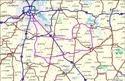
GPS Track Log - Saturday 09/01 |

GPS Track Log - Sunday 09/02 |
|
|
HENDERSON, TN - 09/15/07
'07 Honda VFR800
|
|
I headed out with my riding buddy AGirl today to visit
a friend in Henderson, TN (no, not Hendersonville, Henderson. It's south of Jackson, TN). She
met this gentleman in Fairbanks, AK last month while she was there. Frank is quite an amazing person
and is a Long Distance Hiker. At 69 years of age the man has more energy and stamina than I did when
I was 29 years old! There is a photo and some information about him on
This Page
of AGirl's web site (second photograph down).
The weather was absolutely perfect for a change. It was 53 degrees when we left Nashville, and warmed
up to the upper 70's during the day. A little bit of breeze but a cloudless blue sky and low
humidity. Needless to say we didn't take the straight route there or back, rather we took a more
scenic and "Interesting" route down the Natchez Trace Parkway, through Hohenwald, TN and Clifton, TN. We
came back on Highway 100 and then cut back over to the Natchez Trace Parkway again. Why go in a straight
line when there are curvy roads all around?
Today was just half of a "Double Header" since we are heading for Crossville, TN tomorrow
to see another of her friends. We are also supposed to stop by a covered bridge north of Carthage, TN
for some photographs. I rode the VFR today and plan to take the V-Strom tomorrow. I don't want
either of them to feel neglected!
I didn't take any photos today but AGirl took a few.
Here Is A Link to the photos on her site. As usual, a GPS track log is included below.
|
|

GPS Track Log - Saturday 09/15/07 |
|
|
|
CROSSVILLE, TN - 09/16/07
'06 Suzuki DL650
|
|
Once again I headed out with my riding buddy AGirl today to visit
friends today. Today it was a very interesting couple in Crossville, TN. We were welcomed into their
home, fed a great barbeque lunch with all the trimmings, and had a long discussion about shared travels that
AGirl and they have been on. Thanks David and Susan, your hospitality was much appreciated!
The weather was much the same as yesterday, or in other words about as good as it could possibly be. A
little cool when we left this morning, the Weather Channel showed 53° in Nashville, but it warmed up all
day and felt just right when I headed home. I said "I" headed home because we had separate destinations
today. I've really enjoyed having AGirl around for the past couple of weeks, but her wonderlust was
tugging at her so she headed north to begin her
Fall Foliage Frolic in the northeast. I'll miss her but she won't be gone for long, she never is ;)
When we left Nashville we headed east on I-40, but that didn't last long. We stopped for breakfast in
Gordonsville, TN (at a Waffle House, of course!) and then headed up north of Carthage to visit a covered bridge
(photos below). The bridge appears to be on private property right off the side of the road, and the
owners have apparently gotten it dressed up for Halloween. They have done a great job on it and it
really looks great.
All in all a great ride today and a great weekend overall. 600 more miles in the books, and I enjoyed
every one of them. Perfect weather for a change and it really felt good to get out and put some miles
on my bikes finally.
|
|
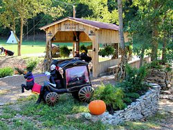 |
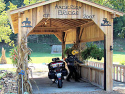 |
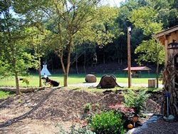 |
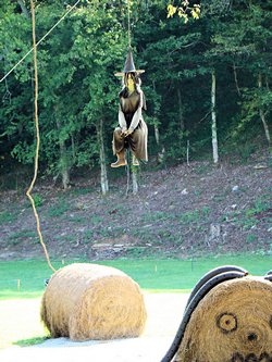 |
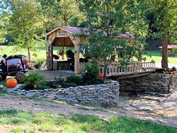 |
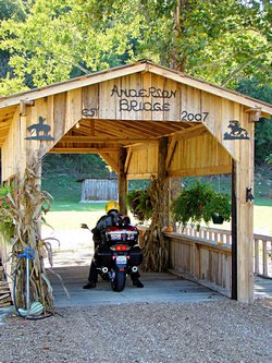 |
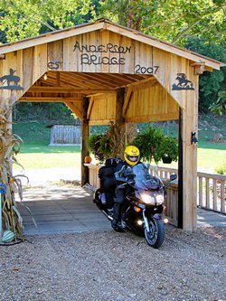 |

GPS Track Log - Sunday 09/16/07 |
NATCHEZ TRACE PARKWAY - METAL FORD - 09/23/07
'06 Suzuki DL650 - GPS Coordinates: N35.46329 W87.47894
|
|
I was supposed to ride with a friend today but I got stood up. I guess he forgot about it. Oh
well, it was a beautiful day and I rode about 60 miles down the Natchez Trace Parkway to an area called
the "Metal Ford" (mile 382.8).
This spot is, in my opinion, the prettiest area on the north end of the Natchez Trace Parkway. Located
beside the Buffalo River it was the location of the Steele Iron Works in 1820 although there is nothing left
of the original iron works now. A mill race that used to carry water into the facility is still present but
that is pretty much it. In the fall when the trees are in color it is a gorgeous spot. See fall
photos at This Link (last 10 photos in the
section).
Today it was sunny and clear and warm. Not a cloud in the sky although it did get pretty warm. I've
been meaning to head down that way all summer but it's just been too hot. Today was a good day for a ride
though, so it seemed like the right thing to do!
|
|
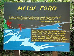 |
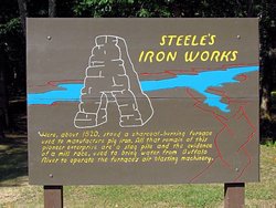 |
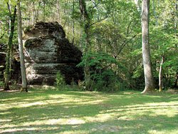 |
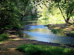 |
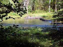 |
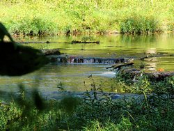 |
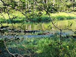 |
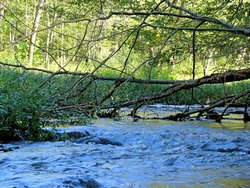 |
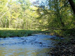 |
 |
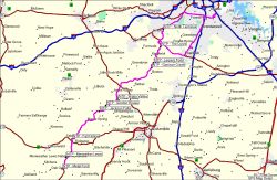
GPS Track Log - 09/23/07 |
|
BARBER VINTAGE MOTORSPORTS MUSEUM - Birmingham, AL - September 29, 2007
'06 Suzuki DL650 - GPS Coordinates: N33.53305 W86.61368
|
|
I was invited by another V-Strom rider to visit the Barber Vintage Motorcycle Museum
in Birmingham, AL today. Having been there in June I was thrilled at the opportunity to go back again. That
facility absolutely amazes me. The exhibits, the work involved in restoring and maintaining them, everything about
it just plain amazes me.
I left home early and rode down there the long way. I stopped in Manchester, TN for some breakfast and then continued
east to near Chattanooga, TN. I grabbed a few photos at the rest stop near the Nickajack reservoir, and then headed
south on I-59 through Fort Payne, AL and Gadsden, AL. Coming back home I just took it easy back up I-65. All
in all a great trip and a lot of fun. 460 miles for the day, 2,200 for the month, and 13,000 for the year so far.
Rather than try and put all the photos I took on this page (there are 113 of them) they are on a page to themselves at
This Link. Additionally, all of the photographs I took
when I was there in June are on a page to themselves at
This Link. I've included a few photos below just to get your interest up!
|
|
 |
 |
 |
 |
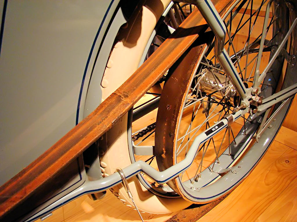 |
 |
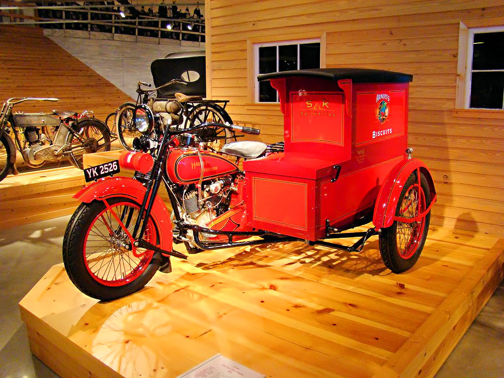 |
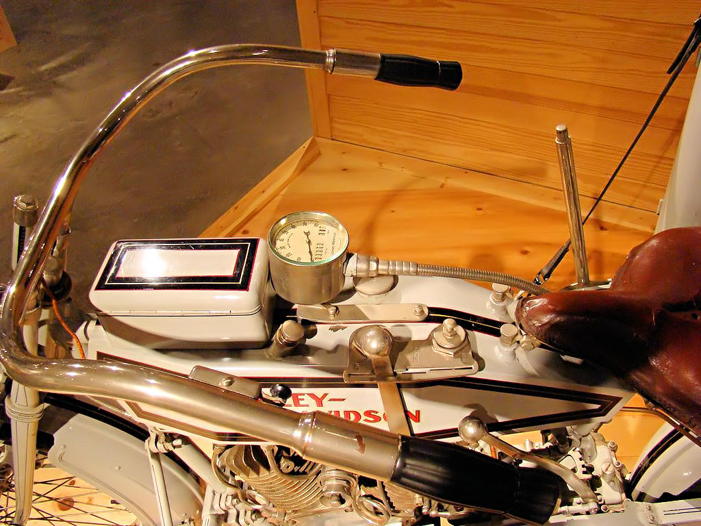 |
COUCHVILLE LAKE AT LONG HUNTER STATE PARK - Nashville, TN - October 6, 2007
'07 Honda VFR800 - GPS Coordinates: N36.09414 W86.54431
|
|
OK, so it wasn't a long ride. Couchville
Lake at Long Hunter State Park is about 15 miles from my home. It also happens to be one of my
favorite "Quiet Spots". I used to go there frequently after work to fish or walk the trails and just
clear my head for a while.
Couchville Lake is located in Long Hunter State Park. Is a land-locked lake of about 110 acres, and
there is a 2-mile asphalt trail completely around the lake. Fishing is allowed on the lake, however
powerd boats of any kind are not. Even though it is located close to Percy Priest Lake the quiet of
the lake is something that must be experienced.
Photographs of the lake area are included below. Be aware that because of the pathetic government that
the state of Tennessee has endured for the past few decades the list of things that are prohibited is longer
than the list of things that are allowed.
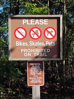
(the images above are links to larger photos. Click the image to view the larger photo)
|
Apparently defacing public property is one of the things that is not disallowed. There are benches
place around the trail by the lake and each of them that I saw were adorned with graffiti. I supose
some people think this is humorous or cute. To me it is just childish.
|
|
|
 |
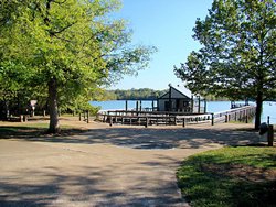 |
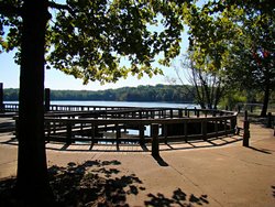 |
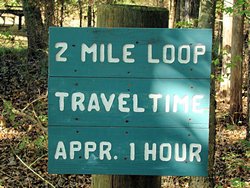 |
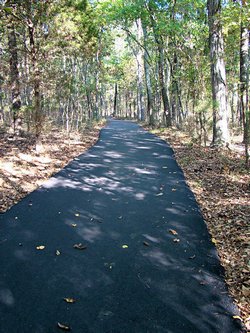 |
 |
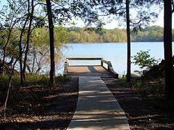 |
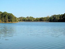 |
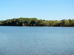 |
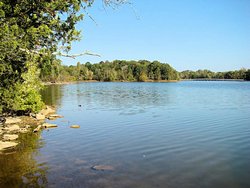 |
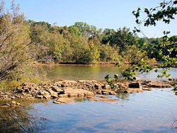 |
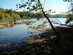 |
BURGESS FALLS STATE PARK - Sparta (White County), TN - 10/13/07
'07 Honda VFR800 - GPS Coordinates: N36.04389 W85.59476
|
|
For the first time in longer than I can remember the temperature here was perfect for riding
today! When I left Nashville it was 43° and when I got back home it was about 75°
and there wasn't a cloud to be seen. It doesn't get much better than that!
I'm hoping that this cooler weather will convince the trees to start changing color. It's
difficult to tell from these pictures but if you scroll up a bit and look at those from Couchville
Lake last weekend you can see that there is not a trace of color in the trees yet. I've
heard several people say that because of our extreme heat and drought in August that there is a
chance the leaves will just fall without changing color. I'm optimistic and I think it's
going to be a beautiful fall once it finally starts up.
Today I rode to Burgess Falls
near Sparta, TN to get some waterfall photographs. Burgess Falls apparently has three
waterfalls and I only saw one of them. They appear to be strung out down a 3/4 mile
trail and I wasn't much in a hiking mood so I contented myself with taking photos of the
first one. It may be the smallest of the three, but it is still a beautiful place to visit.
|
|
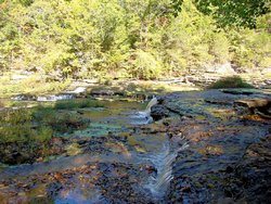 |
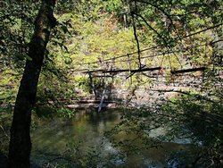 |
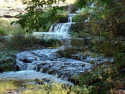 |
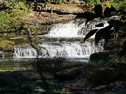 |
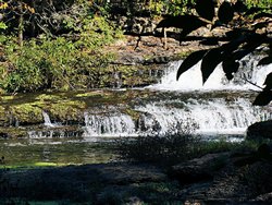 |
 |
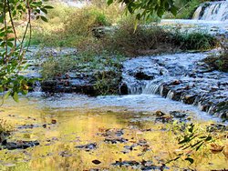 |
GPS Track Log - 10/13/07 |
Crossville, TN - 10/20/07
'07 Honda VFR800
|
|
I headed out today to visit a friend in Crossville, TN. David recently purchased a Suzuki DL650 V-Strom and is
getting back into riding on it. He has been riding around town some but today was his first real trip on the
new bike.
I headed out about 7:00 and grabed some breakfast in Gordonsville, TN (yes, it was at a Waffle House!). After
warming up a little, and filling my tummy, I headed north through South Carthage and cut east on Highway 70N to
Cookeville. I made it into Crossville at about 10:00. When I got there David was just about ready to go.
Even though this was David's first real ride we turned it into a good one! We headed south down Old Highway 28
through a valley between two mountain ridges. Gorgeous scenery with the trees starting to change in that
area.
I'm really jealous of the color over there, we have virtually nothing here. Our temperature is starting to cool
off finally though. After the August we had, during which we set several all-time record highs, we are due for
some cool weather and it really feels good to me. The last couple of weekends we have had temperatures in the
low 40's when I left home, and I have gotten to use my heated gloves running on the interstate. Still very
little color in the trees though, just a slight tint in some of the leaves. This time last year the trees
here were gorgeous as can be seen in
These Photos. Oh well, we can't hurry nature, I guess.
We came back up Highway 127, ran into Highway 70, and rode over to Eureka, TN. Highway 70 in that area has
some nice twisty sections and it was a lot of fun. We rode back west on 70 into Crossville to finish up the
day (at least for David, I still had to beat my way back to Nashville!).
David did great on his first major outing. Much better than I did on my first real ride, that's for certain! We
rode 93 miles according to my odometer through some beautiful countryside. Perfect weather, and hardly a cloud in
the sky.
I just rode I-40 west back to Nashville and stared at the sun in my face for a couple of hours. One of these
days I'll figure out a way to go west in the mornings and east in the afternoon because it always seems like I'm
doing it the other way around. Oh well, who cares. As long as it's riding it's still great.
No photos this trip, but the usual GPS track log is shown below. Thanks David, I had a blast!
|
|

GPS Track Log - 10/20/07 |
|
|
|
OUT AND ABOUT (yet again!) - 10/27/07 & 10/28/07
'07 Honda VFR800 & '06 Suzuki DL-650
|
|
Saturday - 10/27/2007 ...
Well, I guess fall has been and gone and I missed it. We effectively went from late summer to late
fall with very little in between. Last weekend was perfect with temperatures in the mid 70's. It
started raining late Sunday night and everything went downhill from there. It rained every day this
week, and the temperature has been topping out in the 50's. Nothing wrong with that temperature, I
happen to like 50's, but the rain was nasty.
Today wasn't bad though. It started out a bit cool and when I left home at about 8:30 the thermometer
on my VFR showed 43°. I was just riding today trying to get this week's cobwebs out of my head
and decided to ride down to the site where I took my BRC about 18 months ago. From what I understand
the company that gave the course, Mid-South Motorcycle Training Center, is now defunct or moved or
something. I'm not certain what the story is but they aren't giving courses in this area any longer.
The range was in Chapel Hill ,TN in the parking lot of an old factory. It is a great place for a BRC
and I hate to see it go to waste. If you look at the second photo below you can still see some of the
lines painted on the asphalt parking lot. The third photo is also taken at the range and shows how little
the trees have changed around here.
After taking a couple of photos I headed over to Columbia, TN and grabbed a cup of coffee to warm up. Then
a run up I-65 to Yamaha-Suzuki of Cool Springs to get some oil and a filter for my V-Strom. On the way home
I stopped at an overlook on Lynnwood Way to see if any of the trees visible from there had any color in them. As
you can see by the last photo below there is hardly any. I don't know whether or not we are going to get
any real color this year. Many people are forecasting that because of the serious drought we had in August that
they will probably just drop off the trees without changing color. I'm optimistic though, and think that in
a couple of weeks it will finally start to look like fall (just in time for Thanksgiving!). Tomorrow I'm
heading down the Natchez Trace Parkway with a friend. Perhaps there is some color down that way.
Oh, and before anyone complains about my parking my helmet where it is in the photos I should mention that it's
clamped over my GPS. Trust me, it fits tightly and is not going to fall without some help.
Sunday - 10/28/2007 ...
I rode down the Natchez Trace Parkway with a friend today to see if there was any color in the trees. As
can be seen in the third row of photos there is a little bit. The first photo was taken at Leipers Fork, TN
and the other two were taken at the Metal Ford south of Nashville on the Natchez Trace Parkway. Sorry about
the power lines in the Leipers Fork photo, I couldn't get around them.
David's Honda Rebel 250 is next to my V-Strom and the two Suzuki Boulevards belong to a couple from New Orleans
who were traveling back south. They trailered their bikes from New Orleans to Jackson, MS and then rode
the bikes up the Natchez Trace Parkway. They were headed back to Jackson today. Good meeting you
guys, hope you had a safe trip home.
|
|
 |
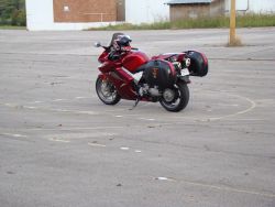 |
 |
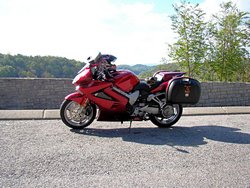 |
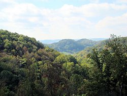 |
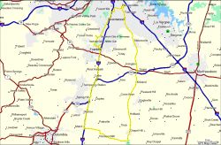
GPS Track Log - 10/27/07 |
|
|
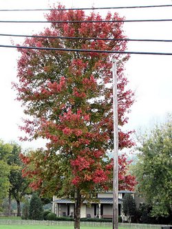 |
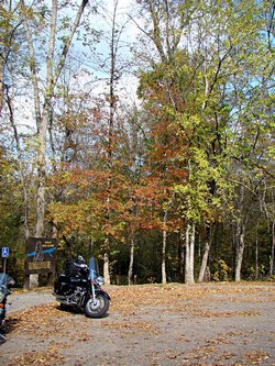 |
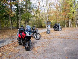 |

GPS Track Log - 10/28/07 |
CLARKSVILLE, TN - 11/03/07
'07 Honda VFR800
|
|
Today's weather was the kind that bike riders dream about! At least this one does. It was cool this morning,
ok it was COLD this morning, but it warmed up and became an absolutely perfect fall day.
I grabbed some breakfast in Brentwood and had to go by my office for about an hour. After that I decided to head
for Clarksville, TN and see my mother for a while. When I left home the thermometer on my VFR said it was 32°
at 7:00. When I left the office at about 9:00 it was up to 44°. Perfect riding weather assuming you have
enough gear to keep you warm. I have good cold weather gear so I headed up I-24 for Clarksville. Since that
is my original home I rode around town a bit to see if anything had changed much since I was last through there. The
trees were gorgeous around the county courthouse and museum in downtown Clarksville so I stopped for a few photos.
After visiting with my mom for a while I headed back toward Nashville. It was just way too nice to take the slab
back so I headed down Highway 12 through Ashland City and then took Highway 251 (River Road) back to Nashville. The
trees along River Road were really bright and colorful so I stopped at Sam's Creek to take a couple of
photos. Unfortunately at that particular place the only color was yellow so the pictures don't really reflect how
pretty the ride along the Cumberland River actually was.
A great day for riding! Check out that cloudless blue sky in the photos below. It's supposed to be like this
for the next few days so I'll probably head down the Natchez Trace Parkway a bit tomorrow to see how the trees look.
|
|
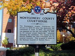
Montgomery County Courthouse |
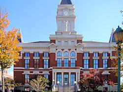
Montgomery County Courthouse |

Montgomery County Courthouse |
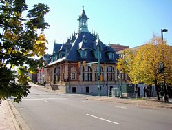
Montgomery County Muesum |
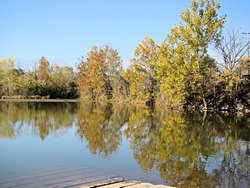 |
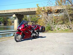 |
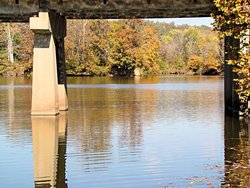 |
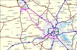
GPS Track Log - 11/03/07 |
TREES ALONG THE TRACE - Part I - 11/04/07
'06 Suzuki DL650
|
|
Trees Along The Trace or Autumn FINALLY Comes To Tennessee!
I started to hang around home today. The time changed last night (or this morning, or something) which always plays
with my mind. It was also COLD when I got up (at either 7:00 or 6:00, I have no idea which), as in 35°. But,
I didn't and I'm sure glad I made the effort. I took my usual Sunday ride down the Natchez Trace Parkway to check out
the leaves and they were absolutely magnificent!
We have had frost here a couple of nights this past week. That isn't unusual for us this time of year, but what is
unusual is that we haven't had much rain or wind which is also common this time of year. For some reason our trees
seem to go in cycles. The trees that turn yellow tend to get their color first, and then the wind and rain comes
along and knocks all the leaves off. When the trees that turn orange and red get their fall colors the yellow is
usually already gone. This year everything seemed to work together to make them absolutely gorgeous.
I rode down to the Water Valley Overlook, about 30 miles south of the Northern Terminus at Highway 100 in Nashville, and
it was hard to get down that far and hard to get back simply because I kept stopping. At every curve the trees were
more colorful than the previous curve. I stopped every couple of miles going down and back for some pictures so I
couldn't tell you where half of those shown below were taken. I wanted to go to the Metal Ford, which is the most
scenic spot on the north end of The Trace in my opinion, but if I had continued I'd still be out there taking
pictures! I'll check things out again next weekend, weather permitting, but my guess is that a lot of the leaves
will be on the ground by then. Who knows though, this has already been a strange autumn so maybe it will just
get better.
Photos below! Enjoy the ride!
|
|
 |
 |
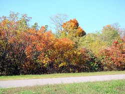 |
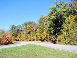 |
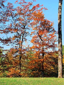 |
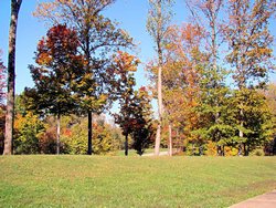 |
 |
 |
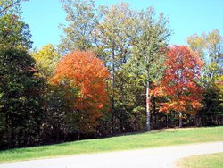 |
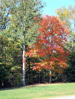 |
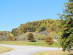 |
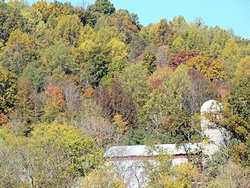 |
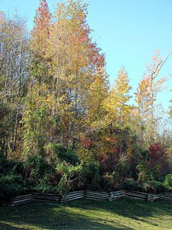 |
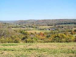 |
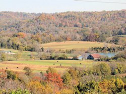 |
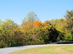 |
 |
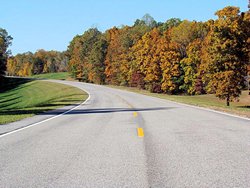 |
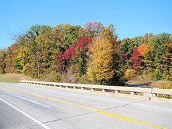 |
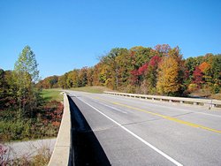 |
 |
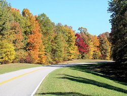 |
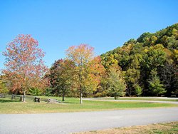 |
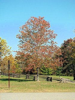 |
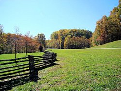 |
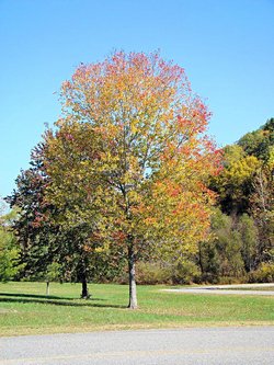 |
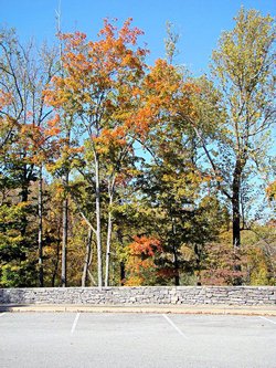 |
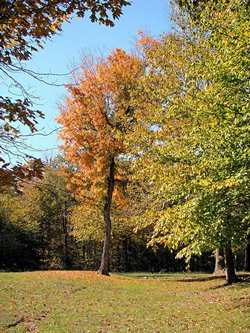 |
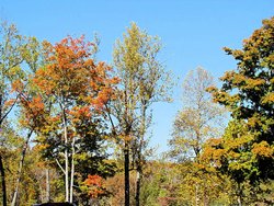 |
 |
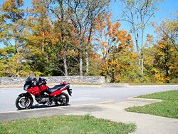 |
 |
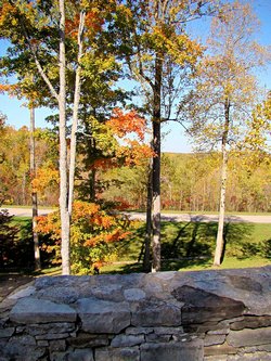 |
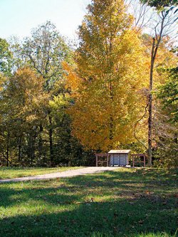 |
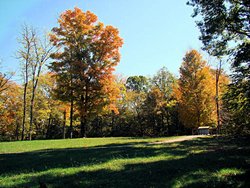 |

GPS Track Log - 11/04/07 |
TREES ALONG THE TRACE - Part II - 11/10/07
'07 Honda VFR800
|
|
Despite some very severe storms early this past week most of the leaves have hung onto the trees and they are
really beautiful right now. Everywhere one looks the trees are in full color. Those who forecast a
dismal and dull fall in this area were completely wrong. This has been one of the most colorful I've seen
in many years.
I decided to ride down to my favorite spot on the Natchez Trace Parkway at the Metal Ford to see how things looked
down there. That is such a tranquil area next to the Buffalo River that I expected to see some truly gorgeous
trees. While the trip down lived up to my expectations the actual area around the Metal Ford had already lost
most of its leaves. I guess the winds were worse there than in most other places because most of the trees
were already bare. Oh well, I got some good photos anyway and there is always next year.
The first photo below is of a tree outside my office. It has been so colorful all week that I've regretted not
having my camera at work. I stopped on the way out of town today and grabbed a photo of it anyway.
|
|
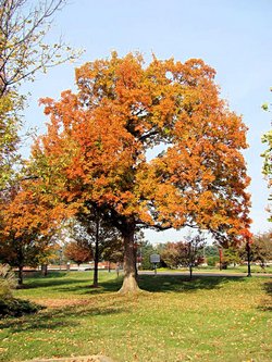 |
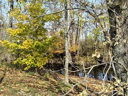
Natchez Trace Parkway - Garrison Creek |
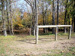
Natchez Trace Parkway - Garrison Creek |

Natchez Trace Parkway |
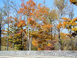
Natchez Trace Parkway |

Natchez Trace Parkway - Metal Ford |
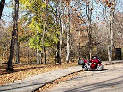
Natchez Trace Parkway - Metal Ford |

Natchez Trace Parkway - Metal Ford |
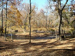
Natchez Trace Parkway - Metal Ford |
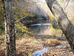
Natchez Trace Parkway - Metal Ford |

GPS Track Log - 11/10/07 |
|
FALL CREEK FALLS - 11/11/07
'06 Suzuki DL650
|
|
I met a friend in Monterey, TN this morning to ride some of the backroads in that area. From Monterey
we took Highway 84 to Sparta, TN (which is a great road unto itself) and then from Sparta Highway 111 to
Highway 30 in Spencer, TN. Highway 30 from Spencer to Fall Creek Falls is one of my favorite roads
in this area. Once you get into the twisty section it is one curve after another and none of them are
mild curves. Unfortunately it probably won't last. As we were coming back I saw several guys on
sport bikes trying to turn it into a race track so it probably won't be long until the police are all over
it.
The leaves in the area are still gorgeous. I keep expecting that to come to an end as there are more on
the ground than on the trees now, but there is still a lot of color in them as can be seen in the photos
below. The waterfall itself was still a disappointment though. Due to our drought of the past few
months there was still very little water coming over the falls.
All in all it was a great ride. Perfect weather although a bit on the nippy side heading down I-40 early
this morning. To top it all off I turned over 15,000 miles for this year between both bikes and the V-Strom
turned over 20,000 miles on the way home. Thanks for the ride, David, I had a blast again!
|
|
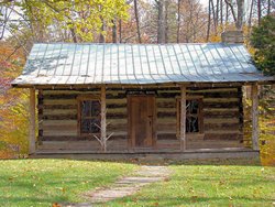 |
 |
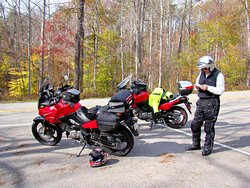 |
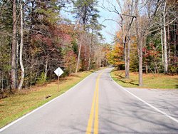 |
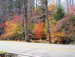 |
 |
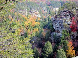 |
 |
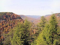 |
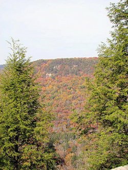 |
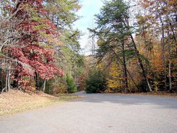 |

GPS Track Log - 11/11/07 |
WINTER ARRIVES - KIND OF COOL NOW! - 11/22/07 - 12/01/07
Both Bikes
|
|
Winter has arrived in Tennessee with a vengeance. While our fall was very colorful it was a little bit on the
chilly side, and a whole lot short!
I haven't been riding very much because of rain and cold weather but I have managed to get out and ride some. I
rode my VFR to Clarksville, TN on Thanksgiving to visit with my family. It was 35° when I left and about
60° when I got home. The following day the high temperature was 39°! The next three days it rained
and stayed cool but eventually cleared up. I managed to ride to work a couple of days during the week
finally. On Wednesday it was 31° when I left home but warmed up pretty nicely during the day. On Thursday
it was 45° when I left home and didn't warm up much at all during the day. December 1 I got out and rode a while and
it was really nice; sunny and rather warm. It's supposed to start raining again on 12/2 and then get cool again by
Monday. Next week is forecast to be in the upper 40's and low 50's though with lows in the 30's. I can handle
that for the few miles I ride to work so maybe I can get a little bit of riding in. Next Saturday is forecast
to be in the 60's and if that actually happens I may have to go somewhere to ease these withdrawals!
|
|
END OF THE YEAR - 12/22/07 - 12/31/07
Both Bikes
|
|
2007 is nearly ended now. Lots of miles and lots of places visited, several that I have been
wanting to visit on a bike. A lot of unseasonable weather, both hot and cold. A new bike in August, and
many miles of fun on my V-Strom. All in all I had a blast on my bikes this year and look forward to doing it again in 2008.
The year is trying hard to end in a wet, sloppy mess. There have been a few gorgeous days so far this December but most of
them have been cold and/or rainy. We did have a day that was a near record high (75°) but we also have had
a number that were near record cold (near 20°). All in all December has not been a good riding month and I've
only managed to get a few short (as in less than 100 miles!) rides in. I've been down with the flu for the past couple
of days but the weather hasn't been great anyway. Perhaps January will be better. If that doesn't work out,
Spring is coming!
|
| 2007 STATISTICS |
|
| Total Miles Ridden in 2007: |
15,765 mi (Suzuki DL650: 12,461 - Honda VFR800FI: 3,304) |
| Longest Single-Day Trip: |
469 mi |
| Longest Multi-Day Trip: |
1,546 mi (6/29-7/4) |
| States Visited: |
7 (TN, AL, GA, NC, VA, KY, MS) |
|
|
|
RIDE MAPS |

May 2, 2006 - December 31, 2006 |

January 1, 2007 - December 31, 2007 |

January 1, 2008 - December 31, 2008 |
|
|
PLACES I STILL HAVEN'T GOTTEN TO YET |
Below is a partial list of places in this area that I want to visit on my motorcycle. They are not in
any particular order, and while I haven't been to them yet I will in the upcoming months. Stay tuned
for more photos! If you compare the list to
Last Year's List you'll see that it is getting shorter all the time!
|
Oak Ridge Museum
Oak Ridge, TN |
Cumberland Gap National Park
Cumberland Gap, TN |
Waverly, TN
(to see the airport runway I designed) |
|
|

| Copyright © 1997-2024, Scott A. Craig, All Rights Reserved |
|
|
|